Black Mountain (via Nighthawk Trail)

Decided to get a few miles in and hike Black Mountain, again. I decided to take the Nighthawk trail up from Hilltop Park this time, as I had not done this route in a while.

A mild Santa Ana was blowing, so I was mindful of my hat not blowing away as I worked my way up the trail.

I snapped a few photos at the summit, then headed back down. A few folks were making their way up, some on foot others on their mountain bikes. Soon the parking lot came back into view and back at my car. A nice start to Thanksgiving week.


Buy Me a Coffee at ko-fi.com

I am an avid peak bagger, sometimes backpacker, and former sea kayaker living in San Diego. In 2019, I became the third person to complete the San Diego 100 Peak Challenge. Not stopping with that accomplishment, I set my sights on the harder San Diego Sierra Club 100 Peak list, which I completed in 2021. In addition, I have conquered several Six-Pack of Peaks challenges (SoCal, San Diego, Central Coast, and Arizona-Winter). Beyond attempting the San Diego Sierra Club 100 Peak list a second time, I am looking forward to exploring new summits and new adventures across the southwest. 

Sitton Peak

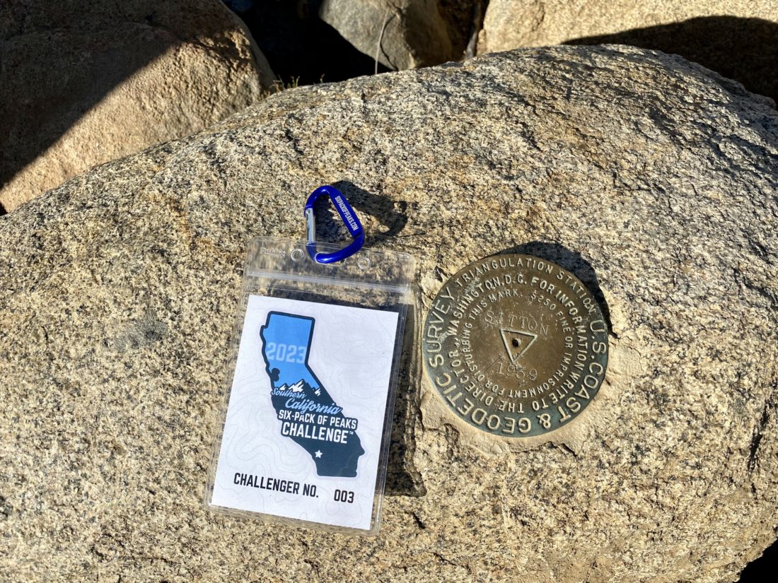
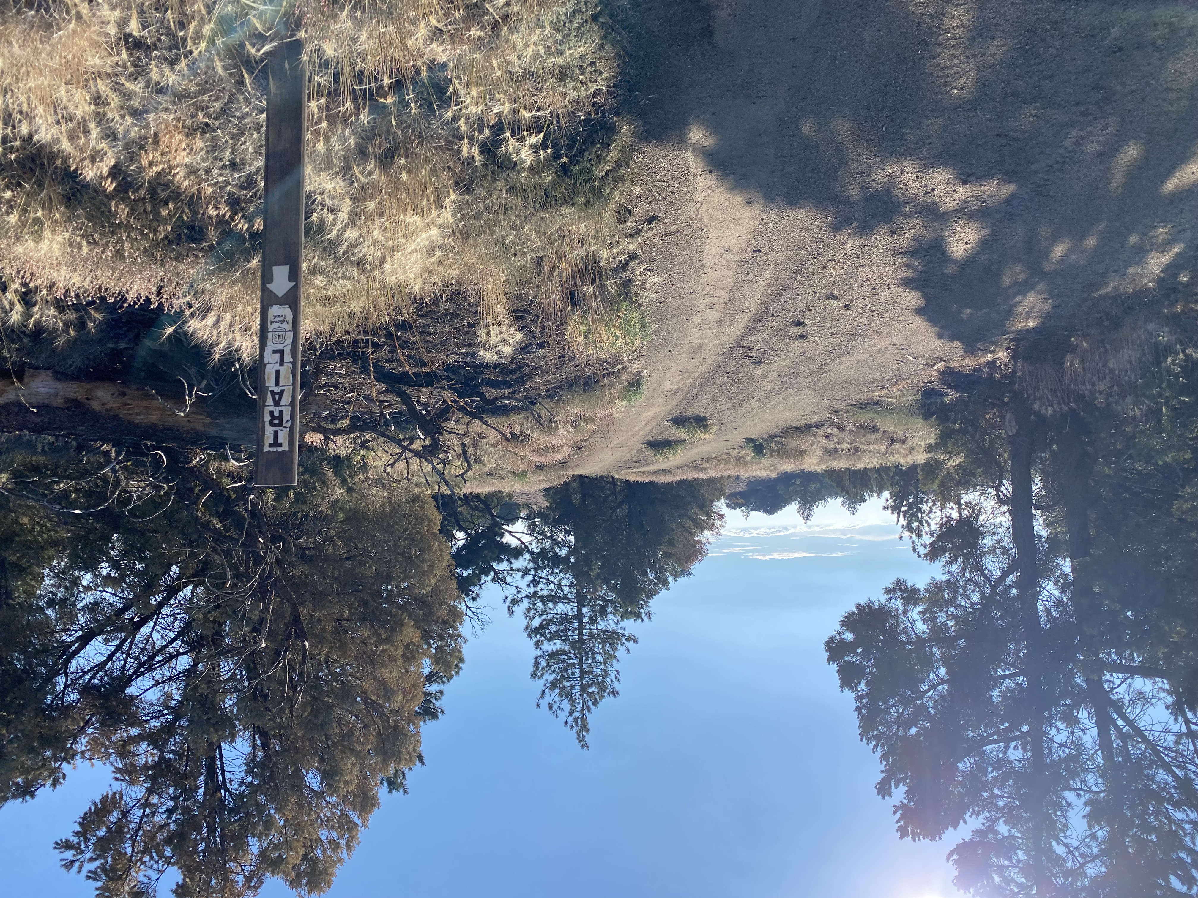
The morning was a tad chilly when we pulled into the parking lot across from the trailhead for Sitton Peak. This was to be my 6th peak for my 2023 SoCal Six Pack of Peak Challenge. Ted had never hiked this peak with me, so he was up for a new adventure. I also invited one of my co-workers along for the almost 10-mile round-trip journey through the San Mateo Wilderness. Once Maegan arrived, I introduced her to Ted, and we quickly gathered our gear. Ted and Maegan opted for an extra layer, while I stuck with just my base layer. The forecast was for a high of about 77°F, so I knew it would soon be warming up as the sun rose. Plus, I am using a waist pack until my back is up to having the weight of a pack on it. We scurried across the newly paved highway and began our adventure. I explained the hike could be broken into sections, one for each trail junction, and the final climb. This was my fourth time up the summit, so I felt very comfortable leading them. Near the trailhead, I signed us in and we set off.

After a bit, both Ted and Maegan shed their initial layers as the day indeed was starting to warm up. We also stopped from time to time as a plant would catch Maegan’s attention. She had taken a course on the local plants and was trying to put those skills to use.

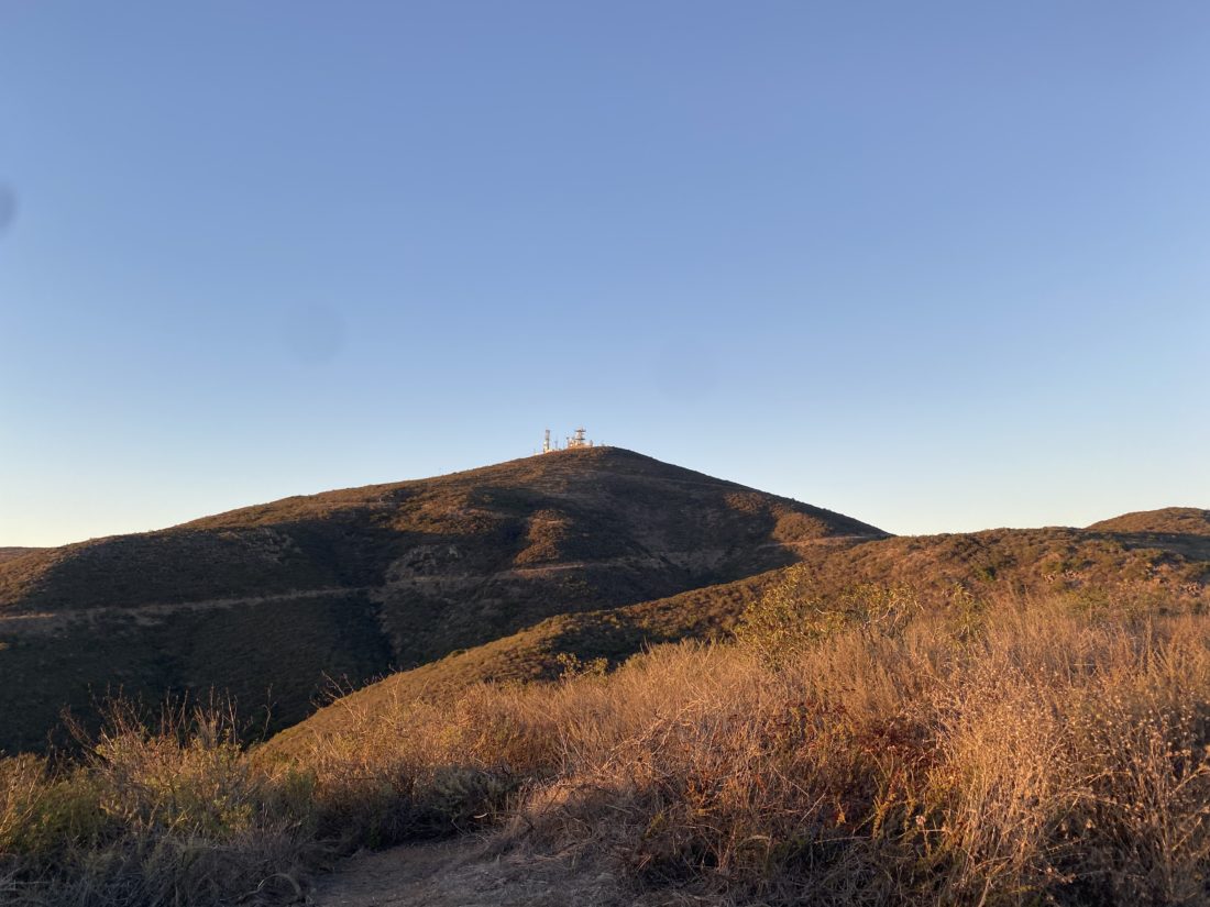
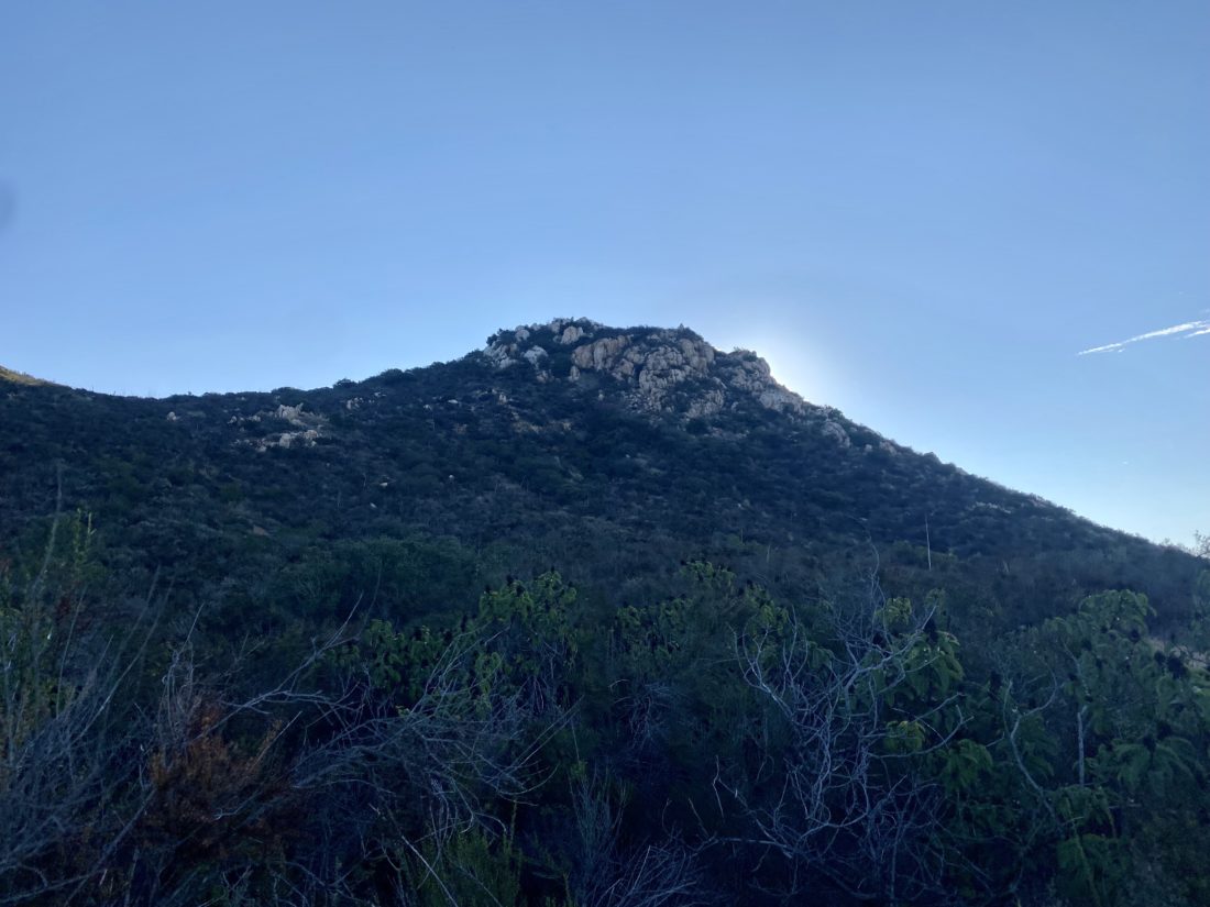
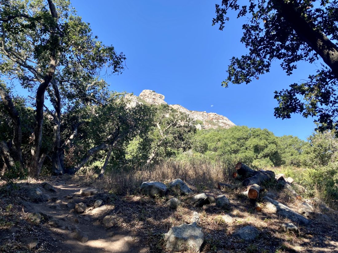
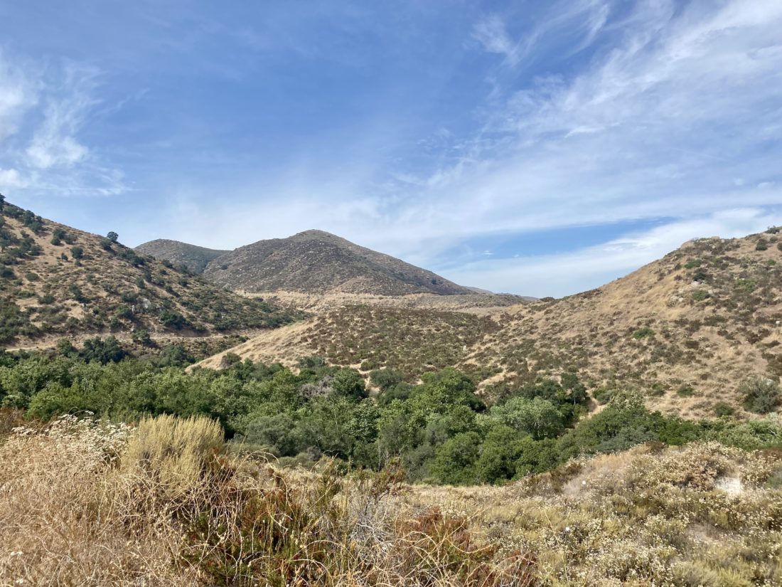
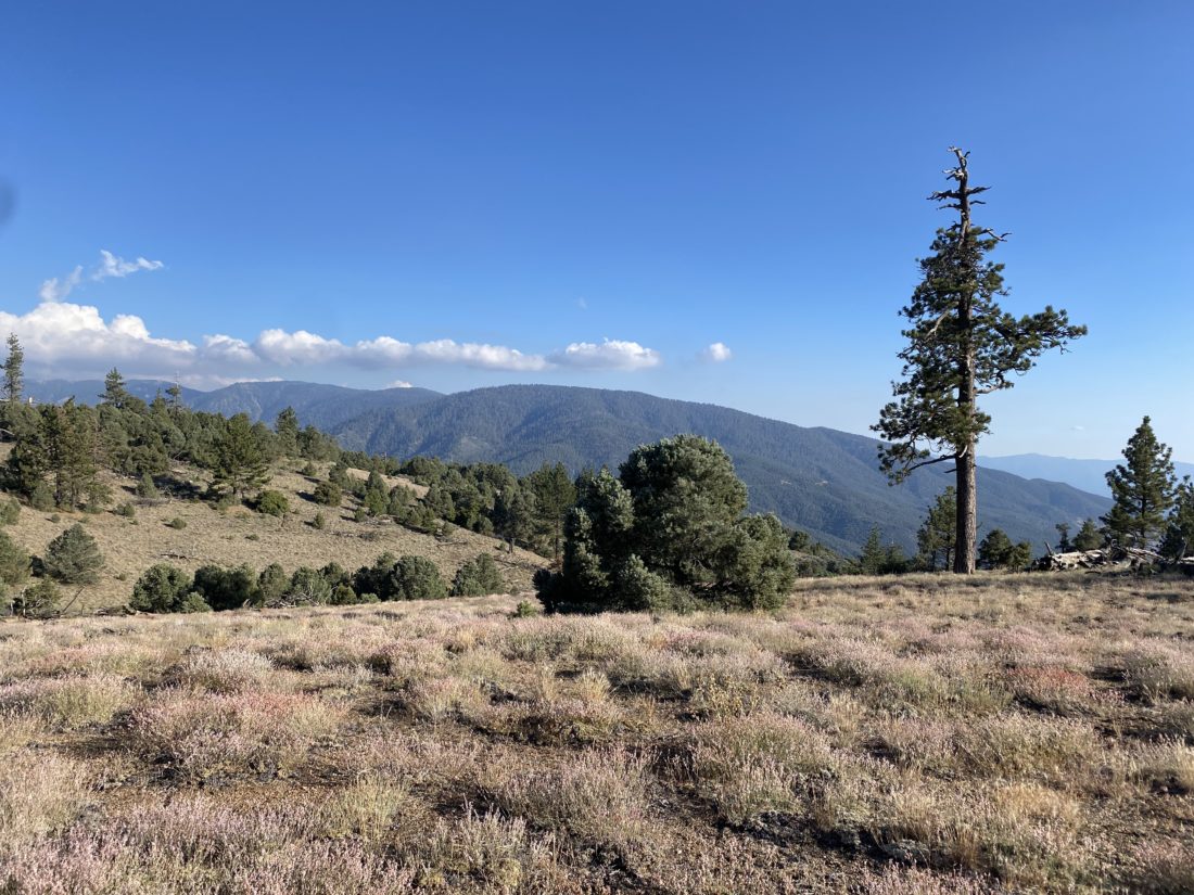
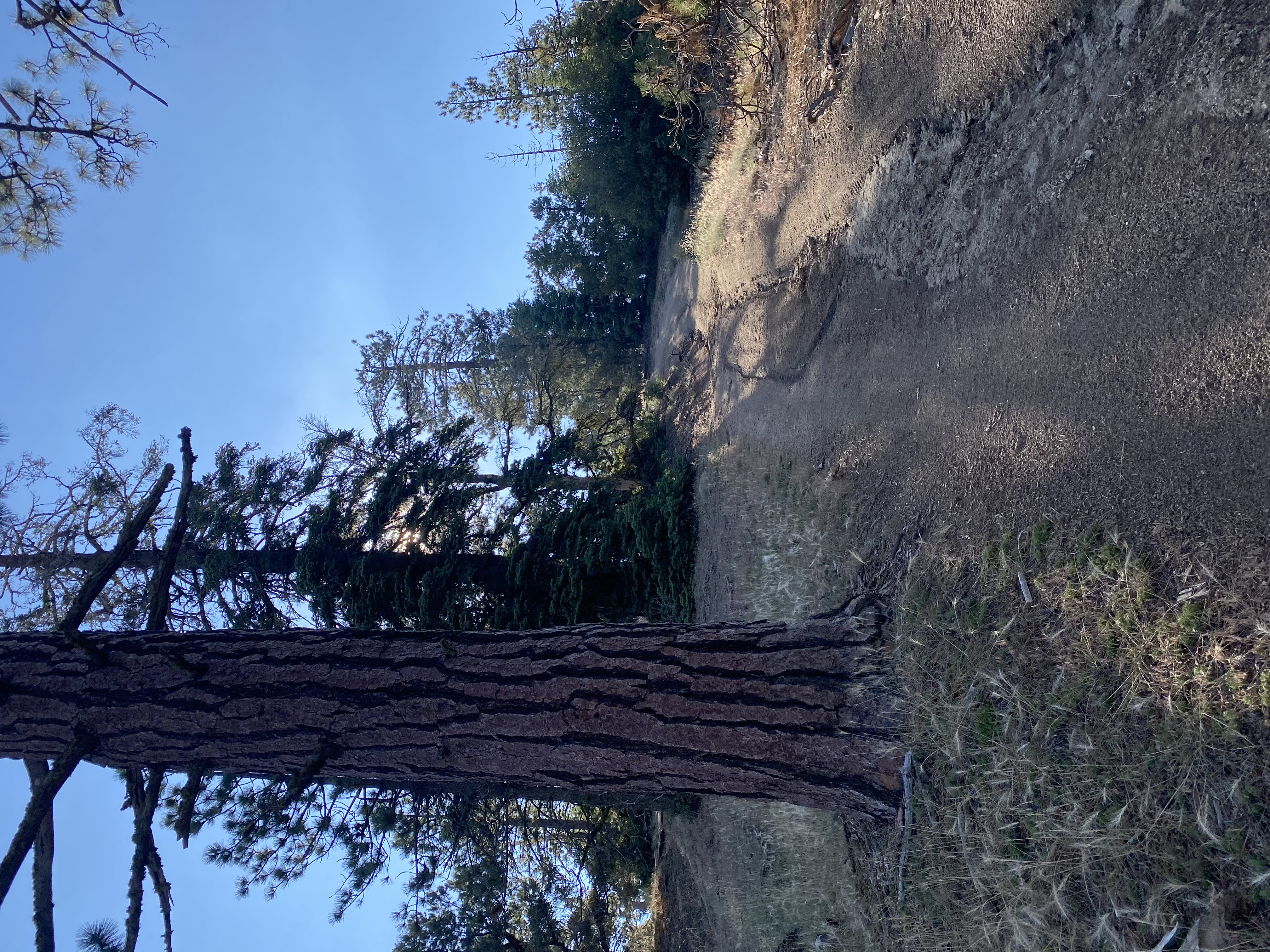
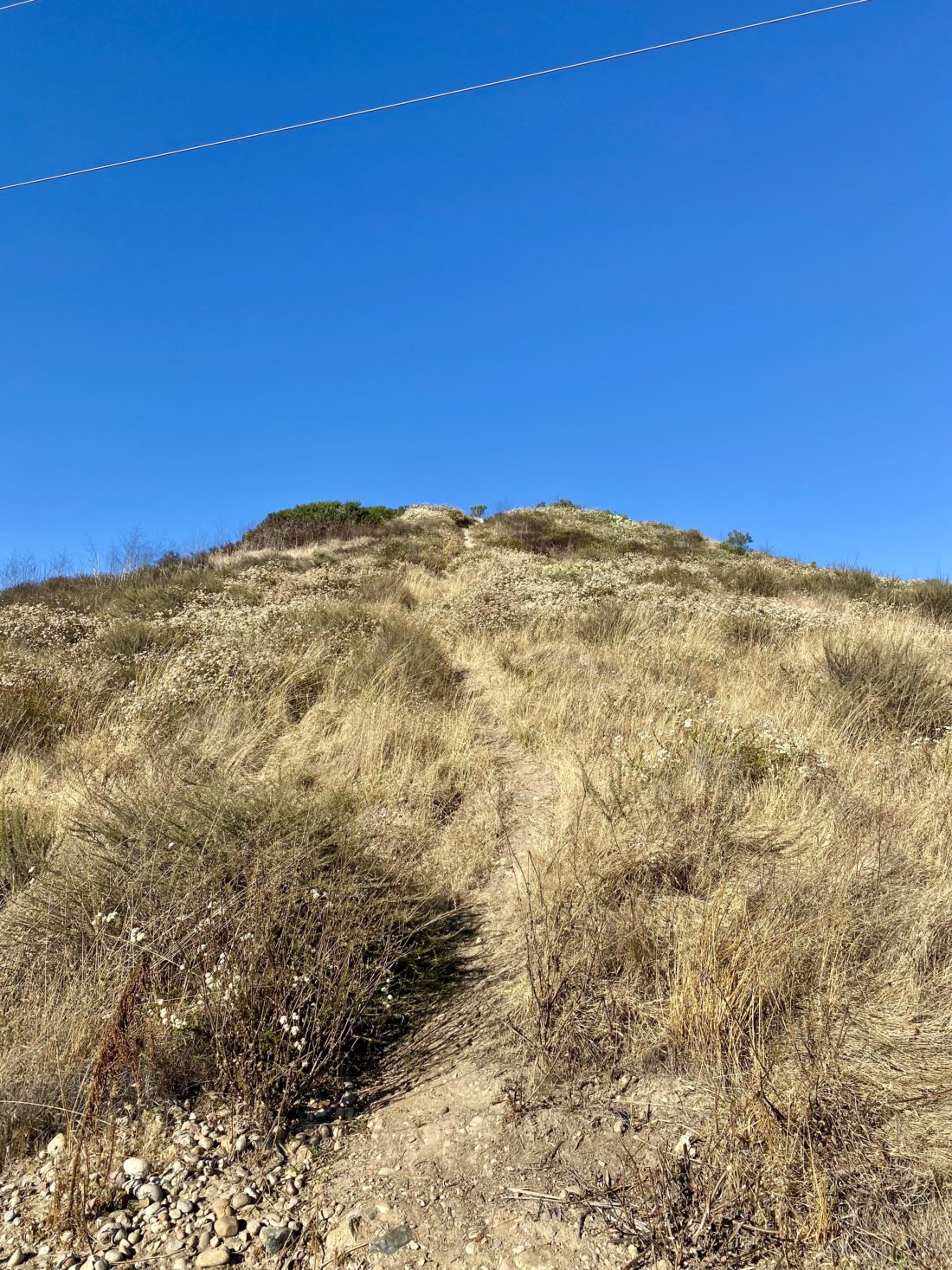
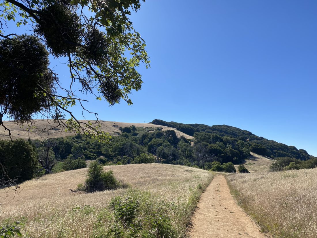
The miles passed, and we paused at each junction for a short break. We chatted about various things as we drew nearer to the summit. After we passed Four Corners, I was keeping an eye out for a possible campsite. I originally had planned to do this peak as an overnight, but I certainly wasn’t going to attempt any backpacking anytime soon. We spied the use trail to the campsite and it looked to be a good one (ignoring the illegal fire ring). We were getting a bit hungry, so once we reached the old crash site, we took our snack break. With a bit of food in our stomachs, we began the steep, but thankfully relatively short,  climb to the summit. Ted and I crested the climb and kept an eye down the trail for Maegan to make her way up. Once we had regrouped and had a moment to recover, we hiked the last bit to the summit. 

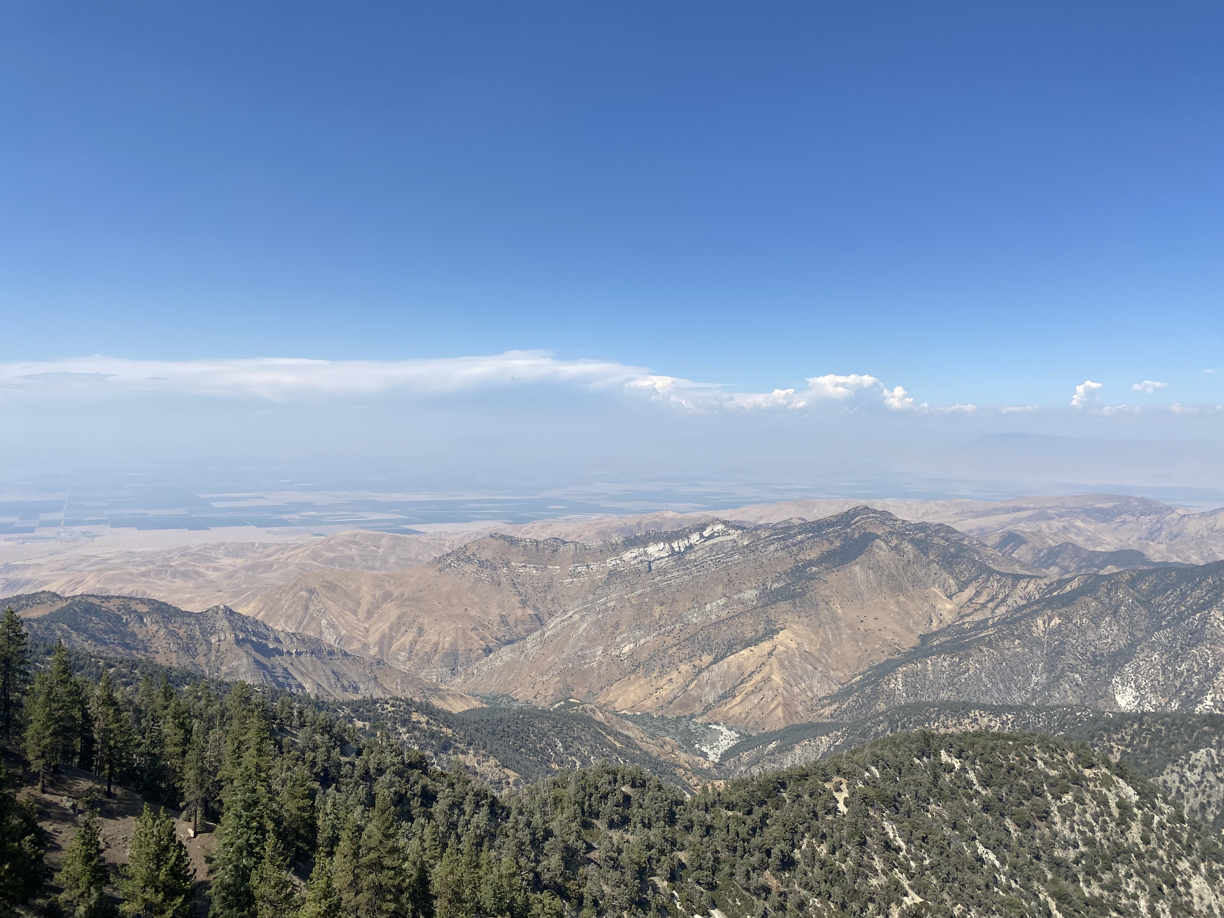
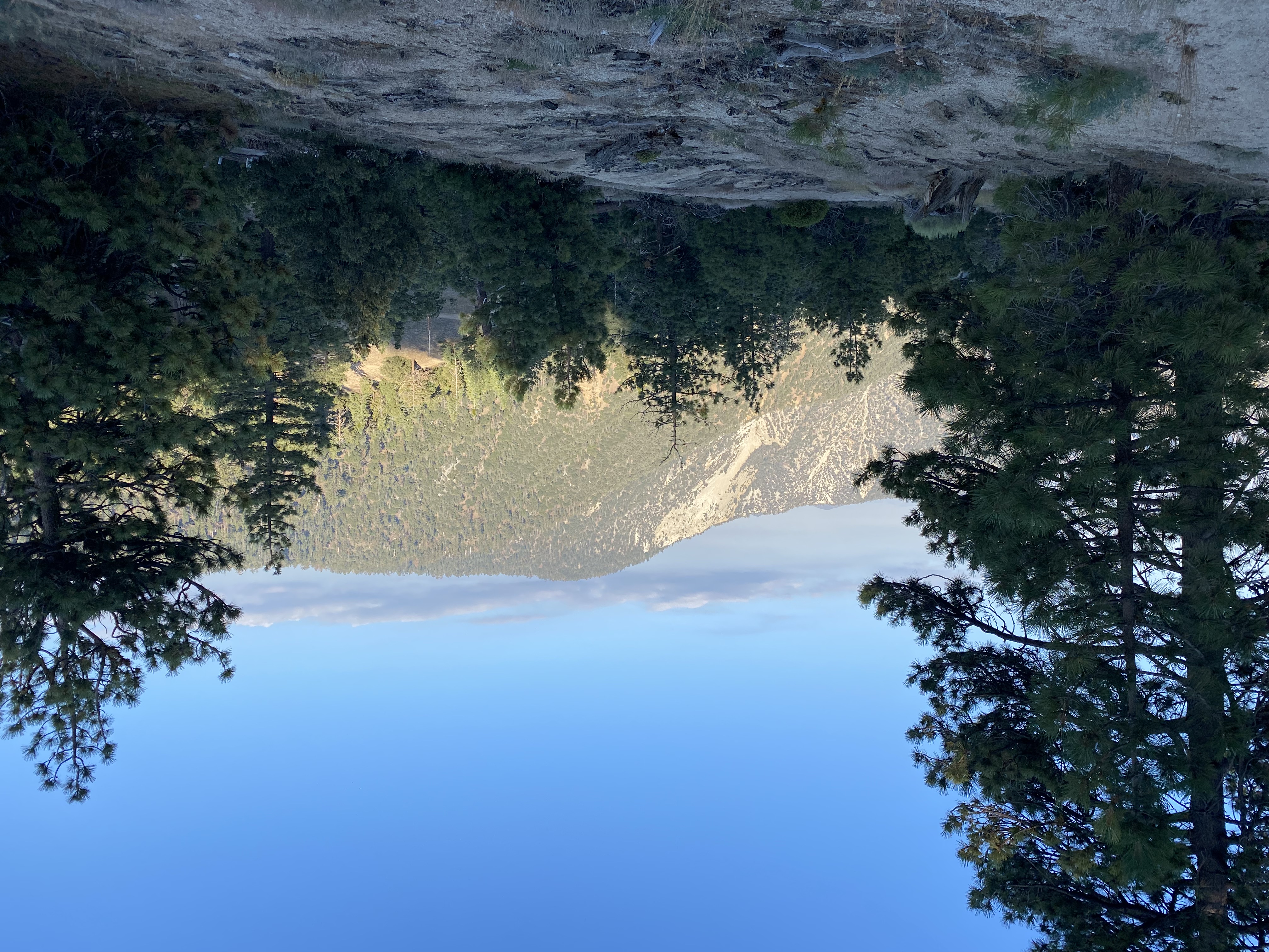
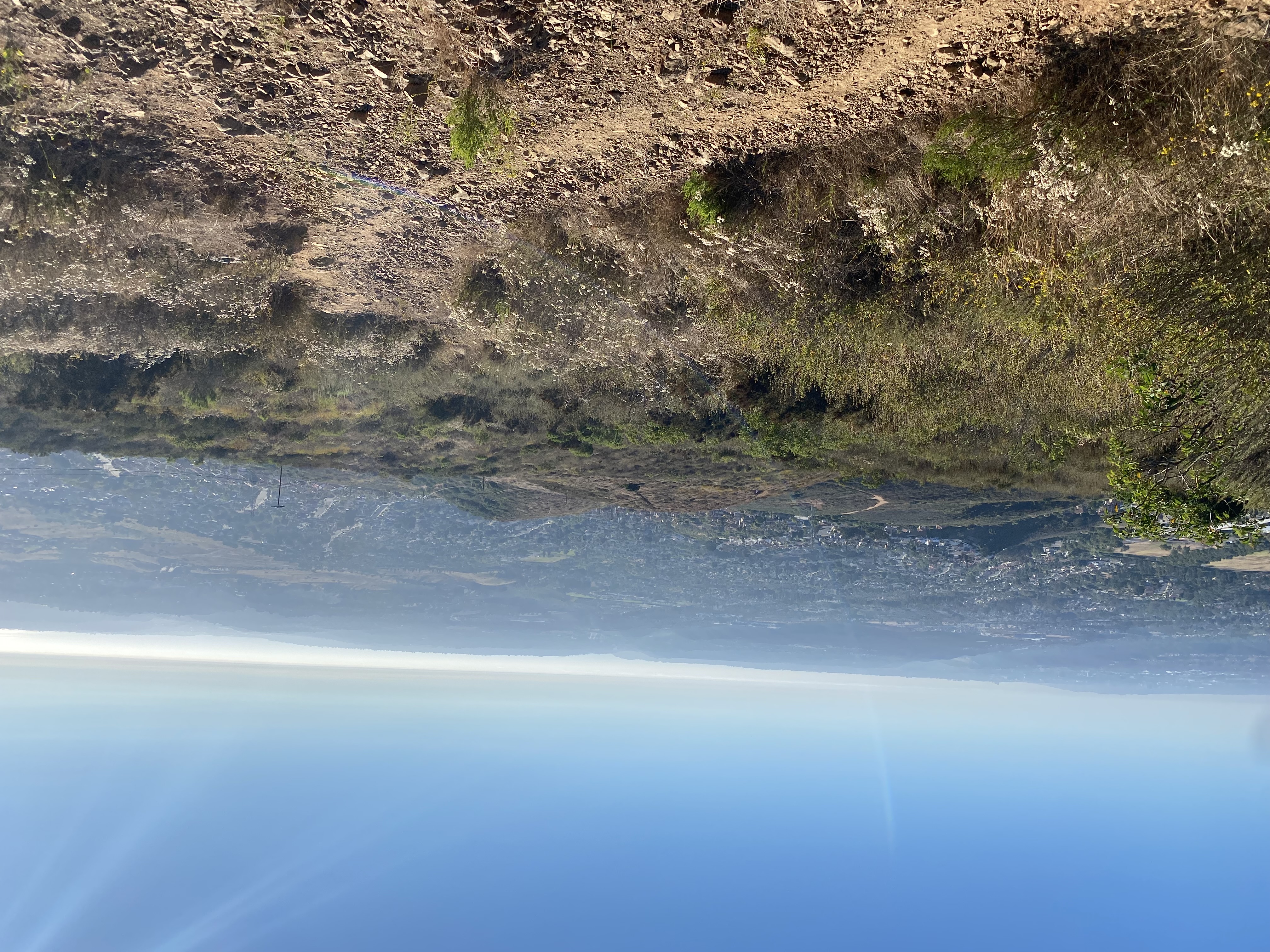
Two sets of hikers were there enjoying some really clear views. We took a few photos and then found a spot to enjoy some well-earned snacks and a rest. Since we knew that we had 5 miles back to the car and the day was warming, we began our descent. We carefully picked our way down the steep section, hoping not to slip (narrator: someone did slip). Back on the more gentle portion of the trail, we began working our way back to the car. Ted and I discussed our lunch options. Maegan had to get back home so she let us hash out our post-hike plan. I tossed out the question, “What is an urban hike in San Diego?” This provided a good debate on the topic. Feel free to offer your opinion in the comments. Unfortunately, I made a couple of missteps and rolled my right foot. Enough to feel it, but nothing to create an issue. I figured it would be tender later (narrator: he was right).

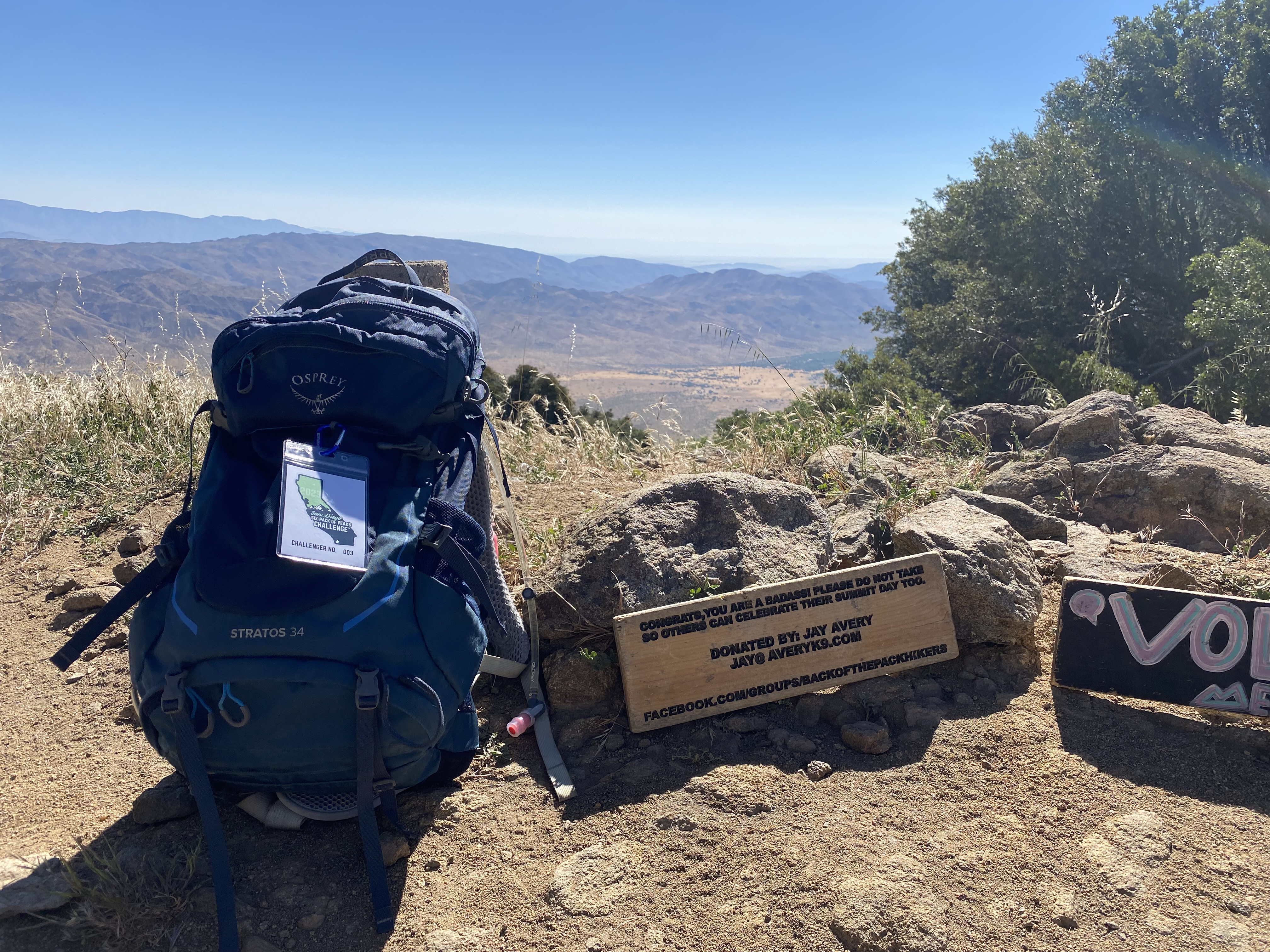
Soon the din of traffic from the highway started to fill our ears, signaling that we were almost done. My back had done pretty well, so that in itself was a victory for me. Ted and Meagan got to cross off a new peak and I finished my 2023 Six Pack of Peaks Challenge. After tossing our gear in our cars and putting on a clean shirt and comfy shoes, we drove over to the Candy Store to pick up a few treats and a cold drink. Maegan said her goodbyes and headed back to San Diego. We followed soon after. I convinced Ted we should stop in Pala Mesa, and we both got lunch from the Rib Shack. There was a mix-up with my order, and I accidentally got someone else’s (right sides, they got tri-tip and brisket). I didn’t notice that until I dug in. Oops! But damn, both of the meats were outstanding! Still, this was a slightly later-than-planned lunch. It actually worked in my favor as I was attending an event in the evening and that dinner was not scheduled until 8 pm. My tracker did not restart once we left the summit, so Ted’s tracker logged us in at 9.8 at the car. Being so close to 10, we did a few laps in the parking lot. Our moving time was 4:49 with 2,150 feet of gain. I am hoping the next time I climb this peak it will be an overnight.


Buy Me a Coffee at ko-fi.com

I am an avid peak bagger, sometimes backpacker, and former sea kayaker living in San Diego. In 2019, I became the third person to complete the San Diego 100 Peak Challenge. Not stopping with that accomplishment, I set my sights on the harder San Diego Sierra Club 100 Peak list, which I completed in 2021. In addition, I have conquered several Six-Pack of Peaks challenges (SoCal, San Diego, Central Coast, and Arizona-Winter). Beyond attempting the San Diego Sierra Club 100 Peak list a second time, I am looking forward to exploring new summits and new adventures across the southwest. 

Goat Peak

With Ted needing to be home by noon-ish and the predicted warm temperatures, we settled on hiking Goat Peak as our adventure. I have done this one twice already, but Ted had never done it. We parked at the trailhead and gathered our gear. Since this hike was about 3 miles round trip, we both went lighter on our gear, with Ted wearing one of his running vests, while I opted for my new Osprey Waist pack. My upper back has been bothering me since my overnight trip to San Jacinto, so not having a pack on my back was a good thing. The trail starts off nice and mellow, crisscrossing the currently dry Sycamore Creek several times before beginning to make a steep climb toward the summit.

As we neared the start of this section, we heard some voices ahead of us. I was a bit surprised, as this peak is a little off the beaten path. It turns out it was a group of about 10 women hiking to celebrate one of their birthdays! They kindly let us motor past.

Soon we found ourselves at “The Wall”, and scaled it with no issue. Finally, the summit came into view, and shortly thereafter we were scrambling to its summit. There is no benchmark here, but there was a wooden sign and register box. We relaxed here a bit, and soon the women reached the summit as well. After chatting a bit, Ted and I began our careful descent. At one point I mentioned to Ted “Aren’t you glad you have trekking poles?” To which he answered with a resounding, “yes”.  Soon we were back on the mellow section and cruising back toward the car. The entire hike was 2.8 miles with 1,105 feet gain and in 2:19.


Buy Me a Coffee at ko-fi.com

I am an avid peak bagger, sometimes backpacker, and former sea kayaker living in San Diego. In 2019, I became the third person to complete the San Diego 100 Peak Challenge. Not stopping with that accomplishment, I set my sights on the harder San Diego Sierra Club 100 Peak list, which I completed in 2021. In addition, I have conquered several Six-Pack of Peaks challenges (SoCal, San Diego, Central Coast, and Arizona-Winter). Beyond attempting the San Diego Sierra Club 100 Peak list a second time, I am looking forward to exploring new summits and new adventures across the southwest. 

Hazard Peak

After climbing Bishop Peak in the morning, I drove over to Montaña de Oro and set up camp at the Islay Campground. The general plan for the afternoon was to relax at the campsite for a while, then head over to the trailhead to hike up Hazard Peak. I hoped that the marine layer would stay away long enough so I could enjoy the view of Morro Bay directly to the north of the peak. As I woke up from a short nap, I could see that the clouds were starting to roll in, so I gathered my gear and made the short drive to the trailhead. The route I wanted to take starts next to Camp KEEP (Kern Environmental Education Program) which is a residential outdoor science program. The camp was quiet, I am guessing due to it being Labor Day. I did not see any signs prohibiting me from hiking along the service road to the camp, so I continued on. I reached the Heidra Trail and left the service road behind. The trail was a bit sandy until it reached the junction with the Hazard Peak Trail. There another surprise greeted me, a lovely swing hanging from an eucalyptus tree. I snapped a few photos for my friend Amber who is obsessed with hidden swings, then continued on.

I got a few views of Morro Bay and its famous rock before the cloud cover obscured the view. The trail was pleasant and I cruised along toward the summit. I reached the junction with the Canyon View trail. If I had wanted to come directly from the campground, this is the trail I would have used, but it is a bit longer. From this intersection, the summit was just about a mile away.

As I looked up toward it, I wondered if I would be fully in the clouds or not. I soon drew near and spotted the two benches and picnic table that reside at the summit. I was not in the clouds but had no view to speak of. I took a short break, snapped my photos, and headed down. Some mountain bikers had joined me, and I let them pass before starting my descent. A couple of trail runners raced upwards as I made my way back. Soon, I was back down, and as I neared my car, I spotted several deer nearby. That was a nice surprise. I snapped a few photos, then made the short drive back to my campsite. I finished getting ready for the evening, made some dinner, enjoyed a fire, and went to sleep. Tomorrow was going to be a big day with an attempt at Alan Peak, over 11 miles of hiking, and the largest elevation gain to date for my foot. Hazard Peak was 5.25 miles round-trip and a mere 970 feet of gain.


Buy Me a Coffee at ko-fi.com

I am an avid peak bagger, sometimes backpacker, and former sea kayaker living in San Diego. In 2019, I became the third person to complete the San Diego 100 Peak Challenge. Not stopping with that accomplishment, I set my sights on the harder San Diego Sierra Club 100 Peak list, which I completed in 2021. In addition, I have conquered several Six-Pack of Peaks challenges (SoCal, San Diego, Central Coast, and Arizona-Winter). Beyond attempting the San Diego Sierra Club 100 Peak list a second time, I am looking forward to exploring new summits and new adventures across the southwest. 

Bishop Peak

4 a.m. came very early, but if I wanted to get past Los Angeles on Labor Day, this was the price I had to pay. The goal for the next few days was to camp at Montaña de Oro State Park and climb several of the peaks that are on the inaugural Central Coast Six Pack of Peaks Challenge. The freeways were fairly empty as I made my way northward, taking a short break along the way for some more coffee. As I neared Santa Barbara, my navigation app had me take Hwy. 154 over the mountains and past Lake Cachuma. Initially, this was a little surprising, but it had been years since I had driven through here, so why not? One of the peaks on the challenge has its trailhead off this highway, so refreshing my memory of the road would be another benefit. I cruised past the very full lake until I rejoined Hwy. 101 and continued on toward San Luis Obispo. The first peak that I was attempting was Bishop Peak. This peak is a 1,546-foot volcanic plug that is right in town. It is the tallest of the Morros or “Nine Sisters”, a chain of similar peaks stretching to toward Morro Bay. I opted to start my hike from the Highland trailhead, as it was the shortest. There is no parking lot, so I had to find some street parking a bit down the road. This was starting to remind me of Cowles Mountain. After grabbing my gear, and electing to use my new smaller pack for this hike, I trodded up the road. Several nice homes lined the east side of the street. The trailhead had the basic safety information and leashes you could borrow for your dog. That was a nice touch. Sadly, all the dogs I did encounter were unleashed. The trail works its way around the back of a couple of the homes, and under some lovely oaks before beginning to climb toward the summit.

The area around the peak was turned into a preserve by some of the early residents of the area, and their efforts were memorialized on two plaques alongside the trail. The trail worked its way southward, still mostly under the shade from the oaks. Some poison oak did line the side of the trail, and I made sure to mention that to an SLO student hiking with her parents. Bishop Peak offers some rock climbing opportunities, so there were a few spur trails to climbing areas that were marked by signposts, but I continued along the summit trail.

The trail arcs around and heads northward. It is here that you start to get some great views of the town, Cerro San Luis Obispo to the south (another one of the plugs), and Laguna Lake. This is also where you start to actually gain some elevation. As I climbed, the hikers that I passed reminded me more and more of the ones I encountered on Cowles. Thankfully, no one was sharing their “killer” tunes as I made my way up the switchbacks. I wasn’t racing toward the summit, knowing I had another longer hike planned in the afternoon, and my longest hike to date planned for the next day. But, soon, the pair of benches that serve as the informal summit came into view. The true summit actually requires climbing gear, so for most, this is our summit. I took a moment or two to take some photos and enjoy some shade next to some rocks. A memorial plaque was affixed nearby for a hiker who had fallen to his death. I was starting to get a little hungry, so I started back down the trail. Back at the car, I headed into town for my planned lunch of some delicious BBQ tri-tip. For those who don’t know, tri-tip is to SLO as fish tacos are to San Diego. With my belly now full, I made the 30-minute drive to Islay Campground, with a quick stop at the Ralphs for some last-minute provisions. The hike was 3.1 miles round-trip and had an elevation gain of 956 feet. 


Buy Me a Coffee at ko-fi.com

I am an avid peak bagger, sometimes backpacker, and former sea kayaker living in San Diego. In 2019, I became the third person to complete the San Diego 100 Peak Challenge. Not stopping with that accomplishment, I set my sights on the harder San Diego Sierra Club 100 Peak list, which I completed in 2021. In addition, I have conquered several Six-Pack of Peaks challenges (SoCal, San Diego, Central Coast, and Arizona-Winter). Beyond attempting the San Diego Sierra Club 100 Peak list a second time, I am looking forward to exploring new summits and new adventures across the southwest. 

Santa Ysabel Lower Truck Trail

The hike along the Santa Ysabel Truck Trail was back on this year’s list of hikes for the Coast to Crest challenge. I really enjoyed doing it last time, so I was looking forward to hiking it again. Since the hike is a fairly mild one, I invited my friend Jeremy to join Ted and me on this adventure. We pulled into the parking lot and got our gear together. The skies were slightly overcast from the incoming Hurricane Hillary as we set off.

We cruised along the trail, catching up about our recent college graduates, various trips we have taken, and life. Soon we reached the junction with Orasco Guejito Truck Trail and took a short break. I warned Jeremy that our return would be a touch harder, as you don’t directly feel it, but you are following the San Dieguito River, and water only flows one way…

Along our way back we encountered some cyclocross riders trying to get some outside time in before the rains and winds hit. When we got back to the car, two horse trailers had arrived. Since we did not encounter them, I assume they were off enjoying the Pamo Valley trail. We drove back home and enjoyed a well-earned lunch at Mi Ranchito in PQ. Three hikes down, two to go! The stats for the hike were 6.7 miles with 600 feet of gain in 2:44.


Buy Me a Coffee at ko-fi.com

I am an avid peak bagger, sometimes backpacker, and former sea kayaker living in San Diego. In 2019, I became the third person to complete the San Diego 100 Peak Challenge. Not stopping with that accomplishment, I set my sights on the harder San Diego Sierra Club 100 Peak list, which I completed in 2021. In addition, I have conquered several Six-Pack of Peaks challenges (SoCal, San Diego, Central Coast, and Arizona-Winter). Beyond attempting the San Diego Sierra Club 100 Peak list a second time, I am looking forward to exploring new summits and new adventures across the southwest. 

San Emigdio

I initially thought about hiking over from Marian Campground to San Emigdio on Sunday, but I knew that after the effort Sawmill took, plus planning to stay up a bit late to catch the meteor shower, that was not going to be in the cards. Instead, once we were back on Hudson Ranch Road, we then turned onto Forest Route 9N34 and began driving up. This road was a little rougher than the one to the campground, but nothing an Outback couldn’t handle, so the Rubicon had no issues. We stopped at an incredible vista then backtracked a touch for me to walk up to the peak. The rest of the group opted to see the old quarry just to the south.

At the summit, a pile of rocks surrounded the register. After scaring a lizard away, I removed the register to see my friend Greg Gerlach’s name twice on the main page. I added mine and returned it to its spot on the summit. While the mountain itself has 1000 feet of prominence, the actual summit affords no views to speak of. I retraced my steps with my legs feeling the Sawmill hike earlier in the day. We continued our off-roading adventures by taking the 22W12 that led directly back to our campsite. The campground had filled up with folks coming to watch the Perseid meteor shower slated for later in the evening. We had another fine dinner. I turned in early, figuring at some point during the night I would wake up and enjoy some of the light show. I was too worn out from the Sawmill hike to stay up until midnight when they were slated to be at their peak. I did wake up around 1 am, and saw a few shoot across the sky, before crawling back into my tent and drifting back to sleep.


Buy Me a Coffee at ko-fi.com

I am an avid peak bagger, sometimes backpacker, and former sea kayaker living in San Diego. In 2019, I became the third person to complete the San Diego 100 Peak Challenge. Not stopping with that accomplishment, I set my sights on the harder San Diego Sierra Club 100 Peak list, which I completed in 2021. In addition, I have conquered several Six-Pack of Peaks challenges (SoCal, San Diego, Central Coast, and Arizona-Winter). Beyond attempting the San Diego Sierra Club 100 Peak list a second time, I am looking forward to exploring new summits and new adventures across the southwest. 

Brush Mountain

With Sawmill Mountain such a long drive from San Diego, I looked to do it as some kind of overnight adventure. I knew I was not ready to backpack it again, so I convinced my good friend Dave to come do it as a traditional camping trip. He has an awesome off-road trailer and a Jeep to pull it, so we would have a very comfortable stay. Initially, I reserved a spot at Campo Alto Campground, but due to some tree hazards, they canceled us. Looking around I found Marian Campground. The campground is primitive, and despite what is stated on the website, there are no pit toilets. I met Dave at his house and transferred my gear to the trailer and we set off. After a quick stop to pick up his oldest son in Santa Monica, we made it to the campground in the late afternoon. The drive up the dirt road was not a problem, and we only dropped into 4wD due to the weight of the trailer and the four of us. We pulled in and had our pick of the five spots. After setting up, I went off to bag my first peak. Just to the west of the campground stands Brush Mountain, #115 on the Sierra Club Hundred Peaks Section list. I followed the steep road toward the summit, enjoying the views. Once I reached it, according to my GPS, I looked around for a register but came up empty.

I decided to continue along the road to Brush Mountain-North Peak, as I thought I read the register was there. Again no luck, but still had rewarding views. I retraced my route and was greeted by the rest of my campmates busily finishing up making dinner. Grilled chicken, veggies, and rice. A nice step up from a Mountain House Meal! We enjoyed a nice fire for a while, then around “hiker midnight” we turned in. Tomorrow we were driving over to near the campground we initially wanted to stay at and hike Sawmill Peak from the West Tumamait trailhead. I have never hiked this section so it was going to be an adventure!


Buy Me a Coffee at ko-fi.com

I am an avid peak bagger, sometimes backpacker, and former sea kayaker living in San Diego. In 2019, I became the third person to complete the San Diego 100 Peak Challenge. Not stopping with that accomplishment, I set my sights on the harder San Diego Sierra Club 100 Peak list, which I completed in 2021. In addition, I have conquered several Six-Pack of Peaks challenges (SoCal, San Diego, Central Coast, and Arizona-Winter). Beyond attempting the San Diego Sierra Club 100 Peak list a second time, I am looking forward to exploring new summits and new adventures across the southwest. 

Black Mountain (via Black Widow Trail)

For those hikers who tend to seek out summits, one of the major sources of information (also known as beta) that we use is peakbagger.com. While not the nicest-looking site, the data stored within is invaluable. On the mobile app, the default starting point is a listing of nearby summits. Recently a new summit near my house was added to the database. So, every time I launched the app on my phone, this unclimbed summit was staring me in the face. As one who likes to complete things, this would not do. So, I finally decided to cross Peak 1005 off that unclimbed list.

I parked near the service road entrance to Black Mountain and set off in the late afternoon. It was still warm, probably low-80s. Making a turn onto one of the other service roads for the powerline before finding the use trail that I take up to the summit. The trail was very rocky and very steep. This route was certainly one that I would not recommend descending. The trail crest the bump, and I checked my location and I was on top of the summit. I decided to keep climbing to the summit of Black Mountain. My route linked up with the Black Widow trail, and up I went. 

This trail is interesting, there is an almost straight route up the side of the mountain and a trail that snakes its way back and forth. I opted to plod straight ahead. Finally, I reached the main service road and then cruised onto the summit. This time there was no mountain biker sharing their music. I hung out a bit before heading back down, this time taking the service road the entire time. It was late enough in the day that almost this entire road was now in the shadow of the mountain. The shade was very welcomed. The entire hike was 3.1 miles in 1:17. The total elevation gain was 751 feet, which occurred in the first 1.1 miles of the hike.


Buy Me a Coffee at ko-fi.com

I am an avid peak bagger, sometimes backpacker, and former sea kayaker living in San Diego. In 2019, I became the third person to complete the San Diego 100 Peak Challenge. Not stopping with that accomplishment, I set my sights on the harder San Diego Sierra Club 100 Peak list, which I completed in 2021. In addition, I have conquered several Six-Pack of Peaks challenges (SoCal, San Diego, Central Coast, and Arizona-Winter). Beyond attempting the San Diego Sierra Club 100 Peak list a second time, I am looking forward to exploring new summits and new adventures across the southwest. 

Volcan Mountain

Today was going to be a real test of my foot. I have to admit, I was nervous.  It had been almost a year since I had done any real hiking and today’s hike up Volcan Mountain was going to be my longest and highest effort. My primary goal for the rest of 2023 is to try to complete several Six Pack of Peak Challenges. Ted pulled up to my house just before 7 am, and I tossed him the keys to the Subaru so he could make the hour-long drive to the trailhead. I did not want to over-exert my foot by driving. The drive was uneventful–the familiar road passing quickly by. I still can’t believe they haven’t finished rebuilding the McDonalds in Ramona yet. When we arrived at the trailhead, there were only about 4 cars parked along the road. I was a bit surprised that there were so few cars, but a quieter summit is always welcomed. We gathered our gear and set off. After a quick bio-break at the porta-potties, we passed through the ornate gateway and the hike began.

I had thought that my hike on Volcan Mountain back in 2022 was when my plantar fasciitis became an issue. Turns out I was off by a couple of weeks, it was actually when we hiked Santa Ysabel East, which is just a few miles away, that the injury occurred. Nevertheless, I was going to be pushing my foot and my fitness on this hike. The well-groomed dirt road quickly gained elevation and I could feel my heart begin to beat faster. This was going to be my 7th time climbing this peak, so I was quite familiar with what lay before me. My heart kept pounding away while my lungs kept working overtime. We opted to stay on the main road and not use the Five Oaks Trail like we normally do. The foot was doing well up the steep grades, each step closer to the summit. I pushed through the tougher sections, knowing that an easier section was just over the rise or around the bend. Soon, we passed under the pines, and the open meadow near the summit came into view. I knew that in a few minutes, I would reach the summit! 

I sat in the shade on the picnic bench next to the abandoned aerial navigation tower and enjoyed my well-earned rest. After a bit, it was time to set off back down from the summit. In many ways, this was the bigger test of my foot. We stopped off at the actual benchmark and grabbed a few photos with the summit signs and one with my Six-Pack-of-Peaks tag. One down, five to go!

The weather was near perfect, with nice temperatures, a light breeze, and fairly clear skies. More importantly, not a lot of bugs. The descent went well as we retraced our route and a few more folks were making their way up toward the summit. The nice thing about descending was I was no longer breathing so hard that you could hear me all the way in Julian.

Soon we were back at the car. It was still too early for a sandwich at Dudley’s or a pint at Calico Cidery, so we headed directly home. During the hike, I purposefully did not look at my tracker, but now that we were done I wanted to see how long it took. Back in 2022, Ted and I did this hike in just over 2 hrs. (using the slightly longer Five Oaks Trail). AllTrails reports the average time for this hike at 2:41. We clocked our active hiking at 2:11! I honestly did not believe it. This really made me feel a lot better about the whole journey. 


Buy Me a Coffee at ko-fi.com

I am an avid peak bagger, sometimes backpacker, and former sea kayaker living in San Diego. In 2019, I became the third person to complete the San Diego 100 Peak Challenge. Not stopping with that accomplishment, I set my sights on the harder San Diego Sierra Club 100 Peak list, which I completed in 2021. In addition, I have conquered several Six-Pack of Peaks challenges (SoCal, San Diego, Central Coast, and Arizona-Winter). Beyond attempting the San Diego Sierra Club 100 Peak list a second time, I am looking forward to exploring new summits and new adventures across the southwest.