Boy Scout Trail

With my usual hiking partners busy, I decided to take a backpacking trip in Joshua Tree National Park. My friend Ted from Santa Barbara, who had joined me when I hiked Santa Cruz Island, was able to join me. We opted to hike the Boy Scout Trail, which would be a nice 8-mile hike, allowing us to explore both the upper Mojave desert with its Joshua Trees and then the lower Mojave desert, with cacti and yuccas. In addition, I hoped to summit two peaks on the Lower Peaks Committee list that are near the trail–Keys Peak and Mount Mel. We were doing this trip as a point-to-point hike, starting at the Keys West Trailhead and working our way down to the Indian Cove Trailhead. I arrived first at the Indian Cove Backcountry parking area and waited for Ted to arrive. Another hiker was getting ready to head off and planned on following the same route, but as a day hike. Since there is cell coverage at this trailhead, he had called for a cab to drive him to the other trailhead. This also could be an option for those who can’t or don’t want to set up a car shuttle. Ted eventually arrived, after getting a late start, and having to get a pass from the ranger station ($30). I took a short nap in the car while I waited. Once Ted arrived, I transferred my hiking gear into his car and he tossed his backpack into mine. With that, we headed back into town to grab lunch before setting off. 

After enjoying a nice burger and soda at JT’s Country Kitchen, we drove back into the park via the West Entrance. This is the main entrance to the park from the north, so be prepared to wait a bit to pass by the ranger station. Since I have a National Parks Annual Pass, I was able to bypass some of the waiting. We drove south toward the Keys West parking lot. This is a large lot but can fill up. Sure enough, upon arriving, there was not a spot to be found. The Boy Scout Trail is also a popular day hiking site, so we decided to wait for some returning hikers and then take their spot. After about 10 or 15 minutes, a couple did return and I was able to take their spot. Two other cars were waiting behind me. I had grabbed two backcountry permits (free) while waiting at the other trailhead and had them filled out.

NOTE: Permits are no longer free for backpacking in Joshua Tree. You need to obtain them from Recreation.gov or from the Park Headquarters in Twentynine Palms.

We had left one at our destination and had the other ready to deposit at the backcountry board in this location. We took advantage of the primitive pit toilet before setting off. Another thing to note, there is no water at this trailhead.

The trail sets off to the north. Soon you will see a mileage sign to the three main destinations from this trailhead; Willow Hole Trail (1.2 miles), the Big Pine Trail (3.7 miles), and Indian Cove (7.7 miles). What is interesting is the mileage sign next to the parking lot lists the Indian Cove at 7.5 miles. Since I had created markers for the turn-offs to each of the side peaks, I wanted to make sure my tracking app was working. For some reason, it was not recording the distance. After relaunching the app a few times, then finally rebooting my phone, it started working. I could have enabled tracking on my Garmin InReach Mini, but I like to only use that for communication with my wife or in a real emergency. 

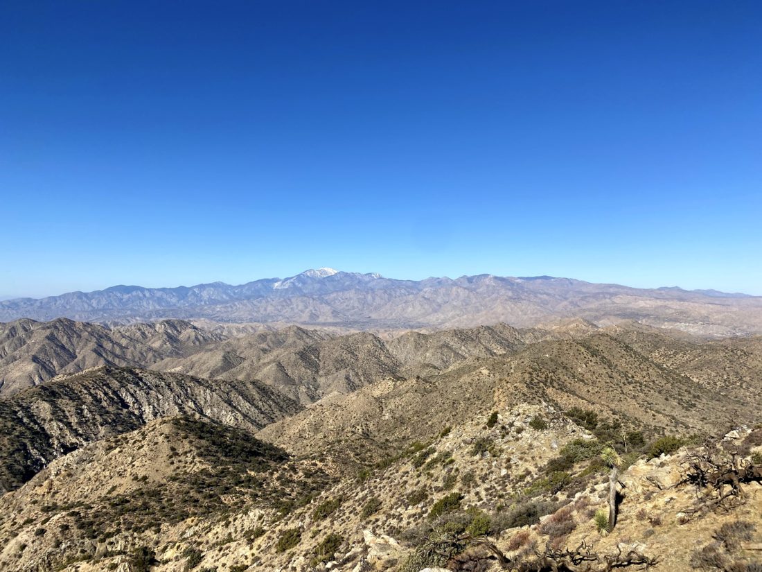
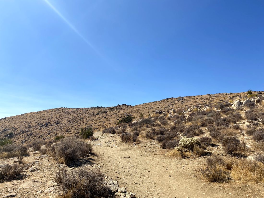
Off to the west, we could see the snow-capped summit of San Gorgonio, Southern California’s highest peak. The trail is nice and flat for almost the first 3.5 miles, so we were able to cruise along. This area is also a popular climbing area, and we would pass signs indicating various climbing access trails to spots like “Brownie Girl Dome” and “Hidden Dome”. The first real junction that you need to look for is the Willow Hole Trail. Stay to the left to keep on the Boy Scout Trail. As you cruise along the trail, enjoy the Joshua Trees that will dot the landscape.

I knew at a certain point the trail would begin to pass into rockier terrain and we would no longer find a suitable campsite. In addition, there are some rules that we needed to observe. Besides the “stand 1 mile from a road and 500 feet from the trail”, we were also not allowed to camp on the east side of the trail. (NPS rules). We could see the terrain becoming less sandy, and the plant life began to change as well.

NOTE: There are now designated dispersed campsites that you have to camp at to reduce the impact on the area. See https://www.nps.gov/jotr/planyourvisit/the-boy-scout-trail-zone.htm

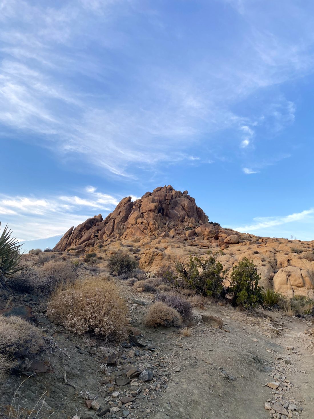
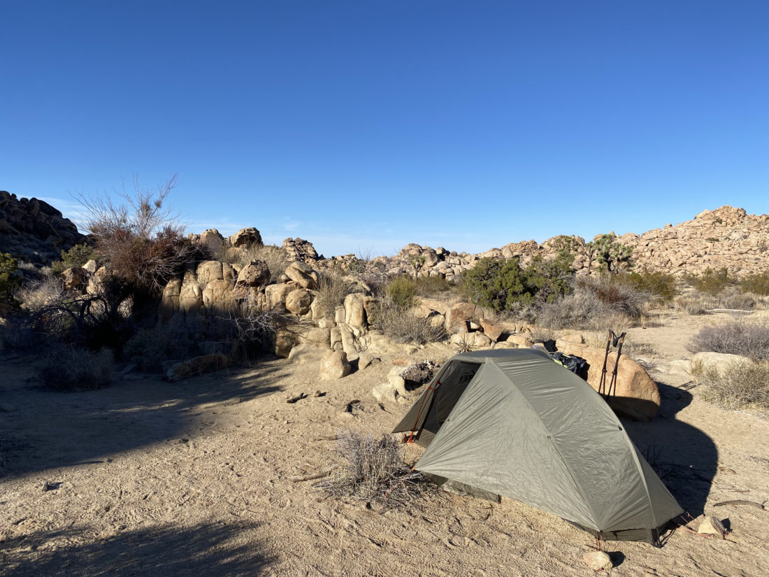
Off to my right, I could see Key Peak in the afternoon sun. We had been seeing several possible camping sites but decided to keep heading north just a bit. Not really finding anything else suitable, we retraced our route about .1 mile to a nice area near Keys Peak. We picked spots about 20 yards apart, so our snoring did not bother each other. Once camp was set up, we headed over to the base of the peak.

I looked at the western face and felt that we could tackle it straight on until near the summit where the rocks looked larger and we would stay to the right for the last bit. While I spotted one cairn near the start, I did not see the next one. No matter, the terrain did not provide any issues. About halfway up, something shiny caught my eye, and I found a mylar balloon caught in a bush, so I headed over to collect it. Once the trash was packed away, I headed back toward my original route. As I expected, toward the top, there were a few Class 2 sections to scramble through, but soon we were on the summit. I found the benchmark and register. We snapped our photos and took advantage of cell service to check in with our spouses. The sun was setting and there was a light breeze, so I was eager to climb back down and start thinking about dinner. Coming down, I quickly found the string of cairns that guided us back to the desert floor. This little excursion was .5 miles with just over 325 feet of gain. 

As the sun’s light began to fade, I sat back and enjoyed the changing light upon the rocks around us. We each had our dinners and some beers we had packed in as well. It was getting colder, so we each retreated to our tents for the night. Ted had brought a tripod and DSLR in hopes of getting some nice star shots later once the sliver of moon had set. I did not have the best night’s sleep, as I needed just a bit more warmth. I woke before the sun crested the hills to the east, and Ted was up soon thereafter. Ted took a bit longer to get ready, so I scrambled up the mound of boulders to our west for a look around. Once we were done with breakfast, we finished packing and headed back onto the trail.

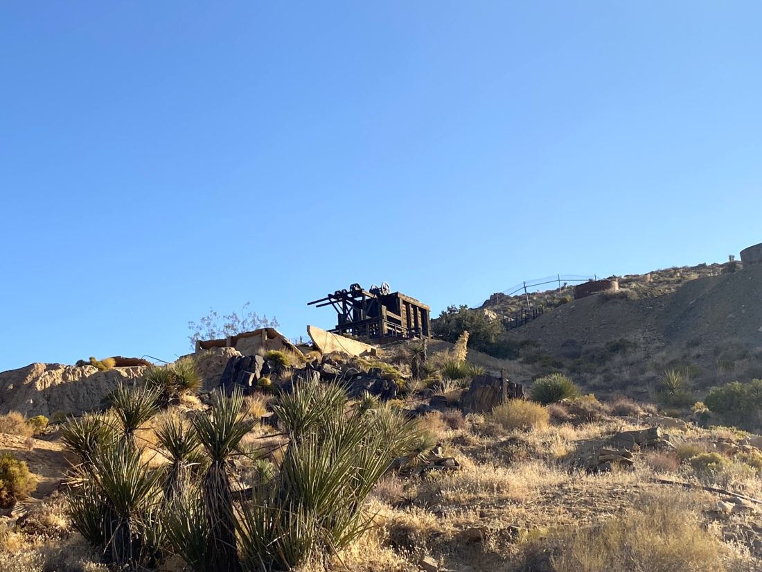
We came to the intersection with the Big Pine Trail that could take us to the west and eventually to the main road, but we continued working our way northward. The trail was getting rockier and rockier. There were a few boulders to work our way down, but nothing serious. It was more about having a backpack on versus a standard daypack. Along the way, we passed an old water basin from a nearby mine.

The trail markers kept us on the trail, although the route was very easy to follow. We had begun the descent toward the canyon that we would eventually follow out. Ted commented that we certainly picked the right direction, as climbing this with a full pack would take some effort. The next point of interest was the Boy Scout Viewpoint. This spot gave us an epic view toward the east. After capturing the panoramic view, we would descend through a series of switchbacks until we reached another wash. Here the trail made a hard right turn and began heading eastward.

While trail markers would still guide us through the wash, there really is only one route to take. Various cacti would dot the sides of the wash and canyon walls, including some very beautiful and colorful barrel cacti. We still had some shade, so the temperatures were pleasant as we worked through the wash and the narrow slots. I kept an eye on our track for the turn-off to climb Mount Mel. I wasn’t certain if I was going to do it as the poor sleep had not left me overly eager to scramble up the rocky slopes to this summit. Once at the turn-off, I looked at it and decided to skip it. It is close enough to the other trailhead that returning another time was not going to be an issue. 

Finally, the trail left the wash, then hugged the side of the hill before exiting into the wide flat desert. From here we had a long gradual downhill hike back to the car. This trailhead only holds about 6-7 cars, and there were a few open spots. There are no facilities, but both the ranger station and Indian Cove campground do. We changed our shirts and shoes and headed back to go get my car. Along the way, we grabbed lunch at the Crossroad Cafe. They had a one-hour wait, but that gave us time to go into the park, get my car and be back in time. After lunch, Ted and I said our goodbyes until our next adventure.

Day 1: 3.93 miles, 1:35 with maybe 200 or so feet of gain.

Day 2: 4.45 miles, 2:09 with 1,280 of loss.


I am an avid peak bagger, sometimes backpacker, and former sea kayaker living in San Diego. In 2019, I became the third person to complete the San Diego 100 Peak Challenge. Not stopping with that accomplishment, I set my sights on the harder San Diego Sierra Club 100 Peak list, which I completed in 2021. In addition, I have conquered several Six-Pack of Peaks challenges (SoCal, San Diego, Central Coast, and Arizona-Winter). Beyond attempting the San Diego Sierra Club 100 Peak list a second time, I am looking forward to exploring new summits and new adventures across the southwest. 
Mount Inspiration

After grabbing lunch, it was time to enter the park proper to summit my third peak of the day, Mount Inspiration. As I sat in the slow-moving line of cars to enter, I enjoyed my burrito. Once in the park, I drove on toward Keys View. Along the way, I passed full parking lots and tons of people enjoying the park. I hoped I would be able to find a spot in the parking lot once I got there. One advantage of this destination is most do not stay that long, so I should not have to wait long for a spot to open. Thankfully, just as I pulled up, a spot opened and I grabbed it. I had tried to do the peak a couple of times before but was never able to work out the logistics. 

The trail begins at the northwest corner of the parking lot. I could see a few folks atop the first section of the trail enjoying the views. I worked my way up the trail with no trouble. Once I was at the top I could see the use trail continuing off to the northwest. It dropped down to a small saddle before working its way up toward South Mount Inspiration. Here I met two hikers returning from the summit. They were also working on the Sierra Club Hundred Peaks Section (HPS) list. One of them had about 70 done! We chatted a bit before parting ways, and I noted a section they mentioned gave them trouble.

The use trail continued to be really good until it reached a small bump en route. I scanned the terrain and spotted it working its way around it to the east. This is where I think those two hikers had the trouble they mentioned. Also along the way, I passed a metal shed. I have no clue as to what it is — some more research is going to be needed.

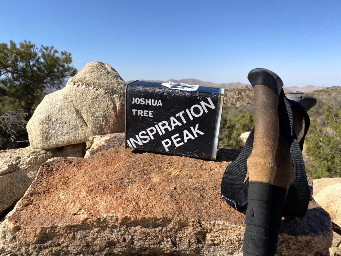
Once on the summit, I found the primary mark, and reference mark #2. Try as I might, reference mark #1 could not be located. I also found the register tucked under a small rock pile. The label box made for a nice photo. The skies had become hazy, so those snow-capped mountains from earlier in the day were not nearly as visible.

On my way back, I made the small detour to the top of South Mount Inspiration just because. Soon, the parking lot came back into view, and shortly thereafter I was back at my car. With that, three more HPS peaks were now complete. Next week, I will attempt my 98th peak on the San Diego Sierra Club 100 Peak list.


I am an avid peak bagger, sometimes backpacker, and former sea kayaker living in San Diego. In 2019, I became the third person to complete the San Diego 100 Peak Challenge. Not stopping with that accomplishment, I set my sights on the harder San Diego Sierra Club 100 Peak list, which I completed in 2021. In addition, I have conquered several Six-Pack of Peaks challenges (SoCal, San Diego, Central Coast, and Arizona-Winter). Beyond attempting the San Diego Sierra Club 100 Peak list a second time, I am looking forward to exploring new summits and new adventures across the southwest. 

Eureka Peak

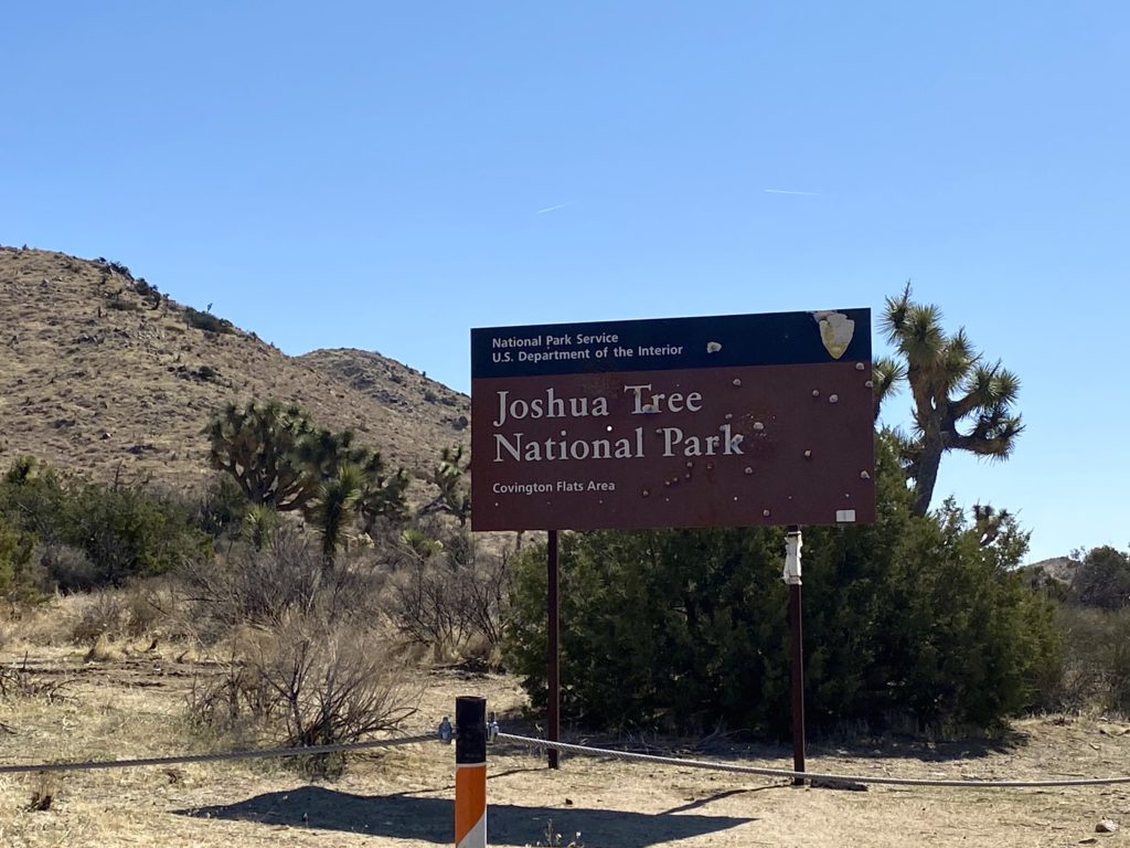
Had I not wanted to have a low-key day, I might have connected my trip up Warren Peak to Eureka Peak, but I was not interested in that kind of mileage. Instead, I drove down Covington Flat road toward Warren Peak. This was a nicely groomed dirt road, better than some roads I have driven in San Diego. I had the window down and enjoyed the 25-minute drive.

I parked at the end of the road, with one other car parked nearby. Since the peak was only about 1/10th of the mile from the parking area, I just grabbed my wind shell and trekking poles.

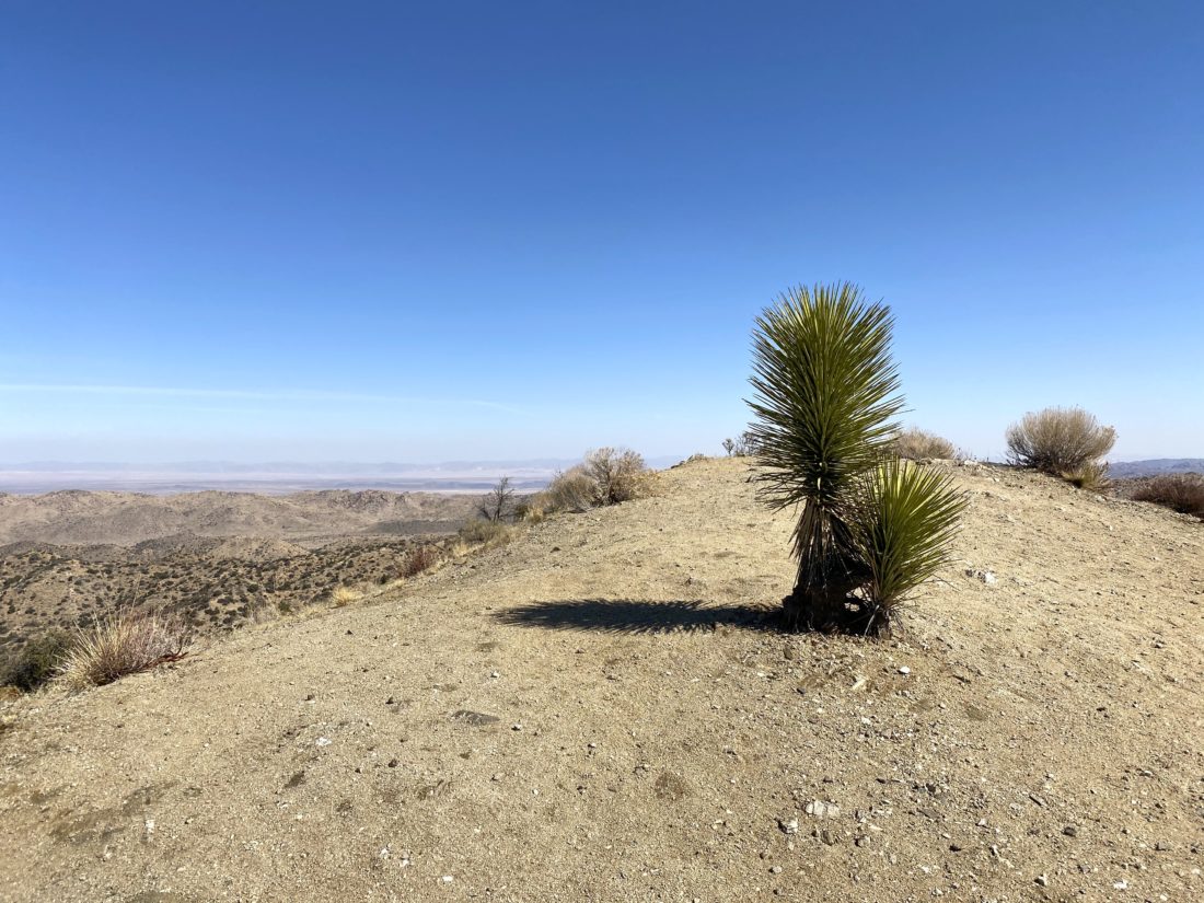
The actual peak is almost barren, sans one lone plant. I could not find any marks nor a register but was not surprised. The views were lovely, but the wind made it chilly, so once again I did not linger. As I drove back toward town to grab lunch, several cars passed me. While some were off-road friendly, I hoped the Honda Civic and Tesla did not encounter any issues.


I am an avid peak bagger, sometimes backpacker, and former sea kayaker living in San Diego. In 2019, I became the third person to complete the San Diego 100 Peak Challenge. Not stopping with that accomplishment, I set my sights on the harder San Diego Sierra Club 100 Peak list, which I completed in 2021. In addition, I have conquered several Six-Pack of Peaks challenges (SoCal, San Diego, Central Coast, and Arizona-Winter). Beyond attempting the San Diego Sierra Club 100 Peak list a second time, I am looking forward to exploring new summits and new adventures across the southwest. 

Warren Peak

After the intense effort of last weekend’s peaks, I wanted to spend some time taking it a bit easier. While I did have some friends planning to hike Mile High via Rattlesnake Canyon, a route that looks very interesting, that was going to be a bit more than I wanted. So, instead, I opted to head out to Joshua Tree and try to knock off some of the peaks on the Sierra Club Hundred Peaks Section (HPS) list. Since it is high desert season, I knew I needed to get to the trailhead early for my first peak, Warren Point. The trail begins from the Black Rock Campground, & I got one of the last spots at the trailhead parking area when I arrived at 7:30. I grabbed my gear and set off through the campground. 

The trail was very well marked and clearly well-traveled by the number of footprints in the dirt. After a short bit, the West Side Loop Trail connected with the Black Rock Canyon Trail and continued south. This trail eventually reached the Panorama Loop. As tempting as it was to add this onto the adventure, I was hoping to cross three peaks off the list today, so I took the fork leading up to Warren Peak.

The trail would start to turn westward as it made its way up toward the peak. The peak finally revealed itself near the junction to the spur out to Warren View. The path now became a bit steeper, and I met two hikers returning from the summit. As I approached the summit, the winds had picked up a bit, so I tossed on my wind shell before reaching the top. The trail had curved behind the peak, so the scrambling I thought I might have to do never materialized.

I found the primary mark and the register. This is a fairly popular peak, given its closeness to the campground, so the register was at best a year old. The views of San Jacinto and San Gorgonio were spectacular from the summit. I did not linger too long, as the wind was a touch chilly and I had two more peaks to visit.

On my return, I passed quite a few groups of hikers making their way up the trail. For the most part, the trail is nice and wide, so I had no concerns. I opted to stay on the Black Rock Canyon trail the entire way back to the car. When I got to the car, every parkable area was taken. I was able to carefully back out and head to my next destination, Eureka Peak.


I am an avid peak bagger, sometimes backpacker, and former sea kayaker living in San Diego. In 2019, I became the third person to complete the San Diego 100 Peak Challenge. Not stopping with that accomplishment, I set my sights on the harder San Diego Sierra Club 100 Peak list, which I completed in 2021. In addition, I have conquered several Six-Pack of Peaks challenges (SoCal, San Diego, Central Coast, and Arizona-Winter). Beyond attempting the San Diego Sierra Club 100 Peak list a second time, I am looking forward to exploring new summits and new adventures across the southwest. 

Mastodon Peak

I pulled into Cottonwood Springs Campground around 3 pm. Since this part of Joshua Tree National Park is lower in elevation, it was a bit warmer. I set up my tent and relaxed in my chair beneath some shade. I rehydrated some more while enjoying Journeys North: The Pacific Crest Trail by Barney “Scout” Mann. As the sun began to get lower, I thought about summiting Mastodon Peak then, instead of in the morning. Since the trailhead right at the campground, so I grabbed my gear, making sure to toss in my headlamp and set off.

Opting to take the loop in a counter-clockwise route, I soon found myself at Cottonwood Springs. The evening light was making the palm fronds glow. I continued up the trail, watching as the evening light crept across the desert. Soon I reached the turnoff toward Mastodon Peak and Mine. The Lost Palm Oasis would have to wait for another time…

The trail continued working its way up. There were even some nice carved steps at one point along the trail. Finally, Mastodon Peak revealed itself. A sign indicated that the summit was just .1 miles away but on an unmaintained trail. I knew from my research that the path circled around to the eastern side of the peak and had some light scrambling. I found the route without issue, and with two little scrambles was standing atop Mastodon Peak. The sun had almost set, so I was being mindful of the time. Even so, I got some nice photographs.

After scrambling back down, I rejoined the trail and soon found myself at the Mastodon Mine. The actual mine shaft is grated over and is now home to a variety of bats. I looked over some of the other artifacts for a bit before continuing on.

The trail was still fairly easy to follow as the light faded. Finally, I stopped and donned my headlamp. When I was on a rise, I could see the lights of the campground off in the distance. Once in a while, I would see a bat fly by, much too fast to even attempt to snap a photo.

Soon, I found myself back at the junction to the trail and my thoughts were turning toward dinner. All told this hike was 3.36 miles with just over 500 feet of elevation gain. It took me 1:35 to complete it (including a short side spur). 


I am an avid peak bagger, sometimes backpacker, and former sea kayaker living in San Diego. In 2019, I became the third person to complete the San Diego 100 Peak Challenge. Not stopping with that accomplishment, I set my sights on the harder San Diego Sierra Club 100 Peak list, which I completed in 2021. In addition, I have conquered several Six-Pack of Peaks challenges (SoCal, San Diego, Central Coast, and Arizona-Winter). Beyond attempting the San Diego Sierra Club 100 Peak list a second time, I am looking forward to exploring new summits and new adventures across the southwest. 

Ryan Mountain

My second peak of the day was to be Ryan Mountain, which is also on the Sierra Club Hundred Peaks Section list (#239). This peak is one of the more popular hikes in the park, in part due to the incredible views from the summit. Before I set off, I saw a couple looking over a map, and I offered some assistance as to their next adventure. Afterward, I chatted with one of the volunteers nearby. We commented on how many of the hikers were improperly clothed for the hike. Shorts, t-shirts, or tank-tops were common on many of them. While we stood there in long pants and long-sleeves and wide-brimmed hats just shaking our heads. 

The trail begins climbing straight from the parking lot. For the first part of the trail, stairs built from the native rocks helped me make the 1,000-foot climb to the summit. Standing off to the right, just after hitting the trail, was a massive rock formation. This white tank granite is over 135 million years old.

I would keep climbing up the mountain, letting the returning hikers pass safely by. It was hit and miss on the face-covering usage. After a short, relatively level section, the rock stairs returned until I reached the saddle. Here I got my first real view of the summit. At this point, the trail’s grade eased and I soon found myself atop Ryan Mountain. 

I had packed my lunch, so I found a nice spot to rest and enjoy my well-earned meal. The views were truly spectacular. The summit is nice and wide, so everyone was able to find a spot a safe distance from one another.

While it was warmer, the breeze made it pleasant to just soak in the views. I eventually figured I should head back down, as I had about an hour’s drive down to my campsite at Cottonwood Springs. The descent was uneventful, except for the sweeping views. All told, I covered the 2.8 miles in 1:43 with 1,054 feet of gain. 


I am an avid peak bagger, sometimes backpacker, and former sea kayaker living in San Diego. In 2019, I became the third person to complete the San Diego 100 Peak Challenge. Not stopping with that accomplishment, I set my sights on the harder San Diego Sierra Club 100 Peak list, which I completed in 2021. In addition, I have conquered several Six-Pack of Peaks challenges (SoCal, San Diego, Central Coast, and Arizona-Winter). Beyond attempting the San Diego Sierra Club 100 Peak list a second time, I am looking forward to exploring new summits and new adventures across the southwest. 

Lost Horse Mine

I decided to spend a couple of days exploring Joshua Tree National Park. The first day was spent summiting some peaks, and the second day would be playing tour guide for a friend. Since the weather was still warm, I knew I wanted to get an early start. I arrived at the trailhead for Lost Horse Mine to an empty parking lot around 7:30 am. This was to be the longest hike of the day, so I wanted to get it done first. After grabbing my gear, I set off to see the well-preserved mine and then summit the nearby peak. The entire loop is just about 7 miles, while if you just go to the mine and back it is about 4.5 miles. Being mindful of the temperatures, I was unsure which option I was going to take. As I stepped onto the trail, I saw the sign that the park had turned this trail into a one-way route, so I realized I’d doing the loop.

The trail worked its way back into the wilderness. About a mile in, a runner shouted that he was coming up from behind. I didn’t expect to see that on the trail. I wished him a safe run and he wished me an enjoyable hike. As I made my way toward the mine, I was rewarded with some nice vistas of the park. Soon the mine came into view. I had tried several times in the past to hike out to this site but had been unable to. 

I took the spur trail up to the Lost Horse Mine. The mine itself is fenced off, so it took a little finagling to take my photos. It is quite a sight to see. After exploring some of the surrounding artifacts, I rejoined the main trail and headed along my clockwise route. I soon came to the turnoff to make the ascent to Lost Horse Mountain. This peak is #251 on the Sierra Club Hundred Peaks Section, hence why I was eager to climb it.

The route is straight up the short slope, and I was able to follow the faint use trail for most of it. As expected I was rewarded with some sweeping views. A light breeze made it quite nice. There was no register nor benchmark to be found. After a short break, I headed back down, knowing I had another 4 or so miles of hiking to return to the car. 

Once I was back on the trail, it began its steep descent for a while. I stopped for a bit to explore what appeared to be closed mine shafts. Here, an actual hiker passed me. We exchanged hellos as he continued on. Since I was hoping for a multiple peak day, I was playing it conservatively with my pace and energy. 

After a bit, I came to the ruins of an abandoned cabin that Johnny Lang, the founder of the mine, moved to after being accused of stealing gold from the mine. All that remains is the chimney and the bed frame. This is also the site of the Optimist Mine, which unlike the Lost Horse Mine, was a bust.

Once I made a short climb, the trail would gradually descend back to the car. I was passed by another runner. Did I miss the notice for the race? Around a mile to go, I encountered three hikers going the other direction. I let them know that this trail is one-way and they might encounter some folks giving them the stink-eye.

While I cruised along, I debated what my second peak will be. Mount Inspiration was an option. While short, it was a use-trail-only hike. My other option was Ryan Mountain, which would have more traffic. In the end, I decided Ryan Mountain would be the smart choice. Soon the road came into view as well as the parking lot. The lot had filled up since I set off. Tossing my gear into the back and enjoying some cold water, I was off for the short drive to the next peak. This hike took me 3 hours to cover the 7 miles with 1,049 feet of gain.


I am an avid peak bagger, sometimes backpacker, and former sea kayaker living in San Diego. In 2019, I became the third person to complete the San Diego 100 Peak Challenge. Not stopping with that accomplishment, I set my sights on the harder San Diego Sierra Club 100 Peak list, which I completed in 2021. In addition, I have conquered several Six-Pack of Peaks challenges (SoCal, San Diego, Central Coast, and Arizona-Winter). Beyond attempting the San Diego Sierra Club 100 Peak list a second time, I am looking forward to exploring new summits and new adventures across the southwest.