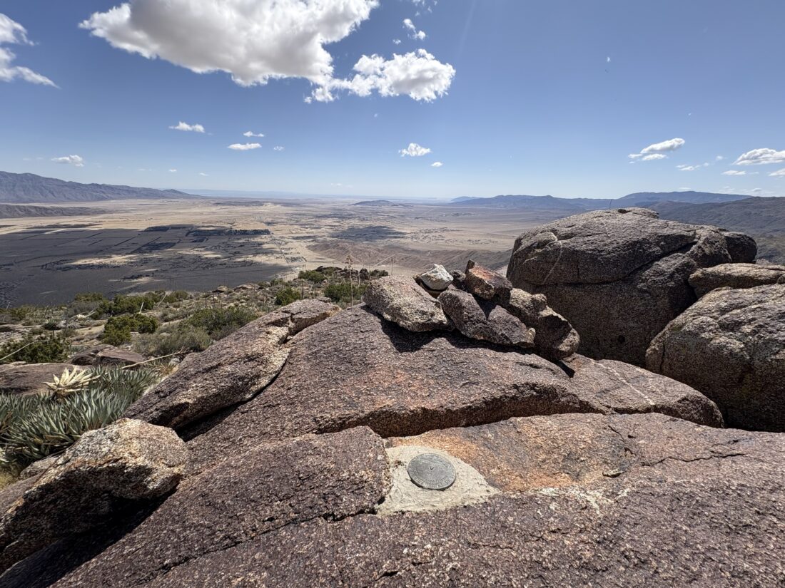
With desert season drawing to a close, I decided to try to get another San Diego Sierra Club peak crossed off my list. I decided on attempting Kay Benchmark, which is just to the west of the Anza-Borrego State Park Visitor Center. I arrived a bit after 8 am, paid my $10 day use fee, and took advantage of the freshly cleaned restrooms. After a short walk across the desert floor, it was time to ascend the ridgeline that I would follow. A faint use trail guided me through the early section of the climb, and about a 1/2 hour later, I was standing atop Ode Benchmark. Ted and I had climbed this peak back in 2019 but did not venture past it. I actually have never climbed up to Kay Benchmark, as my only “ascent” was when I hiked over from Ranchita.
After a quick check-in at Ode, I descended toward a small saddle before continuing my climb. It was here that, during Greg Gerlach’s last summit, he exited the ridge and returned via the drainage to the north. I might consider that option upon my return, but for now, my focus was on the steep climb ahead of me.
I would dodge and weave around cacti and look for more friendly routes up the slope. A slight breeze helped keep things pleasant from a temperature point of view. As I neared 3,400 feet in elevation, the ascent became more difficult, and I was now faced with some serious rocks to pick my way through. That section was not going to be fun upon my return. I worked my way through them, and the summit was almost in view.
As I reached it, a sense of accomplishment came over me. When I last stood atop this pile of rocks, I had just down-climbed some serious terrain. While the ascent had a few challenges, nothing compared to that. I took in the views and had a nice, relaxing snack. Unfortunately, I forgot to pack any electrolytes, so I hoped that wouldn’t be an issue on the descent. I still had plenty of water, so I was not worried about that at least.
Now for the long descent. I carefully worked my way down past that steep rock face, only having to retreat once from a route that was not safe. Once that section was behind me, I could feel my anxiety level drop. Now, it was mostly standard desert ridgeline hiking. I just needed to take care and dodge and weave around the cacti and find solid footing.
Once at the saddle, I looked up at the climb to pass over Ode Benchmark and said to myself, “Greg had the right idea”. So down a side ridge I went, and soon I was in the wide drainage leading back to the east. While a bit rocky, it was still easier than continuing on the ridge. Before too long, I spotted the flagpole at the Visitor Center, and not much later, I was back at my car. I tossed my gear in and headed into the center for information about my next adventure: Vallecito Mountains High Point. They did not have a lot of information, but it was worth checking. After grabbing lunch in town, a well-earned burrito, I also grabbed a sandwich for dinner later. For Kay Benchmark, my stats were 4.51 miles in 5:31 with 2,860 feet of elevation gain.
I am an avid peak bagger, sometimes backpacker, and former sea kayaker living in San Diego. In 2019, I became the third person to complete the San Diego 100 Peak Challenge. Not stopping with that accomplishment, I set my sights on the harder San Diego Sierra Club 100 Peak list, which I completed in 2021. In addition, I have conquered several Six-Pack of Peaks challenges (SoCal, San Diego, Central Coast, and Arizona-Winter). Beyond attempting the San Diego Sierra Club 100 Peak list a second time, I am looking forward to exploring new summits and new adventures across the southwest.
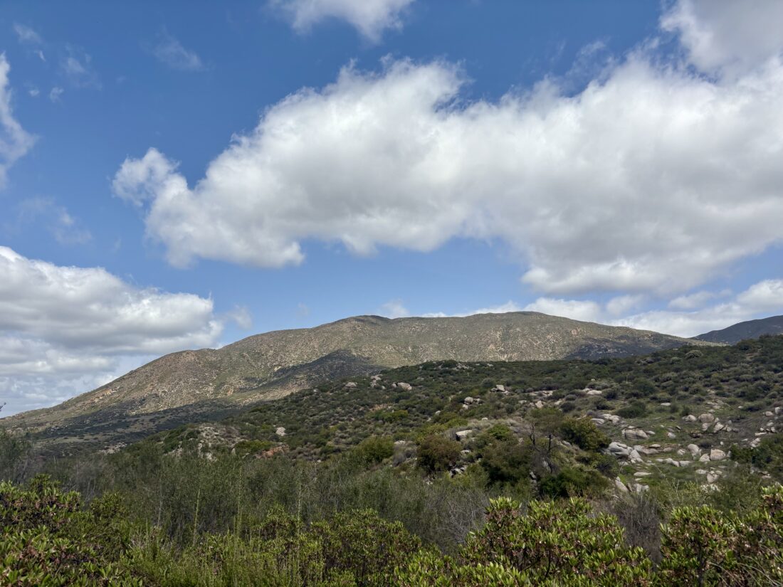
The original plan was for us to tackle Goat Benchmark, San Ysidro East Peak, and The Sirens as an overnight adventure. However, checking the forecast Friday morning quickly put an end to that plan. Winds between 25-30 mph, with predicted gusts up to 50 mph. None of us wanted to camp in that, especially in an exposed open flat, so we began looking for alternate hikes. The high winds scuttled anything out in the desert. Rick and Andrea suggested an interesting loop in Mission Trails, and I offered up doing either Mt. Gower or Paradise Mountain (both of which Ted needs). We settled on Paradise Mountain and agreed to meet at the trailhead at 8. Ted and I arrived first, and just before 8, Rick and Andrea pulled into the parking lot. The skies were overcast, and the summit of the peak was obscured by the clouds as we set off down the trail.
The trail almost immediately began to descend 300 feet down to Hell Creek. After the simple water crossing, the trail became mostly flat before beginning the climb to the summit. We chatted about all sorts of topics as we motored along the fairly well-maintained trail. The clouds had lifted, and the summit stood above us.
When we reached the junction, we all agreed that we should do the loop in a clockwise fashion. We pushed upward, pausing a few times to link back up. A side trail took us over to Viewpoint A, as labeled on Peakbagger. It did offer some nice views from there, but we did not linger. Once back on the main loop, we quickly reached Ditch Benchmark and stopped for a few photos. Someone had incorrectly left a summit sign for Paradise Mountain there. We tucked it into my pack and carried it over to the proper summit, about 1/2 mile to the east. We stopped for a snack break and to soak in the views.
Once refueled, we set off down the trail. Unlike our steep ascent, the descent was a gentler grade, which made everyone’s knees happier. Before we knew it, we were crossing back over the creek, starting the climb back to the trailhead. Along the way, a horse and rider passed us, heading down the trail. Once back at the trailhead, five more horses were getting ready to take their riders along the trail. We quickly cleaned up and headed out for a well-earned lunch at Burger Bench. I logged the hike at 8.25 miles in 4:31, with an elevation gain of 2,080 feet. The only negative was that I did find a tick on me later. It was still crawling, so I removed it and crushed it. Rick found one on him while hiking, so we’re keeping an out for any more.
I am an avid peak bagger, sometimes backpacker, and former sea kayaker living in San Diego. In 2019, I became the third person to complete the San Diego 100 Peak Challenge. Not stopping with that accomplishment, I set my sights on the harder San Diego Sierra Club 100 Peak list, which I completed in 2021. In addition, I have conquered several Six-Pack of Peaks challenges (SoCal, San Diego, Central Coast, and Arizona-Winter). Beyond attempting the San Diego Sierra Club 100 Peak list a second time, I am looking forward to exploring new summits and new adventures across the southwest.
After the scouting trip to the trailhead on Saturday, I decided to take advantage of the break between the storms to go climb Granite Mountain again. The other time I summited this peak was via the Cool Canyon route, and this time I really wanted to use the Rodriguez Canyon trailhead. After filling up the gas tank and grabbing my breakfast and coffee, I headed out to the desert. As I drove through Julian, I spied a PCT hiker thumbing a ride back down to the trail. I pulled over and offered a lift. We had a lovely chat as we drove down the Banner Grade. I dropped him off at the Scissors Crossing parking lot and wished him well on his journey. I then cruised down to the trailhead, making a quick stop at the pit toilets in Blair Valley. I was glad I had my “poop kit” with me, as both toilets had no toilet paper. I turned off the highway, and began driving the road that Ted and I drove on Saturday. The heavy construction equipment that was parked beside the road had been busy, as one section of the road had been smoothed over. I still had to carefully pick my way up out of Vallecito Wash, but the Outback handled it like a champ. I drove up Rodriguez Canyon a short distance and found a nice spot to pull off. Grabbing my gear I headed north across the open desert floor until I linked up with an old jeep road that led to a couple of abandoned mines. The road was overgrown and would fade from time to time.
At some point I lost the road and began working my way up a ridge. When I checked my position again, using Keith Winston’s route, I found myself on the wrong side of a ravine. I decided to keep on my route, follow the contour to get closer to Keith’s route and go from there. I knew after the mines that I missed, the route follows the ridgeline up. I began weaving and dodging cacti as I kept climbing. The temperature was perfect, cool with a slight breeze. I had a fleece and a wind shell in my pack, but never needed them. I would stop to snap a photo from time to time, but just kept motoring on.
From time to time, cairns would appear. Around 5000 feet in elevation, small patches of snow started to appear in the shade. I could see snow over on the Laguna Mountains to my southwest and on Volcan Mountain to my northwest. As I neared the end of this ridgeline, there was one small bouldery section to climb, but nothing like the mess I recall from the Cool Canyon Route. At the end of this ridgeline, I followed another ridgeline to the northeast. Once over a small false summit, the peak and its massive granite boulders stood before me. This was certainly an easy route, although the section in Cool Canyon itself is a highlight.
I scouted around the boulders looking for a route up, and eventually found one. As I made my final move onto the summit, my two full water bottles on the side of my pack fell out. One went bouncing one way and the other a different way. Crud! I hoped I would be able to find them in the rocks below, otherwise I would be collecting some of that snow to turn into drinking water.
On the summit, I enjoyed some snacks and the last of the water from the bottle that I keep in my shoulder pouch. The views were as stunning as I remembered. If there was a register, it is tucked somewhere below, and I did not bother to go scouting for it, I figured I would have enough scouting to find my water. After a nice break atop the summit, it was time to head back. I surveyed where one bottle bounced, and declared it lost. I worked my way down from the summit block and hoped that the second bottle could be located, and thankfully it was. Since I was heading down and had water in the car, I felt I should be ok. I slipped the recovered bottle into the side pouch and tightened the strap to be sure.
My goal for the descent was to stick to Keith’s track more closely, as I really wanted to see one or two of the abandoned mines. The descent went fine, and there was a faint use trail that I picked up from time to time, just like on the ascent. For the most part, though, it was again weaving past the cacti as I hiked down the ridge. I reached Keith’s turn off spot and generally stayed on course.
I spotted the first mine and peered in, but really did not have any interest in clamoring inside. I walked over to where the second mine was, but it appears that it is no longer open. I could see the outline of the jeep road across the ravine and worked my way carefully down to it. Once on it, I continued to follow it down the mountain. I could see my car off in the distance, always a good sign. Once back at the car, I drank 1/2 liter of water, as I had finished my remaining water about a mile back.
As I drove out, a lone backpacker was hiking along the road. I stopped and chatted with him. He had hiked down Oriflame Canyon and was headed over to the campground at Stagecoach Trails. I offered him a ride, as I was stopping there for a cold soda and snack, but he wanted to hike the whole route. I wished him well and drove away to get that aforementioned soda and begin my drive home. All told, I hiked 7.4 miles with just over 3,000 feet of elevation gain in 6:01.
I am an avid peak bagger, sometimes backpacker, and former sea kayaker living in San Diego. In 2019, I became the third person to complete the San Diego 100 Peak Challenge. Not stopping with that accomplishment, I set my sights on the harder San Diego Sierra Club 100 Peak list, which I completed in 2021. In addition, I have conquered several Six-Pack of Peaks challenges (SoCal, San Diego, Central Coast, and Arizona-Winter). Beyond attempting the San Diego Sierra Club 100 Peak list a second time, I am looking forward to exploring new summits and new adventures across the southwest.
With a bit of weather rolling in, Ted and I headed out to the desert to find something hike-able. We settled on Whale Peak, one that Ted still needed to climb, and maybe we would add on Pinyon Mountain after. The clouds covered the mountains as we drove through Julian and down toward the desert. The Subaru handled the off-road section to the trailhead without incident.
We parked at the trailhead, and felt the cold wind as we stepped out. Ted stayed in his puffy and I slipped on my fleece and made sure my wind shell was in my pack before setting off. The trail immediately starts climbing, so if you need to warm up first, I suggest a short hike down the road. We followed the drainage up to the first saddle. I drifted out of the drainage area toward the end, but in hindsight should have just stayed in it. Once at the saddle, a clear trail could be spotted, plus an extensive collection of cairns would line our route. We cruised along, chatting about recent college visits or other upcoming trips. This would be my third time doing this peak, so much of the route was familiar.
The route would climb over several small ridges before making the final climb to the summit. We had some dramatic views of the surrounding mountains and the swirling clouds. Along the way, we found an iPhone lying on the trail. It didn’t power up as the cold probably drained its battery. I slipped it into my pack to hopefully be able to return it to its owner. Note: We were able to locate the owner and return the phone to him.
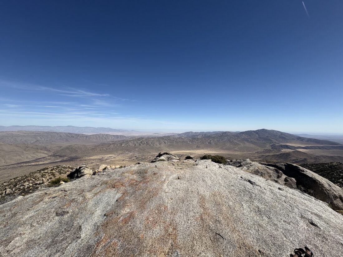
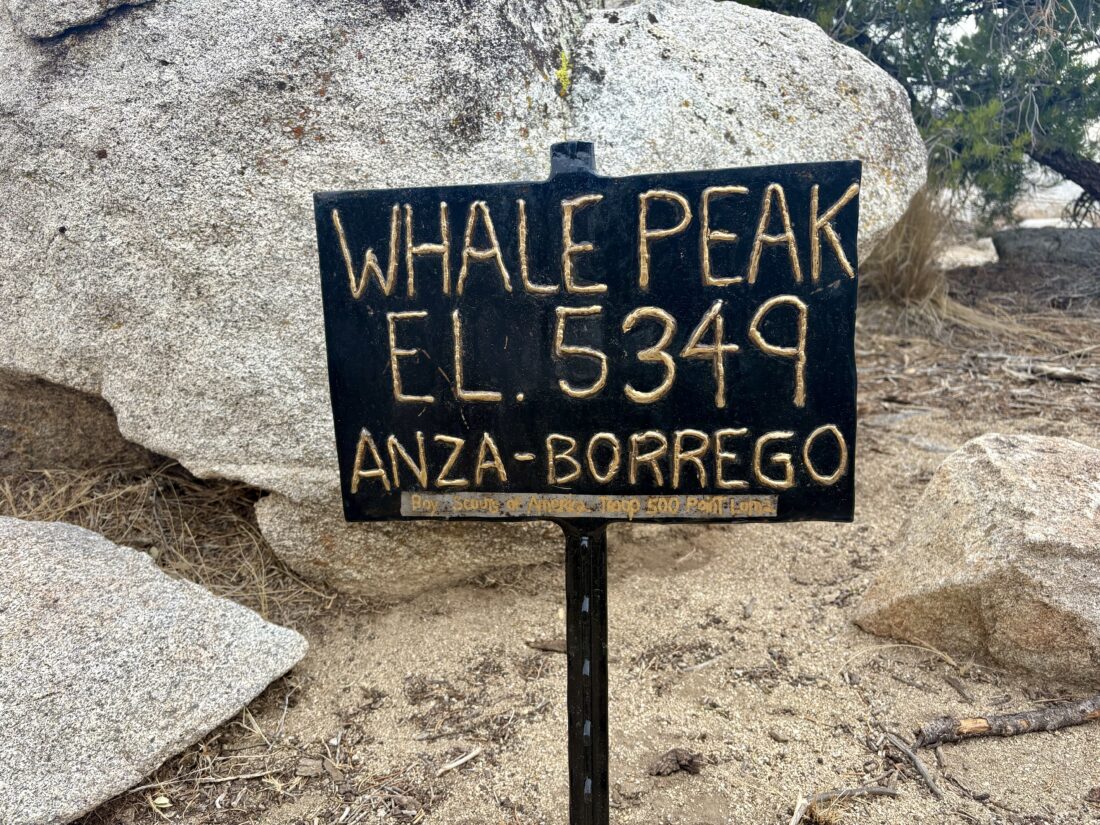
Soon, we were on the summit plateau and we strolled over to the proper summit. We took in the views, found the benchmark and a reference mark, and of course the metal sign. We ducked behind a rock wall to hide from the wind and have a snack. That wind shell came in handy, despite the sun starting to poke out.
After our break, we began our descent. This time, I made sure to head in the right direction. As we worked our way down the steep section, I noted that we were a little off track, so we made a course correction and were soon back on track. We cruised along, and after about half a mile, we shed our layers and continued. As we cruised along one of the small flat areas, we encountered a trail runner making his way up the summit.
Our route down the drainage went smoothly and we were back at the car. Beyond the mystery of the found iPhone, Ted’s recorded mileage and my recorded mileage varied by 3/10 of a mile. Quite a difference! I asked Ted if he wanted to try for Pinyon Mountain next. The issue was this hike would be along a ridgeline and subject to the cold winds. We decided to pass and return another day. As we drove back to the highway, our adventure was not over. Since we had time, we drove down to explore the trailhead for the southern route for Granite Mountain. This road certainly was tougher than the one we drove to the trailhead for Whale, but not as tricky as the road to Jacumba. We stopped short of exiting the wash, as we had a nice spot to turn around. We did walk the next section of the route and I felt it was drivable. This was a good sign as I want to climb Granite via the southern route. We drove back to Julian and had some food and beers at Julian Beer Company before continuing on home. Our ascent of Whale took us 3:03 and on my tracker, 4.3 miles.
I am an avid peak bagger, sometimes backpacker, and former sea kayaker living in San Diego. In 2019, I became the third person to complete the San Diego 100 Peak Challenge. Not stopping with that accomplishment, I set my sights on the harder San Diego Sierra Club 100 Peak list, which I completed in 2021. In addition, I have conquered several Six-Pack of Peaks challenges (SoCal, San Diego, Central Coast, and Arizona-Winter). Beyond attempting the San Diego Sierra Club 100 Peak list a second time, I am looking forward to exploring new summits and new adventures across the southwest.
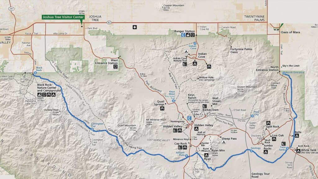
My good friend Ted H. said he would love to join me, along with one of his long-time hiking buddies. The basic plan was for me to drive to various spots along the trail and cache the water we would need along our trek. After that, I would spend the night car camping at Blackrock Campground, which is conveniently located next to the western end of the trail. With my gear packed into the Subaru, I left for Joshua Tree in the morning, hoping to have a relaxing day. I pre-ordered a sandwich from Jersey Mike’s along the way. Not 15 minutes into the drive, Anita calls me to let me know I forgot to pack my eggs in the cooler. Thankfully, she was headed in my general direction, so at least I did not have to drive all the way home. With that crisis averted, I again headed northward, just a little behind schedule. Around Menifee, something clicked in my head, “Did I pack my hiking boots?!” Normally, I wear them out the door when I go hiking, but I was in my regular shoes for some comfort. I found a place to pull over and check, and sure enough, I had forgotten them! Anita was working in East County, so she could not help me this time. Back to San Diego I went. I called Jersey Mike’s to put my sandwich away, as I would be delayed in picking it up. With my hiking shoes acquired, I got back on the road. Given the delay I did swap the order of the water caches, just in case I had further unexpected delays.
Stop one was now the end of Upper Covington Flats Road. Since this was about a ten-mile drive along a dirt road, it made sense to do this while I had daylight. The rest of the caches would be near easily accessible roads. The road was in good shape, and a few pools of water from the recent rains did offer a little fun to the drive (and the need for a car wash later). A lone Prius sat at the trailhead as I tucked 3 gallons of water under some brush. Each cache would have a gallon for each of us. Next, I headed to what would be our last cache, near the parking area for Arch Rock. I wanted to place these jugs a little further from the trailhead, as this spot is heavily trafficked, and did not want someone to accidentally use our water. From there, I drove westward to Geology Road for what was planned for our water for the end of day 2. The final cache was to be placed at the trailhead to Juniper Flats. With our water safely tucked away, I drove back toward Blackrock, making a stop at Stater Bros. to grab a steak to grill, some firewood, and an orange juice for the morning.
The sun had set, so it took a little bit to find my campsite. I quickly unloaded, set up the Luno, and started a fire. The winds made it chilly, so I was glad to have a fire to warm up. I grilled my steak, this time just right. I enjoyed it, along with a nice salad and fine beer from The Bruery. Tomorrow was going to be the start of a big adventure, so I turned in just as the moon was rising over the hills to the east.
It was chilly when I woke up, and I quickly cooked my eggs. I packed up my car camping gear and drove over to the backcountry parking area. The plan was for Mark to drive over to the eastern terminus of the trail and get picked up by Ted and Andrea. The original plan was to start at around 8. Unfortunately, Mark got a late start leaving his campsite. Adding to the mix, the cell network was completely down, so we had no method of communication with each other. Finally, just before 10, they returned from the car shuttle setup, and we could hit the trail.
I carried 3.75 liters of water as we set off on the trail. I did consider having Andrea drive us down to Covington Flats Trailhead and just start from there so we would have time to easily make the planned campsite. The others felt that we should be ok, so we stuck to the original plan. The recent rains compacted the sandy section, making the hiking a bit nicer. This first section was a steady climb, the wind was making the day chilly. Both San Jacinto and San Gorgonio’s snow-capped summits peaked into view from time to time.
After about 6 miles, we found a spot out of the wind and had a snack break. I had hoped to film a lot more on the trip, but that 2-hour delay scuttled that plan. Once we reached Upper Covington Flats, we each strapped our gallon of water to our packs and continued on (after another snack). The sun was setting, and it was pretty clear that we were not going to make the planned campsite. There was another possible site that was only 2.8 miles further, so that became our new destination.
The water jug made a rhythmic sound as I hiked down the trail. When I came to the location of the campsite, it was clearly not going to work. The site sat on the crest above a valley, and the winds were howling. I was actually being pushed from time to time. Setting up camp here was not an option. So, we dropped down and found a spot that was a bit more sheltered. We each found a spot to pitch our respective tents. I did not repeat what happened on San Gorgonio, so I made sure all my tent stakes were highly secured. I set up my camp chair I opted to bring and cooked up dinner. The winds made it too chilly to sit around and chat, so after I ate, I retreated to my tent and listened to an audiobook. The tent would feel the wind, but it held firm. I drifted off to a little sleep, as the winds would wake me briefly. Around midnight, the winds calmed down, and I drifted into a nice slumber. I woke up just before sunrise to answer nature’s call and caught a nice morning sky. I crawled back under my quilt for a little more rest before really starting the day.
I emerged from my tent around 7, and I cooked up some oatmeal and a nice hot cup of coffee. As I was packing up, I could not locate my tent stake bag. My guess was that I left it out and the winds blew it away. I did scout the surrounding brush, but no luck (I later found them tucked in my jacket). I was ready to hit the trail at about 8, however, we did not hit the trail until 9. Thankfully, without the wind, it was quite pleasant. From time to time, we would see trail runners race past along the trail above us.
The trail continued descending for a while before we would have two steep climbs that would have us enter Juniper Flats proper. I reached the crest and found a nice rock to wait for Ted and Mark to rejoin me. I soaked in the view and the silence. Once back together, Ted and I set off together, with Mark keeping his own pace. The plan was to rejoin at the Juniper Flats trailhead and top off our water from the cache I had left on Friday. As I was descending, I felt a couple of hot spots forming. At the trailhead, I put some KT blister tape on where I thought they were.
After a nice lunch, I went solo, as Mark was just pulling in as I was set to head out. I again was concerned about our timing to reach the next planned site and the water as well. I tossed my empty water jug into the recycling at Ryan Campground and motored on. I could feel my feet, but I hoped the blister tape would do its job. I had a slight climb leaving Ryan Campground, but then the trail leveled out.
My feet started to hurt more, so I stopped under the shade of a Juniper tree and took a look at them. A quarter-sized blister had formed on the balls of each foot. This was not good. I applied more KT tape, but I suspected that I might have to call it. My best guess is I actually was hiking too fast to make up for our delayed starts and created the friction to cause them to form. I began thinking of options. I could camp early and then hike to Geology Road in the morning. I could attempt to make it to the planned site and either backtrack to Geology Road and get picked up or if the feet were up to it, limp to Arch Rock and bail there. Hiking to the end was no longer an option. As I drew nearer to Geology Road, I began messaging Anita about her driving out to pick me up. I actually hoped to hitch a ride from someone who could take me back to my car, but first I needed to tell Ted and Mark of my plan to bail here. So I set up my chair and waited. I actually had a cell signal, so I called Anita and gave her the details for plan B if I could not hitch a ride.
After about 30 minutes, they reached the trailhead. I told Ted where the water was at Arch Rock and began looking for someone returning from driving Geology Road. Sure enough, the first car stopped and had room for me and my gear and was headed in the right direction. I said my farewells to Ted and Mark. My rescuers kindly drove me back to my car. Once back out of the park, I texted Anita that she could return home, as she had preemptively started out to meet me. I tossed my gear into my car and bid farewell to my rescuers.
My adventure was not quite over. I opted to fuel up at the Morongo gas station and grab dinner at In-n-Out. As I entered the traffic circle, a Mercedes Benz SUV cut in front of me, causing me to slam on my brakes, and unfortunately, my burger and fries flew off the seat onto the floor. I lost about half my fries, but the burger was still intact. Thankfully, that was the last of the misadventures.
I did hear from Ted that they completed the hike, but he, too, had blisters that slowed him down.
I am an avid peak bagger, sometimes backpacker, and former sea kayaker living in San Diego. In 2019, I became the third person to complete the San Diego 100 Peak Challenge. Not stopping with that accomplishment, I set my sights on the harder San Diego Sierra Club 100 Peak list, which I completed in 2021. In addition, I have conquered several Six-Pack of Peaks challenges (SoCal, San Diego, Central Coast, and Arizona-Winter). Beyond attempting the San Diego Sierra Club 100 Peak list a second time, I am looking forward to exploring new summits and new adventures across the southwest.
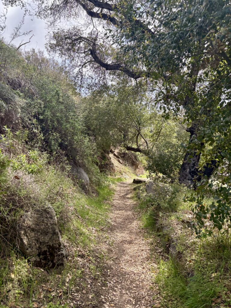
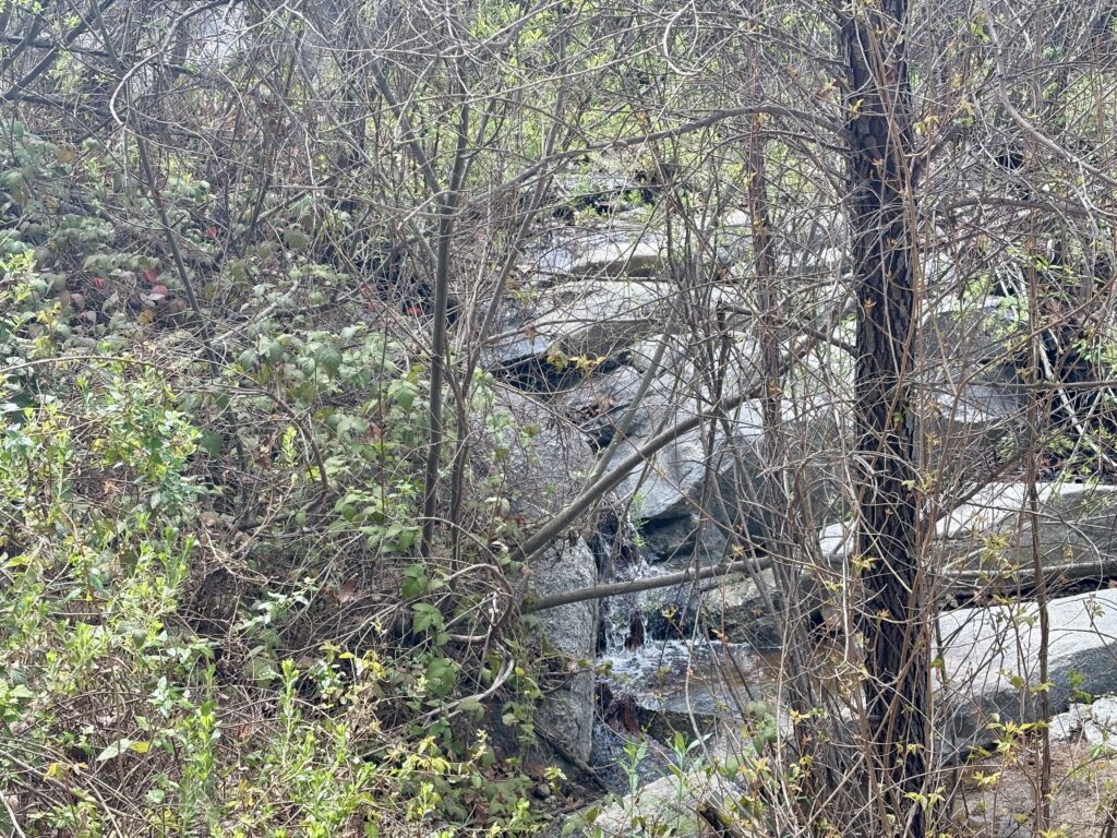
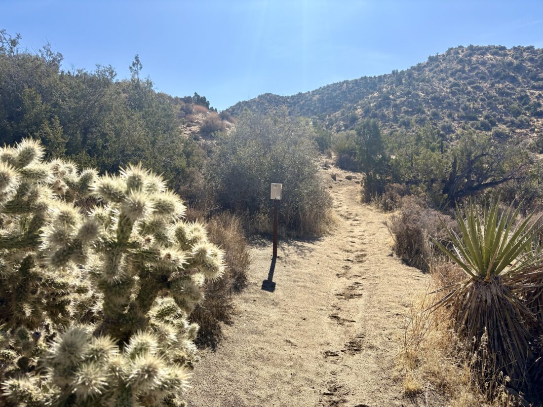
As we cruised out toward Anza-Borrego, the eastern sky was glowing a fiery red as the sun began to rise above the mountains. The plan for today was to hike up the ridgeline to Webo Benchmark which sits atop its end. Along the way, we would pass over Ted Benchmark. Rick and Andrea needed both toward their quest to complete the San Diego Sierra Club 100 peak list. I had done this hike several times before, but I was happy to make the climb again, as who doesn’t love a good desert hike? The parking area had one other car there when we pulled in just after 7:30. Rick went to pay the $10 day-use fee, while I liberally applied some Voltaren on my achy left knee. Once we were geared up, we set off down the trail that most visitors take to view Maidenhair Falls (which given the lack of rain probably are not even flowing). The weather was pleasant, even a touch warm. After about a mile, we headed cross-country for a short distance before ascending onto the ridgeline that we now followed toward our destination.
We weaved our way upward, avoiding the various cacti along our journey. Rick and I cruised along carrying a good pace, but Andrea just wasn’t feeling it. Something I can relate to. She felt that she could make it Ted Benchmark, but would probably turn back at that point. Once Rick and I reached Ted Benchmark, we signed the register and snapped a few photos. We then began discussing options: do we continue on up to Webo and give the car keys to Andrea and let her return solo, or do we all just turn back and get Webo another time (either repeating this hike or tacking it on when we try for San Ysidro East)? In the end, we opted to return together and drive over to scout Sunset Mountain for them. Once off the ridge, we encountered a few folks headed to the falls and the nearly empty parking lot now had quite a few more cars parked.
It was still too early for lunch as we drove through Borrego Springs on our way over to Pinyon Canyon. Turning off the 78 onto the dirt road, we cruised along the fairly well-groomed route. We parked near the starting point I used the last two times when I climbed Sunset Mountain and gave them a brief rundown of the route. Once that was completed, we continued driving down the road, wondering what it might lead to. Finally, the road came to an end, and we then retraced our route back into Borrego Springs and grabbed lunch at Los Jilbertos. With our stomachs now full, we drove home. While we didn’t get both benchmarks, we did have a nice 4.2-mile hike and were able to explore a little bit more of Anza-Borrego.
I am an avid peak bagger, sometimes backpacker, and former sea kayaker living in San Diego. In 2019, I became the third person to complete the San Diego 100 Peak Challenge. Not stopping with that accomplishment, I set my sights on the harder San Diego Sierra Club 100 Peak list, which I completed in 2021. In addition, I have conquered several Six-Pack of Peaks challenges (SoCal, San Diego, Central Coast, and Arizona-Winter). Beyond attempting the San Diego Sierra Club 100 Peak list a second time, I am looking forward to exploring new summits and new adventures across the southwest.
Having knocked out two peaks on the San Diego Six Pack of Peaks challenge on New Year’s Day, I decided to cross another off the list — Cuyamaca Peak. While the forecast did call for some windy conditions, that did not deter me. I arrived at the trailhead just before 8. Unlike last time when I was racing against the heat of the day, this time I wanted some of the sun’s warmth to offset the winter chill. I cruised along Milk Ranch Road, falling into a nice groove. I wondered if I might see any wild turkeys, and a few minutes later, almost 20 stood in a field next to the road.
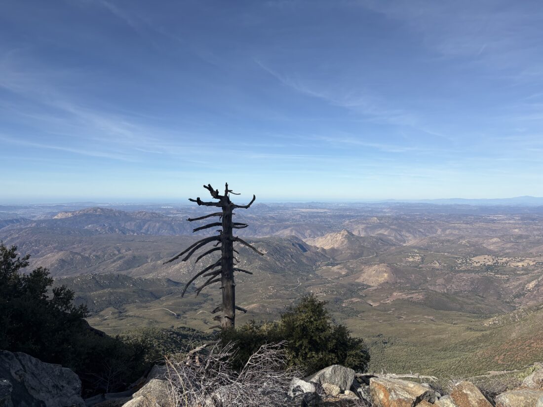
The day felt more like a fall day rather than a day in January. I turned on to the Conejos Trail and began the climb in earnest. The legs still felt good, even after the adventure in the desert the day before. I passed two hikers making their way back from the summit. They said it was quite breezy up there. I thanked for the information and continued on. Once at the service road I slipped rubber tips onto my trekking poles as there was no need to wear down the metal tips on the asphalt. As I approached the summit, I could hear the wind at times whistling through the communications tower. The summit itself was actually fairly well sheltered, so I snapped my photos and enjoyed my PB&J. I didn’t linger past that, set off back down the road, and passed a few other hikers making their way to the summit.
The legs continued to feel good as I turned on to the Azalea Glen Fire Road. Just after the spring, I saw the SD Sloth group. Some of them had been on yesterday’s hike, so I knew they had this on their calendar. I said a quick hello before continuing on. Before too long the end of the trail came into view. I had resisted really looking at my time/pace, but was very curious what my final time would be. I did the 8.6 miles in 3:17! That was a great pace for me on this climb. Since I was solo, I decided to grab some tri-tip from Grand Ole BBQ in Flinn Springs, which hit the spot.
I am an avid peak bagger, sometimes backpacker, and former sea kayaker living in San Diego. In 2019, I became the third person to complete the San Diego 100 Peak Challenge. Not stopping with that accomplishment, I set my sights on the harder San Diego Sierra Club 100 Peak list, which I completed in 2021. In addition, I have conquered several Six-Pack of Peaks challenges (SoCal, San Diego, Central Coast, and Arizona-Winter). Beyond attempting the San Diego Sierra Club 100 Peak list a second time, I am looking forward to exploring new summits and new adventures across the southwest.
When I saw the hike announcement from the Jacumba Hikers that they were leading a hike in Indian Gorge to a “hidden” cave, I knew that they were headed to the Solstice Cave near Sombrero Peak! I had known of this cave for some time, and had always wanted to see it in person. I drove out to the Imperial Valley Desert Museum to rally with our trip leaders. Since my Outback was still out of commision, I would need to carpool out to the actual trailhead. Several of the San Diego Sloth Hiking Group also arrived for the trek, and after signing our waivers, we piled into two capable vehicles and set off. The road to the trailhead took some care — not as bad as Carrizo Gorge, but certainly one that requires some off-road driving skills.
The familiar trailhead for the east approach of Sombrero Peak came into view. A small palm grove stood just to the west. We gathered our gear and set off. Mike took the lead, following the use trail that faded in and out as we made our way up the drainage. Instead of turning left to follow the route that I took on two of my summits of Sombrero Peak, we continued westward. We climbed up over the boulders and through the cat’s claw and cacti. From time to time we would stop and regroup, as the terrain would cause us to spread out a bit. While some were very comfortable hiking in this terrain, others were less so.
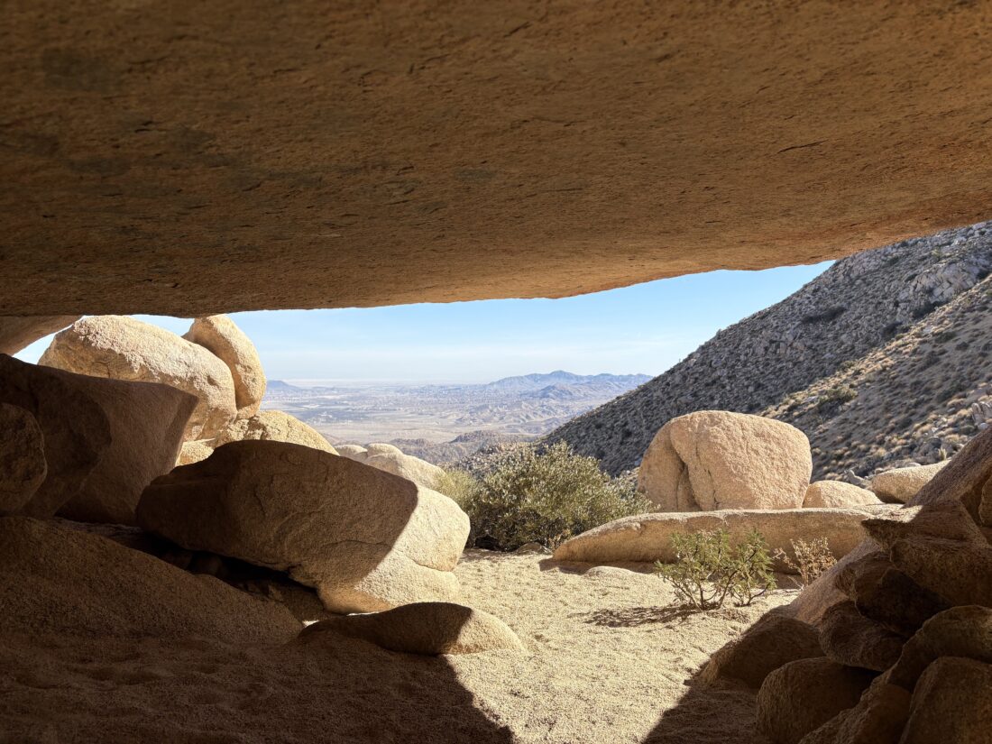
I soon found myself with Mike at the head of the group, and as we neared our destination, it became a game of double checking which rock cluster in which the cave was actually located. When we reached the first set of boulders where Mike thought it was, I offered to scramble around to see if the cave was there. After turning up empty, we set off higher on the slopes to another grouping of large boulders. I again scouted ahead and soon found the rear entrance to the cave! While I had it to myself, I took in the significance of this place for a moment, before stepping out to the front of the cave and signaling to the group its location. They soon filed in and began to marvel at the pictographs along the ceiling. We also had a stunning view back down the drainage. Sombrero Peak stood to our south.
Orange and red-hued suns are placed throughout the ceiling with other forms, some seemingly human, found in the back of the cave. A pointed rock also stands to the south of the cave entrance. Some think this might act as a sundial, giving this cave its name. After a snack and retrieving one of my water bottles that had fallen down some rocks, we bid the cave goodbye. Our trip leaders decided to try following a route more on the southside of the drainage, rather than fully retracing our route. I worked with Mike to pick our route across the hillside. After some “fun” side-hilling, we decided to drop down toward the base of the drainage. I took the lead, and soon found myself back along the route we used during our ascent. I continued on down the drainage, feeling right at home hiking solo through the desert. Soon I spied the palm grove at the trailhead, and then our cars. I sat in the shade from one of the cars as I waited for the rest of them to make their way down. Once we were all together, cold drinks and snacks were kindly provided. Then we loaded back up and began the drive out. Along the way, we passed two brothers who were out hiking the road. We certainly did not expect that. Once back at the museum’s parking lot, I thanked our trip leaders and set off home.
Due to the historic and sacred nature of this cave, I am not posting my actual GPS track for this hike.
I am an avid peak bagger, sometimes backpacker, and former sea kayaker living in San Diego. In 2019, I became the third person to complete the San Diego 100 Peak Challenge. Not stopping with that accomplishment, I set my sights on the harder San Diego Sierra Club 100 Peak list, which I completed in 2021. In addition, I have conquered several Six-Pack of Peaks challenges (SoCal, San Diego, Central Coast, and Arizona-Winter). Beyond attempting the San Diego Sierra Club 100 Peak list a second time, I am looking forward to exploring new summits and new adventures across the southwest.
Today’s adventure was to summit Sombrero Peak. I had climbed this peak twice before—The first time I went solo and started from the Indian Canyon trailhead and went up and back. The second time, I was with a group, and while we started at the same trailhead, we descended the west face of Sombrero Peak, then went cross-country to climb False Sombrero. This time I opted to try climbing the peak from McCain Valley. Ted needed to be back in town for an early evening engagement, so that meant a very early start to the day.
Turning off the 8, we then turned onto McCain Valley Road. We passed the turn-off to Mt. Tule, and then the turn off at the trailhead to Gasp Benchmark. Finally, we reached Cottonwood Campground and turned in. There is a $6 day-use fee, which thankfully I knew about and had cash to slip into the envelope. After making use of some extremely clean pit toilets, we gathered our gear and set off down the Pepperwood Trail. Our route would zig-zag north and east toward the peak. We had caught a glimpse of its unique shape on the drive to the trailhead.
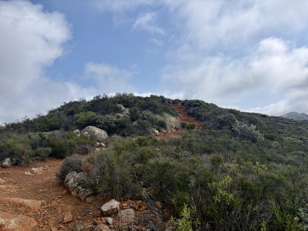
We cruised along, with the trail being a mix of motorcycle tracks and roads, allowing us to make good time. Along the way, we passed an old barn and corral. The trail would rise and fall as we drew nearer to the peak. Finally, we reached the point where we would begin the cross-country portion of the hike. Weaving past the cat-claw bushes and the cacti, we reached the base of the peak, near a very faded sign indicating it was Sombrero Peak. We took a break before beginning our ascent. I reviewed Greg Gerlach’s track that I had loaded into OnX and tried to plot our way up the boulders. We followed a faint use-trail for a bit until it faded away. I remembered following cairns before, so I began scanning the boulders for tell-tale signs of the route. I spotted some and we continued upward. As we drew closer, our route drifted from Greg’s, so we worked our way back toward the southern side of the peak. I made one slightly exposed move to get us back on track, while Ted was able to scramble around it, as that is not his thing. The route now seemed a tad more familiar, and a string of cairns quickly led us to the summit.
A register can and summit sign were tucked in the rocks, and I signed us in and snapped a photo with the sign. I showed Ted the east face of the peak and what the route from that side looked like. He thought this was a better choice, even with the 4.75 miles to the base of the peak. I mixed up some electrolytes and enjoyed a Kind bar and oranges before beginning our descent.
Our route down was much easier, but that typically seems to be the case. Back on the trail/road, we cruised toward the car. The day had warmed slightly, and I started to feel the effort a bit. With about a mile to go, I realized I missed a turn, but with the myriad of motorcycle trails and having downloaded the satellite imagery, I spotted another connecting trail that would lead us to the campground. As we approached the campground, four motorcycles rode past us. These were the first ones we had seen all day and I had honestly expected to see more. Back at the car, we tossed in our gear, changed, and then headed toward Mike Hess Brewery in Alpine for some well-earned pizza and beverages. My tracker clocked us at 10.0 miles (Ted had 10.25 on his Garmin) in 5:15 (including time on the summit). All in all, a great day out peakbagging. Plus, Ted is one peak closer to finishing the San Diego Sierra Club 100 Peak list…
I am an avid peak bagger, sometimes backpacker, and former sea kayaker living in San Diego. In 2019, I became the third person to complete the San Diego 100 Peak Challenge. Not stopping with that accomplishment, I set my sights on the harder San Diego Sierra Club 100 Peak list, which I completed in 2021. In addition, I have conquered several Six-Pack of Peaks challenges (SoCal, San Diego, Central Coast, and Arizona-Winter). Beyond attempting the San Diego Sierra Club 100 Peak list a second time, I am looking forward to exploring new summits and new adventures across the southwest.
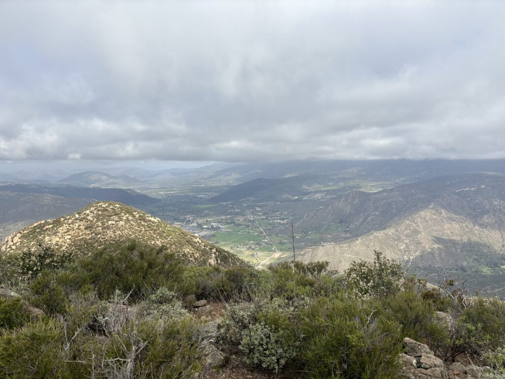
I stood in predawn in the park-and-ride, clutching my warm cup of coffee while waiting for Rick and Andrea to pull up. Today’s adventure was hopefully to be climbing to the top of Groan Benchmark out in the southern portion of Anza-Borrego. This was going to be the first peak of this year’s desert season and we were looking forward to it. We made our way out past Ocotillo and to the turn-off to Carrizo Gorge. We stopped for Rick to set up the camera for some footage for their YouTube channel.
I debated about airing down my tires but opted not to. Rick got his footage and off we went. This was the biggest uncertainty of this hike—could I drive my Outback to the actual trailhead, or would we have to stop early and begin from that point? The first time I hiked Groan, Matt Hanan took us in his Jeep, so there were no issues with the 6.7 miles of off-road adventures. The other time I had been back down this road was also in another 4×4. The road started off pretty sandy, but we got through that without incident. As the canyon narrowed, the road became rockier. With some care and my upgraded tires, we got through it all and arrived at the trailhead. On the flip side, the check engine light came on, and both the Eyesight and X-mode were not working. Great….. At this point, though, we opted to do our hike and see what happened with the car on our return.
With our packs on us, we set off. I opted to use my Daylight Plus instead of my Stratus, as I wanted to go a little lighter this time. After filming our walk-away shot and then getting the camera, we set off down the gorge. Our plan was to follow the same route we used during our descent from Groan back in 2020, and Greg Gerlach and Susie Kara used it when they did the peak in 2022.
The wash was a solid bed of smooth rocks, so we had to be mindful of our steps. After a bit, we made the short scramble up to see the pictographs adorning a small cave on the east side of the canyon. Once we were done marveling at them and wondering what various symbols truly meant, we turned back to the wash and trekked on. The weather was pleasant, albeit a touch warm. Originally, we had discussed car camping, as there was another peak I wanted to climb from the same trailhead, but a forecast for possible rain made that unwise.
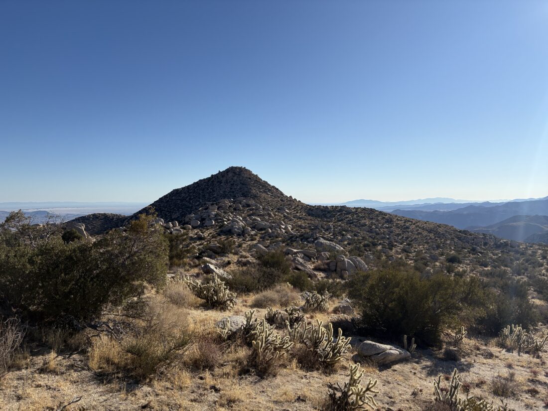
We could see some trestles for the railroad along the east side of the gorge, but not the famous wooden trestle. That would not be visible until we reached the summit. We spotted the wash that would begin to take us westward. Cruising along, we came to the first of two dry falls we would need to climb over. Thankfully, both were passable without too much difficulty.
Our real issues were around the vegetation that grew along the canyon floor. We had to push through several sections of brush to continue. One section was pretty nasty, as it was choked with thorny plants. We were not looking forward to fighting our way back through that section. At the small palm grove, we stopped for a snack and some hydration, as we were getting closer to exiting the canyon floor and starting toward the summit. It was about 72°F or so in the shade, and I wished I had more fluids with me.
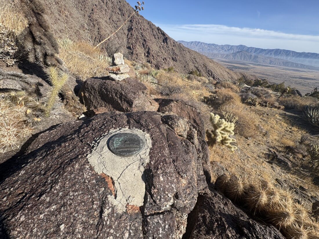
With our break over, we continued on for about .1 miles, and then up we went. Groan Benchmark was finally in view. Between avoiding the cacti and the steepness of the slope, we tended to follow a switchback-like pattern. Once atop the small bump, we had some side-hilling to reach the saddle next to the peak. I am not a fan of side-hilling (but who really is?) but we traversed that section without incident. As I reached the saddle, I could feel myself starting to bonk. I had been conserving my water and probably could have had another snack as well. The summit wasn’t that far away, so I pushed on. From the saddle, we would go up three fairly steep bits before finally reaching the summit proper. Once there, I plopped down, enjoyed my Gatorade, ate my lunch, and relaxed.
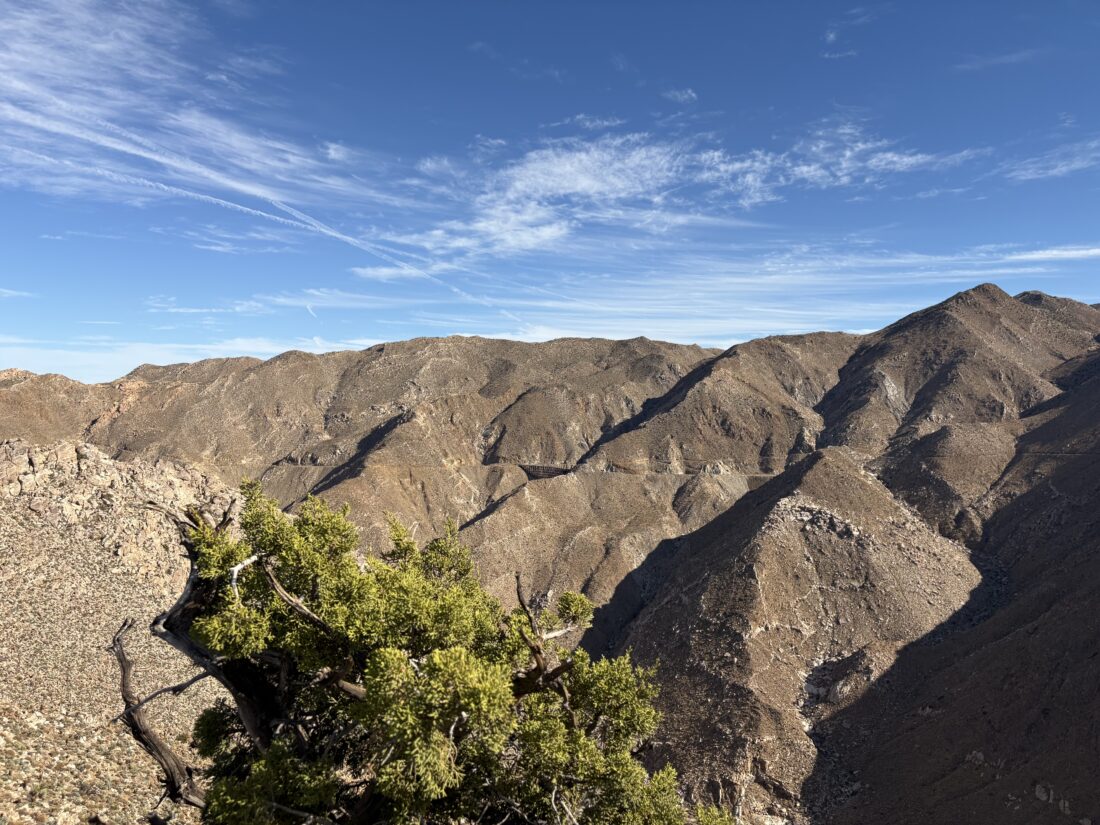
The view was stunning. Across the gorge is the Goat Canyon Trestle, and I wondered how many hikers made their way along the abandoned railroad tracks to walk across it. Next to it stood Puff Benchmark, which I have twice stood atop. Feeling better, I snapped a few photos and hunted for the register, which we could not locate. I tested out the satellite communications options on my new iPhone and let my wife know my status and that of the car. I am not ditching my Garmin InReach, but having a secondary communications device is useful, especially since I am already carrying it.
The descent went fine, and we discussed our favorite shows on Apple+ while watching our footing. The shadows were starting to get longer, and I realized I forgot to pack my regular glasses. We worked our way down those dry falls without any issues and scrambled up the south side of the canyon to avoid most of that thorny section. I motored ahead of Rick and Andrea to race against the fading light. Along the way, I found some cairns, which did allow for some slightly faster traveling. Soon, it was too dim, so I took my glasses off. Thankfully I could see well enough without them to hike at a decent pace. Once back at the car, I put on my regular glasses and enjoyed some cool water, and about 15 minutes later, Rick and Andrea arrived. We did not linger too long, as we still had to drive back out and the owner’s manual did not provide any real insight on the warning lights.
Once past the rocky sections, I felt relief. Even if we had a real issue, we were now in someplace more accessible to be recovered. As we cruised along the sandy portion, we spotted a young man walking along the road. We stopped and he asked if this was the road to Bow Willow campground. We informed him it was just a bit to the north of this road. It turned out he and his companion had gotten their Hyundai stuck in the soft sand, and he had been walking for a bit trying to find the campground with their buddies to help with a recovery.
He hopped in and we continued our drive out. After about a mile, there was the yellow Hyundai with its front wheel partially buried in the sand. Rick, myself, and our guest tried to see if we could give it a push to free the car, but it did not move. Since they had help back at the campground, and where they were stuck was actually not too far from the main road, we left the car as-is. We drove him to his buddies while his partner stayed at the car. As we neared the campground, the sun had set, so it took a bit to locate his friends’ site. As we drove away, we commented how lucky he was that we came along. He had no water on him and probably would have kept walking down the road for at least another mile before making the call to turn back. By that time, he would have been hiking in the dark, with the flashlight on his phone as the only source of light.
Back on the S2, we continued the long drive home. I took it a bit slower up from the desert, but knew we would now be back in “civilization” and my car anxiety lessened. All in all, quite a day. A good solid desert hike, got to cross off a peak from the San Diego Sierra Club list, helped some stranded people, and enjoyed some quality hiking time with some friends.
Update: I disconnected and then reconnected the car battery and the warning lights cleared. This issue has occurred before to other Outback owners, but I will be mindful of it over the coming days.
I am an avid peak bagger, sometimes backpacker, and former sea kayaker living in San Diego. In 2019, I became the third person to complete the San Diego 100 Peak Challenge. Not stopping with that accomplishment, I set my sights on the harder San Diego Sierra Club 100 Peak list, which I completed in 2021. In addition, I have conquered several Six-Pack of Peaks challenges (SoCal, San Diego, Central Coast, and Arizona-Winter). Beyond attempting the San Diego Sierra Club 100 Peak list a second time, I am looking forward to exploring new summits and new adventures across the southwest.