Chicken Spring Lake

I had planned to do this solo overnight trip this past weekend, but that early snowstorm forced me to postpone it. Since the weather was looking much better for this weekend, I decided to make the drive up the 395 and try again. One of the questions I had was actually about the timing of getting to the trailhead at Horseshoe Meadows. I had three options:

  1. Leave early Saturday morning (think 4 am), and drive straight to the trailhead,
  2. Leave Friday afternoon, drive to the trailhead, and camp in my car at the Walk-In Campground, or
  3. Leave Friday afternoon, drive to Ridgecrest, stay in a motel, then make the 2-hour drive to the trailhead on Saturday.

I ruled out option one. Since I was going solo, I did not want to deal with the combination of the drive and the hike in one day. Option 2 had some appeal, as since I would be at altitude, I could get some acclimation time in before I set off. In the end, finding a motel for $90 in Ridgecrest sealed the deal for option 3. I checked into the motel a bit after 5 pm, unloaded my gear, and set off to grab dinner. I knew exactly where I had to have dinner, John’s Pizza. For over 30 years, my dad was a Field Engineer for NCR, which meant he was the nice man who fixed that cash register or later, that ATM. One of the places he would have to drive out to for a service call was John’s Pizza in Ridgecrest. I made the short drive to the restaurant and ordered a beer, some breadsticks, and a pizza. I did not have the courage to order the Peanut Butter Pizza (yes, this is a thing and has been for decades). As I ate my food, I reflected a bit on my Dad and his impact on me. Back at the motel, I read a bit before turning in.

I awoke the next morning and grabbed a warm breakfast at the Denny’s before continuing on to Horseshoe Meadows. Turning off the 395, I could see the road snaking its way up the steep mountainside and began the long climb up from the floor of Owens Valley. Along the way, I passed two cyclists testing their legs and lungs climbing up the road. That would have been me 30 years ago…  I pulled into the parking lot for the Cottonwood Pass Trailhead and began to get ready. Since this is active bear country, I placed my return drinks and snacks in a bear box, along with a few other scented items. No need to come back to a car that a bear had vandalized to get at something it saw or smelled.

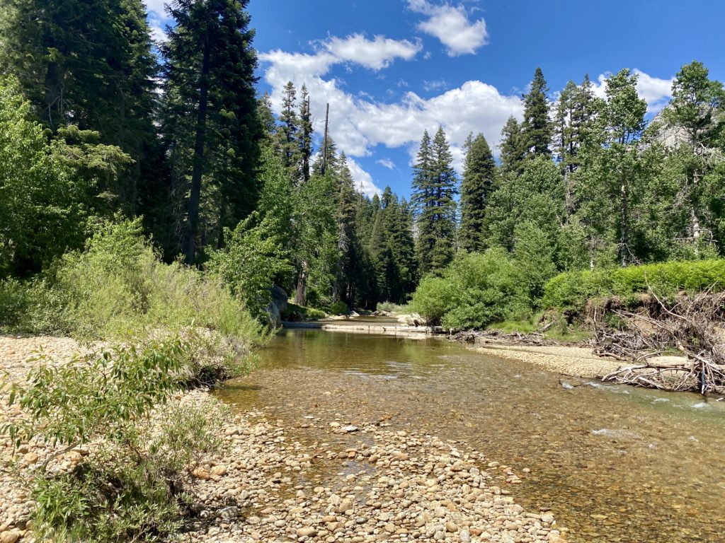
With one last stop at the pit toilets, I set off along the flat but sandy trail to the west. The trail reached a junction with the trail leading south to Trail Pass, and north to Cottonwood Lakes. However, my destination lay off to the west, on the other side of Cottonwood Pass. For the first 2 miles, the trail hugs the north side of Horseshoe Meadows and it is pretty gentle in terms of elevation gain. The hike starts at just under 10,000 feet. This area is a popular area for hikers who are planning to ascend Mt. Whitney to the north to work on their acclimation. Temperatures were in the low-50s, so it was really pleasant hiking weather. After crossing a stream twice, I soon reached the end of the ‘flat’ portion of the hike and would start the ascent of Cottonwood Pass in earnest. One of the items that I was trying on this hike was a new, lighter backpack. I swapped out my Osprey Atmos 65 for an Osprey Exos 58. There is almost a 2 lbs. difference in the weight between the two packs. So far, the pack was feeling comfortable, so that was a good sign. Earlier, I chatted with a father and son who were returning from their trip (it turns out they were from San Diego), and when I left the parking lot, a returning hiker was also from San Diego (did I miss an email that it was San Diego weekend on Cottonwood Pass?). While chatting with the father and son, 3 horseback riders came passing through. I knew I would now need to be mindful of horse droppings on the trail as well…ssing through. I knew I would now need to be mindful of horse droppings on the trail as well…

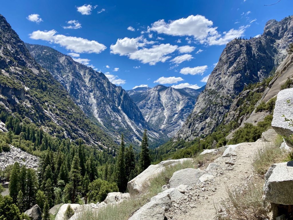
I took the climb in a measured fashion, as I had no need to try to race up and over the pass. I would occasionally stop to snap a photo, usually looking back down toward Horseshoe Meadows (getting further and further away). I reached those riders again, just as they were finishing their break and returning to their ascent. I continued making my own ascent, sensing that I would soon be reaching the pass. Sure enough, I reached it! I found a nice spot, slipped off my pack, and broke out my lunch. A sweeping view to the west filled both my eyes and my soul as well. Just in front of me was the Pacific Crest Trail. I pondered all those hikers who have passed along this point. When I get home, I need to rewatch some of the YouTube videos of some of the thru-hikers I followed this year to see if they captured their passing. After a nice break, I set off for the final bit to Chicken Spring Lake.

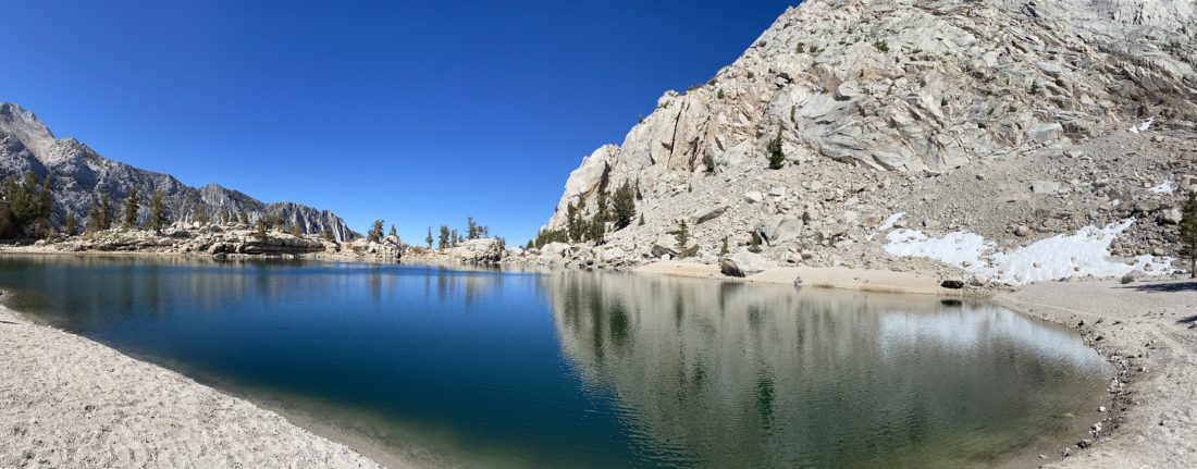
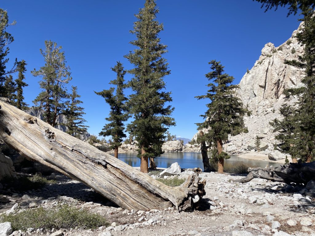
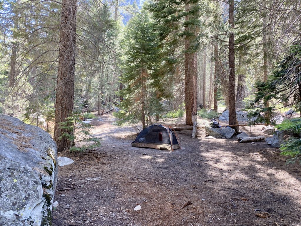
Just as I reached the junction to Chicken Spring Lake, I spotted the horseback riders making their return from the lake, so I paused to let them pass. Then, two older hikers came down the PCT to the junction as well. They dropped their packs and took a short break. I spotted the PCT hiker tag on one of their packs and asked if they were SOBOs (SOuth BOund). Turns out, they were originally NOBOs but had been flip-flopping due to various closures, and the exit at Cottonwood Pass was their actual completion point! I congratulated them on their achievement! They were looking forward to a real bed, a lot of food, and some cold beer. I helped one lift their pack back on (arthritis in his shoulder, to which I can relate…) and waved them off. I walked over to the small rise to be greeted with Chicken Spring Lake before me. I had reached my goal for the day. I walked along the eastern shore, scouting out possible campsites. After passing a family of four, I found a nice spot to set up camp. I slipped off my pack and went about my chores. One of the new pieces of equipment I was testing was the Flextail air pump. Weighing in at under 2 oz., this little air pump quickly filled up my air mattress. Being at over 11,200 feet in elevation, not having to huff into a blow sack to inflate my sleeping pad made it all worth it. I made sure the stakes to the tent were very secure as I did not want a repeat of the events on San Gorgonio. I also brought along my portable CPAP unit, so I tucked that inside the tent as well. This would be the first time trying it out on an actual backpacking trip. I had used it before, but only when car camping.

After tucking my bear canister safely away from my tent, I decided to lie down and take a well-earned rest. That was part of the plan, to simply enjoy the destination…  Feeling refreshed, I wandered down to the water’s edge to fill my CNOC water bag so I could filter water for later. I drank another .5 liter of electrolytes to hopefully prevent the cramping I had on my last overnight. I strolled along the lakeshore, enjoying the calmness it offered. As the sun continued to sink, I knew it was getting closer to making my dinner. Another new piece of gear I was testing was an insulated food bag from Big Sky International. This bag helps keep the heat from the food pouch in, thus aiding in rehydration, as well as just help keeping it warm. It was worth the $16 I spent on it! My lasagna stayed warm down to the last bite. I packed my food away for the night, along with anything else scented, and returned to my tent. The temperatures were starting to drop, and I broke out my down jacket. I watched the colors on the mountains above the lake turn into an amber glow as the day faded away. I crawled into my tent, turned on an audiobook, and relaxed. The new pillow, a NEMO Fillo Elite, was also working out well. Normally, I return my puffy jacket into the stuff sack I store it in, to act as a secondary pillow, but I was starting to really feel the chill, so I put it back on. My quilt is technically rated to 30°F, but I wasn’t sure what its comfort rating actually was. I still have to be mindful of my neck, so I folded up my seat pad that I use to act as my under pillow to get my neck angle just right.

The night continued to get colder, so I slipped on a pair of gloves I brought, as my fingers were getting pretty cold. I had turned off my audiobook at this point and was ready to plug my phone into the battery to recharge it, when I discovered its connector had been twisted slightly, making it impossible to plug a cable into it. I had already forgotten the cable for my Apple Watch. If needed, I could hopefully charge my phone using the CPAP battery in the morning. I drifted off to sleep, and the light breeze from earlier in the day had thankfully faded. From time to time, I would wake, usually from my feet feeling the chill. It was certainly cold. I would double-check that I was still properly tucked in, and would fall back asleep. I had wanted to step out at some point and take in the night sky, but it was just too chilly for me to leave my tent. Maybe if I had to answer the call of nature…

Around 5 am I awoke, as my CPAP had run out of battery. Normally, I can get almost two nights’ worth of power from the battery, but the cold had drained the battery. I closed my eyes again for a bit before climbing out of my tent. Since I did have a thermometer on my pack, I took a look at the reading, and it measured just above 30°F. None of my water froze, so I knew it did not get below 32°F. I wasn’t in a real hurry to leave, but I knew I did have a 5+ hour drive home. I made a hot cup of coffee and began packing up. I finished breakfast and a second cup of coffee and repacked my backpack. The family of four that I saw on the way to my campsite had already left, but a young couple was just getting their breakfast ready at one of the first sites I passed the day before. We chatted for a good while, shoeing away some rather aggressive squirrels trying to get into their packs. They were starting a multi-day trip that hopefully would include an ascent of Mt. Langley. I bid them farewell and began retracing my path. I had considered turning my return into a longer loop, passing by Trail Peak and descending via Trail Pass, but in the end, I opted to save that for another trip.

The descent went quickly. Along the way, I passed a collection of other backpackers setting off, or a few day hikers out enjoying the first days of fall. Soon, I was cruising along Horseshoe Meadow, and finally back at the trailhead. I grabbed my stuff from the bear box and enjoyed a cold drink while changing into some clean clothes for the long drive home. This was a great overnight trip, and one I plan to do again (probably turning it into a multi-day adventure if permits allow). I almost forgot to mention another new piece of gear I had for this trip was a 3D-printed holder for my Garmin InReach. OHM3 reached out to me via Reddit and sent me one. Their cradle worked really well. It was nice having my Garmin securely fixed to my pack and not flopping around as I hiked. The drive home was uneventful, except for seeing the large smoke cloud from the Line Fire that had flared up again.


I am an avid peak bagger, sometimes backpacker, and former sea kayaker living in San Diego. In 2019, I became the third person to complete the San Diego 100 Peak Challenge. Not stopping with that accomplishment, I set my sights on the harder San Diego Sierra Club 100 Peak list, which I completed in 2021. In addition, I have conquered several Six-Pack of Peaks challenges (SoCal, San Diego, Central Coast, and Arizona-Winter). Beyond attempting the San Diego Sierra Club 100 Peak list a second time, I am looking forward to exploring new summits and new adventures across the southwest. 

Little Lakes Valley

After spending the night at the Grandview Campground, I made my way toward Mosquito Flat Trailhead to begin my backpacking trip in Little Lakes Valley. While I could have made breakfast at the campground, I had a recommendation to stop at the Rock Creek Lakes Resort and have breakfast there instead. After enjoying some eggs, toast, and coffee out on their deck, I hopped back in the car and continued driving toward the trailhead. While it was just after 9:30, I got the last available parking spot. There were some available in the overflow section about ¼ mile back down the road. As a point of trivia, this parking lot is the highest paved trailhead in the US at 10,200 feet!

My basic plan was to saunter along the trail, soaking in the views until I reached Chickenfoot Lake, and then find a campsite. Once I had my camp set up, I would then continue exploring the valley up toward its end at Gem Lakes. After taking advantage of the pit toilets at the trailhead, I set off down the trail. The sounds of Rock Creek flowing past me filled my ears. The trail would take me past several lakes, each with its unique beauty. 

Since I was in no hurry, I made sure to keep my pace relaxed. This was in part to manage my foot, but also to remember the fact I am hiking at over 10,000 feet. The trail would gradually climb for a bit, then rise up a bit as it neared a lake, then it would mostly level out again as it passed by it, then repeat the cycle again.

After formally entering the John Muir Wilderness, the next milestone was the junction with the trail that could take you up to Ruby Lake and over Mono Pass. But that was for another adventure. Soon, my first lake, Mack Lake, would come into view. This lake sits down a bit from the trail, so I did not go exploring it. I could see some folks trying their luck in fishing. Over the two days out in Little Lakes Valley, I saw quite a few folks with fishing rods along the trail.

Continuing on, I soon came to my second lake, Marsh Lake. I left the main trail and followed a small spur trail to get an even better view of the lake. I had barely begun this hike and was already blown away by the beauty of the area. Once back on the main trail, and after a short climb, the next lake would open up before me. The trail now hugged the shoreline of Heart Lake. Here a string of Boy Scouts passed me, returning from their overnight adventures. 

Side streams would flow into the lakes. Some of them had real bridges, while others were just rock-hopping across. My next lake along the trail was Box Lake. Much like Mack Lake, this one sits slightly below the trail. Checking my tracker, I had covered about half of the planned 3-mile hike to the campsite.

So far, everything was feeling good as I made my way up toward Long Lake. The trail passes on the left side of the lake, along a rocky shoreline. I could start to see the landscape changing, transitioning from the forest into the alpine. I knew after Long Lake, I would reach the junction with the trail that would take me over to Chickenfoot Lake. 

One of the reasons for picking this lake to set up camp is that it sits off the main trail and is a bit more secluded from the main trail traffic. I worked my way up and over to the lake. While the gain is not much, being at altitude certainly has an effect on the effort needed. I passed several sites but wanted to survey my options before picking one. I found a nice one with a good view of one of the “toes” of Chickenfoot Lake and began to set things up. As I headed down to the lake to filter some water, a couple of hikers were nearby enjoying their lunch in the shade. It turns out one of them was the volunteer at the Bristlecone Forest Visitor Center and the one who swore me in as a “Junior Ranger”. Small world… I quickly filtered some water, as I was hungry as well. I tried a new method of filling my ‘dirty’ Sawyer bags by using a Ziploc bag to scoop the water from the lake, then transfer it into the Sawyer bags. This worked like a charm. No more struggling to fill them via their small openings. 

After stashing my bear canister, I tossed some items into my slack pack and set off to explore the rest of the valley. I rejoined the main trail and headed toward the Gem Lakes. Rising to my left was Morgan Pass. Apparently, there was an effort to have a road cross it and come into the valley from that direction. In fact, the frame of one of those cars sits rusting by the side of the trail. I gave serious thought to climbing up to the pass, but the desire to see the lakes won out.

Gem Lakes is a small collection of about 5 or so lakes at the end of the valley. The two main lakes sit almost next to one another at the actual end. A few wildflowers dotted the trail as I hiked toward it. The steep walls of the valley gave me a clear idea of how much further I had to go. I came up over the small rise, and the main lake spread out before me. Some snow still remained tucked against the rocky talus of the northside of the slope. Some folks had pitched their tents at some of the available spots along the shoreline. I followed the trail along it until I reached the western shore, then found a comfortable spot and just relaxed. 

I decided to head back to my camp. I kept eyeing the climb up Morgan Pass and gave it one last consideration at the junction, but I knew I needed to stay conservative as I still did need to hike out tomorrow. Once back at the camp, I gave my feet a nice soak in the cold lake. I figured they had earned that reward. I found some shade, kicked back, and listened to an audiobook for a while. 

As the sun began to set behind the mountains, I left the shore and began making dinner. I sat against some rocks, gazing at the water while eating my meal. The bugs started to come out, so I opted to retreat to my tent and continue my audiobook for a while. Soon, I could feel sleep coming on and I drifted off. Since it was one day after the full moon, I knew I was not going to have a dark sky to enjoy. Around midnight I woke up and poked my head out of the tent to be rewarded with a magical sight. The glow of the moon was lighting up the mountains and I hoped my phone’s camera captured it. Thankfully, it did.

I woke a bit before sunrise, which was fine as I had hoped to also capture some of the early morning aspenglow. I tried to have some breakfast, but I just wasn’t feeling it. I guess the altitude was getting to me a bit. As I was packing, I got the moon setting behind the pointed peaks to the west, and a few minutes later, I got my aspenglow.

Those pancakes back at the Rock Creek Lake Resort were sounding really good, so I set off. The air was calm as I neared Box Lake, and its smooth surface was a wonderful mirror of the majestic mountains behind it. While the hike out was going to be mostly downhill, I did have a few small bumps to cross over. Several of the other lakes also provide similar shots as I drew nearer to the trailhead. About halfway back, I started to encounter some other hikers, and quite a few dogs as well. I stopped and chatted with some, as they inquired about where I had camped, much like I had done the day before.

The sun finally rose above the high valley walls just before I reached the trailhead. With that my adventure in Little Lakes Valley was drawing to a close. As I made my way to the parking lot, a couple in a truck asked if I was leaving. I told them “yes, in a bit”. They swung around and politely waited for me to switch out of the hiking gear and clean up a bit before heading out. The parking lot was once again full. As I drove away, I saw several folks walking up from the overflow lot to begin their hike. I once again sat on the deck, enjoying a warm breakfast, scrolling through the hundreds of photos I took across the three days, being ever thankful for the opportunities to find peace and joy in this world.

The drive home was uneventful, just long. I made a quick stop at Erick Schat’s Bakery for some bread to bring home and picked up my other Junior Ranger badge at the Eastern Sierra Visitor Center. Once home, I unloaded the car and gave it a good airing out as we needed it to pick up my daughter later that night from the airport. Another great trip was now in the books. And as an added bonus, my foot did ok. 


I am an avid peak bagger, sometimes backpacker, and former sea kayaker living in San Diego. In 2019, I became the third person to complete the San Diego 100 Peak Challenge. Not stopping with that accomplishment, I set my sights on the harder San Diego Sierra Club 100 Peak list, which I completed in 2021. In addition, I have conquered several Six-Pack of Peaks challenges (SoCal, San Diego, Central Coast, and Arizona-Winter). Beyond attempting the San Diego Sierra Club 100 Peak list a second time, I am looking forward to exploring new summits and new adventures across the southwest. 

Ancient Bristlecone Forest

As my backpacking trip in Little Lakes Valley drew near, I began to have concerns about the weather. While the chance of an afternoon thunderstorm is common during this time of year in the Sierras, I began thinking of having some backup plans just in case there was some serious weather. Whitney Portal has been closed twice, Death Valley, Mojave National Preserve, and Joshua Tree were all affected by some significant rain events recently. With a 6+ hour drive to reach the trailhead, I’d be arriving probably in the early afternoon, then possibly hiking out to my planned campsite under the threat of rain or worse. So I began exploring other ideas. One that came to mind was to visit the Ancient Bristlecone Forest, which lies to the east of the town of Big Pine. I could explore the two groves of bristlecones in the afternoon, then spend the night at the nearby Grandview Campground. The next morning, wake up, make the drive to the trailhead, and make camp well before any weather that might appear.

Although the forecast looked great for the trip, after looking closer at my backup plan, I decided it was even better than my original one. I left San Diego around 5:30 am, mostly to reduce my time getting through traffic. While I had some, soon I was cruising up the 395 toward my first stop, Copper Top BBQ in Big Pine. I pulled in just after they opened and ordered lunch. As I ate my lunch, I called my daughter who was getting ready to come home from her summer internship in Sen. Feinstein’s office. With lunch done, I refueled the Outback before heading east on the 168. The road quickly began climbing away from Owens Valley and I could see evidence of the recent rains strewn across the road. After about 20 minutes, I turned north onto White Mountain Road. The road continued to climb…7,000 feet, 8,000 feet… I passed the entrance to Grandview Campground and considered tossing my tent in a spot to hold it. The campground does take reservations, so there might not be an available site. I decided since it was a Thursday, I should be ok. Plus I was planning to sleep on my Luno air mattress that fits in the back of the Outback, so I did have a lot of flexibility as to my potential camping options if for some reason the campground was full.

The paved road kept climbing toward the Ancient Bristlecone Forest Visitor Center. I pulled into the parking lot and was pleasantly surprised to see about 15 or so other cars here as well. I grabbed my slack pack and headed to the gorgeous visitor center building. Inside I looked over the various exhibits and then spoke with the volunteer about my planned hike. One of the other reasons for this hike was to make sure my foot would be able to handle the planned hiking I had ahead of me. Plantar fasciitis had flared up in my right foot recently, and while I have been treating it aggressively, it would still have bouts of pain. Plus all that driving did not help matters.

There are three trail options; the short 1-mile Discovery Trail, the 3-mile Cabin Trail, or the 6-mile Methuselah Trail. I picked the Cabin Trail as it was about the same length as the planned hike for tomorrow. If my foot had issues with that length, better to know now. The trail climbed a short hill before leveling out as it neared the Cabins and Mexican Mine site. This is what the information sign said about the site:

THE MEXICAN MINE – 1863

THE FIRST NON-NATIVE EXPLORERS in the White Mountains were miners looking for gold and silver. You are at the site of the old Reed Mine, first established in 1863 – one of the earliest mines in the White Mountains. It was named after Reed Flat, the open sage-filled “meadow” just across the road west of here. The mine looked promising and plans were made to bring in a large crew to begin full scale production. Lead and zinc ore were extracted in small quantities but nothing resembling the “intense development” that was planned. Imagine the frigid weather, supply problems and other hardships that plagued the miners – all this at 10,000 feet!

The mine changed hands several times and was finally sold to the Mexican Mining Company of Carson City, Nevada and renamed the Mexican Mine. Abandoned in the early 1950’s, it reverted back to public ownership. The buildings and shafts have not been stabilized and are not safe for entry.

Continuing on past the ruins, the trail began climbing again. While not steep, we were at 10,200 feet. That was another bonus for me, to spend some time at altitude doing some acclimatization before heading off with a full backpack. 

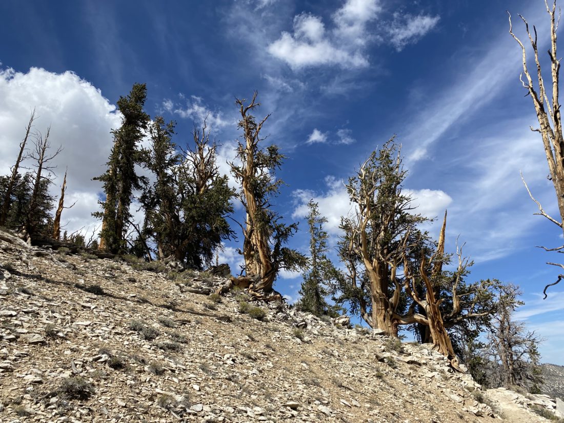
I passed a nice bench that I am sure has seen many winded hikers. After passing the remains of the upper mine, I continued up toward the saddle between the Schulman Grove Overlook and Mexican Mine Peak. Bristlecone trees dotted the landscape, each one a unique shape. 

The trail now descended until it connected with the Methuselah Trail. I had yet to see another hiker, and the peacefulness amongst these ancient trees was welcomed. Once I was on the Methuselah Trail, I did pass a few others who were making the longer journey to try to see the oldest known living thing. I wanted to make sure I could do my actual planned hike, so I resisted temptation and continued on back to the visitor center.

More incredible bristlecones lined the trail, and views of Nevada and Death Valley to the east, as I continued on. Soon, I was back at the visitor center. My foot was feeling the hike and the drive, so I decided not to attempt the Discovery Trail. I did, however, inquire if they had a special Junior Ranger badge. I had picked up the booklet for the Inyo National Forest from the Eastern Sierra Visitor Center in Lone Pine, which is worth the stop as well. It turns out they do, so I took the booklet, did the activities, and earned another one for my collection.

It was still early, so I decided to drive up and see the Patriarch Grove, home to the largest of Bristlecones. This would let me see more of the road to the start of the hike up White Mountain, which is on my bucket list. Just after Schulman Grove, the pavement ended and became a well-graded dirt one. But for the most part, it was in fine shape. After about 30 minutes and some gorgeous views, I came to the turnoff to the grove. The quality of the road became rockier and I took extra care as I drove the one mile to the parking area. I had some cans of tire sealant just in case. The parking area was empty. I followed the path toward the Patriarch Tree and stood before its immense size. A marker told a bit about the discovery of this tree. I continued on the trail for a bit, being mindful of my foot. Once I had seen enough, I returned to the car. While the Cottonwood Basin Overlook Trail was only ½ mile, I did not want to risk bothering my foot further. The call of Little Lakes Valley was too strong. 

I drove back down toward Grandview Campground, but before I got there, I stopped at the Sierra View Overlook. This was a short walk to a small bump that offered a great view of the Eastern Sierras, and as a bonus is listed on Peakbagger. 

I pulled into the campground and surveyed the possible open sites. The first couple did not work as the parking area was not flat, but I did locate one that fit the bill perfectly. I inflated the system, broke out my folding chair, and enjoyed the mountain air. After dinner, I tried to enjoy a campfire, but the wood I bought in Big Pine was just too wet to stay lit. I finally gave up and hit the pillow. I recently bought window shades for the rear windows and was glad I did, and it helped keep the full moon’s light out of my eyes.

I woke just before sunrise, had some coffee, and repacked what I needed to. The plan was to grab breakfast at the Rock Creek Lake Resort and then hit the trail by mid-morning. Once I made it back to Big Pine, I took advantage of having a cell signal again and took care of a few things before I continued on toward Little Lakes Valley. 


I am an avid peak bagger, sometimes backpacker, and former sea kayaker living in San Diego. In 2019, I became the third person to complete the San Diego 100 Peak Challenge. Not stopping with that accomplishment, I set my sights on the harder San Diego Sierra Club 100 Peak list, which I completed in 2021. In addition, I have conquered several Six-Pack of Peaks challenges (SoCal, San Diego, Central Coast, and Arizona-Winter). Beyond attempting the San Diego Sierra Club 100 Peak list a second time, I am looking forward to exploring new summits and new adventures across the southwest. 

Mirror Lake

Matt’s alarm went off at midnight, and shortly thereafter it wished him a “happy birthday”. Once it was done singing to him, I did the same. Matt was getting ready to attempt to summit Mt. Whitney, while I was planning to hike as far as Trail Camp. This opportunity for me was fairly last minute, so I had not had the chance to do any training for a hike of the magnitude of the summit. I let Matt focus on getting ready, as I was not scheduled to sync up with David until around 1:30 am. Matt finished up and set off for Whitney Portal. David arrived on schedule and we tossed our gear and began our drive up.

Driving in, we could see headlamps dancing along the trail. When we parked at the portal, the car’s thermometer read 43°F. We grabbed our gear and clicked on our headlamps and set off. There was some comfort having hiked this about 12 hours earlier as we climbed in the darkness. My legs, and more importantly lungs, were feeling good as the trail climbed ever upward. I knew not to compare my pace, as night hiking is always slower. As we made our way up, David was having trouble following my pace. He said to go on and he would meet me at the Lone Pine Lake junction. I continued hiking at a nice pace, being mindful of bears that might be out. All was going well until the long log crossing near the junction. While it had not been an issue in the daylight, this night crossing was nerve-wracking. It was more of a shuffle than actually walking. I reached the junction and waited for David. I found a spot to sit and turned off my headlamp to save my batteries. The stars were majestic as there was no moon to hide their brilliance. In addition, a meteor shower was just concluding, and I spotted one very bright one streaking across the sky. As I waited, several more vaporized into our atmosphere. It had been some time sitting here and I was starting to shiver. I got up and paced a bit to warm back up. I am fairly sure it was below freezing here. Several hikers passed by, but no David. I decided to continue on, knowing David would either turn back and relax back at the portal, or I would meet up with him on my descent.

Just past the Lone Pine Lake junction is the entrance to the Whitney Zone. I stopped for a photo and continued on. To the east, the predawn glow was starting to appear. I kept climbing toward Outpost Camp, the next milestone for me on this hike. The mountains were slowly being bathed in light. The trail eases some as it makes its way through Bighorn Park, the creek flowing next to the trail. As I neared Outpost Camp, I could see the tents scattered about and continued on, trying to be quiet for anyone who might still be asleep.

From there I would have another set of switchbacks to climb until I reached Mirror Lake. My plan was to reach it by sunrise, then enjoy a second breakfast and coffee before pushing on. Waiting for David put me behind schedule, so I watched the sunrise while I was on the switchbacks. 

As I reached the junction for Mirror Lake, I could start to feel the altitude and was glad to be taking a break. I found a nice flat patch of granite near the south shore and pulled out my water filter, but for some reason, I could not get it to work. It might have been clogged from the last time I used it or for some other reason. I had enough clean fluids to get down, so that was not an issue, but I did not have enough to continue on nor make my breakfast. I snapped some photos of the peaks reflecting down onto the water. Several groups of hikers passed by as they made their way forward. While I was bummed about not reaching my goal, this hike had been a spectacular one. I hung out here for about 30 minutes, soaking it all in.

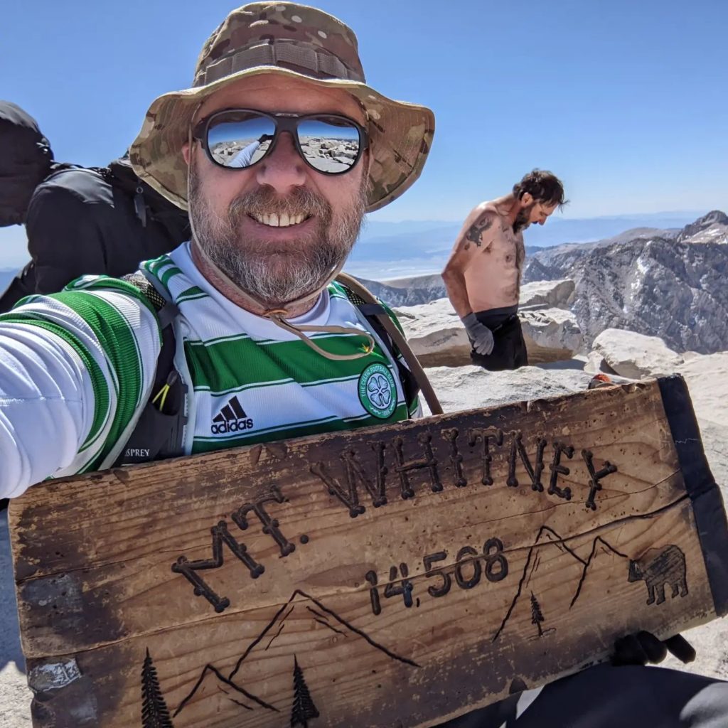
As I made my way back, I would mention to ascending hikers to be on the lookout for a fellow in a green and white Celtic jersey and to make sure to wish him a happy birthday! One set of hikers asked if I was Chris and relayed a message from David that he would meet me at Outpost Camp. 

There, as promised, was David. He said it just wasn’t his day on the mountains, and with that, we began heading down toward the trailhead. Along the way, we spotted some deer and some pikas. More hikers continued on, some with full backpacks ready to make camp, probably at Trail Camp. In fact, one of those folks turned out to be a friend of a friend who recognized me. We made it back down to Whitney Portal just before 9 am. I hiked a total of 8.6 miles in 6:26. My final altitude was 10,655 feet, meaning I climbed 2,386 feet. After driving back down to Lone Pine, David hopped into his car to race back to his hotel in Ridgecrest to grab a shower. I gathered my gear from the hotel and set off. As I drove away, I looked off to the west, hoping that Matt would be successful and one day I might stand atop that summit. Later that evening, I got a message from Matt that he made it and 15+ people wished him a happy birthday!


I am an avid peak bagger, sometimes backpacker, and former sea kayaker living in San Diego. In 2019, I became the third person to complete the San Diego 100 Peak Challenge. Not stopping with that accomplishment, I set my sights on the harder San Diego Sierra Club 100 Peak list, which I completed in 2021. In addition, I have conquered several Six-Pack of Peaks challenges (SoCal, San Diego, Central Coast, and Arizona-Winter). Beyond attempting the San Diego Sierra Club 100 Peak list a second time, I am looking forward to exploring new summits and new adventures across the southwest. 
Lone Pine Lake

Matt Hanan reached out to me and asked if I would be able to join him in climbing Mt. Whitney on May 31st. As much as I wanted to climb to the highest peak in the lower 48, I had not been training for it, and did not want to hamper Matt’s attempt if I ran into issues. Also, May 30th is my wedding anniversary (29 years), so I would need to make sure missing most of that day was ok. Anita gave her approval, provided I did not actually attempt the summit. We agreed that I would not climb higher than Trail Camp and at my own pace, letting Matt stay focused on his ascent. Since Matt had one more space on his permit, my friend David also planned to meet us there. His plan was to probably stick with me as he had no desire to summit Whitney again, but loved just spending time in the eastern Sierras. I left San Diego mid-morning and drove up to Lone Pine. I met Matt at the motel and quickly changed into my hiking gear. The plan was to drive up to Whitney Portal and hike up to Lone Pine Lake, which is just before the boundary of the Whitney Zone. This would give us some hiking time at some higher altitudes, before the bigger hikes the next day. We found a spot and parked Matt’s car, fully cleared out as this is active bear country and the last thing you want is to return to your car to find it had been torn open by a bear looking for a snack. 

The trail begins almost across from the pit toilets. We each grabbed a wag bag and stuffed them in our packs. The trail headed east for a bit before turning back west. This was my first time here, so I was soaking in the beauty that was all around me. The next day, when I would be on this section of the trail, it would be pitch dark. The grade of the trail wasn’t too bad, but I could definitely feel the altitude. 

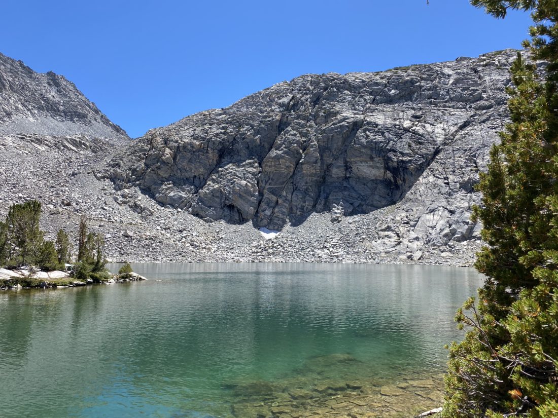
Matt had been here several times before, so he led the way. Lone Pine Lake sits about 1,750 feet above Whitney Portal, so we had some gain before us. We continued plodding along, taking some short breaks to let me catch my breath. We crossed the North Fork of Lone Pine Creek with no issues. Matt said the fun crossing was just before the junction with the trail down to Lone Pine Lake. As we climbed up the switchbacks, the views to the east were breathtaking. Soon, we came to the main crossing of Lone Pine Creek. This crossing is a long series of logs spanning the wide flow of water. Matt mentioned in previous years water had been flowing almost over the tops of them. Sadly, now it is well below that level. Once across, we reached the junction and made a short 0.1 mile jaunt to the lakeshore. A few folks were milling about, including one person hoping to catch some fish.

With a very early start time, we did not linger as we wanted to get back down into Lone Pine, grab dinner and hit the sack. I tracked our hike at 5.7 miles in 3:05 with 1,750 feet of gain. 


I am an avid peak bagger, sometimes backpacker, and former sea kayaker living in San Diego. In 2019, I became the third person to complete the San Diego 100 Peak Challenge. Not stopping with that accomplishment, I set my sights on the harder San Diego Sierra Club 100 Peak list, which I completed in 2021. In addition, I have conquered several Six-Pack of Peaks challenges (SoCal, San Diego, Central Coast, and Arizona-Winter). Beyond attempting the San Diego Sierra Club 100 Peak list a second time, I am looking forward to exploring new summits and new adventures across the southwest. 

Rae Lakes

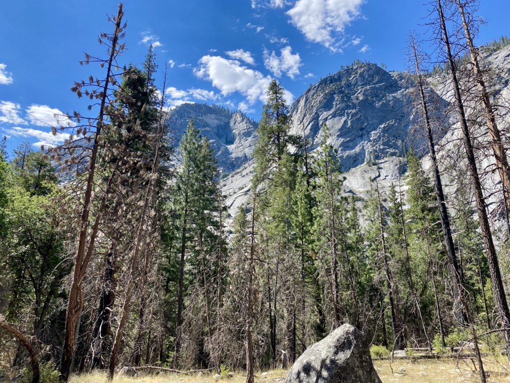
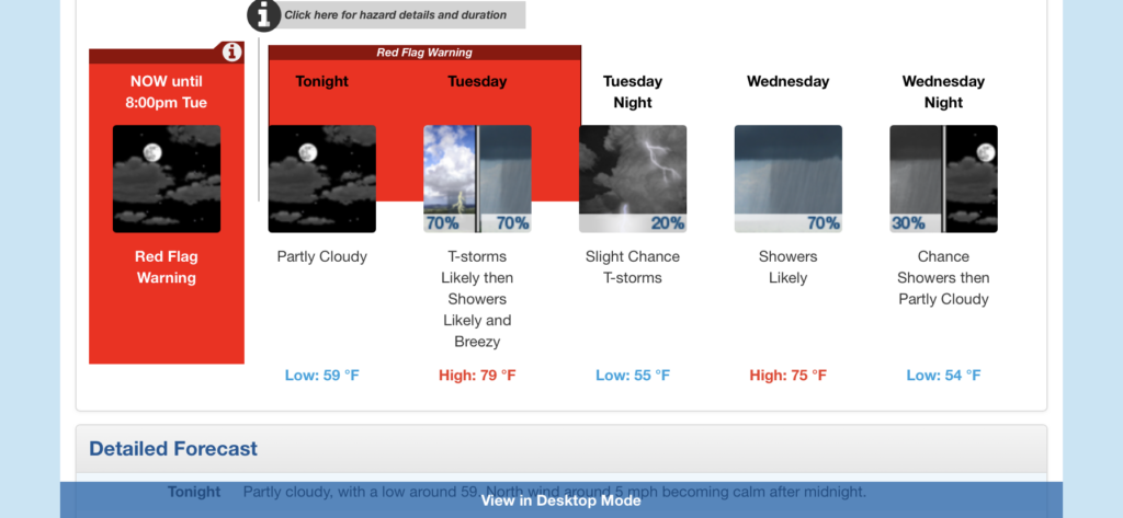
As my permit dates for Rae Lakes began approaching, I started watching the weather forecasts with more interest. Initially, this was to figure out what I might need to pack. But as the days became closer and closer, I became more concerned about the conditions I might find myself in. This was going to be my first multi-day solo trip, so I was trending toward being extra cautious about the journey. Initially, the forecast called for a warm start, followed by a 20% chance of thunderstorms for the rest of the trip. That is manageable, as thunderstorms are common in the latter part of the day. But each day, the forecast kept trending in the wrong direction. That 20-30% chance became 30-40%, then 40-50%. In addition, the weather service also issued a Fire Weather Warning (which was later changed to a Red Flag Warning) for late Monday afternoon through Tuesday evening. They warned of dry lightning triggering fires and the high winds creating the possibility of it becoming fast-moving. Not really the conditions that I looked forward to hiking into. As I sat in my hotel in Visalia, I reached out to some of my more experienced backpacking buddies (David & Leslie/Mike) to get their take. They all agreed that it did not look like it was going to be a fun trip. The general consensus was to go ahead, get up early as planned and drive the 2 hours to Road’s End and consult with the ranger. If I liked what I heard, continue on to the first campsite and spend the night. Then I could make the call and decide if I want to continue or simply turn back. With that, I set my alarm for 4 am, and hit the pillow.

When I woke up. I checked the latest weather report and saw that it was looking more like 50-60% of thunderstorms and showers as well were now in the forecast. Given I had not camped in the rain, doing it for multiple days seemed like a poor option. I got to the permit station just a touch after 7 am. I spoke with Ranger Mary about the forecast and what her thoughts were. She basically asked, “How much do you like being wet?” That settled it, no loop for me this time, but I was still game for one night in the wilderness! So, I parked in the long-term lot, finished getting ready, and hit the trailhead just before 8 am. The forecast for Upper Paradise was to be in the low 80s, with a light breeze. I had hoped that my early start would let me stay ahead of the heat. I had not paid attention to the forecasted high, so I had no idea exactly what I might be racing against.

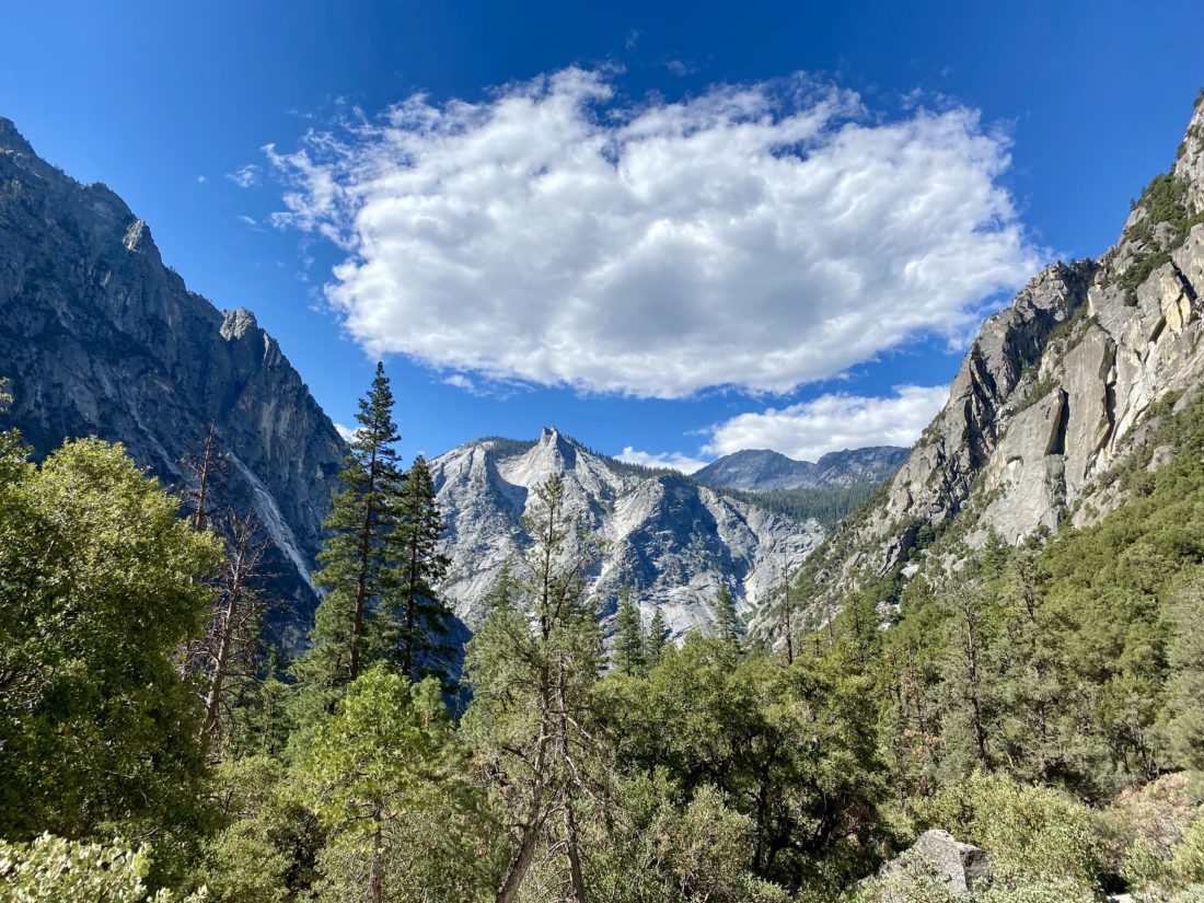
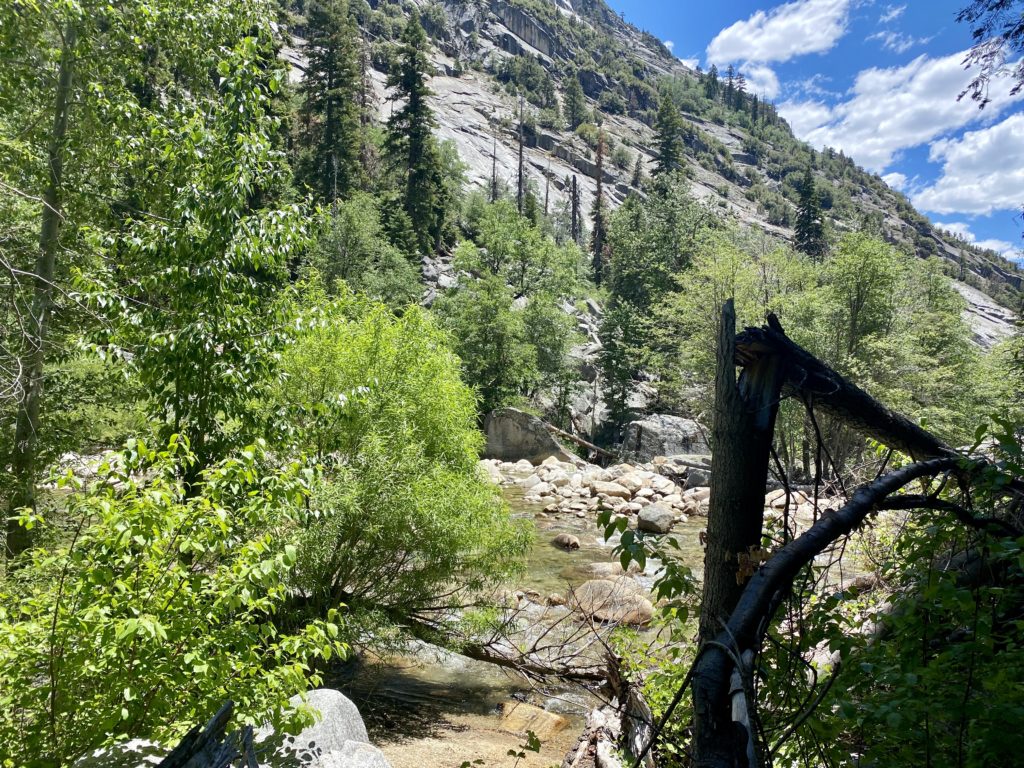
The trail is fairly flat for the first 1.9 miles until it reaches the junction of the Kings River and Bubbs Creek. Here I would take the left fork and begin ascending toward Paradise Valley. The sounds of the river were so refreshing. The views were as incredible as I had imagined. It was getting warmer as I pushed on. I had a liter of water in my interior water bladder, a liter in a side bottle, and 1 liter of Gatorade. I could feel my pace slow. At first, I thought I might be the added weight of 5 days of food, the extra clothing, and other items making it tougher. But, as I felt the sweat begin to soak my shirt, I knew that day was warmer than I had hoped for. 

At Mist Falls I took an extended break. Ate some of the oranges I brought for the first day and drank some more fluids. I decided to spend a bit of time in the shade and recharge before pressing on. Most everyone here were day-hikers. Oh, how I coveted their small light packs… I pressed on, being mindful of the temperatures. I dug out my cooling towel and wrapped it around my neck. 

I kept finding myself looking for a place to sit under some shade for a bit. I checked my position and the topography ahead of me. I gave serious consideration to throwing in the towel and bailing. I found another rest stop and refilled my side bottle with some cool water from the river (properly filtered of course). I finished my oranges but still could not think about having my proper lunch. I knew that this was not a good sign, so I tore open one of my goos and forced it down. 

As I made my way across the exposed switchbacks, I estimated the temperatures were either in the upper 80s or low 90s. This was going to take some serious effort if I was actually going to make camp. My spirits were getting crushed. I would move from shady section to shady section, pausing for a bit almost every time. Once I reached the southern end of the valley, I took another break and was able to eat my lunch. I again went to the river to filter more water, as my bladder had been completely emptied by this point. Rechecking the map, I was not too far from Middle Paradise campsite, so I pressed on. 

Passing through Lower Paradise, I could see the numerous dead trees and why this campsite is currently closed. I then spied the bear locker at Middle Paradise and said this was as far as I was going to go. I was the only one here, so picked a nice spot a bit back from the water, hoping the bugs would not be an issue. Thankfully, for most of the hike, they were not too bad.

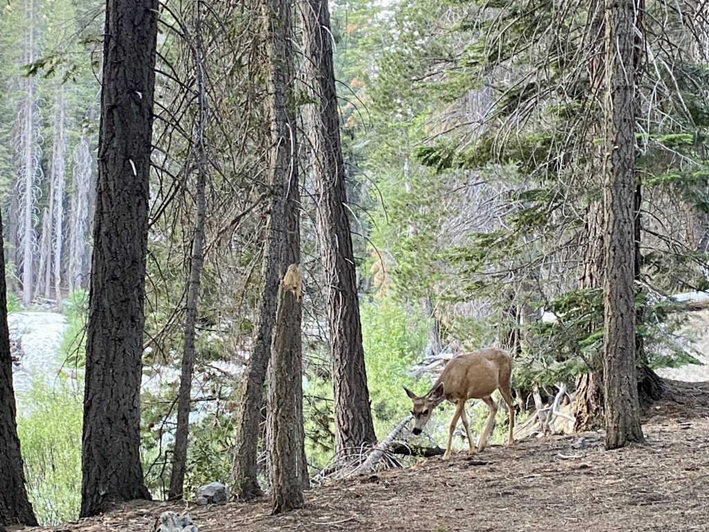
I got some more water and then began to set up camp for the night. It was only 3:30 or so, but I just did not have the energy to hike another 2 or so miles to Upper Paradise. Eventually, 3 other hikers joined me at the site. And not soon after that, a doe strolled past us with not a care in the world. While soaking my feet in the cool water, I used my InReach to report in with my wife and give her my status.

My site had a fire ring, so I had planned for a small fire to pass the time later. I gathered some starter material and placed the pine needles in the pit. I then set off to find some downed wood that I could use. I started to smell the familiar smell of a campfire. I figured it must be from further down the trail. According to GaiaGPS, the Middle Paradise campsite was further north. I then looked over to the fire pit, and the started material had begun to smolder on its own! It seems the last users of this firepit had not properly put it out. Thankfully, I took care of it, but I was pissed. 

About 4 to 6 other hikers passed on through, pushing on toward Upper Paradise. I would say now that I had an extended break here, I probably could have pushed on. But, I was fine spending the night here. Later in the early evening, two more hikers also decided to find a spot to pitch their tents. It was one of them who spotted the bear as it passed around us. We watched it as it took a look at us. It looked to be about 2-3 years old and did not seem to have any tags or collar. Eventually, it wandered away. I certainly was going to be a bit more cautious for the evening. Since I was not needing 5 days of food I treated myself to a double dinner, being a bit more mindful of any unwanted company. 

With plenty of water to manage my fire, I sat and enjoyed the flames. I reflected on what I had overcome. I let the fire die down until only the embers remained, I doused it with my water pouches and made sure it was out. I had really wanted to gaze up at the night sky from Rae Lakes, but this view would have to do. The night was pleasant, I slept without the cover on my tent and just my camp shirt on. Once the moon rose, it did wake me once, but even that was a welcomed sight. As the pre-dawn broke, I found myself rested and ready to head back out. The other folks were going to continue on to Woods Creek and then see what the weather held. I did briefly consider it, but in the end, felt it best to stick to the one night.

I repacked my bag, trying to be mindful of the other campers. I knew I was hiking down into the heat, so I wanted an earlier start. Not ten minutes on the trail, I spotted that same bear dashing in front of me and then stopping a safe distance away. I kept my face toward him as I continued carefully down the trail. Two hikers passed me before I reach Lower Paradise, and I gave them each a heads up about my earlier bear sighting. Upon reaching Lower Paradise there were two folks who had ignored the closure notice and camped there. I let them know as well. 

The miles slipped by much easier, the pack a little lighter, the temperatures pleasant and mostly going downhill. I stopped at Mist Falls, and this time the entire area was empty. I sat a listened to the roar of the river tumbling down. When I went to put my pack back on, the sternum strap snapped. Crud! Maybe this was a sign that turning back was a good idea. Also, I did discover a hole in one of my pairs of Darn Tough Socks…. About ¾ of a mile past Mist Falls, I meet my first day-hikers. A family was taking a break and politely asked if I had bug spray. The bugs had been worse today. In fact, at Mist Falls, I broke out the bug net. I turned around and told the father which pocket to find it in. They were so happy. We chatted some before we each headed our separate ways. 

As I made my way along the trail, a mule train was making its way up, I assume to resupply the ranger station at Rae Lakes. I stepped aside and let them pass. Now I would watch out for fresh droppings on the trail. A bit further down, I met two more day-hikers, they told me they just encountered a rattlesnake slithering off the trail. Sure, enough it was just off to the side, minding its own business. I safely snapped a photo or two and continued on. 

I started to encounter a mix of day-hikers and those still heading out to attempt the loop. I let the backpackers know about my bear sighting at Middle Paradise and wished them well. Soon, I found myself back at the junction of Bubbs Creek and the Kings River. I hoped to cross that bridge upon my return from the loop. But this time just a quick stroll on it would have to do.

The day was getting much warmer, and I could feel the need to drink more and more as I covered the last couple of miles. I found myself drifting from shady section to shady section again. I was guessing it was in the mid to upper 80s. I would know soon enough once I got to the car. It was about 10:30, and I met someone just heading out. We chatted a bit, he had just landed a walk-up permit. He had hoped to have the ability to send a message to his wife, but couldn’t. So I offered to pass along his itinerary for him once I was able to.

Finally, the permit station came into view. I spoke with the ranger and gave him my bear sighting information, as well as the camping at Lower Paradise and the fire issue. The area is now at Stage 3 fire restrictions, so the small fire I had is no longer allowed.  Once at the car, I cleaned up some, then threw on some shorts and a t-shirt. Unfortunately, I also developed a nice blister on my toe. I had felt something earlier, but when I checked my foot, I did not see it. I guess it was another sign that I made the right call. I picked out some snacks for the ride home, but the trail mix was not going to be one of the options, as it had melted into a mass of goo. Yeah, it had been warm on this hike. As I pulled away, heading toward Cedar Grove for some cold soda and a snack, I waited for the car’s thermometer to settle down. It read 95°F at 11 am. Yikes! That would explain why I had so much trouble, it was even hotter than I planned. 

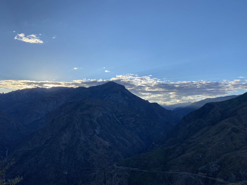
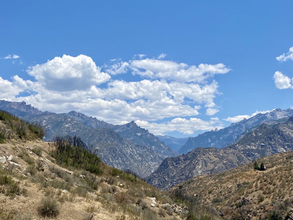
As I drove up out of Kings Canyon, I pulled over at a nice vista and could see the start of the clouds forming in the distance. I decided to take the long way home and drive through Sequoia National Park. I did not plan to stop, I just wanted to enjoy the trees and views. Once back off the mountain, I headed back through Bakersfield, this time stopping at Dewar’s to pick up some chews for the family. All in all, it was an adventure to build on. Except for the one-two punch of the heat and the predicted rain, the trip went mostly well. Maybe in the early fall, I might find an opportunity to try again…

The forecast on Monday.


I am an avid peak bagger, sometimes backpacker, and former sea kayaker living in San Diego. In 2019, I became the third person to complete the San Diego 100 Peak Challenge. Not stopping with that accomplishment, I set my sights on the harder San Diego Sierra Club 100 Peak list, which I completed in 2021. In addition, I have conquered several Six-Pack of Peaks challenges (SoCal, San Diego, Central Coast, and Arizona-Winter). Beyond attempting the San Diego Sierra Club 100 Peak list a second time, I am looking forward to exploring new summits and new adventures across the southwest.