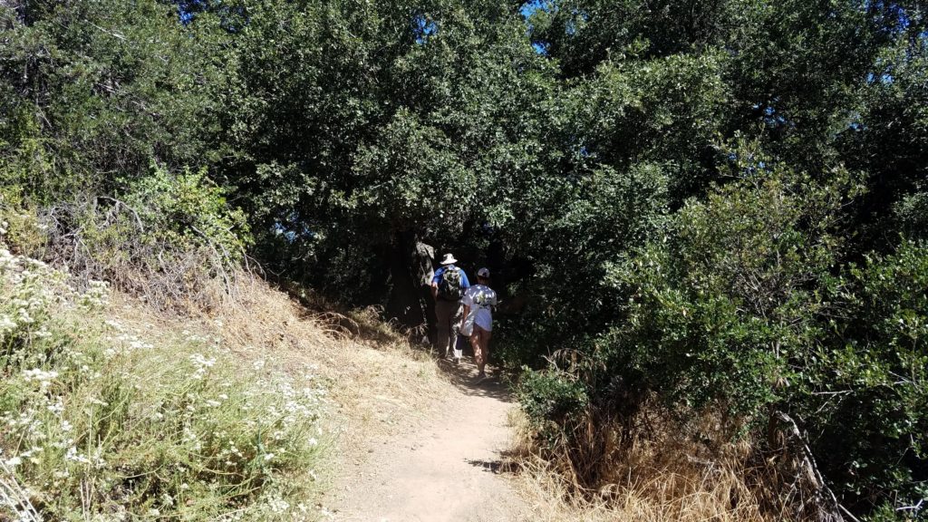
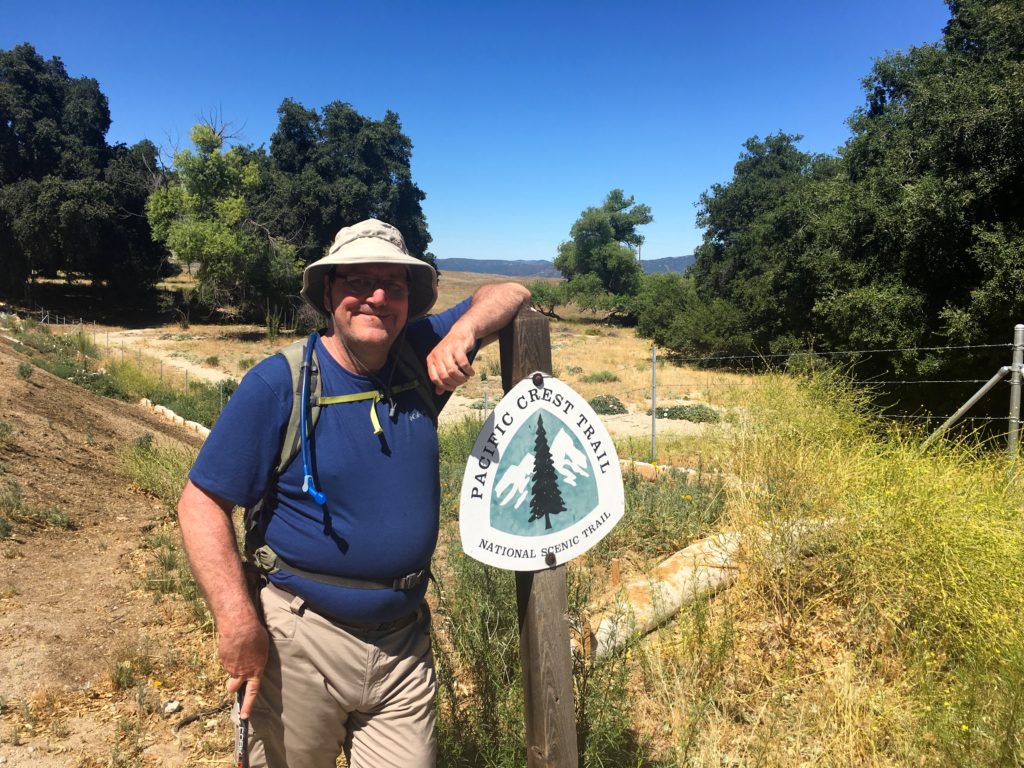
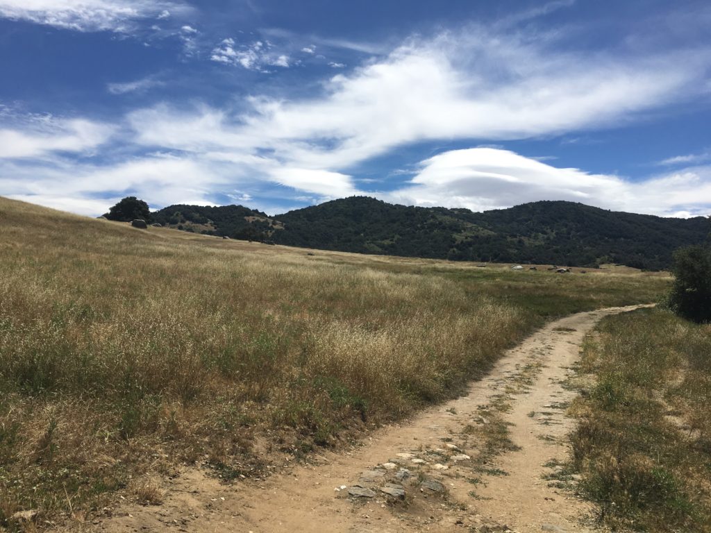
What better way to kick off the Fourth of July than hiking out to see Eagle Rock? My friend Juliet had been wanting to tag along on one of my adventures and this one seemed perfect. She lives up in Temecula, so she met Ted and me in Warner Springs. Since we had two cars we decided to do the hike as a point-to-point along the Pacific Crest Trail. We drove down to the PCT trailhead off Montezuma Valley road and headed out along the trail.
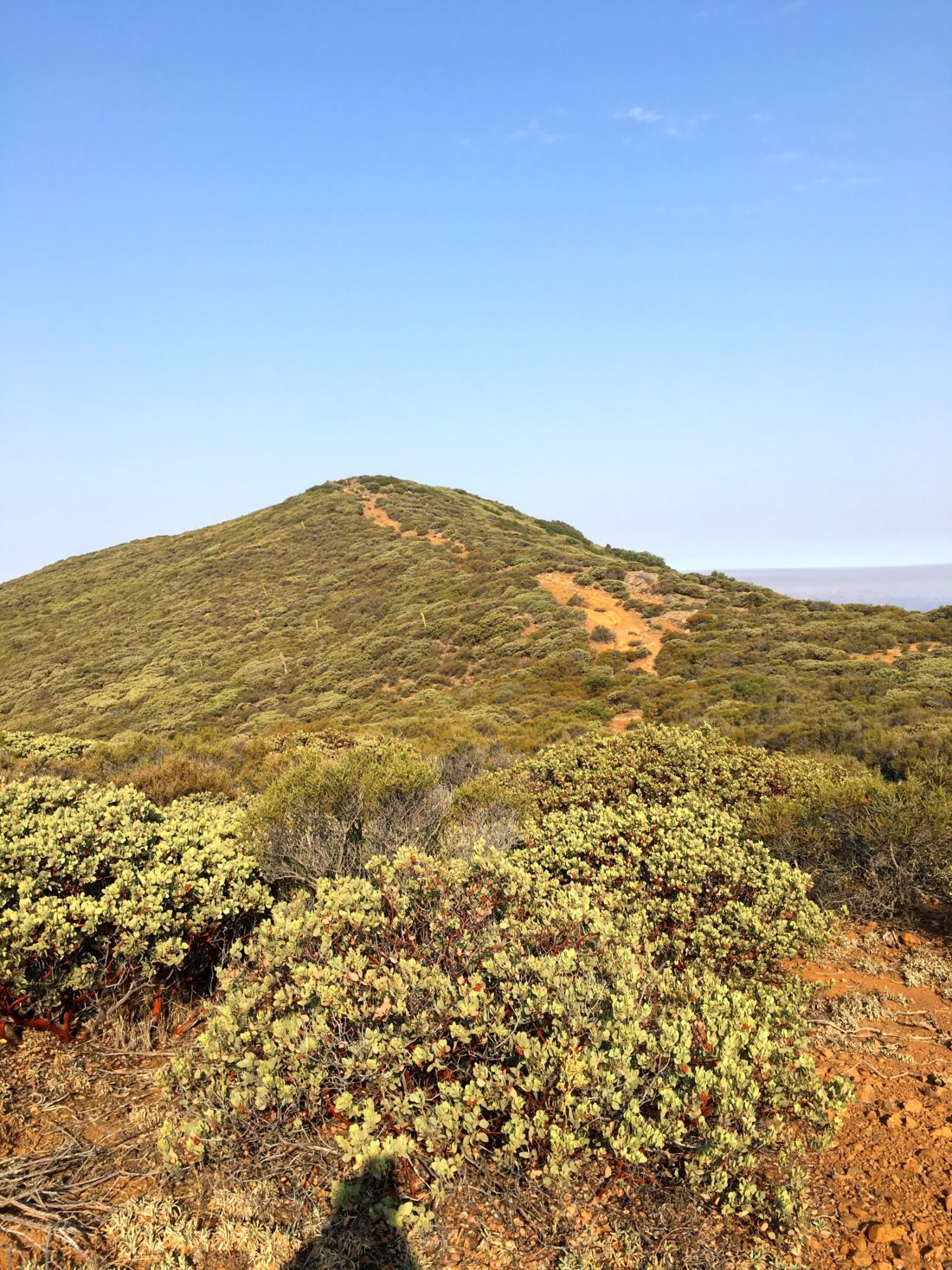
The trail weaved its way through rolling hills and grasslands. It reaffirmed our choice of picking our route out to Eagle Rock.
We crossed a still-flowing stream and up and over the small hills. It was nice having some new company on the trail.
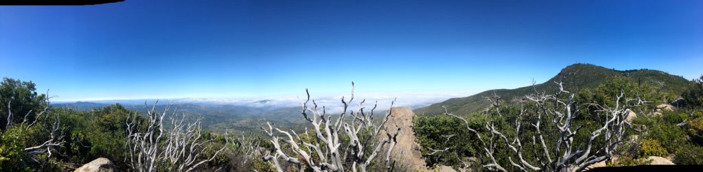
The rock formation soon came into view. There were a couple of folks enjoying the ‘Eagle’, as we arrived. After taking our photos and having a snack, we continued on the PCT toward Warner Springs.
The miles ticked off quickly. We met a few more hikers heading out to Eagle Rock. The shade along the trail was nice and the gentle sounds of another creek were enjoyable.
Soon we found ourselves back in Warner Springs having done 8.1 miles along the PCT. This was my 45th peak of my 100 Peak Challenge.
I am an avid peak bagger, sometimes backpacker, and former sea kayaker living in San Diego. In 2019, I became the third person to complete the San Diego 100 Peak Challenge. Not stopping with that accomplishment, I set my sights on the harder San Diego Sierra Club 100 Peak list, which I completed in 2021. In addition, I have conquered several Six-Pack of Peaks challenges (SoCal, San Diego, Central Coast, and Arizona-Winter). Beyond attempting the San Diego Sierra Club 100 Peak list a second time, I am looking forward to exploring new summits and new adventures across the southwest.
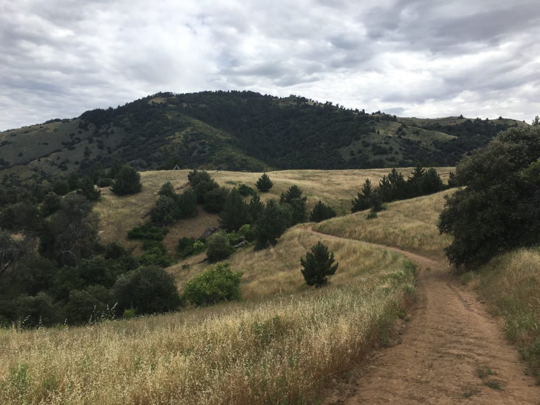
Today was going to be a two hike day, the first up was completing this year’s Coast to Crest Challenge by hiking the Kanaka Loop out in the Santa Ysabel East Preserve. I pulled into the parking area, which is just north of the trailhead to Volcan Mountain. As I gathered my gear, another hiker was returning from the trail. Turns out he was trying to finish the challenge for the deadline. He was off to do his last hike. I wished him well and headed off myself.
The trail gently worked its way toward near a still flowing stream, the trail crosses it before beginning to work its way up the hill. Once atop the hill, I found myself on a nice pasture. The challenge requires you to take a selfie at a specific spot, in the case of a distinct fallen tree. I continued up to it and took my photo. I surveyed the view. Initially, I was just going to hustle up to the photo spot and hustle back down. My main goal was to get another peak done on the 100 Peak Challenge, but I was so taken by the beauty of this hike, I decided to continue the loop.
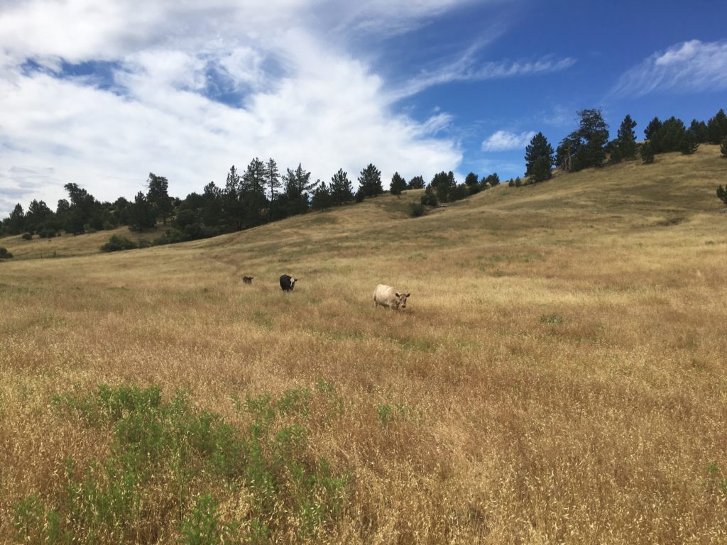
This area is an active pasture, so as I strolled along the trail, cows dotted the area. I kept a respective distance.
I soon found myself back at the junction to descend from the pasture. This might have been one of the nicest hikes of the challenge.
Making my way back to the car, I ran into a grandfather and his grandson out enjoying the trail. We chatted some, turns out he used to be a ranger for the park. I bid farewell and headed back to the car. Another challenge in the books! I stopped off at Wynola Pizza before heading down to summit Arrowmaker Ridge.
I am an avid peak bagger, sometimes backpacker, and former sea kayaker living in San Diego. In 2019, I became the third person to complete the San Diego 100 Peak Challenge. Not stopping with that accomplishment, I set my sights on the harder San Diego Sierra Club 100 Peak list, which I completed in 2021. In addition, I have conquered several Six-Pack of Peaks challenges (SoCal, San Diego, Central Coast, and Arizona-Winter). Beyond attempting the San Diego Sierra Club 100 Peak list a second time, I am looking forward to exploring new summits and new adventures across the southwest.
Update: Have been informed that this peak is now off-limits. It lies within the Pilcha (West Mesa) Cultural Preserve, and since there is no trail it should not be accessed. The replacement peak is now Paradise Mountain.
After completing my last hike for the 2018-2019 Coast to Crest Challenge earlier in the day, I decided to squeeze in summiting Arrowmaker Ridge. I had hoped to do it when I did my Cuyamaca loop, but time was running short and I had a 50th birthday to get to.
After refueling at Wynola Pizza, I drove down to the West Mesa trailhead and headed out. The trail initially follows the Japacha Fire Road and goes steadily upward. At the intersection with the West Mesa Fire Loop Road, it was time to leave the trail and head cross country.
I had generated a route from Google Earth to guide me once I left the fire road. Rather than a direct approach to the summit, I crossed the meadow and then kept to the southeast side of the ridge which had far less vegetation according to the satellite imagery.
For the most part, this route worked great. The summit is anti-climatic, there is no register or Benchmark. But if you are working on this challenge, this summit is a perfect one to test out your cross-country navigation skills.
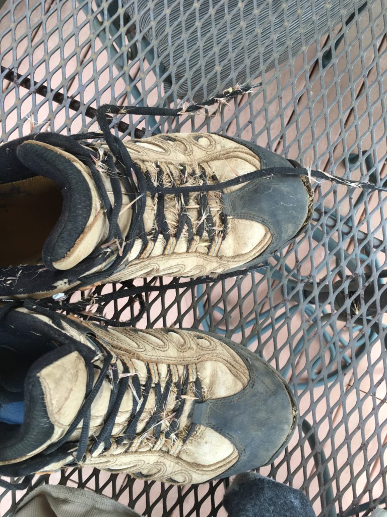
I found my way back down, and with a few false starts, I crossed back through the meadow. Unfortunately, my boots and socks were covered in cattails. I picked out the worst of them, but really wished I wore my gaiters.
I hustled my way back to the car, as I realized I forgot to hang up my Adventure Pass. Thankful, no nasty gram was on the windshield. I shed my boots and socks and drove home. This was peak #43!
I am an avid peak bagger, sometimes backpacker, and former sea kayaker living in San Diego. In 2019, I became the third person to complete the San Diego 100 Peak Challenge. Not stopping with that accomplishment, I set my sights on the harder San Diego Sierra Club 100 Peak list, which I completed in 2021. In addition, I have conquered several Six-Pack of Peaks challenges (SoCal, San Diego, Central Coast, and Arizona-Winter). Beyond attempting the San Diego Sierra Club 100 Peak list a second time, I am looking forward to exploring new summits and new adventures across the southwest.
I wanted to do something with some miles in preparation for the rescheduled Climb For Heroes, looking at my list of remaining hikes for the 100 Peak Challenge Reboot, and thought about connecting several of the peaks in the Cuyamacas. The recent rains had extended the wildflowers, so it seemed like a perfect plan. The goal was to summit Airplane Ridge, then up to Japacha Peak, then Cuyamaca, and hit Arrowmaker Ridge on the return. All told about 14 miles of hiking were planned for the day.
I wanted to start this attempt from the Green Valley Campground, but it is currently closed. Instead, I started at the Sweetwater Parking area. Crossing over the flowing water, I began working my way along the Monument Trail toward the first peak of the day, Airplane Ridge. The grade of the trail made the ascent very pleasant. The big peaks loomed ahead of me. So much so, that I missed hopping off the trail to summit Airplane Ridge. Doh! So I backtracked and tried approaching it from the north. I got close, but not directly at the high point. The bush was too thick. If had done some recon with some satellite imagery, I should have continued backtracking further and would have had a clear path, like a remembered from the first ascent from the south. Looking back at my pictures, I even took a photo of where I should have gone.
After hopping back on the trail, I began climbing my way up toward Japacha peak. The flowers along the meadow were stunning. Soon I found myself weaving my way through the remaining pine trees on the mountain. The crunch of the needles under my boots was music to my ears.
When I ‘summited’ Japacha Peak the first time I only got partially there, as my hiking partner was in shorts and had to turn back. Not a problem this time, as I scouted a sort of path through the brush to the peak. While there is no benchmark, there is a register. The June Gloom was in full force, but it made for a dramatic scene to the west.
After signing in, and a short rest, I picked my way back through the brush and back on the trail. Cuyamaca towered over me as a continued climbing. The Burnt Pine trail ends at the main road to the summit of Cuyamaca. This was going to be my least favorite portion of this loop, as it is mostly steep and paved.
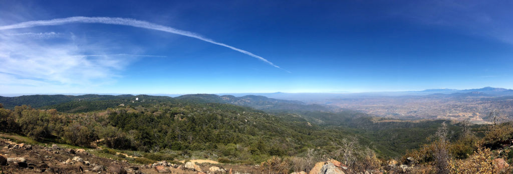
I finally encountered my first other hikers of the day along the road. At the summit, I rested and gazed out across the cloud tops covering much of my view. I had the summit all to myself.
I began to work my way down the road to the Fern Fire Road. I began to encounter more hikers making their way to the summit, along with their dogs in tow. I had forgotten how steep the road was, and as such, my pace slowed some. It might also have been the fact I already hiked 8 miles. I began to become concerned about the time, as I needed to be back in town to celebrate a good friend’s 50th birthday. I wondered if I should just head to the road and hitchhike back to the car. In the end, I figured I could make it back to the car without too much delay.
The road gently worked its way down, crossing various springs along the way. Soon I found myself at the base of Arrowmaker Ridge. I was uncertain if I should attempt it. I was going to be cutting it close in time. Although the peak is not that high, it does require some bushwhacking. Since I was fighting the clock, I had not been resting nearly as much as I normally do. I crossed over the meadow to see if an easy route. Alas, nothing appeared, and I was running out of gas and still had a couple of miles still to go. Since both Middle Peak and Stonewall Peak are nearby, I knew I would have an easy opportunity to try again.
My route took me along Japacha Creek. The flowing water was soothing, I wish I had time to dip my feet into the cool waters and rest.
I finally found myself back at my car with plenty of time to make it to the party. All told this hike covered 14.4 miles in 7 hours. The total elevation gain was 2,775 feet. All in all a fantastic day on the trails. That makes 33 summits of the 100 this year.
I am an avid peak bagger, sometimes backpacker, and former sea kayaker living in San Diego. In 2019, I became the third person to complete the San Diego 100 Peak Challenge. Not stopping with that accomplishment, I set my sights on the harder San Diego Sierra Club 100 Peak list, which I completed in 2021. In addition, I have conquered several Six-Pack of Peaks challenges (SoCal, San Diego, Central Coast, and Arizona-Winter). Beyond attempting the San Diego Sierra Club 100 Peak list a second time, I am looking forward to exploring new summits and new adventures across the southwest.
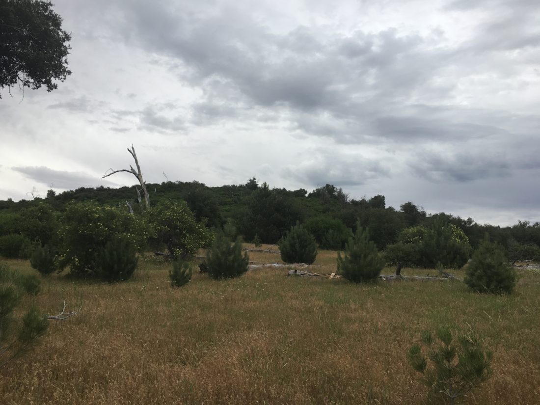
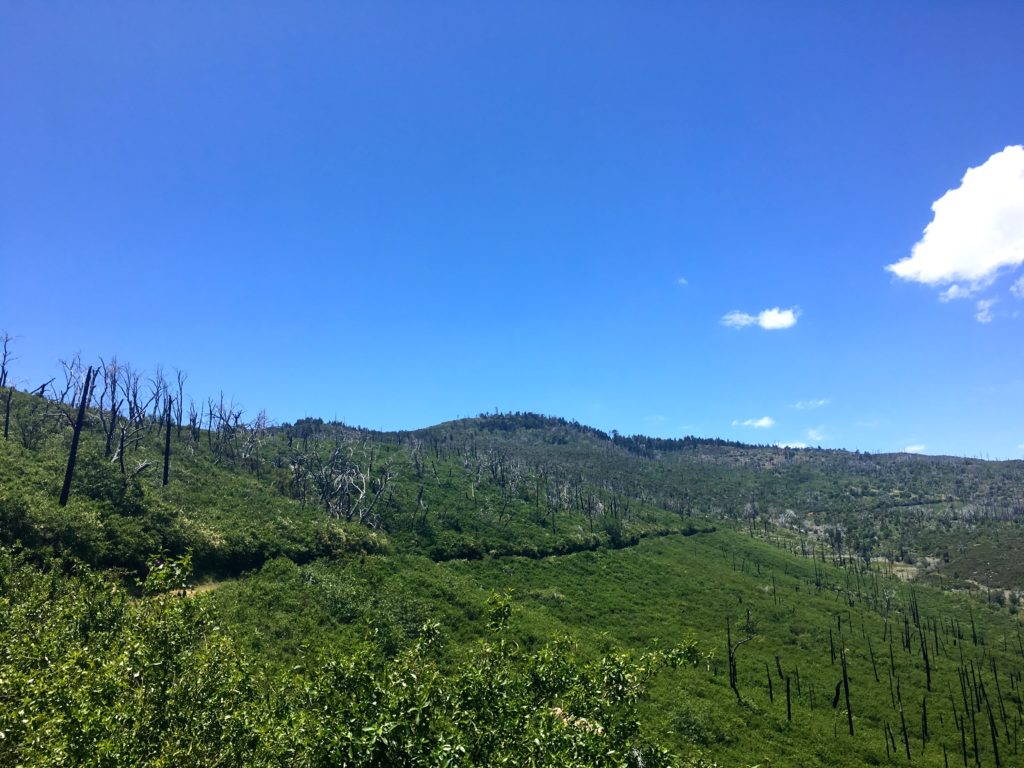
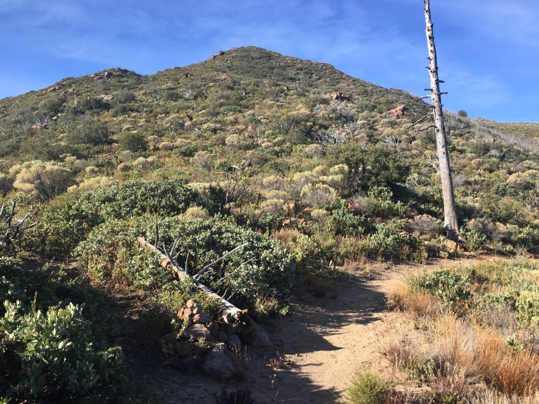
While the rainy Memorial Day weekend put a damper on any big hiking plans, Monday afternoon availed itself for some time on the trails. I mulled several options as a candidate, but in the end, I settled on Guatay Mountain out near Pine Valley. This peak was the first peak I did after my neck injury. It was going to be interesting to compare the two summits.
As I unlocked the gate to the trail, I could hear the stream flowing nearby. Like so many trails, it was slightly overgrown from all the rains we had this year. As expected, some of the steeper sections had become more rutted as well.
I followed the trail for about a mile before reaching the metal fence indicating the turnoff toward Guatay Mountain. This section also showed the effects of our winter, requiring some straddling of the trail to work my way up. The weather was perfect for hiking, a light breeze and perfect temperatures made the climb upward pleasant.
I remembered much of the trail as it passed under my boots. I was curious to discover the difference once I got to the steeper section of the hike. I remembered that it took some effort the first time.
This time I found myself working my way upward without any issues. Glancing northward toward Cuyamaca, its summit was still encased in clouds.
Soon the summit came into view. I took a short break and signed the register. I looked over at Long Valley and debated if I should consider doing it as well…
I headed back down the trail, reflecting on how different these two summits have been. The first time pushed me and gave me confidence that I could hike again. This time, it let me know that I had the strength to complete my 100 Peak Challenge Reboot.
Soon I found myself crossing that small stream again, knowing that this hike was nearing its end. Once back in the car, I decided not to tack on Long Valley, and just enjoy my summit of a Guatay.
I am an avid peak bagger, sometimes backpacker, and former sea kayaker living in San Diego. In 2019, I became the third person to complete the San Diego 100 Peak Challenge. Not stopping with that accomplishment, I set my sights on the harder San Diego Sierra Club 100 Peak list, which I completed in 2021. In addition, I have conquered several Six-Pack of Peaks challenges (SoCal, San Diego, Central Coast, and Arizona-Winter). Beyond attempting the San Diego Sierra Club 100 Peak list a second time, I am looking forward to exploring new summits and new adventures across the southwest.
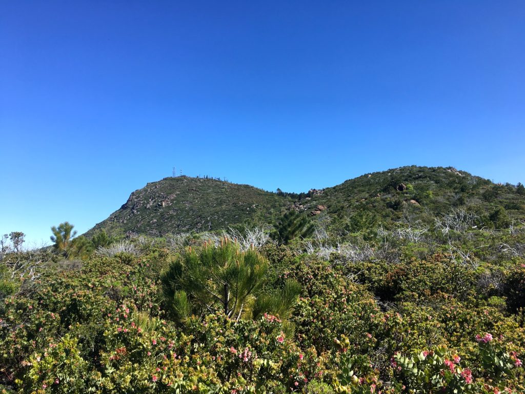
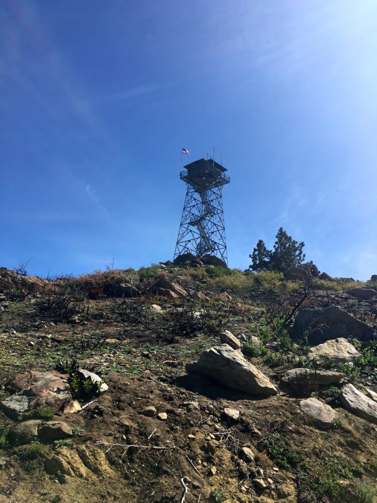
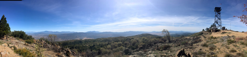
We had planned to attempt to summit Square Top via the Los Coyotes Indian Reservation. Unfortunately, they are no longer allowing access to the trailhead. So, Gail needed to complete her summit of Palomar High Point, so since we had a capable car, along the Palomar Divide Trail we went. We parked at the same spot as before and worked our way to the lookout tower. This time the mountains to the north still gleamed with snow.
The area directly around the tower had been burned, most likely due to a controlled fire.
We took a few photos, then headed back down to the car and off to the next hike. There was an hour of driving down from the summit before we had to make our decision. We debated between Combs Peak, which was to the northwest of us, or out to Eagle Rock.
Once we reached the main road, we decided to go summit Combs Peak again, so off went!
I am an avid peak bagger, sometimes backpacker, and former sea kayaker living in San Diego. In 2019, I became the third person to complete the San Diego 100 Peak Challenge. Not stopping with that accomplishment, I set my sights on the harder San Diego Sierra Club 100 Peak list, which I completed in 2021. In addition, I have conquered several Six-Pack of Peaks challenges (SoCal, San Diego, Central Coast, and Arizona-Winter). Beyond attempting the San Diego Sierra Club 100 Peak list a second time, I am looking forward to exploring new summits and new adventures across the southwest.
After being unable to attempt Square Top, we decided to summit two other peaks nearby. Since Gail needed to finish Palomar High Point, we drove partway up the Palomar Divide Trail and hiked to the top. The second peak, since we all had the entire day free, was hiking Combs Peak. We made our way out Chinuahua Valley Road then onto Long Valley Road. Once we reached the trailhead, after encountering someone also driving east, who decided to stop in the middle of the road and take a piss. Thankfully, he did not also pull into the trailhead. The road was marked with new mile markers that also had the Boy Scout oath upon them. At the trailhead itself, a new PCT trail magic shelter had been built since I had been here last. Since it was the start of the northbound season, we expected to see a lot of folks working their way northward.
The four of us cruised up the PCT to the turn-off and started the steep ascent. In just about .5 miles, we would gain some 600′ of elevation.
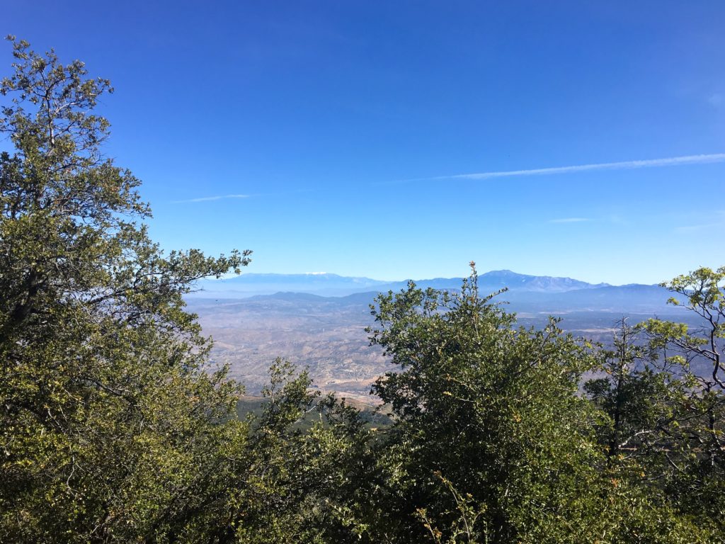
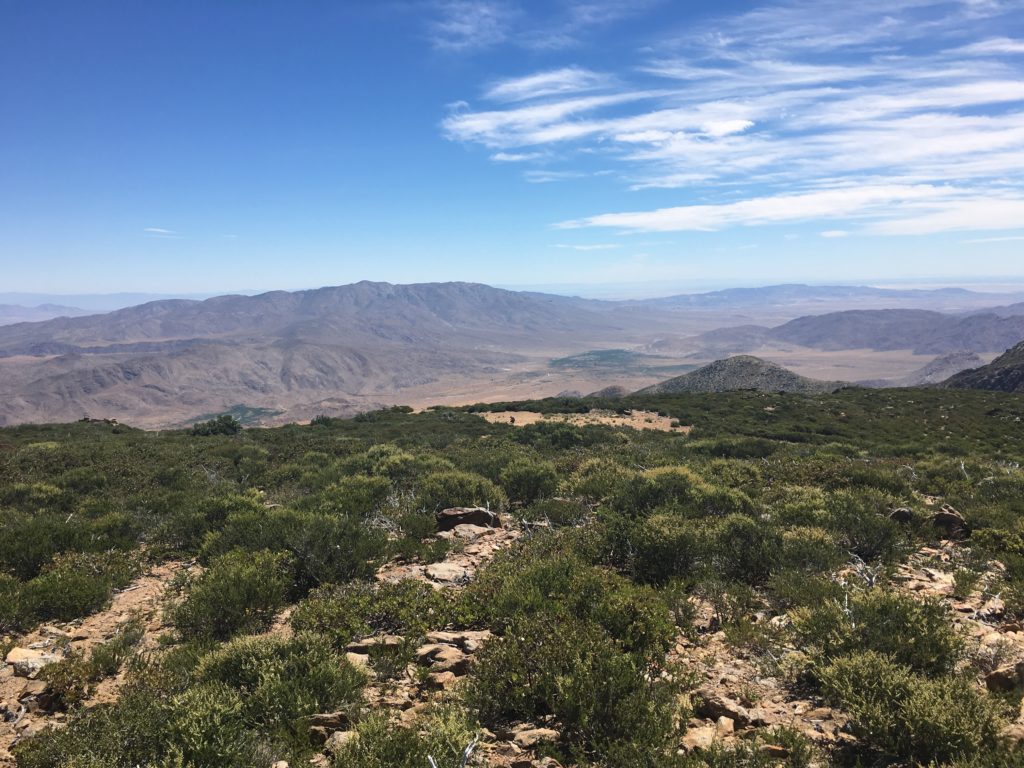
We meet two other hikers just getting ready to descend as we reached the top. The views are still one of the best in the county. Atop the summit, we could see snow-capped San Gorgonio and San Jacinto to the north. To the east, we spied the Salton Sea. The benchmark and register were both found.
Again, carefully working our way down, the expected stream of PCTers appeared. We would stop and wish them well on their journey. I wondered what each was seeking on the trail…
I am an avid peak bagger, sometimes backpacker, and former sea kayaker living in San Diego. In 2019, I became the third person to complete the San Diego 100 Peak Challenge. Not stopping with that accomplishment, I set my sights on the harder San Diego Sierra Club 100 Peak list, which I completed in 2021. In addition, I have conquered several Six-Pack of Peaks challenges (SoCal, San Diego, Central Coast, and Arizona-Winter). Beyond attempting the San Diego Sierra Club 100 Peak list a second time, I am looking forward to exploring new summits and new adventures across the southwest.
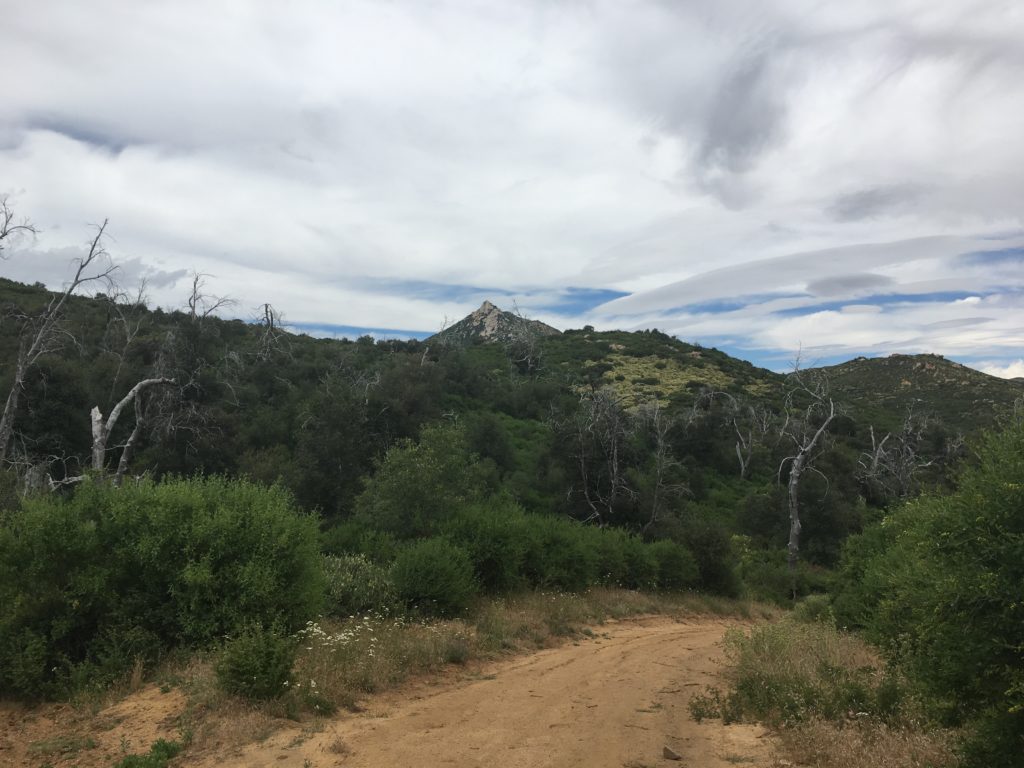
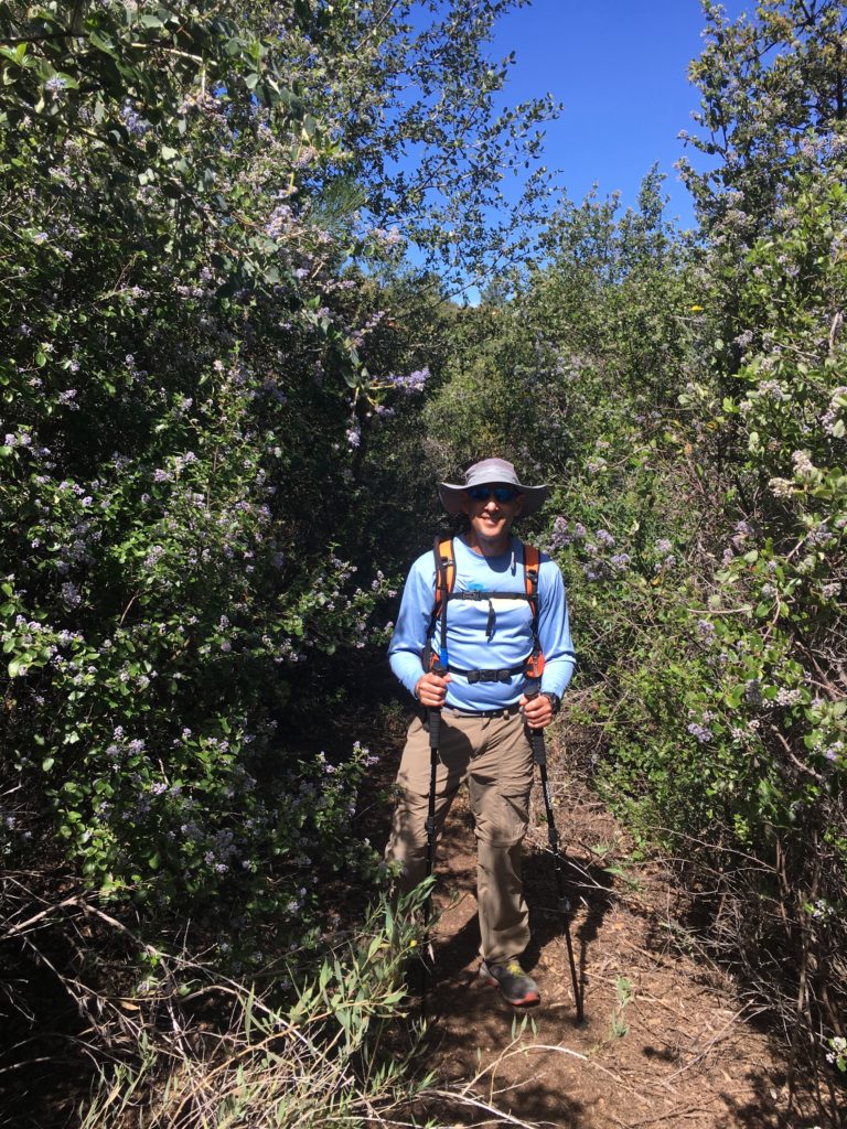
Today’s summit was Agua Tibia, a 4,779-foot peak near the San Diego- Riverside county line. Our planned peak, Square Top, could not be attempted due to a music festival being held on the Los Coyotes Indian Reservation.
The trail starts in the Dripping Springs campground and begins its climb upward. The weather was pleasant, and the smell of flowers filled the air. The trail weaved its way upward, at times switching back and forth to gain elevation. To our north, the snow-capped mountains framed our views.
About 4 miles in, Ted and I found a nice spot for a break. The route is not too hard, mostly just long…
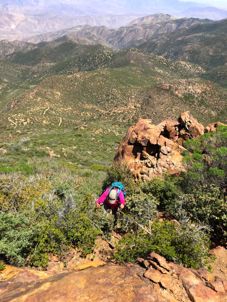
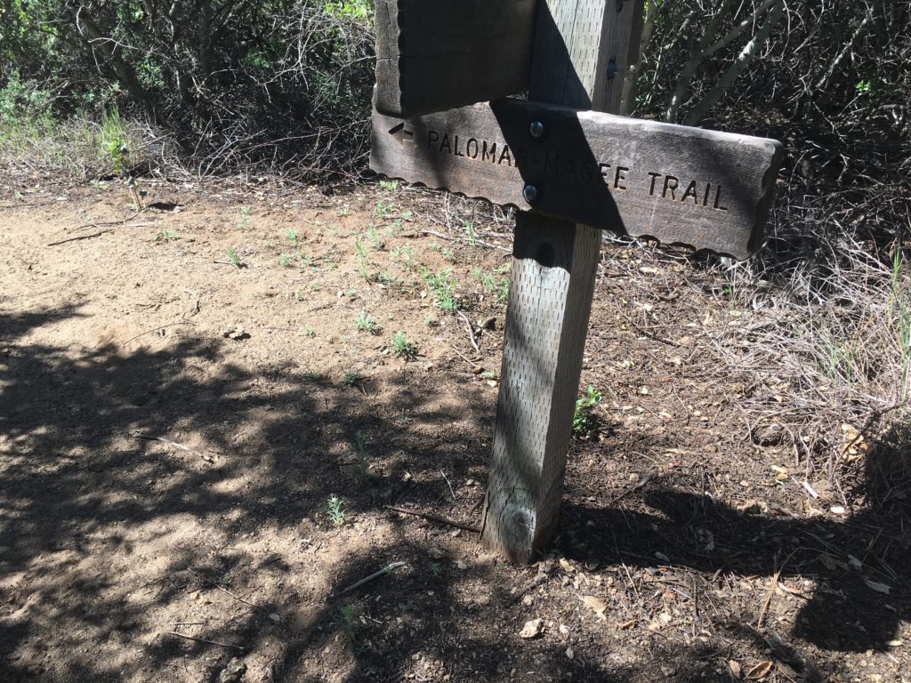
On the way up we encountered two trail runners. One told us the Wild Horse trail had some downed trees. But we were not doing this peak as a loop. Soon we found ourselves about 8 miles in and looking for the use trail to the summit. This was the only portion that had some challenges, as we bushwhacked our way forward. The Palomar-Magee section used to require you to pass through hunched-over. Thankfully, this section has now been cleared.
We found the register, the primary benchmark, and one reference marker. I signed us in and took another break.
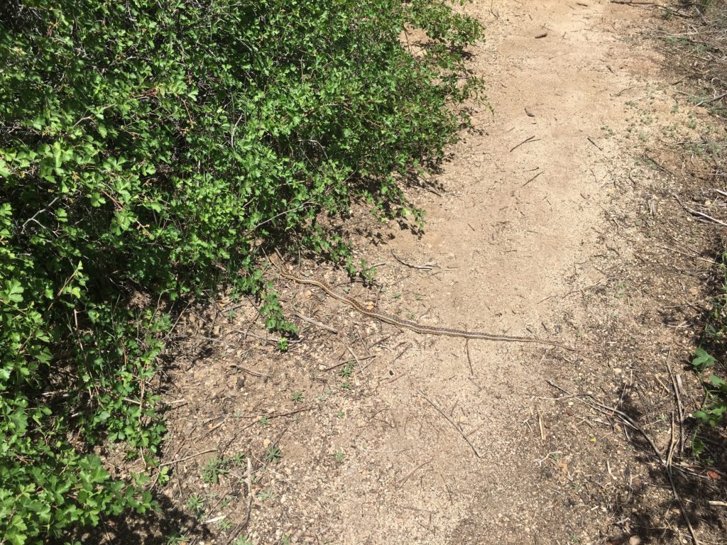
Then we put our packs back on and grabbed our poles and began heading back down the mountain. The miles passed quickly, and we spotted a snake basking in the sun. Since this little fella was just a garter snake, we stepped over it.
We found ourselves back at the same logs for another break. That is one thing that this trail lacks is spots for a break. About a half mile later, we found a family resting on the trail. They looked woefully under-prepared for the hike they are on. Thankfully, they did turn around. As we continued down, we encountered a few more hikers. I doubt they were planning to summit the peak.
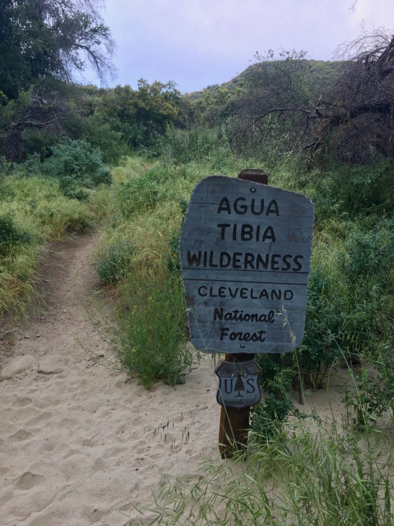
Near the base of the trail, someone was doing some maintenance, and we thanked him for his efforts. Soon, we were passing the Agua Tibia Wilderness Sign and the end of our hike. We covered just over 16 miles, climbing over 3,400 feet of elevation to the summit at 4,762. This hike took just under 8 hours and was a great hike for my 95th peak on my 100 Peak Challenge!
I am an avid peak bagger, sometimes backpacker, and former sea kayaker living in San Diego. In 2019, I became the third person to complete the San Diego 100 Peak Challenge. Not stopping with that accomplishment, I set my sights on the harder San Diego Sierra Club 100 Peak list, which I completed in 2021. In addition, I have conquered several Six-Pack of Peaks challenges (SoCal, San Diego, Central Coast, and Arizona-Winter). Beyond attempting the San Diego Sierra Club 100 Peak list a second time, I am looking forward to exploring new summits and new adventures across the southwest.
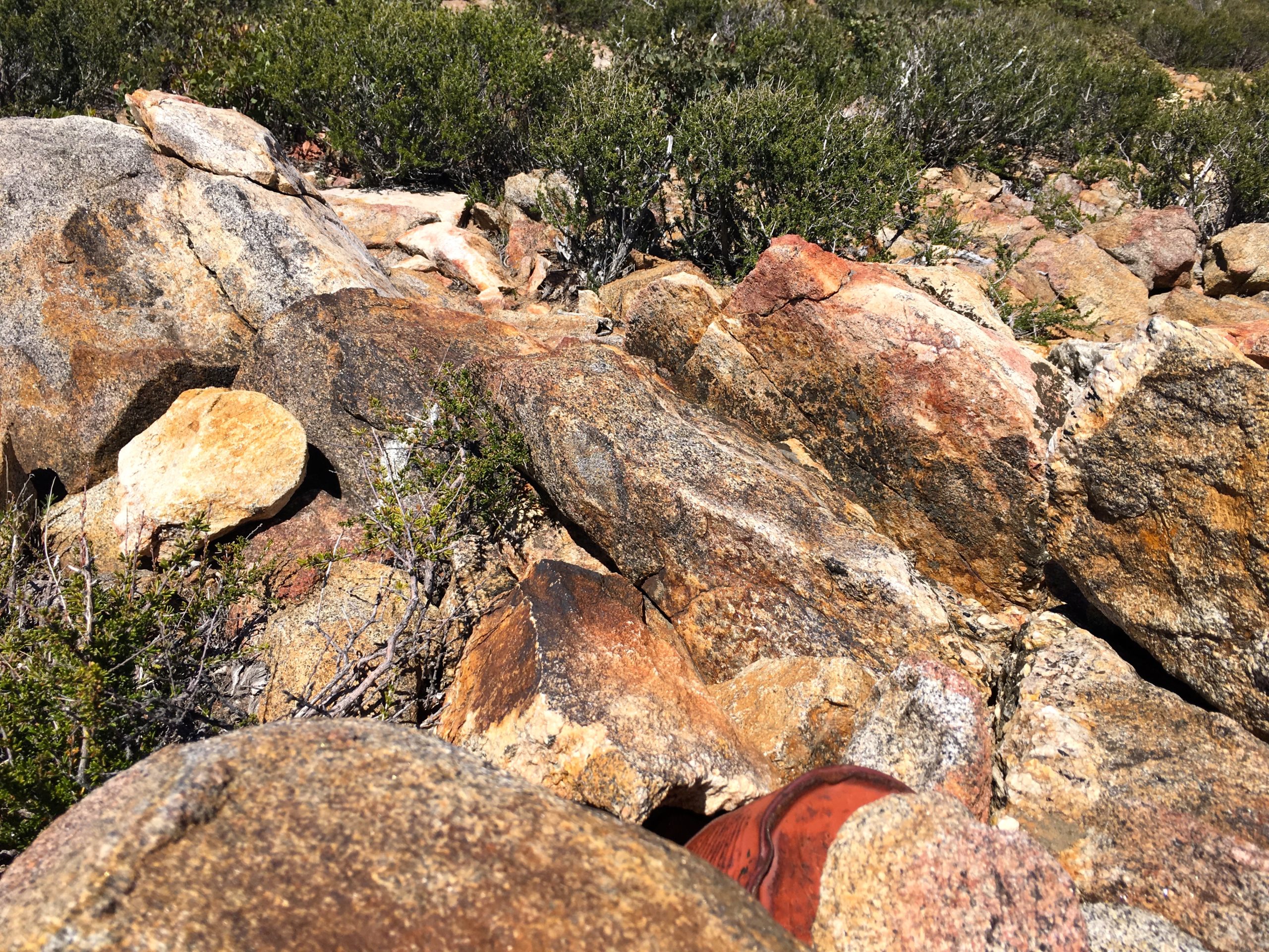
The final peak of the day was Garnet Mountain, just around the corner from Pioneer Mall Campground. The Pacific Crest Trail runs right past the peak, but the short trail to this summit is just to the west. Ducking under a metal gate, the rocky trail heads up, and the wind continued to blow.
Once the trail ends, a hint of a use trail could be seen, up through the brush, I went. Atop the summit, I found the register and carefully signed in to prevent it from blowing away.
From the summit, Anza-Borrego was spread out before me. So many familiar peaks dotted the view. Then it was back down to the car, covering a mere 0.75 miles for the entire trip.
Granite Mountain in the distance
I am an avid peak bagger, sometimes backpacker, and former sea kayaker living in San Diego. In 2019, I became the third person to complete the San Diego 100 Peak Challenge. Not stopping with that accomplishment, I set my sights on the harder San Diego Sierra Club 100 Peak list, which I completed in 2021. In addition, I have conquered several Six-Pack of Peaks challenges (SoCal, San Diego, Central Coast, and Arizona-Winter). Beyond attempting the San Diego Sierra Club 100 Peak list a second time, I am looking forward to exploring new summits and new adventures across the southwest.
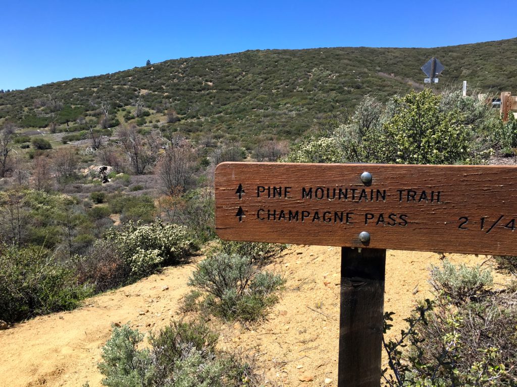
As part of my 100 Peaks Challenge Reboot, I am hiking these peaks again. Since my planned peak had a forecast of 25-35 mph winds, with possible gusts to 50 mph, it decided to look for other options. So, a set of peaks in the Laguna Mountains fit the bill. In gathering my route information, I looked a bit closer at what Ben and I hiked. Now that I am a bit more seasoned in map reading, I realized that while we had hiked a loop along the Pine Mountain Trail, we actually did not approach the actual mountain.
It turns out that when the Pine Mountain Trail intersects with the dirt road, instead of going straight, you should hang a right onto the road.
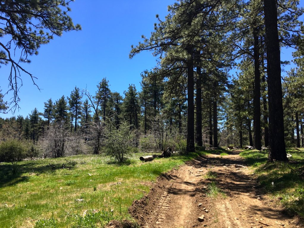
The road had been recently graded, as there were no ruts to be found. The road headed north, then turn west as it gently climbed upward. Once I passed enough of the brush, I left the road and began heading south across the open forest floor.
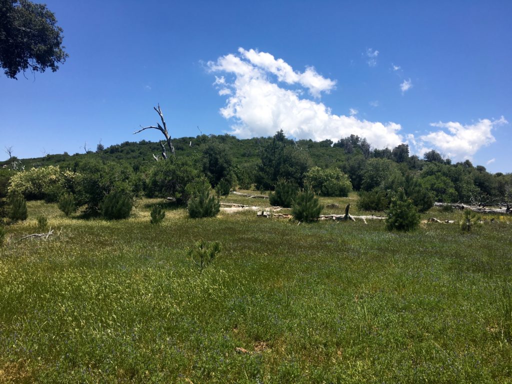
The crunch of the leaves under my feet was a sound I had not heard in a while, as for the past few months I had been hiking in Anza-Borrego. I soon found myself at the top of this gentle summit, sat on a log, and enjoyed a short snack. While the pine trees gave me some nice shade, there really is not any view. I knew this summit would be both benchmark and register-free, so I retraced my steps and returned to the car.
I am an avid peak bagger, sometimes backpacker, and former sea kayaker living in San Diego. In 2019, I became the third person to complete the San Diego 100 Peak Challenge. Not stopping with that accomplishment, I set my sights on the harder San Diego Sierra Club 100 Peak list, which I completed in 2021. In addition, I have conquered several Six-Pack of Peaks challenges (SoCal, San Diego, Central Coast, and Arizona-Winter). Beyond attempting the San Diego Sierra Club 100 Peak list a second time, I am looking forward to exploring new summits and new adventures across the southwest.