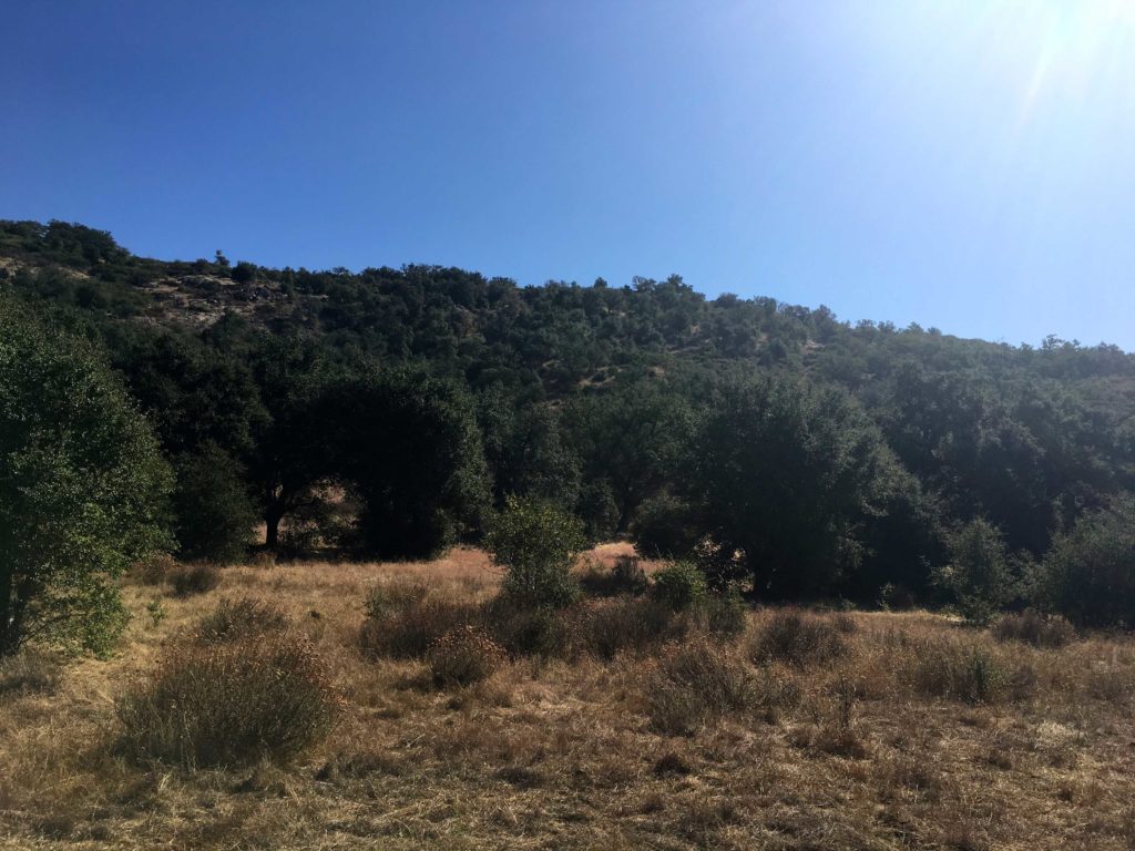
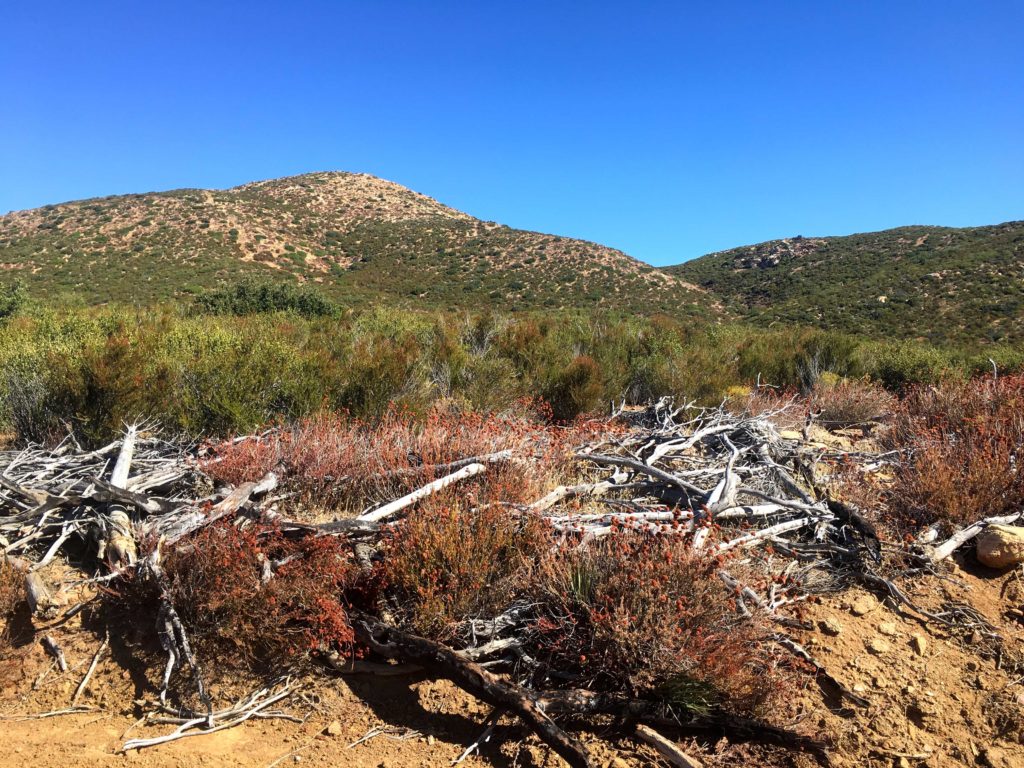
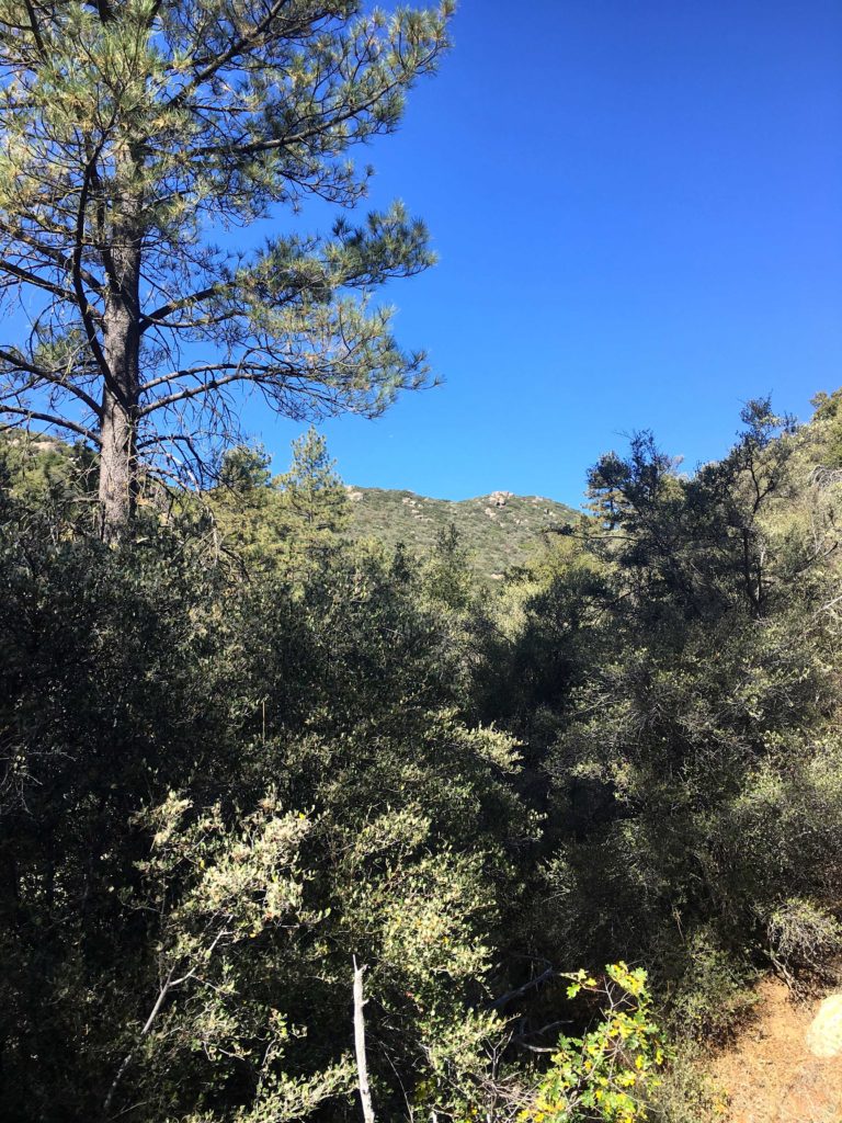
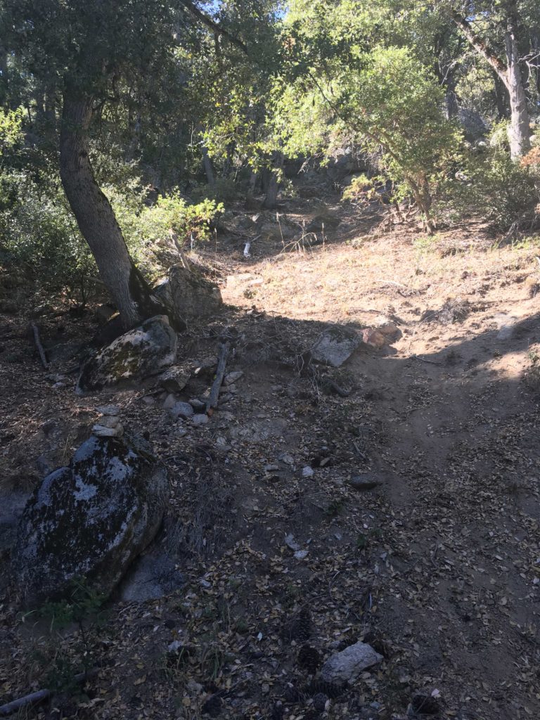
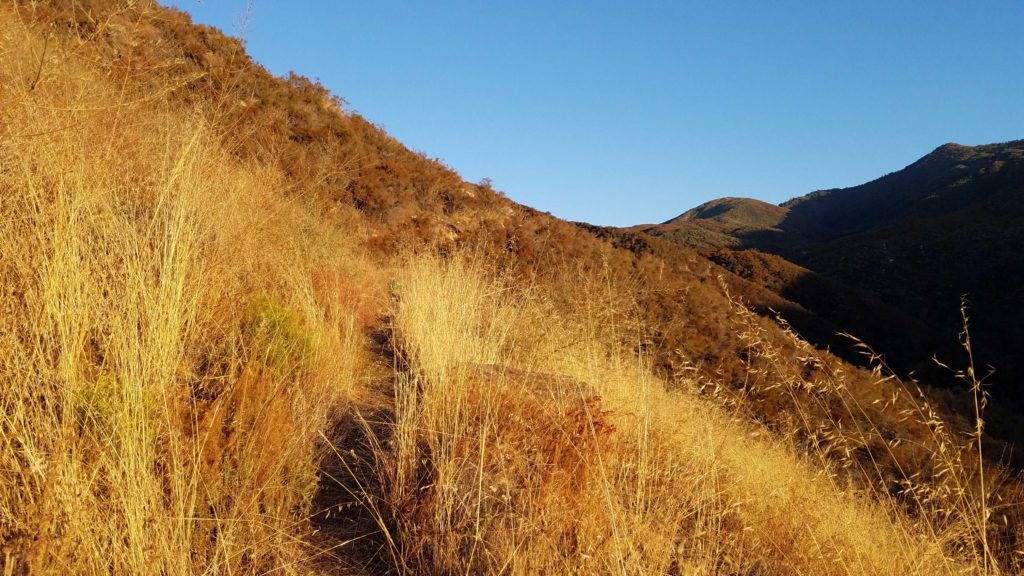
After returning from Cemetery Hill, I took a break at the trailhead and chatted with a couple of hunters who were packing up to try their luck elsewhere. Oak Benchmark was going to be my final peak of the day. While it should only be about a mile round trip, it is steep and without any trail to follow. I remember some of my previous route from last time but knew it was going to be one of the route-finding skills treks. Just south of where I parked, is a nice meadow that serves as the best starting point for the peak.
From there it is up, any way you can. There was some poison oak to avoid, as I eventually found my way to the summit.
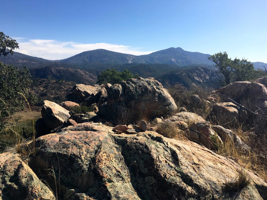
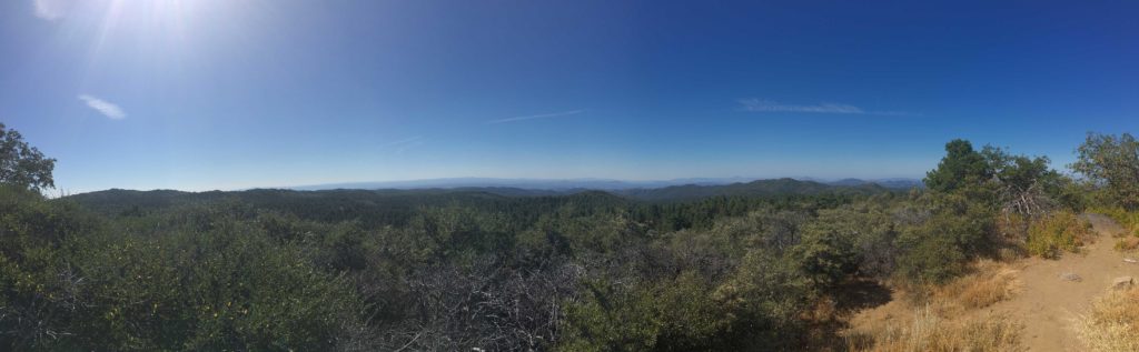
This time a register was waiting to be signed, but also two marks to photograph. While the hike gains about 500 feet in .5 miles, there were some fantastic views to be had as a reward.
It was getting warmer, so I made my careful descent. Back at my car, I was now done with all my non-desert peaks for my 100 Peak Challenge, just 17 to go!
I am an avid peak bagger, sometimes backpacker, and former sea kayaker living in San Diego. In 2019, I became the third person to complete the San Diego 100 Peak Challenge. Not stopping with that accomplishment, I set my sights on the harder San Diego Sierra Club 100 Peak list, which I completed in 2021. In addition, I have conquered several Six-Pack of Peaks challenges (SoCal, San Diego, Central Coast, and Arizona-Winter). Beyond attempting the San Diego Sierra Club 100 Peak list a second time, I am looking forward to exploring new summits and new adventures across the southwest.
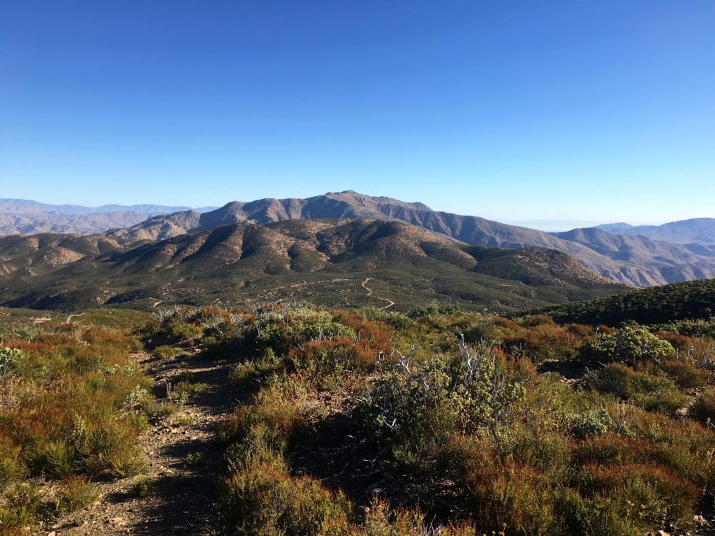
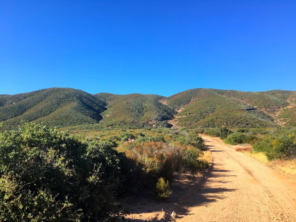
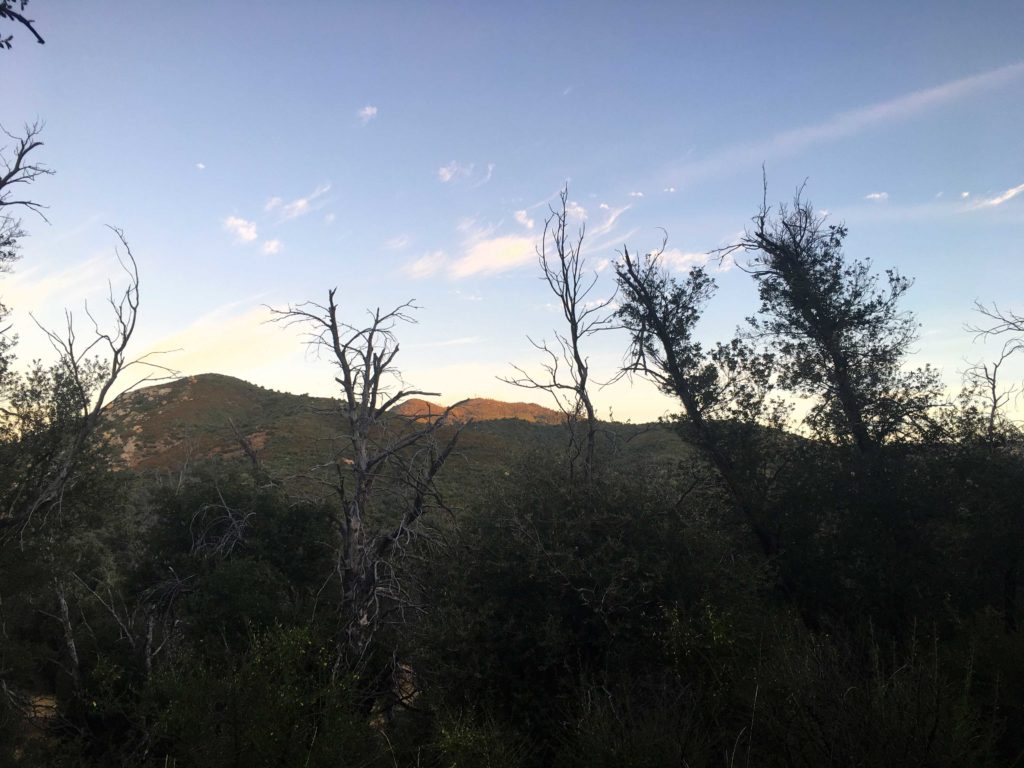
After summiting P1546, I drove back up Eagle Peak Road to the shared trailhead for Cemetery Hill and Oak Benchmark. Along the way, I passed a modest amount of hunters parked along the side of the road. I knew I would need to be alert for the next two hikes. I swapped my normal hat for my red ball cap. Cemetery Hill is another inverted peak, like P1546, so down another old road, I went.
Once at the base of the descent, I had about 1.5 miles to cover over some easy rolling terrain. As I neared the peak, I would have to go cross-country to the summit.
I soon found myself passing the wooden posts that mark the cemetery. There are no other markers to be found. At the true summit, I had a nice rest under the shade of oak before heading back.
That was peak #82 of my #100PeakChallenge.
I am an avid peak bagger, sometimes backpacker, and former sea kayaker living in San Diego. In 2019, I became the third person to complete the San Diego 100 Peak Challenge. Not stopping with that accomplishment, I set my sights on the harder San Diego Sierra Club 100 Peak list, which I completed in 2021. In addition, I have conquered several Six-Pack of Peaks challenges (SoCal, San Diego, Central Coast, and Arizona-Winter). Beyond attempting the San Diego Sierra Club 100 Peak list a second time, I am looking forward to exploring new summits and new adventures across the southwest.
Unlike the last time I tried to hike this peak about a month ago, the temperatures were pleasant and the winds light (think 44°F and 20-25 mph winds). I parked next to the Pedro Fagas monument and gathered my gear. The route to Chariot starts by following the California Riding and Hiking Trail. You can stay on it for a while, then take the Mason Valley Truck Trail down for a 9-mile hike. Instead, I decided to follow some faint use trails across the meadow that would take me to the Pacific Crest Trail for about a 5.5-mile hike instead.
The meadow grasses were pretty high, so I took extra care as I made my way across it. After about .8 of a mile, I came to the PCT, from here I quickly began looking for some metal fence posts to the east, these would indicate the steep trail down the ridgeline. The first time I did this hike I missed them and did an extra quarter mile on the PCT.
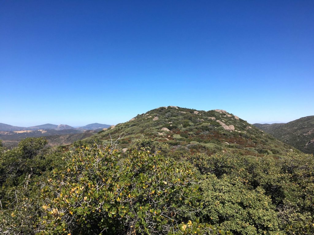
With the use trail found, I began my descent. Chariot Mountain is an inverted peak, meaning you start higher than the summit. The trail was not too bad, I certainly have bushwhacked through worse recently. It was as steep as I remembered from last time, but the uncertainty that hung over me was no longer there. Making it feel a bit easier. However, I still was not looking forward to ascending it on my return. Chariot Mountain was clearly visible across the valley, and Granite Mountain standing behind it.
The trail came to end on Mason Valley Truck Trail. A wooden post on the side of the road would serve as a marker to locate it on the way back. The road appeared to have been graded not too long ago, as machinery treads were visible on the roadbed.
At the T, I turned right and Chariot drew closer. There is an old fire break that serves as the trail to the summit. In fact, the turnoff is marked by a bramble of deadwood blocking it from vehicle access. The climb up was steady, with one steeper section to deal with, but soon I reached the summit plateau and made my way to the true summit.
There is no Benchmark here, but tucked in some rocks was the register. As I enjoyed the views, I flipped through it, seeing many familiar names. After adding mine as a 2x’er, I headed back down, and then back up. Can you tell I wasn’t looking forward to that part…
The ascent up from the road went slow, my snack on the summit didn’t give me the boost I had hoped for. But I slogged on and finally reached the top. From there it was a pleasant stroll back across the meadow, again staying mostly on established use trails.
Chariot Mountain was #77 of #100PeakChallange.
I am an avid peak bagger, sometimes backpacker, and former sea kayaker living in San Diego. In 2019, I became the third person to complete the San Diego 100 Peak Challenge. Not stopping with that accomplishment, I set my sights on the harder San Diego Sierra Club 100 Peak list, which I completed in 2021. In addition, I have conquered several Six-Pack of Peaks challenges (SoCal, San Diego, Central Coast, and Arizona-Winter). Beyond attempting the San Diego Sierra Club 100 Peak list a second time, I am looking forward to exploring new summits and new adventures across the southwest.
After summiting Sheephead Mountain, I drove a short way back down Sunrise Highway to the trailhead. I actually grabbed a spot right next to it. Both the Sunset and Big Laguna trails start from here, so it is a popular spot. I grabbed my gear and set out again. The Sunset Trail is a hiking-only trail so I did not worry about being run over by a mountain bike since the Big Laguna Loop is a very popular trail for them.
As I cruised along the trail, I spotted patches of poison oak to either side. I had a feeling that this was going to be an issue on this summit attempt. Soon I reached the meadow that I needed to cross to join up with the use trail that would take me down the ravine and then back up to Manza Benchmark. As I set off across it, poison oak was scattered about. This was going to be a challenge.
I never found the use trail in the actual meadow, but on the other side, I spotted it and began my descent. The trail through this section was fairly easy to follow and only slightly overgrown, but tons of poison oak to attempt to avoid. After losing about 300 feet of elevation, it was time to make the steep climb out of the ravine. The bugs had started to come out, so on went the bug net.
The trail became fairly well marked with cairns as it quickly rose to the ridgeline. Poison oak continued to grow everywhere, I only hoped my contact would not become an issue later.
So I reached the crest of the mountain and turned northward. Here I would meander through the manzanita and over boulders toward the summit. The trail here was a bit more overgrown and I had a few spots that took a moment to resolve which way to go.
Finally, from atop the false summit, the Manza Benchmark stood before me. As I scrambled over the rocks, the same incredible view was presented to me. I sat on a rock and enjoyed a snack. I took my photos and again signed the register and began the trek down.
The return back to the Sunset Trail went by quickly, again hoping that the poison oak not going to leave a ‘gift’ for later. Soon, I was back at my car and my 74th peak of my 100 Peak Challenge was completed.
I am an avid peak bagger, sometimes backpacker, and former sea kayaker living in San Diego. In 2019, I became the third person to complete the San Diego 100 Peak Challenge. Not stopping with that accomplishment, I set my sights on the harder San Diego Sierra Club 100 Peak list, which I completed in 2021. In addition, I have conquered several Six-Pack of Peaks challenges (SoCal, San Diego, Central Coast, and Arizona-Winter). Beyond attempting the San Diego Sierra Club 100 Peak list a second time, I am looking forward to exploring new summits and new adventures across the southwest.
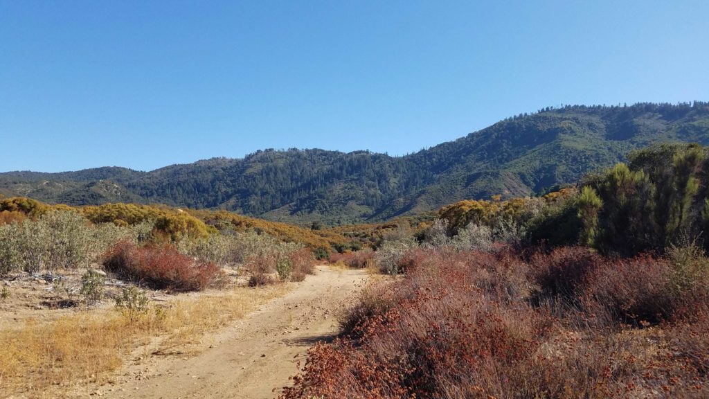
The plan for today was to summit two nearby peaks, Sheephead Mountain and Manza Benchmark both in the Lagunas. The first peak of this two-fer was going to be Sheephead. With the weather beginning to become fall-like, I did not need to be at the trailhead at sunrise. I drove down the semi-paved Kitchen Creek Road off of Sunrise Highway.
The trail seemed very familiar as the pine needles crunched under my boots. When I reached the other Kitchen Creek road, I made sure to leave a mark to find the use trail back up the ravine. I missed it the first time I summited.
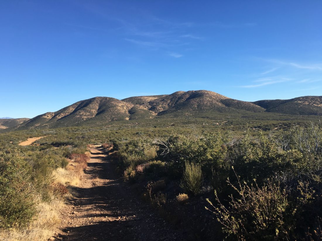
As I cruised down the road, a few cows were hanging around and scampered off as I approached. Ignoring the locked gate and its warning, I continued down the road. Double-checking my original GPS route, I spotted a faint use trail and headed hopefully toward the summit.
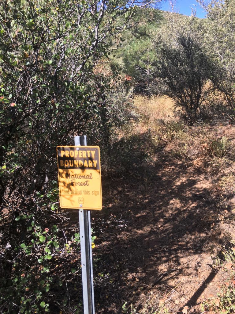
I spotted the boundary sign and knew the entrance to the use trail. Now the real effort would begin, the trail would climb some 600 feet in about .3 miles. The trail was overgrown, in fact, I lost a bandanna somewhere in that mess. Maybe after the challenge is over I might return and do some maintenance.
Finally, the summit revealed itself before me. Conditions were much nicer this time, so I enjoyed the views without feeling I was going to be blown away…
I signed the register and took my photos before heading back down. I kept an eye out for my missing red bandanna, figuring it would be easy to spot, but alas I never found it. But I did find a pair of sunglasses. Too bad I need prescription ones.
The trail deposited me back on the road and I headed back up the road. The cows were still hanging around as I neared the turnoff to the trail to make my way up the ravine. I was pleased about getting another peak out of the way. That was peak #73 of my #100PeakChallenge. Now for the short drive to the trailhead for Manza Benchmark.
I am an avid peak bagger, sometimes backpacker, and former sea kayaker living in San Diego. In 2019, I became the third person to complete the San Diego 100 Peak Challenge. Not stopping with that accomplishment, I set my sights on the harder San Diego Sierra Club 100 Peak list, which I completed in 2021. In addition, I have conquered several Six-Pack of Peaks challenges (SoCal, San Diego, Central Coast, and Arizona-Winter). Beyond attempting the San Diego Sierra Club 100 Peak list a second time, I am looking forward to exploring new summits and new adventures across the southwest.
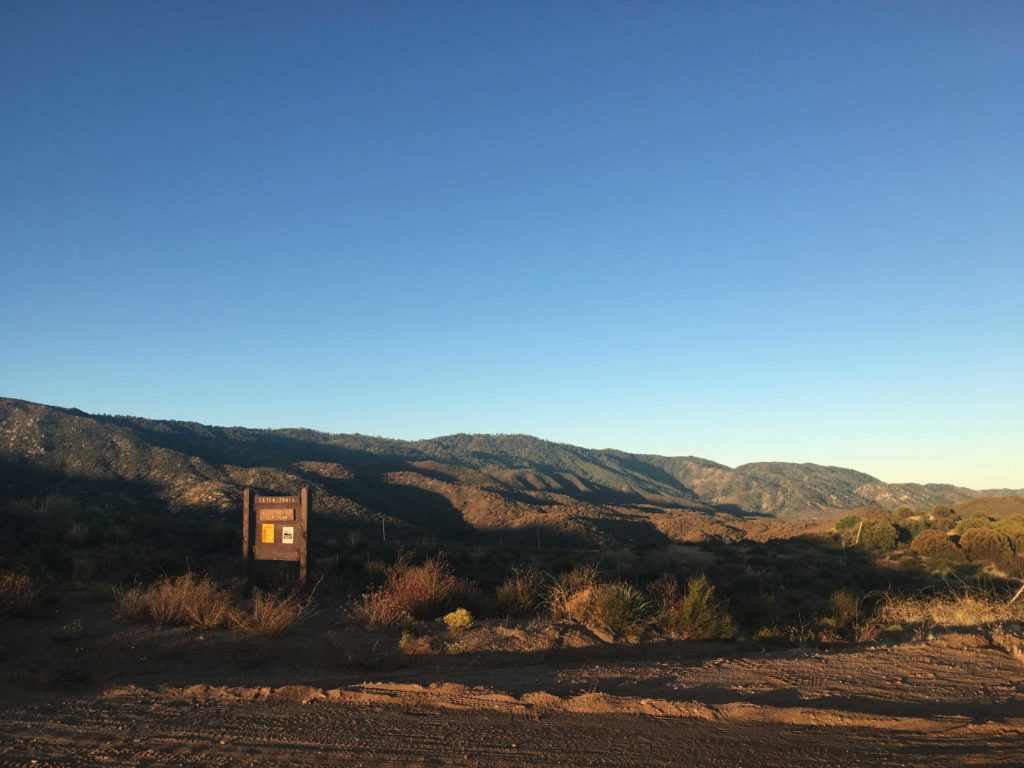
The sun was just rising as we parked the Subaru at the start of the Cutca Valley Trail for our hike out to Eagle Crag. This peak was a special one for me. My first attempt at the 100 Peak Challenge ended with 5 peaks left to summit, and Eagle Crag was one of those ‘Final Five’. When I began my ‘reboot’, I knew that this peak would be one of the challenges left to overcome. First, we checked the condition of the road to the actual trailhead. Thankfully, the High Point Truck Trail was in really good shape as it wound its way up from the Rancho California RV Resort just off the 79.
We knew the day was going to be a long one, some 18 or so miles of hiking with some decent elevation gains both there and back, not to mention the very steep ascent to the summit. The weather was going to be sunny and in the mid-70s, so having enough fluids with us was critical.
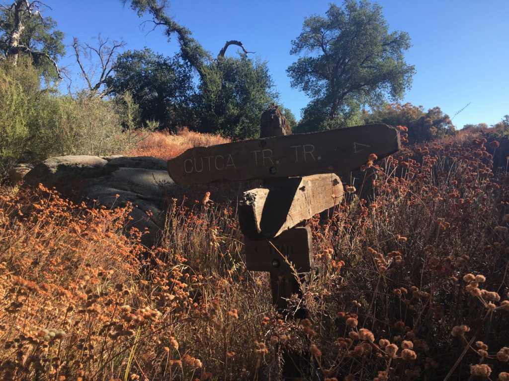
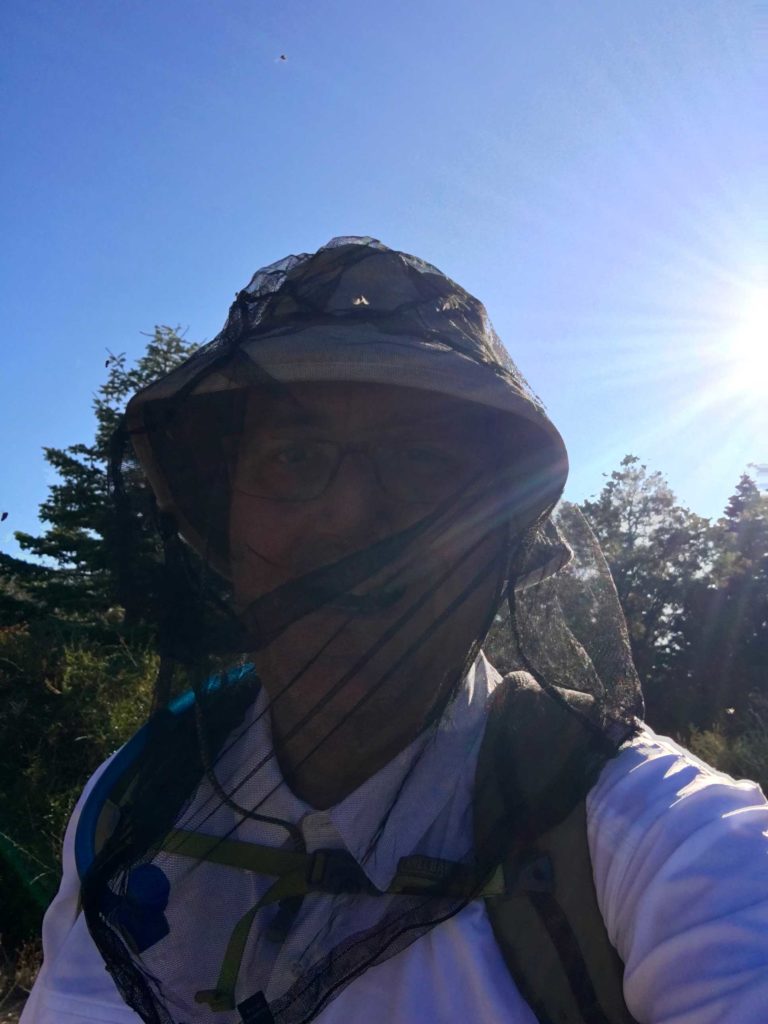
Once we passed the trail sign for the Cutca Valley Trail, we quickly plunged some 500 feet into Cottonwood Canyon. This ascent at the end of the day was not going to be fun. We followed the dry creek bed for a bit, taking care to avoid the poison oak that encroached onto the trail. The trail then began its climb up through a steep and narrow ravine before reaching Cutca Valley. There was some nice shade along this section, which we would appreciate upon our return. Every so often a blue and white ribbon would line the trail, not that they were truly needed for this section of the hike, but they gave us something to look for. The trail then came upon a wide clearing, and I thought this would be the perfect spot to stash one of the extra bottles of water I had brought. My idea was to have this reserve available to us to rehydrate if needed before we made our climb back out of Cottonwood Canyon. Also about this point, the small flies were becoming bothersome, so we donned our bug nets (the best $9 I ever spent) and continued on.
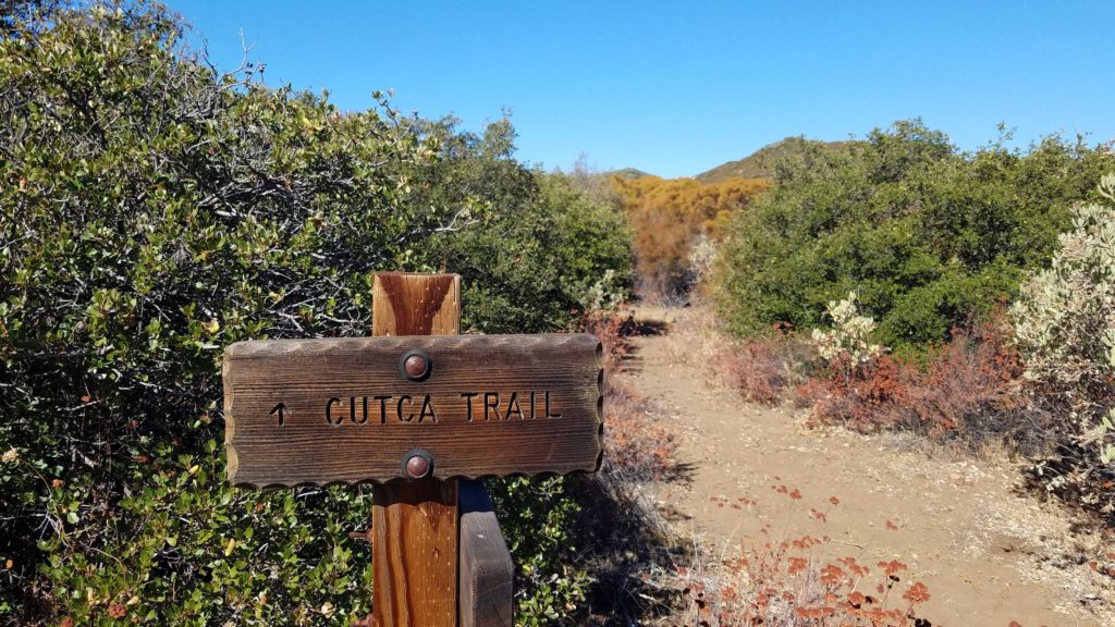
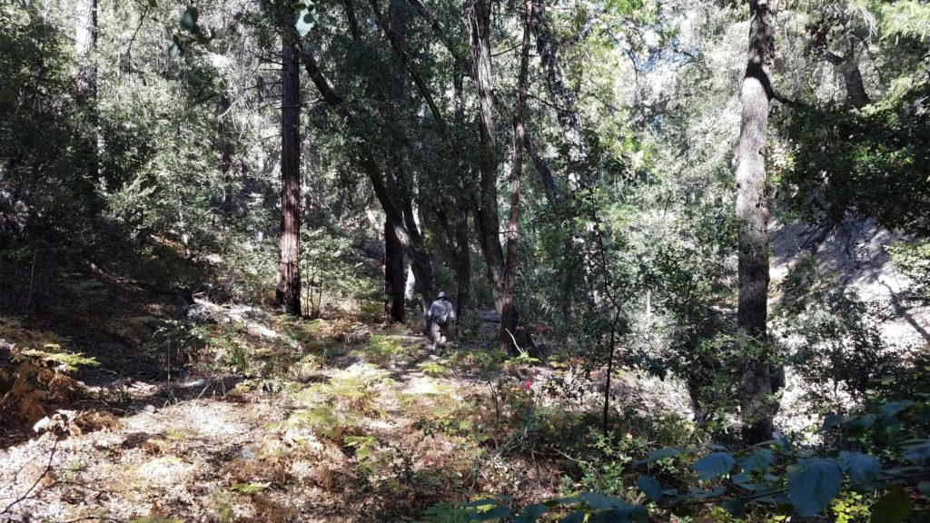
The trail then transformed into the remains of an old road and it would work its way up and down along the contours of the landscape for several miles. Nothing dramatic, but it would be something to deal with upon the trek back. While we had been hiking on the Cutca Valley Trail, we now segued onto the Cutca Trail.
Around the 4 mile point we took a break under the shade of a coastal oak before continuing on. The views to the south of the Palomar Mountains were impressive as we munched on some snacks. Eventually, we came to the turnoff for the Cutca Trail. We would be leaving the old road that we had been on and return back to a traditional trail. Next to this trail sign, Ted and I both stashed a water bottle, no sense in hauling the weight up to the summit.
The trail now began gaining some real elevation, and along with it some of the first real challenges with navigation. As we were now under the canopy of mostly alders, with some Douglas fir and Coutler pine tossed in for good measure, the trail would become harder to find. First, all those trees would provide leaves that would mask the trail at times. Second, the trail would cross back and forth across the currently dry creek bed. We could carefully work our way through the rocks, looking for where the trail would pick back up along its banks. The poison oak would be making its return along the trail, adding another level of caution as we pushed on.
The trail eventually leaves this section behind and starts a series of switchbacks for more elevation gain. The upside was the trail was again easy to follow, and as an added bonus, some great views of the mountains to the north again. Eventually, the trail reaches the junction with the abandoned Palomar Divide Road. Continuing westward, we began looking for the rock cairn that would mark the bottom of the steep ravine that would lead us to the summit.
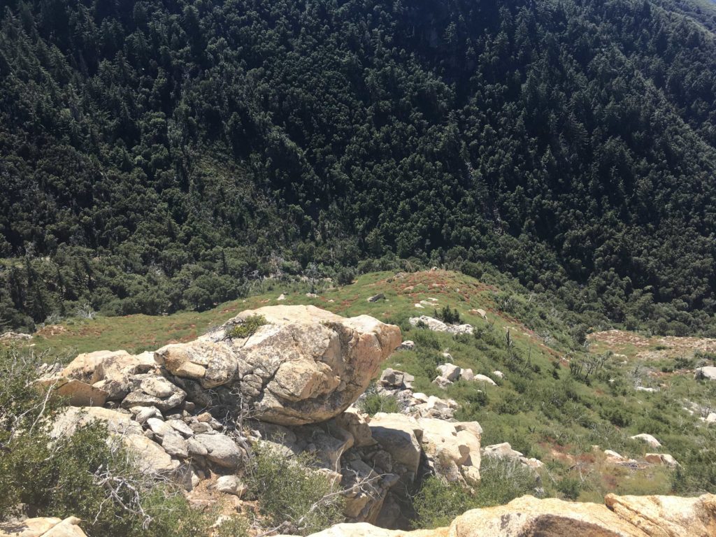
This portion of the hike was brutal. To call this steep is an understatement, and pictures do not do it justice. Foot by foot we would work our way up the ravine. I had a recent GPX track loaded, as I did not spy any ribbons or other markings to guide us. This gave me an approximate sense of where we needed to go. Although we did have to punch through some brush and dead trees at times, we found ourselves on the plateau staring at the summit. Weaving our way through the manzanita, we made it to Eagle Crag!
This was a tremendous sense of accomplishment for me! One of the ‘Final 5’ was summited! (yes, I knew I still had 9 miles back to the car). There was also something that made it stand out personally for me. As I sat upon the crag and soaked in the view, I flipped through the register, spotting many familiar names. It was touching to see many thanking Jerry Schad, the original author of Afoot and Afield in San Diego. I also saw two groups had summited it the day before. I would be remiss as not to point out that this perch is not for those afraid of heights, as the drop-off is almost 1,000 feet down.
After a tasty and well-earned PB&J, some oranges, and some Gatorade, we finished up taking our photos and wandered to the north end of the summit to snap some more photos of our recently conquered Three Saints. It was a bit before 1 pm, so we decided to begin the 9 miles back to the car. We safely navigated our way back down the steep ravine, at times almost sliding. It reminded me of the descent of False Sombrero, just without the rocks.
While the summit was behind us, we knew that in addition to the miles we needed to cover, we still had some climbing ahead of us before we reached the car. Soon the switchbacks were behind us, and we again worked our way through the canyon, enjoying the shade (but not the bugs or the poison oak). As we reached the sign that marked the turn-off, we gathered our water cache. The day had become warmer, and this section of the hike was certainly more exposed as we retraced our route. I could feel both the temperature and the effort of this hike as we trekked on. We did hear the telltale sound of a rattle, and Ted spotted the tail before quickly moving on.
Finally, we came to where I had placed that first bottle. Ted was still feeling good, so I quickly drank it down, along with the last few slices of orange I had kept for the end of the hike. As we descended into Cottonwood Canyon, I broke out my final trick, a small can of Coke. I figured a nice burst of sugar and caffeine would help power me up that 500′ of elevation.
The sun was starting to set and cast its golden glow over the hillside as we plodded upward. We soon reached the car and our journey was complete. 18.4 miles and over a cumulative 3,600 feet of elevation gain. Carefully, we shed our hiking gear and wiped down to hopefully keep any poison oak from triggering a rash. With the sun now set, I carefully drove back down the dirt road and to a hearty dinner at a Mexican restaurant back in Temecula. With that my #72 peak of my #100PeakChallenge was in the books and the ‘Final Five’ is now the ‘Fantastic Four’!
I am an avid peak bagger, sometimes backpacker, and former sea kayaker living in San Diego. In 2019, I became the third person to complete the San Diego 100 Peak Challenge. Not stopping with that accomplishment, I set my sights on the harder San Diego Sierra Club 100 Peak list, which I completed in 2021. In addition, I have conquered several Six-Pack of Peaks challenges (SoCal, San Diego, Central Coast, and Arizona-Winter). Beyond attempting the San Diego Sierra Club 100 Peak list a second time, I am looking forward to exploring new summits and new adventures across the southwest.
The sun was just illuminating the top of Cuyamaca peak as I pulled into the Sweetwater River parking lot. The air was crisp as I gathered my gear and set off counter-clockwise along the Harvey Moore Trail, which was named after the first superintendent of the park, with the goal of summiting the East Mesa High Point.
The trail works its way upward for a bit before reaching the mesa. Oakzanita stood to the south, and soon its summit was lit by the morning sun. Soon the mesa spread out before me, its golden grasses waving gently in the breeze as I made my way toward Granite Springs campground.
I passed through the empty campground, pausing for a bit on the bench beneath a grand oak tree. As the trail continued north, some movement to the left of me caught my eye. It was a deer walking through the grassland. I stopped and watched as it looked back at me, then it began leaping away. I turned back to the trail, and some 10-15 wild turkeys were just off to the side of the trail about 25 yards away.
As I crested the rise, I began to get my first glimpses again of the East Mesa High Point. There is no trail to this summit, so I spent some time scouting the possible route up. I had my GPS track from before but with the rains last year, who know about the growth…
I turned on the Deer Park Trail for a little bit before beginning the cross-country portion. I spotted a faint use trail that headed up the hillside, so I decided to follow it up. The basic route I was going to follow was to stay to the left of the heavy brush in the forested section up to or near the ridgeline, then begin the bushwhacking to the summit. This use trail led me to a small flat area that I remembered from before. Crossing through the knee-high grass, ever thankful for my gaiters, I reached the final rise to the summit. Again, I spotted a faint trail and began working my way up.
Soon, this trail reached the brush and the hard part was about to begin. I scanned the thicket and saw what seemed to be a route into it. I pushed through and would slowly find my way through, it actually turned out to be not as difficult as I had feared. As I neared the summit, I spied the metal pole denoting the summit. Weaving my way through the last of the brush, I had reached the peak again. I signed the register and enjoyed the views. I set back down the mountain, hoping that I would be able to pick up my route again. This is why it is so important to stop and survey the route you have taken.
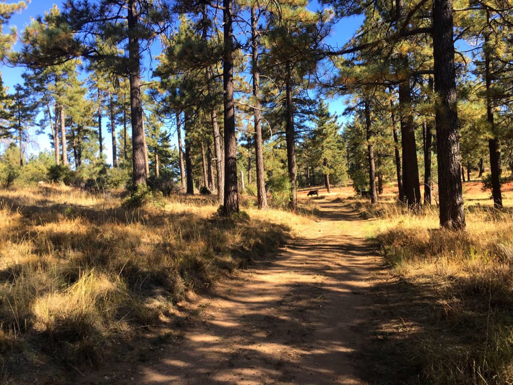
Back on Deer Park Trail, I paused to address some burrs that slipped past my gaiters. A lone mountain biker passed by. We chatted some before we both continued northward. He turned south back along the East Mesa Fire Road/Harvey Moore Trail, and I decided to do the full loop. The last time I did this summit, I did it as an Out-and-Back. But this time I wanted to explore the rest of the trail. My legs were feeling great, even after summiting Hot Springs Mountain the day before. The trail continued through the mesa for a bit before making its steep descent toward Harper Creek. While the scenery was fine, I did have some shade to enjoy.
Once I crossed the dry creek, the terrain was almost desert-like in the canyon. Quite the contrast from the golden meadows a few hours earlier. I hustled down the trail. I could imagine when the creek is flowing, how one might enjoy this section, but for me it was meh. Finally, I reached the East Side Trail and begin heading south again back to the car, where the orange I meant to bring sat in the cooler… I kept up the pace, in part as it was getting a tad warmer and I had a farewell party to attend. The trail was gentle and shaded at times as it followed the dry Sweetwater River. After about two miles or so, I found myself back at the car. I quickly shed some of my hiking gear, enjoyed that orange, and headed back into town. That was my 68th peak of my 100 Peak Challenge!
I am an avid peak bagger, sometimes backpacker, and former sea kayaker living in San Diego. In 2019, I became the third person to complete the San Diego 100 Peak Challenge. Not stopping with that accomplishment, I set my sights on the harder San Diego Sierra Club 100 Peak list, which I completed in 2021. In addition, I have conquered several Six-Pack of Peaks challenges (SoCal, San Diego, Central Coast, and Arizona-Winter). Beyond attempting the San Diego Sierra Club 100 Peak list a second time, I am looking forward to exploring new summits and new adventures across the southwest.
Today’s peak was to be the highest point in San Diego County, Hot Springs Mountain at 6,533 feet. As I drove out to Warner Springs, a fog bank hung over the lake, and the thermometer read 41! Hoping it was not like that at the campground. I made my way onto the reservation and slipped my $10 into the slot. Parking near the chain that blocks driving up Sukat road, the temperature was a crisp 56°F, what I had expected. I gathered my gear and started up the road.
If you have never done this hike, the first two miles are steep! I was glad to have a cool morning and some shade as I made my way up. I was passed by 4 trail runners practicing for the Ragnor race in a few weeks.
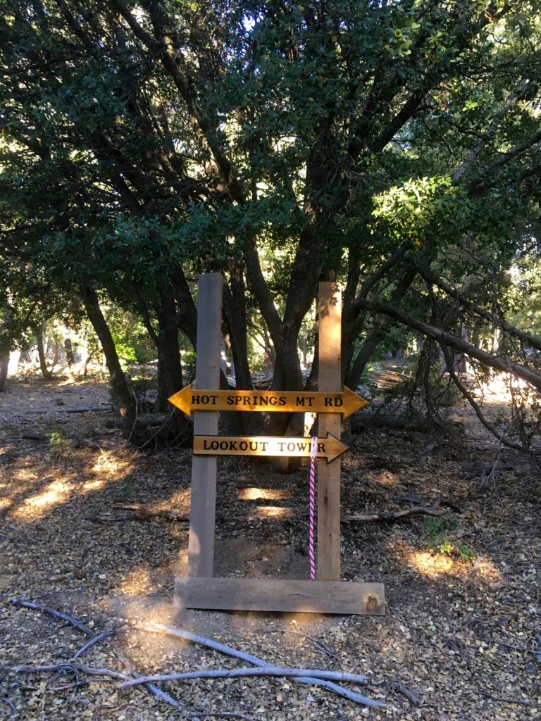
Once the steep section is over, the hike is nice. However, about a mile in the bugs started to appear. I grabbed my bug net and tossed it on. Before leaving the car, I applied bug spray so they avoid the arms. The road continued working its way upward. Portions were covered in acorns. Various animal tracks could be spotted in the dirt. Some nice signage pointed the way to the lookout tower.
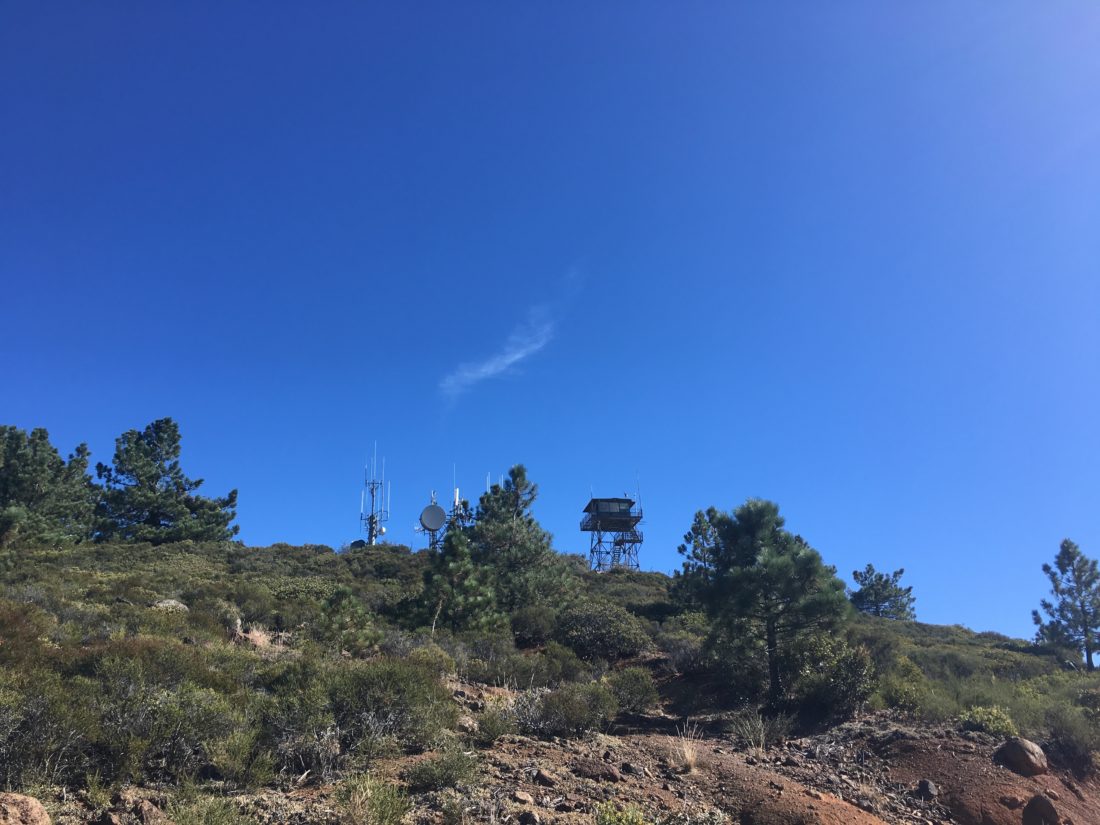
I kept expecting to see the trail runners making their way back down, but I never did. I guess they headed down Hot Springs Road instead of going to the tower. After 5 miles of hiking and almost 2,500 feet of elevation gain, the abandoned tower came into view.
I took a break and enjoyed part of an orange and the views. A breeze had picked up so the bugs were held at bay. A register has been placed here, so I signed it. But the true summit is a just hike to the north.
Following an over-flagged use trail, I found myself at the base of the summit block. The register is located at the base, as it does take a bit of effort to scale the summit. Two ropes are attached to the top and they seemed solid. But I decided to scout around to find a possible safer ascent for a solo climber. Around the north side, a nice crack in the rock allowed me to get past the halfway point. From there it was a class 3 move to the top, the ropes gave me just enough comfort to scale the final portion. There the reference mark was found and the actual benchmark was down inside the concrete platform.
I took my photos and then scaled carefully back down from the summit. Grabbing my poles and pack I set off down the road. I was feeling great as the miles ticked past. I drank some Gatorade and eat some, all while moving. The bugs were too annoying to really stop. After just over 4 hours of hiking time, I found myself back at the car having covered 10.1 miles. This was my 67th peak of my 100 Peak Challenge!
I am an avid peak bagger, sometimes backpacker, and former sea kayaker living in San Diego. In 2019, I became the third person to complete the San Diego 100 Peak Challenge. Not stopping with that accomplishment, I set my sights on the harder San Diego Sierra Club 100 Peak list, which I completed in 2021. In addition, I have conquered several Six-Pack of Peaks challenges (SoCal, San Diego, Central Coast, and Arizona-Winter). Beyond attempting the San Diego Sierra Club 100 Peak list a second time, I am looking forward to exploring new summits and new adventures across the southwest.
While I had considered fully hiking up to Los Pinos from the Espinoza saddle when I restarted my 100 Peak Challenge, the temperatures were not favorable. So, instead, Ted and I drove up toward the summit and would hike the last bit to make it count.
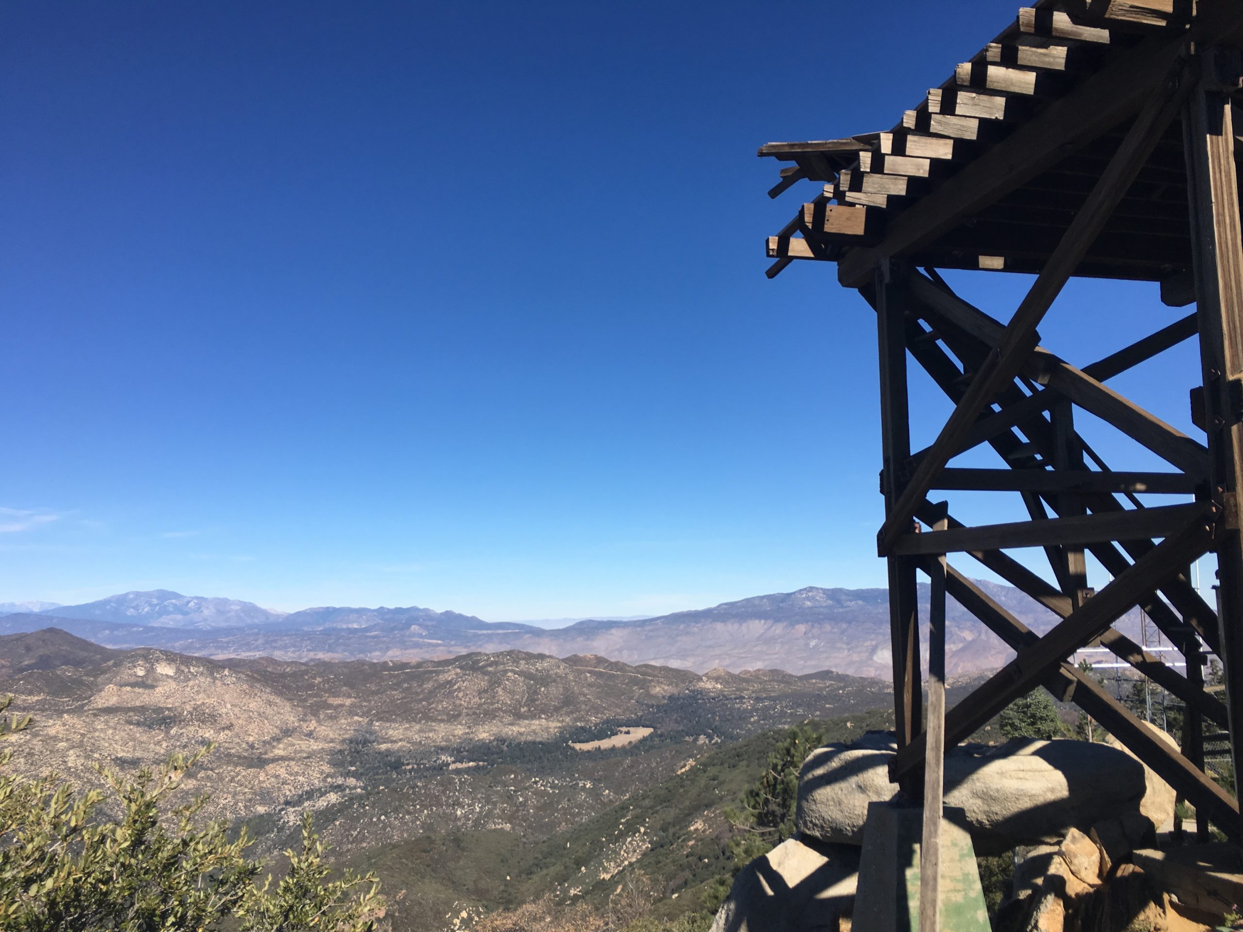
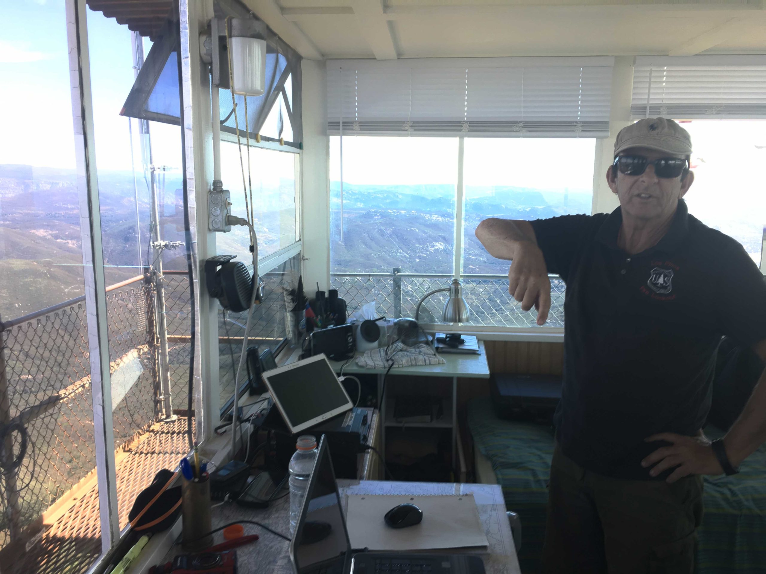
After working our way up the semi-paved road, thankfully only encountering one motorcycle, we pull over at the turn-off to the summit. We hiked up the road. The Los Pinos Lookout tower was manned, and we were invited up.
We got a full tour of the tower and how it works. He shared some of the wildlife he has captured on his camera. It was quite a collection of critters.
We bid farewell and took the shortcut back to the car. This quickly little jaunt was my 64th peak of the 100 Peak Challenge!
I am an avid peak bagger, sometimes backpacker, and former sea kayaker living in San Diego. In 2019, I became the third person to complete the San Diego 100 Peak Challenge. Not stopping with that accomplishment, I set my sights on the harder San Diego Sierra Club 100 Peak list, which I completed in 2021. In addition, I have conquered several Six-Pack of Peaks challenges (SoCal, San Diego, Central Coast, and Arizona-Winter). Beyond attempting the San Diego Sierra Club 100 Peak list a second time, I am looking forward to exploring new summits and new adventures across the southwest.
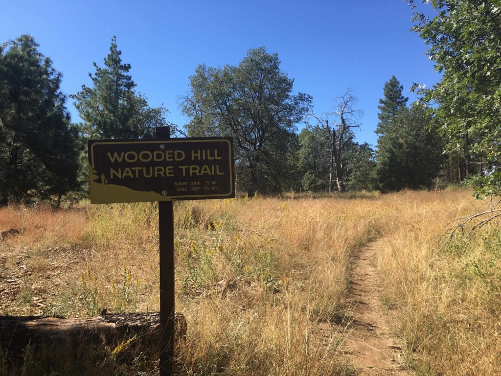
Since it was still early after finishing Oakzantia, I decided to drive up to the Lagunas and quickly so Wooded Hill. I had planned to do this when I did Manza Benchmark and Sheephead Mountain but I thought why not just get it out of the way. I drove down the short spur road the trailhead. Another car was parked under the shade of the trees. While it was still warming up, I knew this trail was short and shaded.
I hustled along the trail toward the summit. The trees certainly made for a pleasant canopy to walk under. The summit is nondescript with no register nor benchmark.
I decided to make the loop again. Two mountain bikers were making their way up, which I politely informed them at this was a hiking-only trail. A bit later I passed a family enjoying the trail as well. Back at the car, it was nice to mark this peak off the list. That was peak 62 of my 100 Peak Challenge.
I am an avid peak bagger, sometimes backpacker, and former sea kayaker living in San Diego. In 2019, I became the third person to complete the San Diego 100 Peak Challenge. Not stopping with that accomplishment, I set my sights on the harder San Diego Sierra Club 100 Peak list, which I completed in 2021. In addition, I have conquered several Six-Pack of Peaks challenges (SoCal, San Diego, Central Coast, and Arizona-Winter). Beyond attempting the San Diego Sierra Club 100 Peak list a second time, I am looking forward to exploring new summits and new adventures across the southwest.