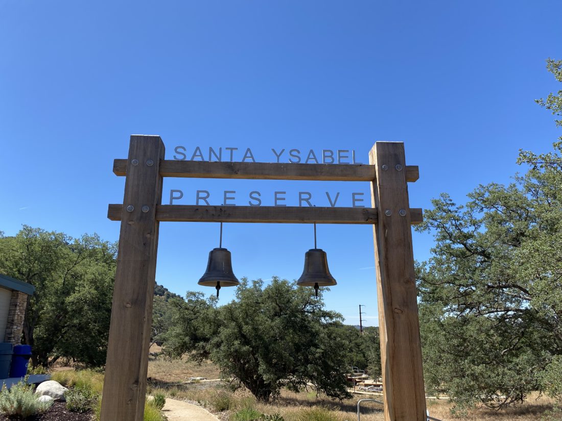
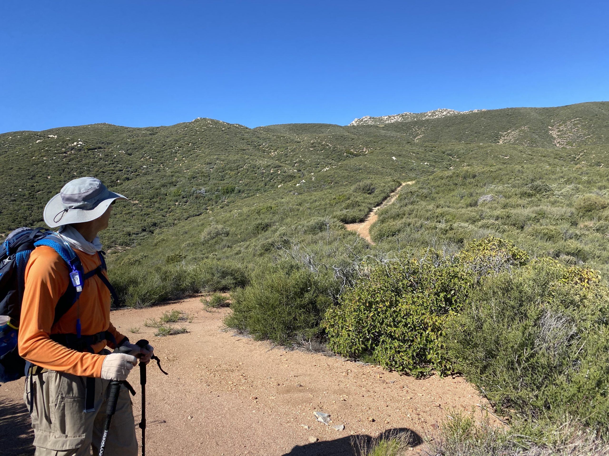
While I had previously hiked a good portion of Santa Ysabel East Preserve, I had not done the Nature Center Loop yet. Since it was on the San Diego County Parks Tour Our Trails Challenge, I convinced my wife to come along for the adventure. We brought our dog along for the adventure as well. We started from their new Visitor Center and began our climb up the hill. We took it slow.
Once up the hill, we cruised to the north before dropping back down and returning to the start. Since we were still dealing with COVID-19, we did not go into Julian or Wynola, but I could see doing that next time.
I am an avid peak bagger, sometimes backpacker, and former sea kayaker living in San Diego. In 2019, I became the third person to complete the San Diego 100 Peak Challenge. Not stopping with that accomplishment, I set my sights on the harder San Diego Sierra Club 100 Peak list, which I completed in 2021. In addition, I have conquered several Six-Pack of Peaks challenges (SoCal, San Diego, Central Coast, and Arizona-Winter). Beyond attempting the San Diego Sierra Club 100 Peak list a second time, I am looking forward to exploring new summits and new adventures across the southwest.
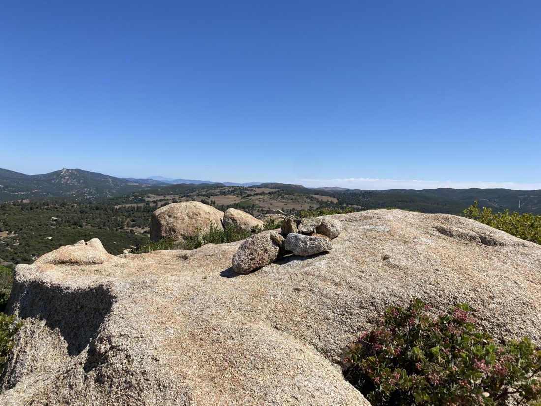
After summiting Monument Peak earlier in the morning, our second peak of the day was going to be Garnet Peak. While the trailhead at Penny Pines was filled with cars, there was no one at the Garnet Peak trailhead. I spied a couple of hikers making their way up the peak, and later a few more along the PCT. We passed through the meadow quickly and found ourselves ready to start up the rockier portion of the hike.
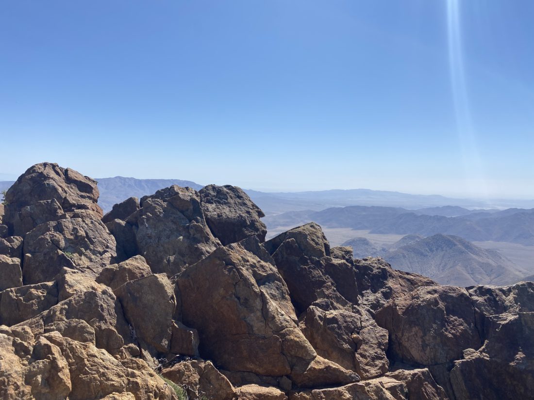
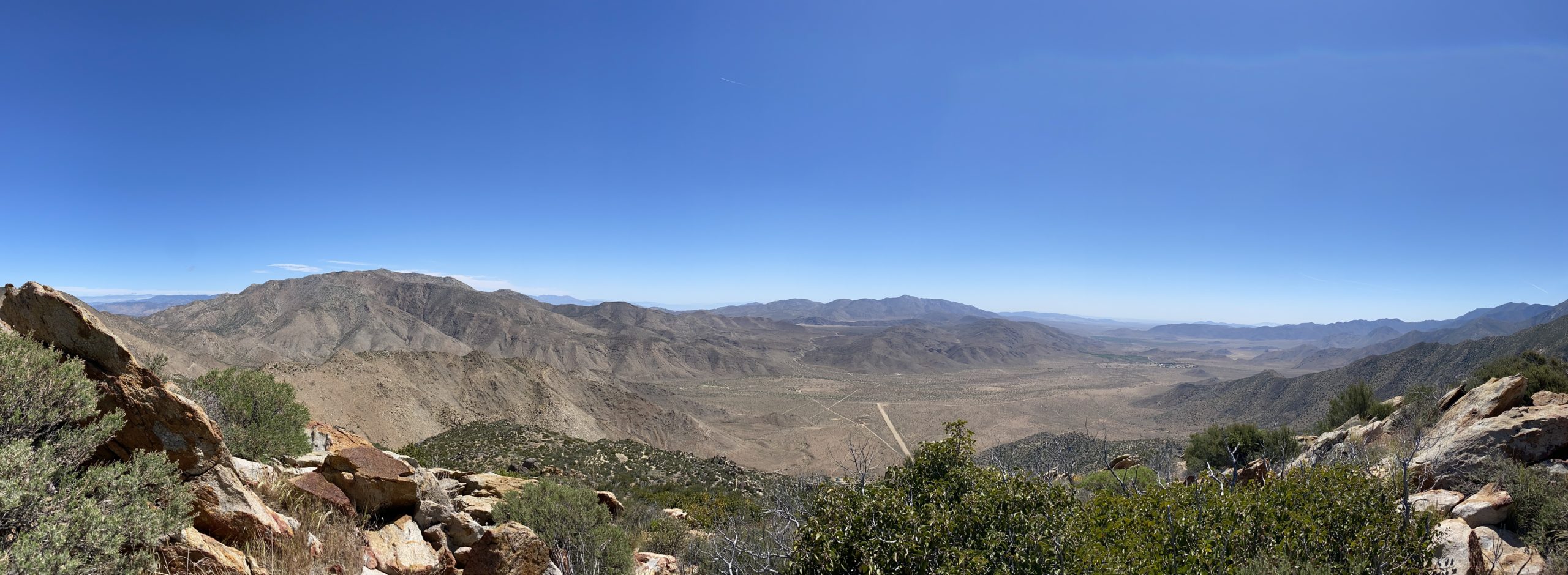
We made good time up the trail, and two hikers passed us returning from the summit. Once there, the three hikers I spotted on the PCT were enjoying the peak. The ‘infamous’ wind that usually is found on this peak was nowhere to be felt. We took a short snack break and snapped our photos. I tried to survey the extent of the fire that had burned recently near Oriflamme Canyon. It appeared not to have reached Roost Benchmark. I would later learn that it actually came within just a few feet of the summit.
As we made it our way back down, there were more hikers making their way up. Once back at the car, we looked at the time and decided that we would skip trying to squeeze in Wooded Hill and headed back into town.
I am an avid peak bagger, sometimes backpacker, and former sea kayaker living in San Diego. In 2019, I became the third person to complete the San Diego 100 Peak Challenge. Not stopping with that accomplishment, I set my sights on the harder San Diego Sierra Club 100 Peak list, which I completed in 2021. In addition, I have conquered several Six-Pack of Peaks challenges (SoCal, San Diego, Central Coast, and Arizona-Winter). Beyond attempting the San Diego Sierra Club 100 Peak list a second time, I am looking forward to exploring new summits and new adventures across the southwest.
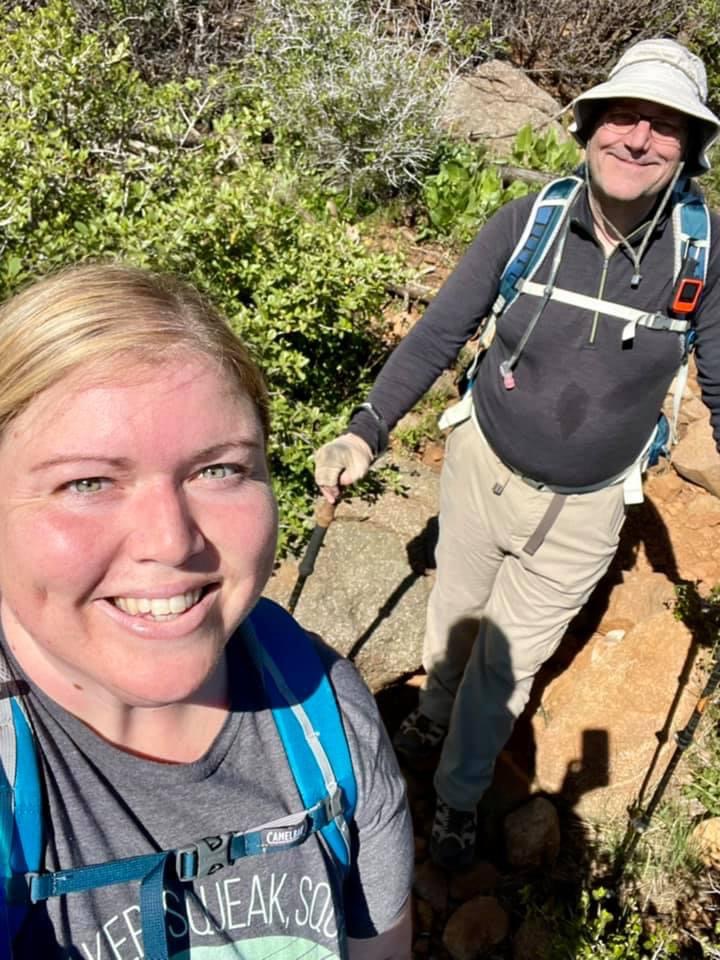
Initially, I had hoped to sneak in one more peak on the Sierra Club list, but some commitments in the early afternoon made it too tight to attempt San Ysidro. Instead, I opted to do some of the shorter peaks in the Lagunas that Ted needed to summit. First up was Monument Peak, a nice 2.8-mile hike. We pulled into the parking area and grabbed our gear and headed off along the trail.
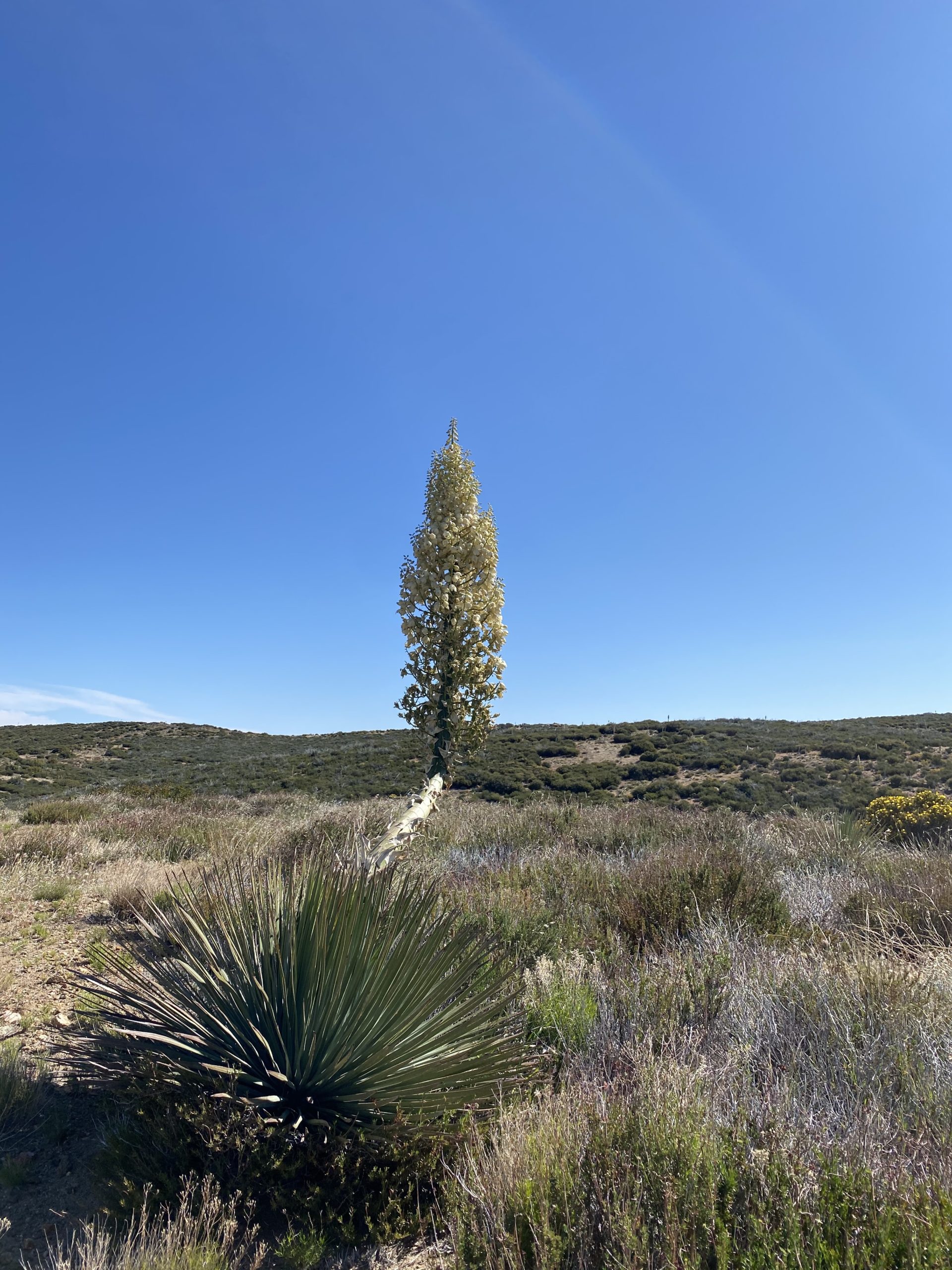
The temperatures were pleasant as we made our way to the summit. Flowers still dotted the sides of the trail, making for an even more visually enjoyable hike. After a short stint on the PCT, we turned on the trail that would take us to the peak. This section of the trail was a bit more overgrown and could use some light pruning.
We reached the summit and were greeted by the fantastic desert views. Unlike previous visits, there was almost no wind to speak of. We snapped our photos and signed the register before heading back down. Once back at the car (and not missing the turn as I did on my first time hiking this peak), we headed off to our second peak of the day, Garnet Peak, just a few minutes down the road.
I am an avid peak bagger, sometimes backpacker, and former sea kayaker living in San Diego. In 2019, I became the third person to complete the San Diego 100 Peak Challenge. Not stopping with that accomplishment, I set my sights on the harder San Diego Sierra Club 100 Peak list, which I completed in 2021. In addition, I have conquered several Six-Pack of Peaks challenges (SoCal, San Diego, Central Coast, and Arizona-Winter). Beyond attempting the San Diego Sierra Club 100 Peak list a second time, I am looking forward to exploring new summits and new adventures across the southwest.
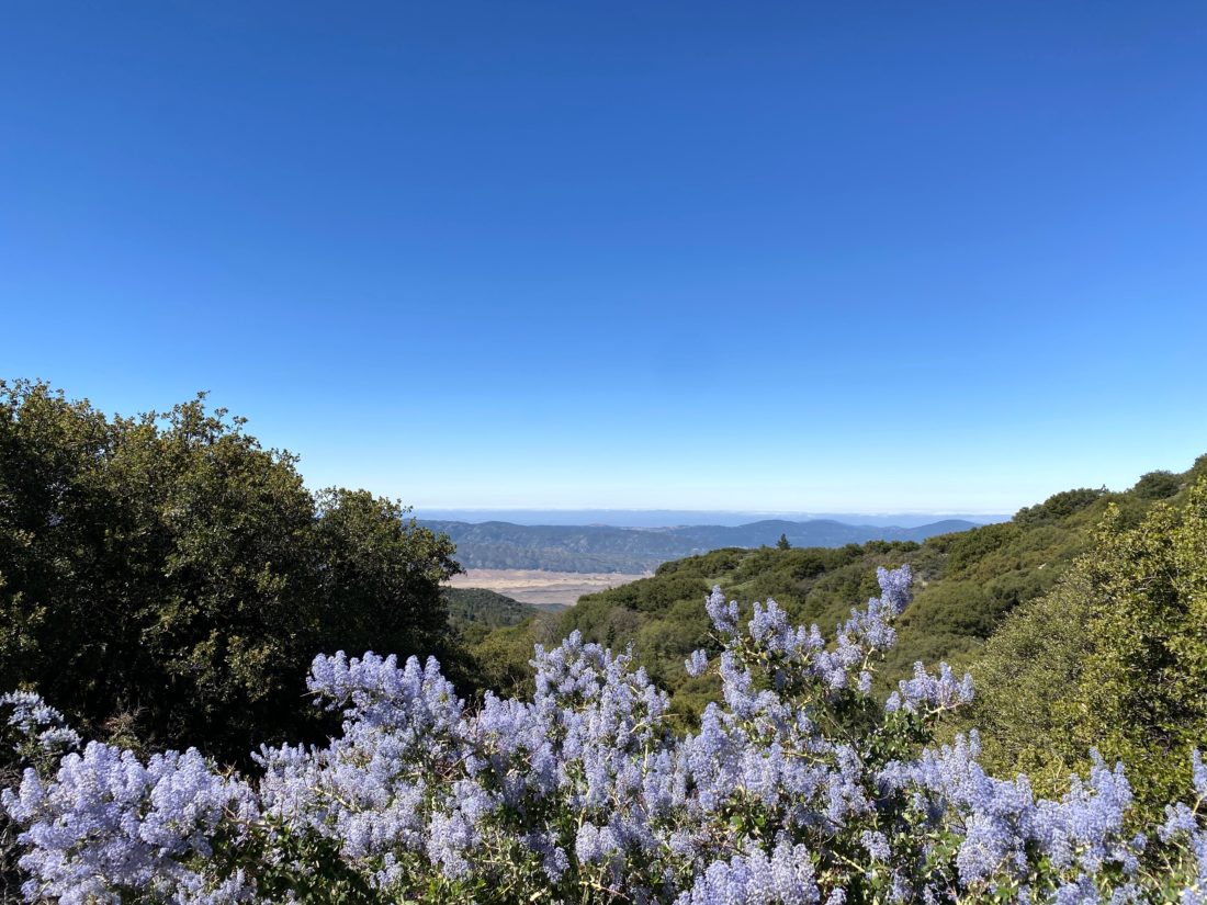
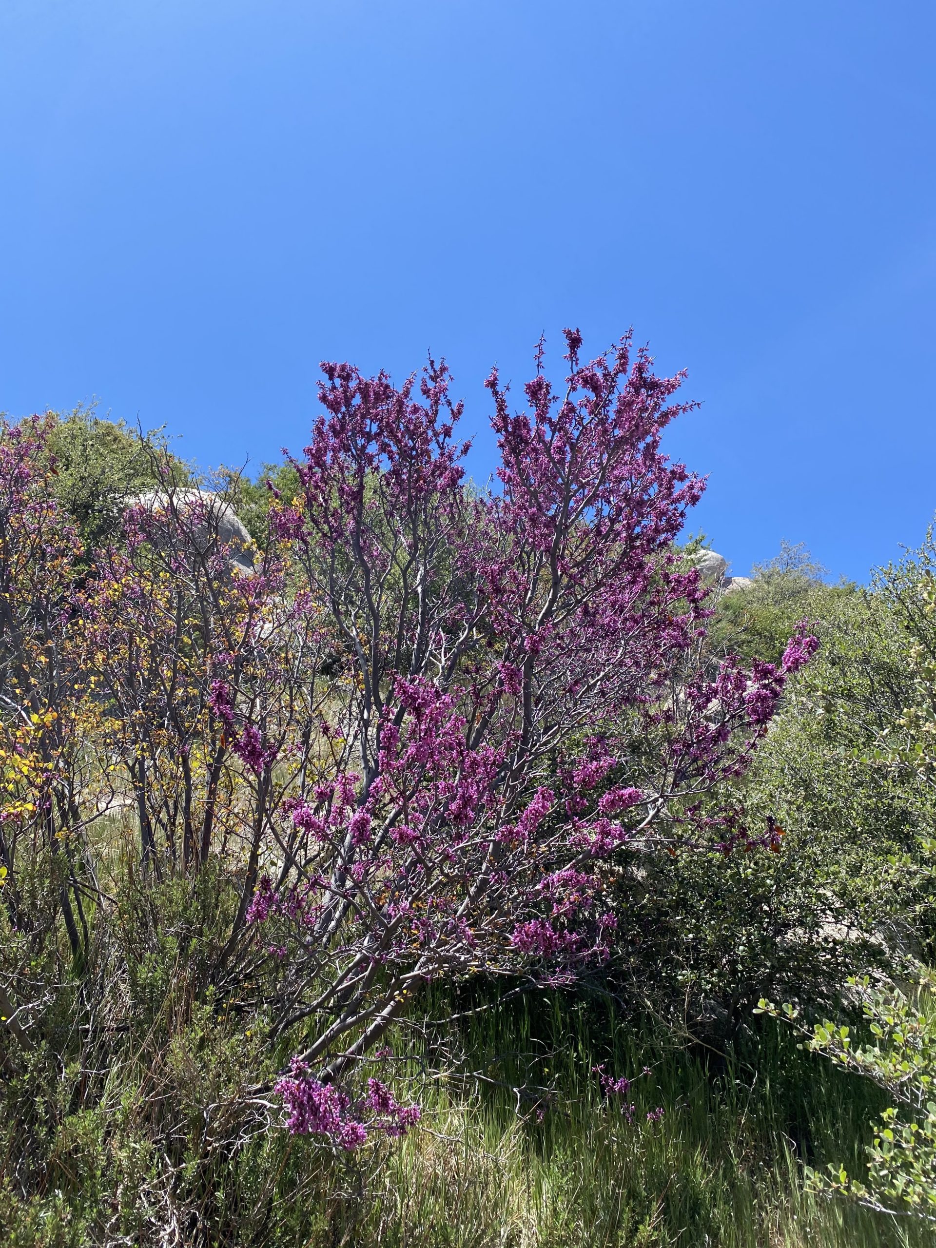
Being Memorial Day weekend, I did not want to drive up and tackle any of the Six-Pack of Peaks, so I turned to one of my non-desert peaks on the Sierra Club list that I needed to summit again. Since Ted Markus was back from his Grand Canyon adventure, I roped him into tagging along. Since he needed to summit Oakzanita, we opted to hit it along the way. We followed the Lower Descanso trail up until it reached the East Mesa Fire Road. After a very short stretch, we hopped onto the Upper Descanso trail. As we made our way up, wildflowers dotted the sides of the trail.
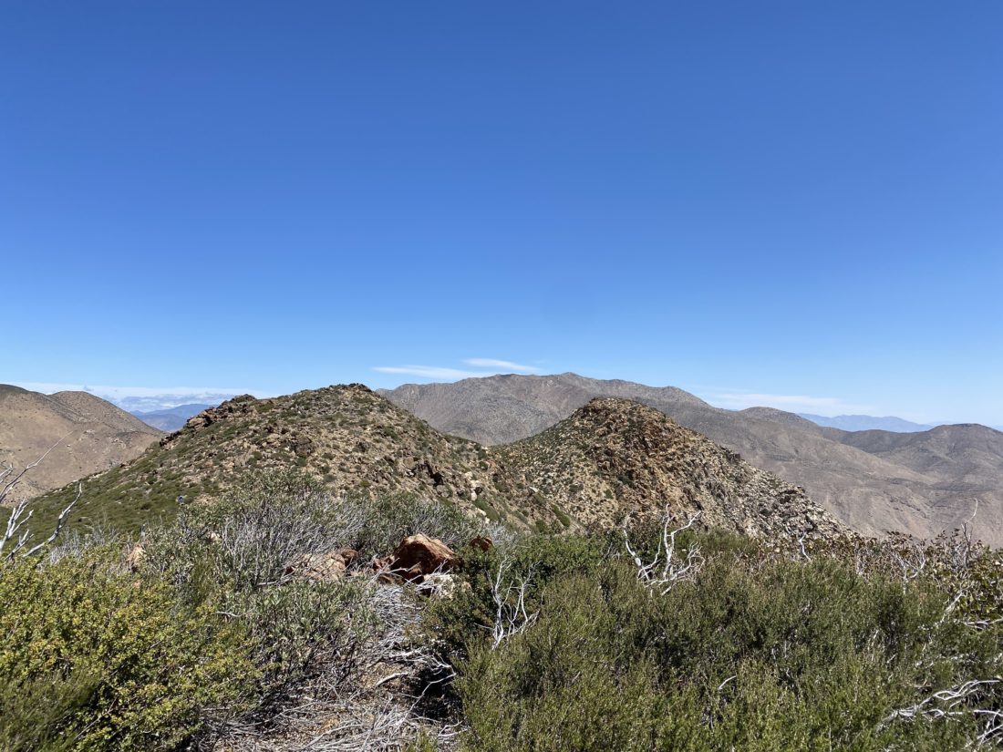
Soon we found ourselves at the junction to the peak, and the trail then began the final push to the top. Once there we enjoyed the views, Cuyamaca and Cush-Pi (Stonewall) to our north, Long Valley to our south, & the Lagunas to the east. We did not linger too long, as we heard voices from some other hikers making their way up. We chatted a bit and let them enjoy their time on the peak.
As we neared the junction, we passed two more hikers en route to the summit. These would be the last people we would see until we returned to the trailhead. Our route was to head south on the trail until it looped northward again, near the meadow we would cross to begin our cross-country trek up to Sugg Peak.
I had my track from 2019 when Susie Kara had graciously guided me to the summit. Now it was my turn to guide Ted. I remembered the landmarks that Susie had used when we did this peak, and I planned to use them as checkpoints. First up were the flat rocks just past the meadow’s edge. From here we were next on the lookout for the boundary fence between Cuyamaca State Park and Cleveland National Forest. After passing through the fence, we were now keeping our eyes out for the route that we would follow south for a bit. I spotted the faint path at the end of a small clearing; it had certainly become overgrown since I used it almost 2.5 years ago. The next landmark for us was the old jeep road sign. Ted did not believe there was once a road off to our right.
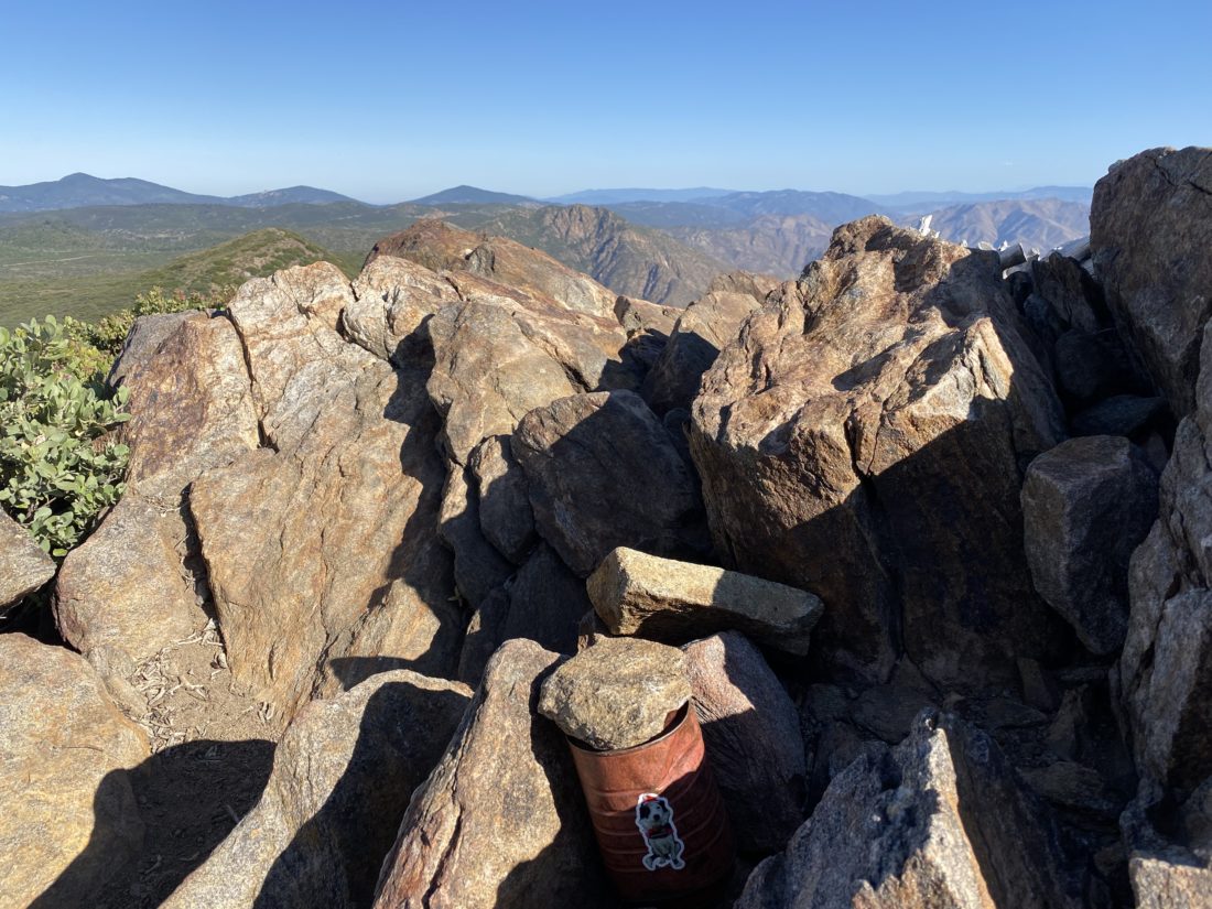
Now for the last bit, the real bushwhacking would begin and the final push to the summit. From here we would leave the ‘trail’ and head east up the saddle toward Sugg. I would mostly just use my guts and some general suggestions from the track to weave through the thick brush that covered its slope. We reached the large rock slab that I tore my pants on the last time when descending. This was the only real landmark for this section of the hike, so reaching it was a good sign. I kept working us upward, checking my decisions with Ted from time to time. Soon we crested the false summit and Sugg Peak stood before us. We made our way over to the true summit. I signed the register, having to move the loose survey mark out of the way. We enjoyed the views while munching on our snacks.
We headed back down, hoping to retrace our steps, but I knew that following our exact route was a pipe dream. We hit a couple of dead-ends, but I worked around them and soon we were spot on with our track where we had left the ‘trail’! Maybe I have learned something after 100s of miles and 100+ peaks 😉
Once I got us back to the edge of the meadow, we had a decision to make. We had considered tacking on East Mesa High Point for Ted, but it was a touch warm and pizza and beer sounded really good (vaccinated bonus!). So, we cruised back down the trail toward the car. All told we covered 8.9 miles in 5:11 hours with 1,787 feet of gain.
I am an avid peak bagger, sometimes backpacker, and former sea kayaker living in San Diego. In 2019, I became the third person to complete the San Diego 100 Peak Challenge. Not stopping with that accomplishment, I set my sights on the harder San Diego Sierra Club 100 Peak list, which I completed in 2021. In addition, I have conquered several Six-Pack of Peaks challenges (SoCal, San Diego, Central Coast, and Arizona-Winter). Beyond attempting the San Diego Sierra Club 100 Peak list a second time, I am looking forward to exploring new summits and new adventures across the southwest.
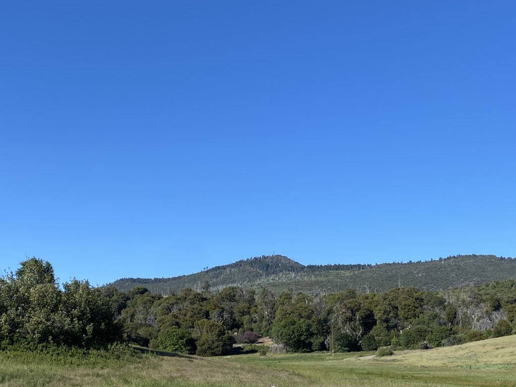
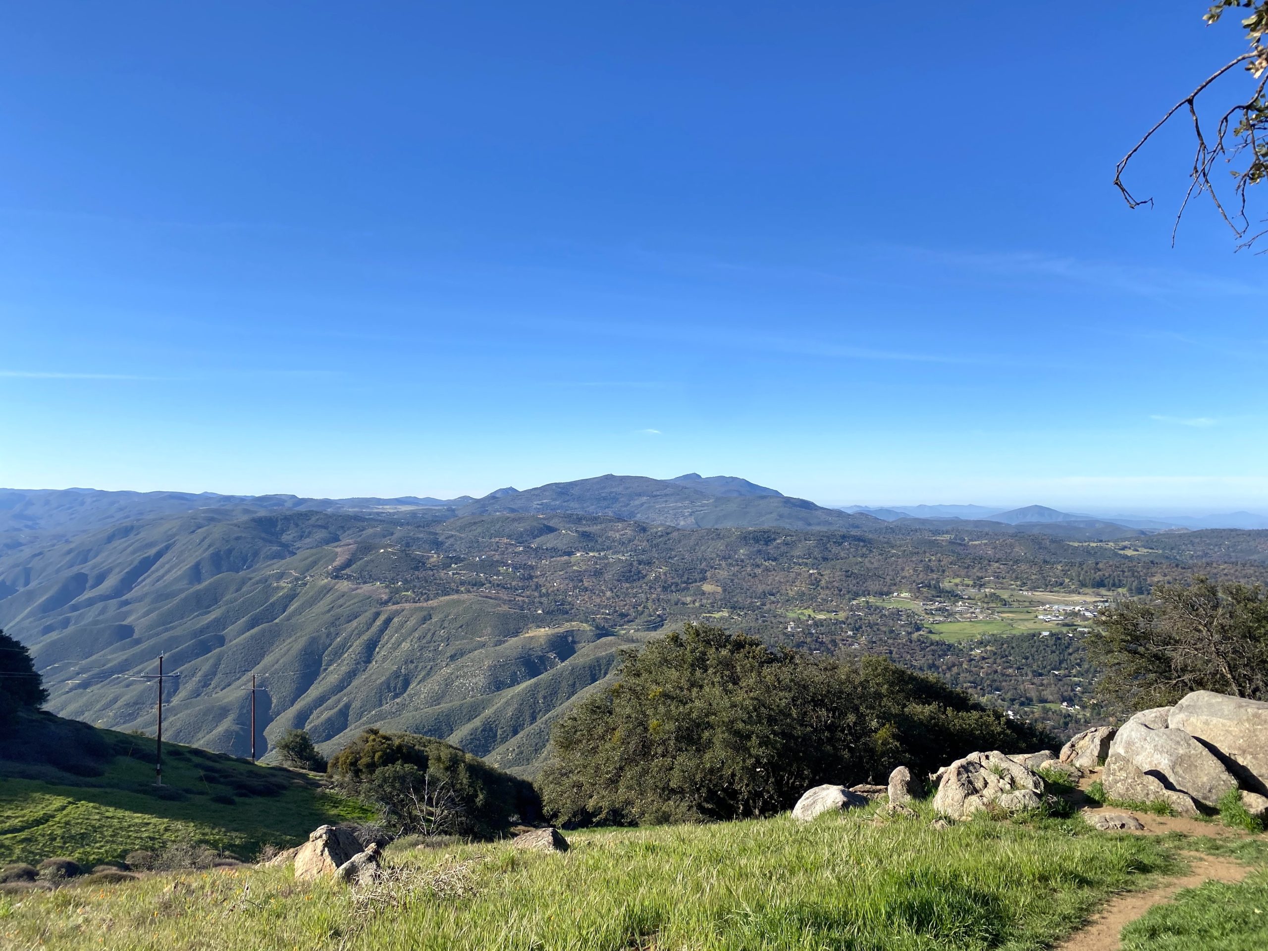
With my recent summit of Hot Springs Mountain, I was down to only one more peak to complete the San Diego Six-Pack of Peaks Challenge — Cuyamaca Peak. Initially I had planned to save doing it until a nice fall day, but we still had some nice spring weather so I decided just to go knock it off the list. The past few times I have summited this mountain I had been working on the 100 Peak Challenge, so getting Airplane Ridge and Japacha Peak had been on the agenda. This time I did not need to revisit those summits, so I looked at some of the other possible routes. For many, they simply take the newly re-paved fire road to the summit from the campground. This was the route I did the first time years ago. While it is the shortest route, it is steep and all on a paved road. I had no desire to take this route again. Instead, I opted to use some of the trails on the north side of the mountain.
Cuyamaca in the distance
I pulled into the parking lot near the Trout Pond trail, just a bit north of the Paso Picacho Campground. This the same starting point you would use if you were going to hike up Middle Peak. There were a few cars here as I gathered my gear. It was still a bit nippy, so I pulled on a fleece. The forecasted high on the summit was in the low 50s, so I was probably going to want it later even if I warmed up while I was hiking.
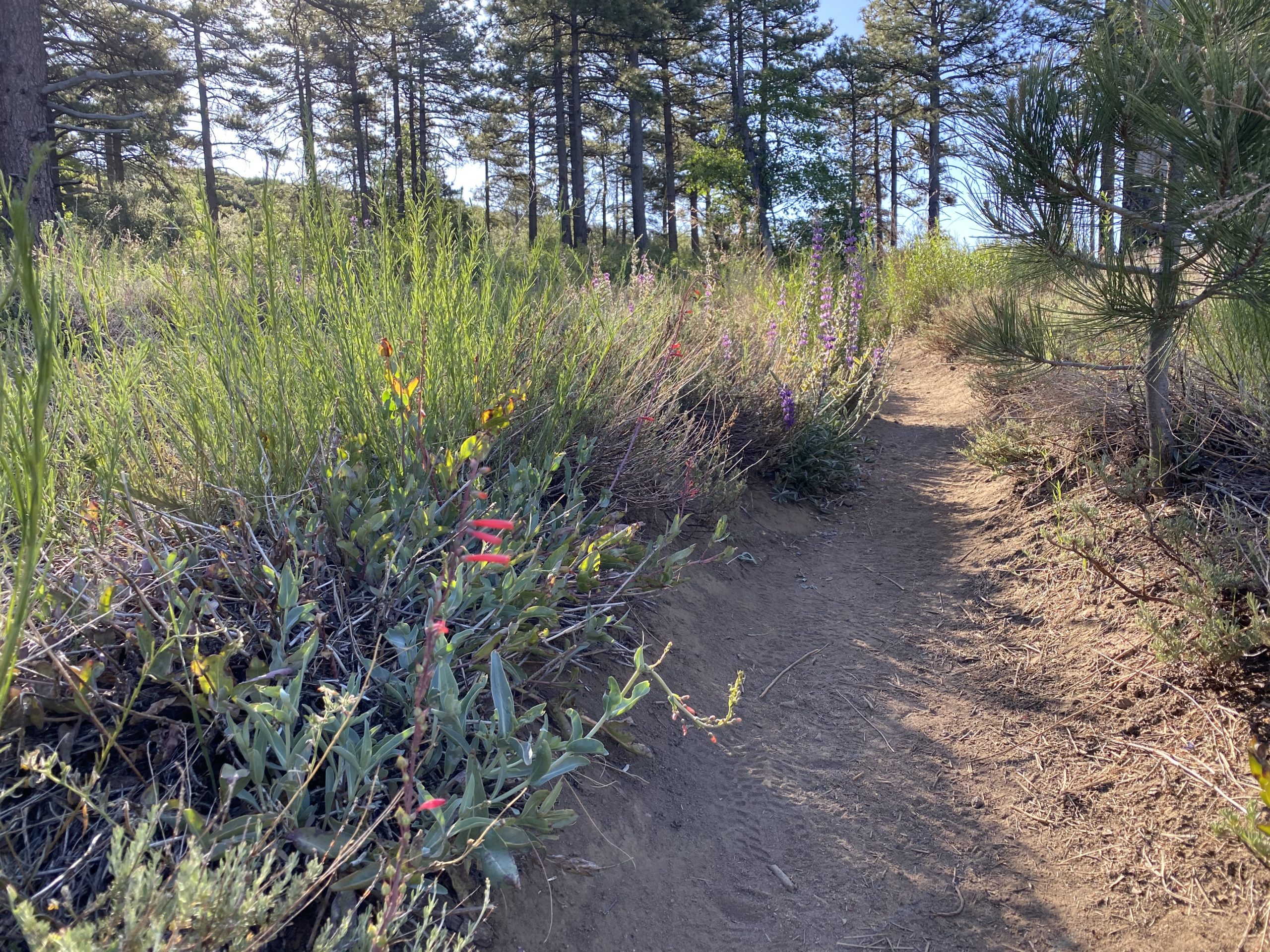
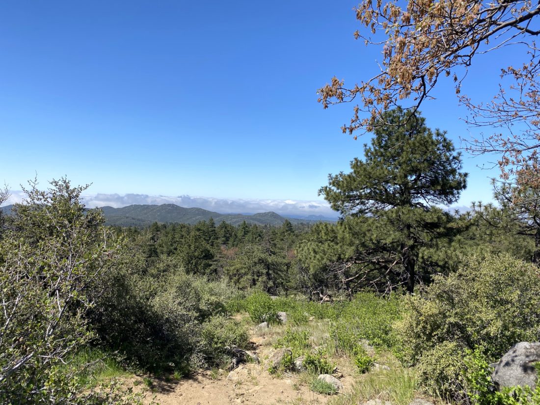
After carefully crossing the highway, I headed down Milk Ranch Road. The grade was nice and gentle and had some lovely views. I passed the turn off that would take you up toward Middle Peak. After about 1.4 miles I came to the junction of the Black Oak Trail to my north and the Azala Springs Fire Road to my south. Walking around the gate, I continued on for about a quarter of a mile until I reached the Conejo Trail. My route now turned from nice wide roads to a more traditional trail. I continued to have a nice view of Cush-Pi (Stonewall) to my east. Over the next 1.5 miles, I would gain almost 900 feet of elevation. I could occasionally hear some voices ahead of me, and since I was making good time, I figured I would probably catch up to them. As I turned the corner of one of the switchbacks, I recognized Amber Haslerud from the San Diego Hiking Society. She and her boyfriend were also climbing Cuyamaca today. I stopped and chatted a bit. I loved following Amber’s hiking journeys, so it was a treat to finally meet her face to face. I wished them a good hike and continued on. The trail still had some nice wildflowers along it, so I seemed to be grabbing my phone to snap a photo quite often.
The Conejo Trail meets up with the Lookout Fire Road about .4 miles from the summit. However, I still had over 300 feet of gain until I summited. As I made my way to the top from the road, I spied two teeny tiny patches of snow tucked in the shade. The summit sign was still there, so I took my summit selfie then wandered over to take a few more photos of some of the interesting landmarks, the NASA benchmark, the Forest Service carving, and of course the view. I had a quick snack and was just about ready to leave when Amber and John arrived. Since this was their first time at the summit, I showed them how to get to the top. Once there, I gave them a quick tour of the summit. We chatted some more, and then I let them enjoy their accomplishment by themselves.
Since I found much of the Conejo Trail a tad rocky, I opted to take a slightly different route back to the car.
So, I stayed on the fire road until it met up with Azala Springs Fire Road. I followed it for about .6 miles until I reached the spring. Now if I had parked at the campground, there is another trail that would take me there, but I continued north back toward Milk Ranch Road, and eventually my car. My entire hike clocked in at 8.73 miles with 1,862 feet of gain in 4:02 (including all the chatting).
I am an avid peak bagger, sometimes backpacker, and former sea kayaker living in San Diego. In 2019, I became the third person to complete the San Diego 100 Peak Challenge. Not stopping with that accomplishment, I set my sights on the harder San Diego Sierra Club 100 Peak list, which I completed in 2021. In addition, I have conquered several Six-Pack of Peaks challenges (SoCal, San Diego, Central Coast, and Arizona-Winter). Beyond attempting the San Diego Sierra Club 100 Peak list a second time, I am looking forward to exploring new summits and new adventures across the southwest.
With the Sierra Club 100 behind me, as well as my backpacking trip on Santa Cruz Island, it was time to turn my attention back to completing the various Six-Pack of Peak Challenges. Since I am hoping to do several of them as overnighters, I had a handful to pick from. Since I knew my friend Gina Norte usually hikes Hot Springs Mountain on Saturdays, I reached out to see what her plans were. She replied that she was taking another San Diego Hiking Society admin, Conni Barth Nardo, and a friend up Hot Springs Mountain, but via the Nelson Camp route. I remember reading about this route in my earlier editions of Afoot and Afield in San Diego. Instead of starting at the campground, this route follows an older jeep road from much further back on the reservation. Access to this part of the reservation has been closed for a number of years, so given the opportunity to explore a new trail, I was so excited to be able to tag along.
We met as usual at the guard shack and followed Gina to the campground. The tribe had recently changed their hiking hours to allow starting at 6 am, and there were about 8 or so cars already parked. We tossed our gear into Gina’s car and set off, driving along the dirt road for a bit. Instead of heading to the right, like we did when we hiked to Palm Mesa High Point, we veered left. We passed through our second locked gate, then past the shooting range. Finally, we pulled over near what Gina referred to as “Four Corners”. From here we would follow an old jeep road until it intersected with Hot Springs Mountain Road.
The four of us began working our way up the mountain, Gina leading the way and telling us about the history of the land and its people. After a bit, we stopped and she led us off-trail to an impressive collection of morteros. These were some of the deepest I have ever seen. Then she led us over to the cooking area. She pointed out some of the shards of pottery that remain. Also, she told us how to distinguish it from the surrounding ground.
Once back on the trail, the “road” became rockier in nature. One of Gina’s roles for the tribe is also to monitor some of the wildlife on the mountain. Along this route, she has a trail camera set up to capture the other ‘visitors’ to Hot Springs Mountain. Near its position, Gina spotted a mound of mountain lion scat. She estimated that it was 1-2 days old. Since we were traveling in a close group, there was very little risk. Plus, we all knew what to do if we did have an encounter.
After about 1.2 miles we met up with the main road and continued on up to the summit. Neither Gina nor I missed bypassing those first couple miles on the normal route. Once at the top, we opted to head over to the summit block first, then return to explore the area around the abandoned lookout tower. As we made our way to the true summit, four ladies were getting ready to take a Happy Birthday photo. Gina asked if they had made it to the top, and they said they did not. Gina being Gina said “come along” and she would guide them up. Arriving at the summit block, there were some other hikers making their way up. Gina offered some tips to them as well. Connie, her friend Meredith, and I just hung around while everyone else made their way up.
The four of us finally scrambled up the rock and soaked in the views. I pointed out the various key mountains that surrounded us. We carefully scrambled down, and even more folks were waiting their turn. HSM was quite popular today. Gina helped another set of hikers make it up before we headed over to the tower.
We poked around there a bit and had a snack. I even ran into a former Qualcomm colleague. After catching up a bit, we headed off. Plus it was getting crowded up there. I was glad I was vaccinated. Upon our return, we decided to take another off-trail excursion, with Gina’s permission to summit Peak 6440. This peak is just about 0.2 miles off the main route. We scrambled up its rocky dome to some incredible views. We could look back and see the summit and tower to our west, and some even better desert views to our east. We wandered the summit a bit before heading back down.
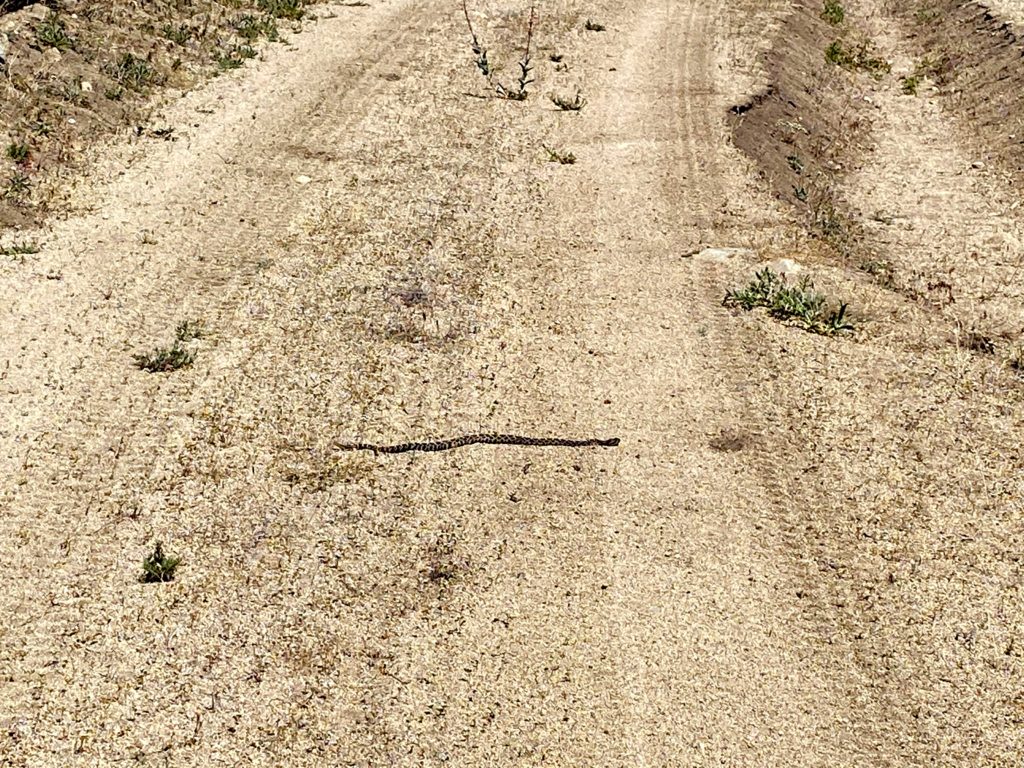
We continued sharing stories and adventures as we made our way back down to the car. The day had warmed up a tad, but it was still pleasant. There was one section of the route that had changed. On the way up there was a portion of the road that was muddy from a spring. Upon our descent, bees had arrived to drink, so we had to carefully pass through it. Once back at the car we returned to the campground, but not before spotting a rattlesnake sunning itself in the road. I snapped a few photos from the safety of the car, then guided Gina around it, as it had no interest in moving. We bid farewell at the campground and headed back home. Since I only had a snack at the tower, I was a bit hungry. I debated just getting some snacks from Don’s Market or a sandwich from Dudleys. Dudley’s won.
I am so grateful that I was able to come along on this hike and see more of this incredible area. We are already planning a laundry list of other hikes to come… The final stats for this route were 6.9 miles in 5:14 with 1,459 of gain.
I am an avid peak bagger, sometimes backpacker, and former sea kayaker living in San Diego. In 2019, I became the third person to complete the San Diego 100 Peak Challenge. Not stopping with that accomplishment, I set my sights on the harder San Diego Sierra Club 100 Peak list, which I completed in 2021. In addition, I have conquered several Six-Pack of Peaks challenges (SoCal, San Diego, Central Coast, and Arizona-Winter). Beyond attempting the San Diego Sierra Club 100 Peak list a second time, I am looking forward to exploring new summits and new adventures across the southwest.
Since I was the hiking consultant for my synagogue’s Stepping Into Israel hiking challenge, I figured I should hike some of my recommendations. One of the hikes I recommended was the Wooded Hill Nature Trail. I have hiked this 1.5-mile loop twice before, but decided to do it once again. As I drove out to the trailhead, the marine layer was so thick that it was actually raining during my drive out. Just past Alpine, I broke through the clouds into a wonderfully sunny day. I pulled into the trailhead, grabbed my gear, and set off. Some remaining wildflowers still lined the edges of the trail.
It was nice to hike this trail on fresh legs. The previous times I had done this hike were after a full day of hiking. As I made my way up the hill, I heard the sounds of a woodpecker. After cresting the summit, I once again encountered mountain bikers on this trail. Wish they would enforce the rules sometimes. Once back at my car, I headed back into town for my second hike of the day.
I am an avid peak bagger, sometimes backpacker, and former sea kayaker living in San Diego. In 2019, I became the third person to complete the San Diego 100 Peak Challenge. Not stopping with that accomplishment, I set my sights on the harder San Diego Sierra Club 100 Peak list, which I completed in 2021. In addition, I have conquered several Six-Pack of Peaks challenges (SoCal, San Diego, Central Coast, and Arizona-Winter). Beyond attempting the San Diego Sierra Club 100 Peak list a second time, I am looking forward to exploring new summits and new adventures across the southwest.
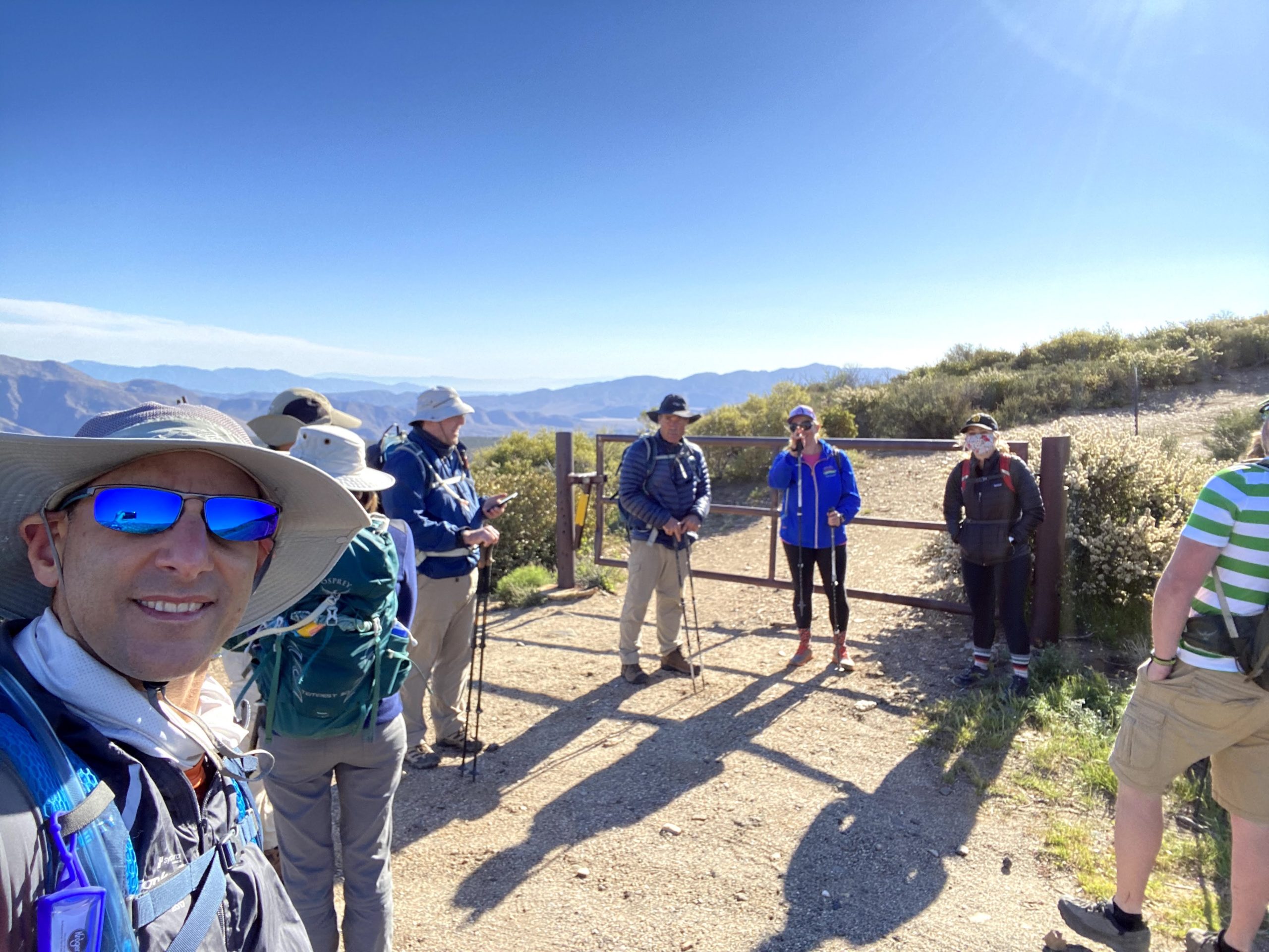
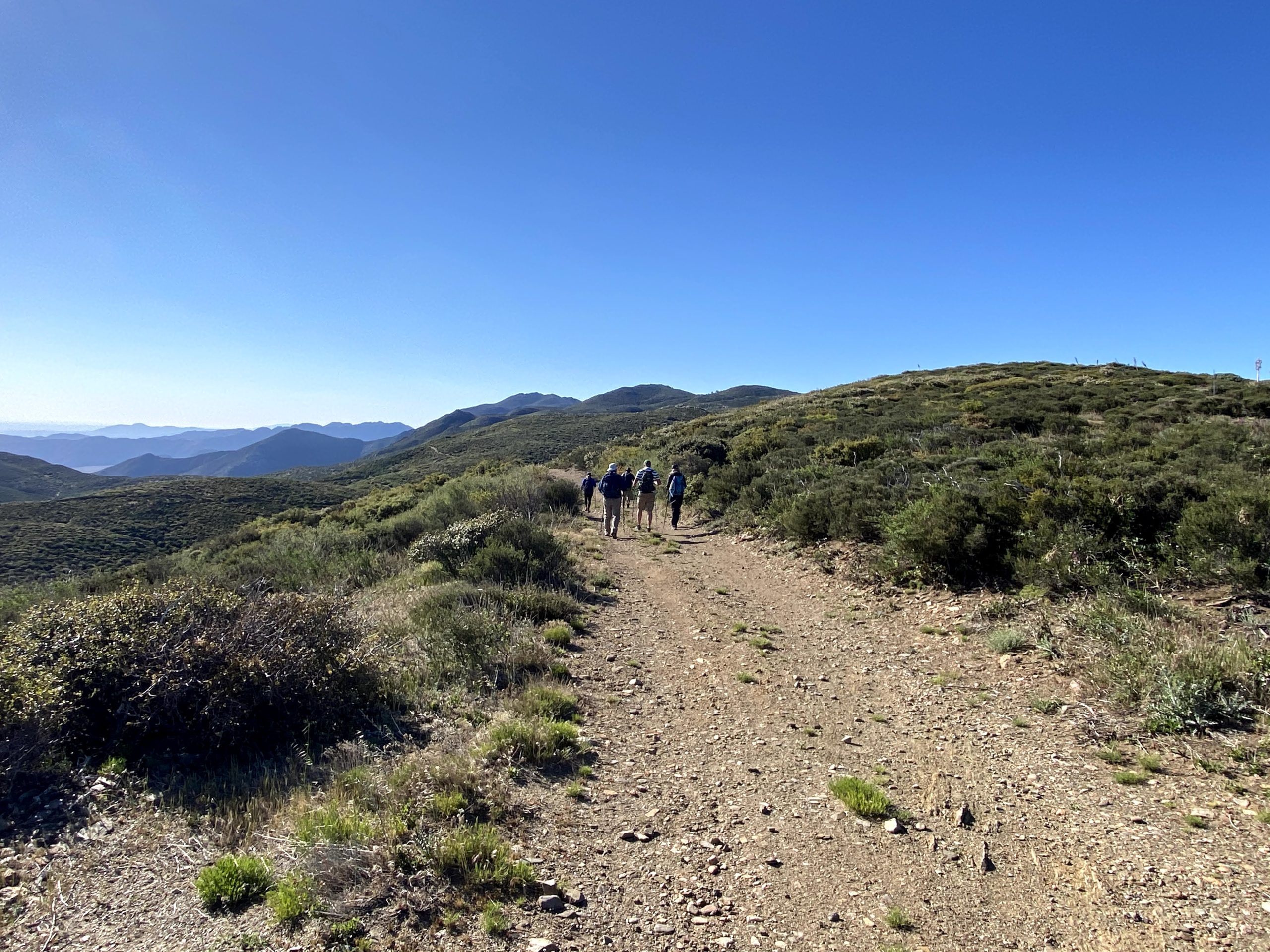
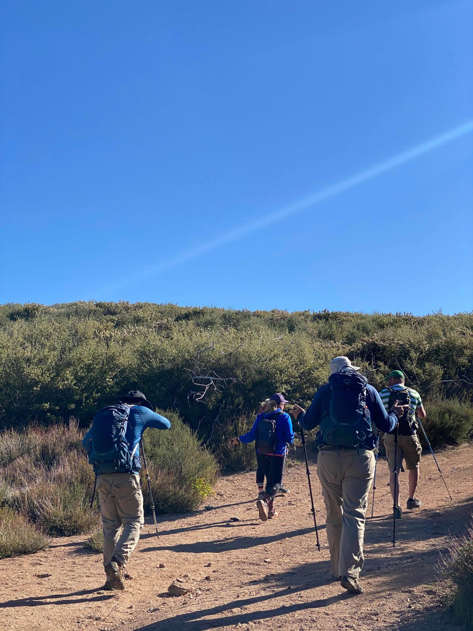
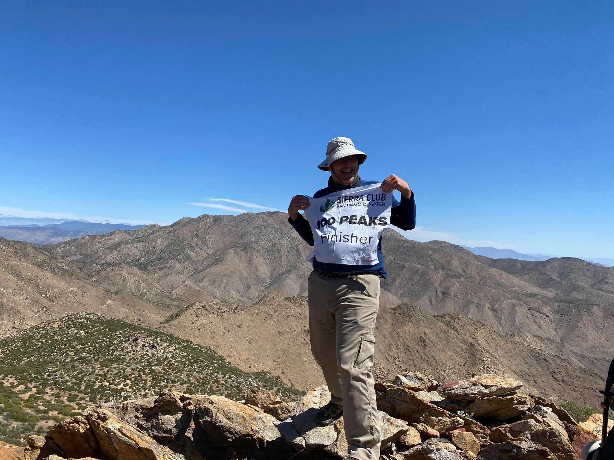
It is hard to comprehend that this summit would mark my completion of the San Diego Sierra Club 100 Peak List. For this milestone hike, I invited several of my hiking companions to accompany me. We met at the Pacific Crest Trail – Sunrise Trailhead at 8 am to condense down to fewer cars, as the actual parking area at the Lucky S Ranch is limited. After driving a couple of miles down the road, a group of mountain bikers had taken most of the available spots, but we were able to squeeze our cars into the area and still allow access to the ranch. We gathered in front of the gate to the old road that we would follow for a while. We discussed if we were going to add Oriflamme Mountain to the hike, and the consensus was to skip it. With that, Ted Markus, Greg Gerlach, Gina Norte, Matt Hanan, Larry Edmonds, Leslie Williams, Susie Kara, and Susie’s friend Jackie set off down the road.
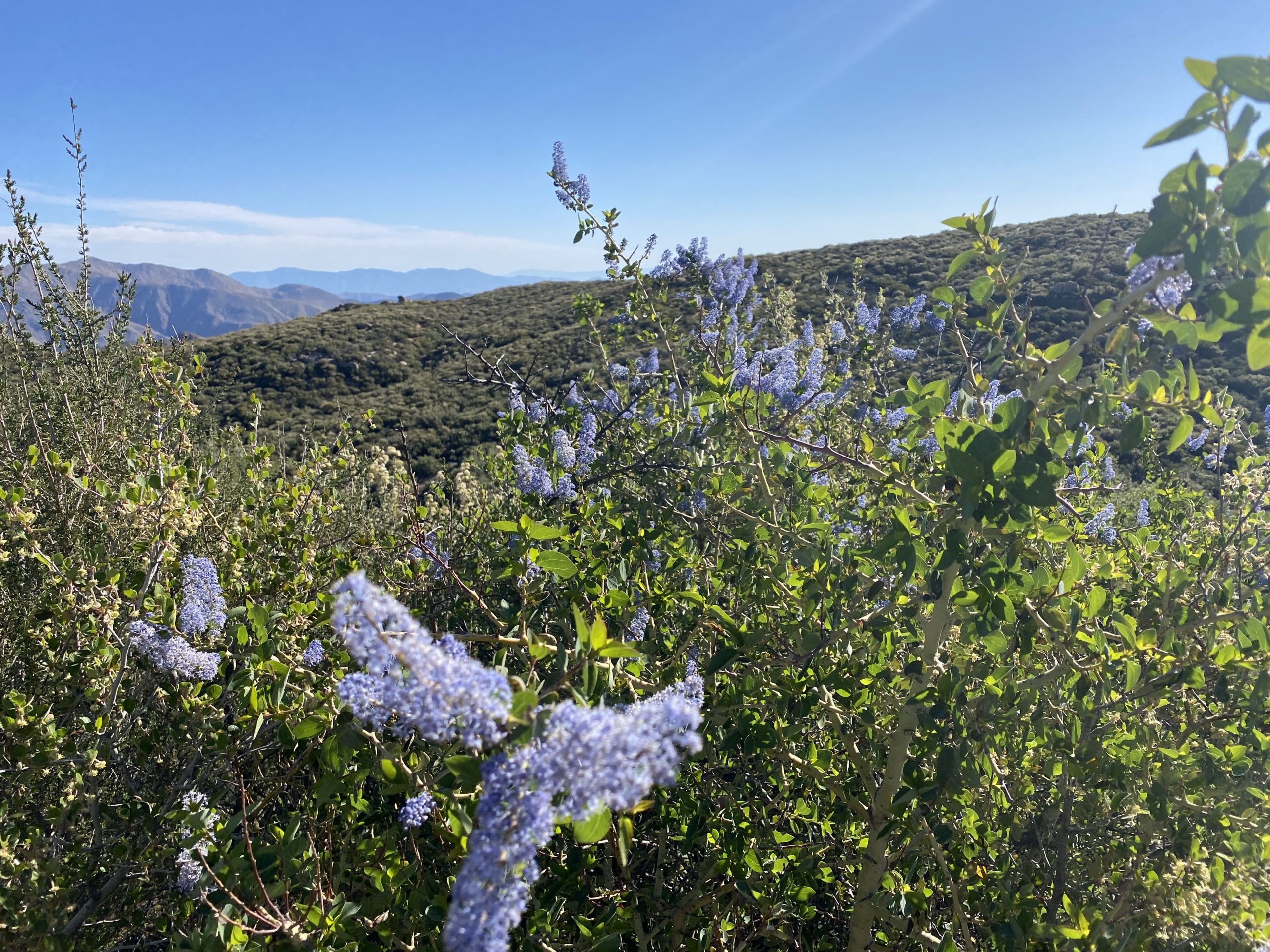
This was an inverted (aka canyon) hike, so we dropped down from our start just off Sunrise Highway. Some lovely wildflowers dotted the sides of the trail as we cruised along. We chatted about recent hikes, and I reflected on what was next on my hiking agenda. Soon we found ourselves at the end of the road and began the cross-country portion of the hike.
Roost Benchmark was the further of the two bumps. Since some of our group had hiked them before we followed their lead to loop around the first bump and then approach the summit from the north/northwest. We could see Larry and Leslie at the summit already. They had taken a different route that we had avoided in part to reports of it being overgrown and tick infested. As we crossed over the saddle, the winds picked up. Just as I was thinking I needed to tighten the strap on my hat, Greg’s hat went sailing. Thankfully it did not go far and he was able to retrieve it.
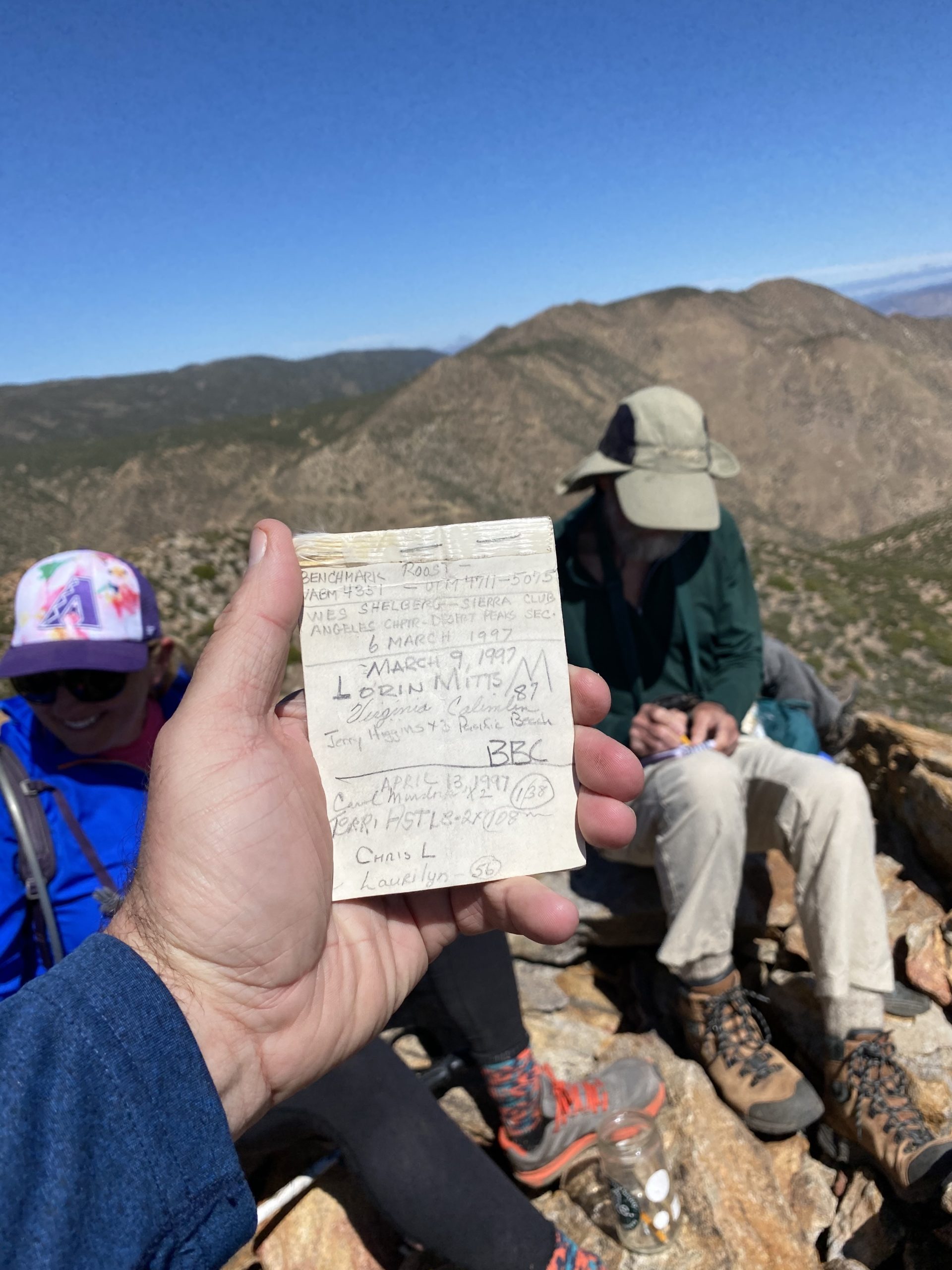
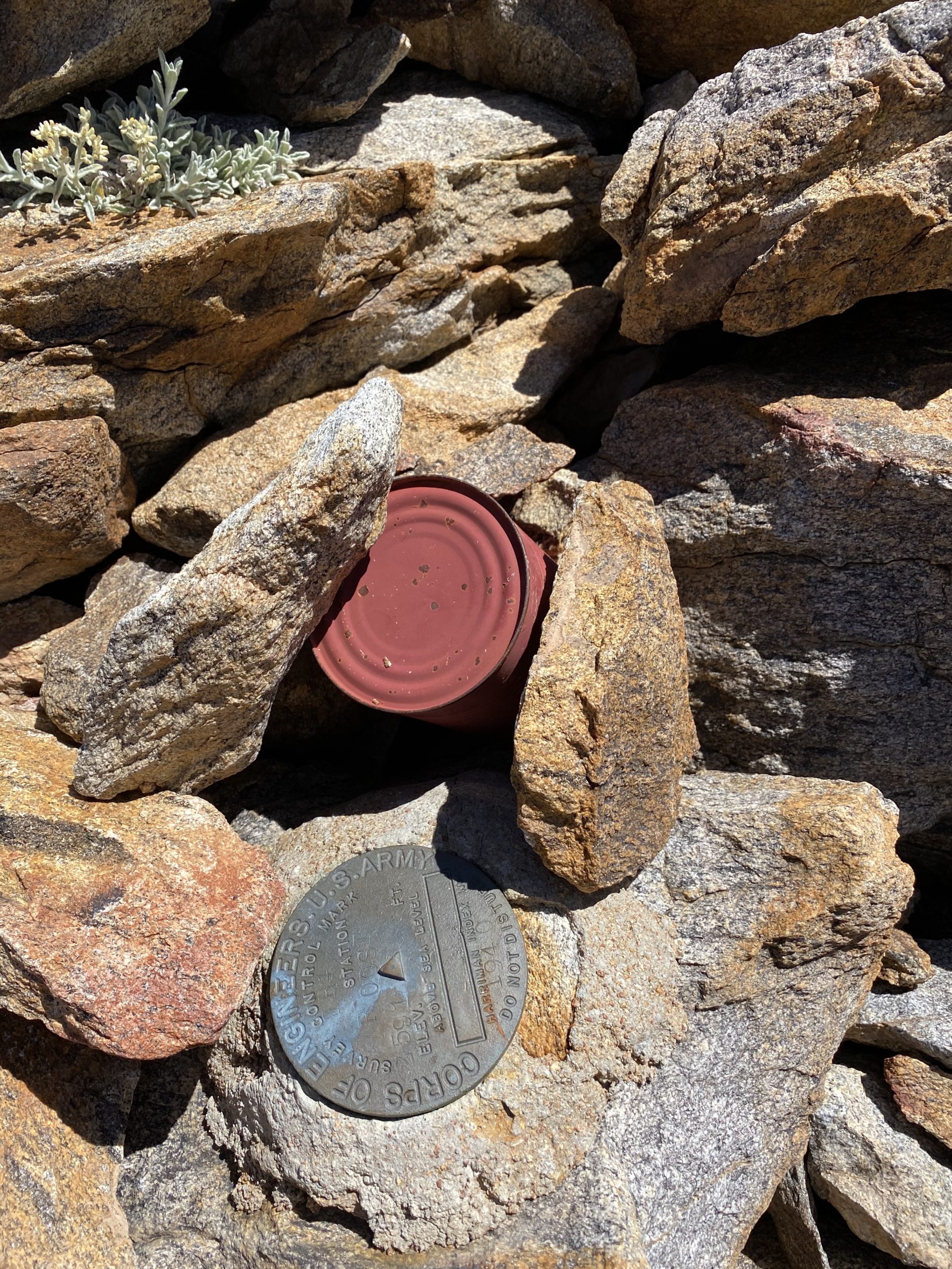
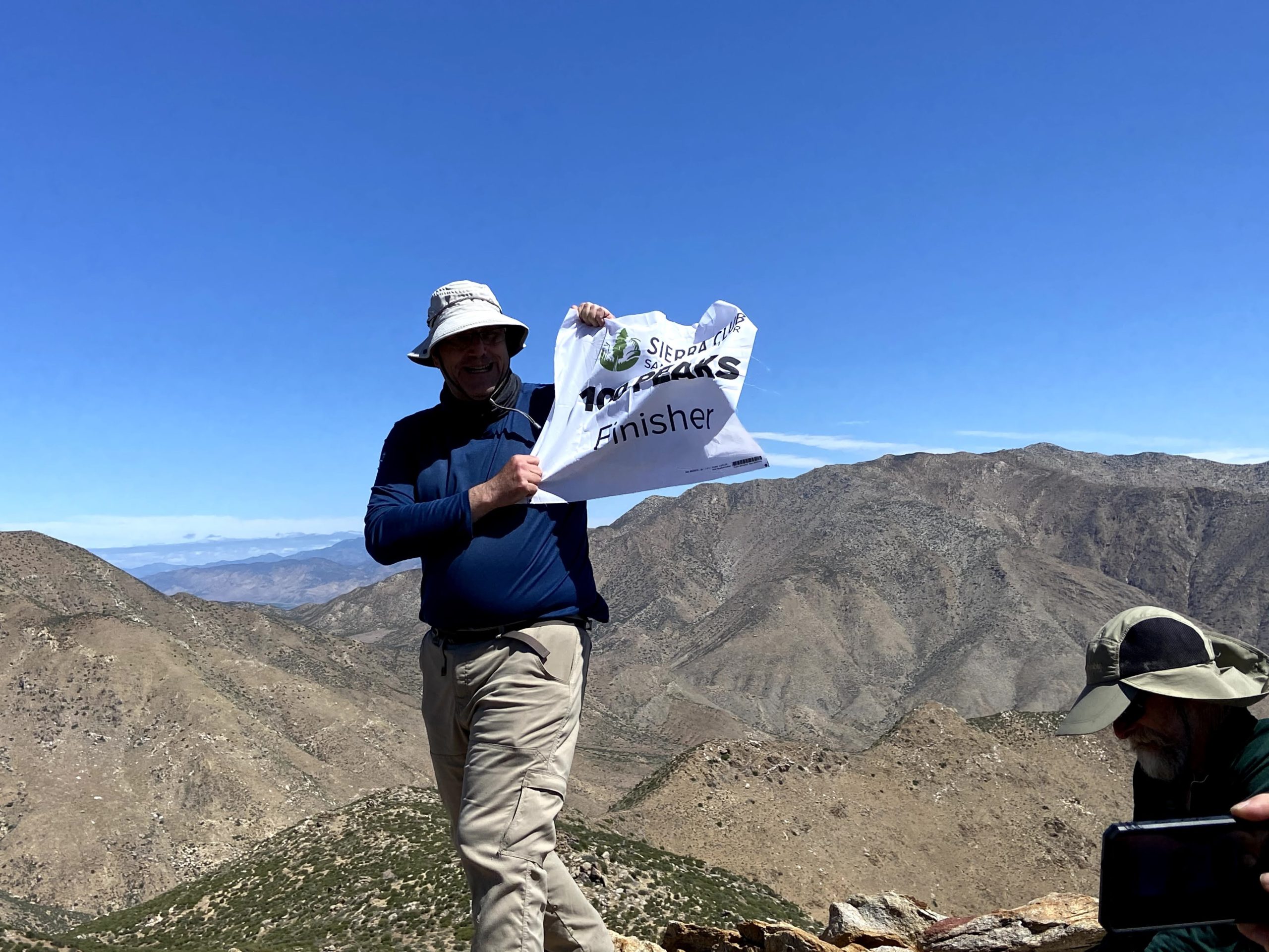
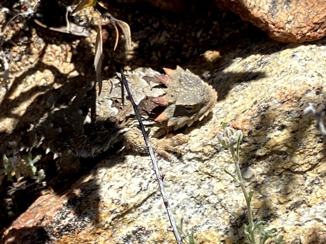
Soon we found ourselves atop the summit. I had done it! I plan to write a proper reflection on this journey, but a tremendous sense of accomplishment filled my heart. We sat around the summit enjoying some snacks, soaking in the views, and proudly signing the register. After a nice break, we began our descent. Along the way, we spotted a nice horn head lizard hanging out under some brush, and Ted got a great shot of it.
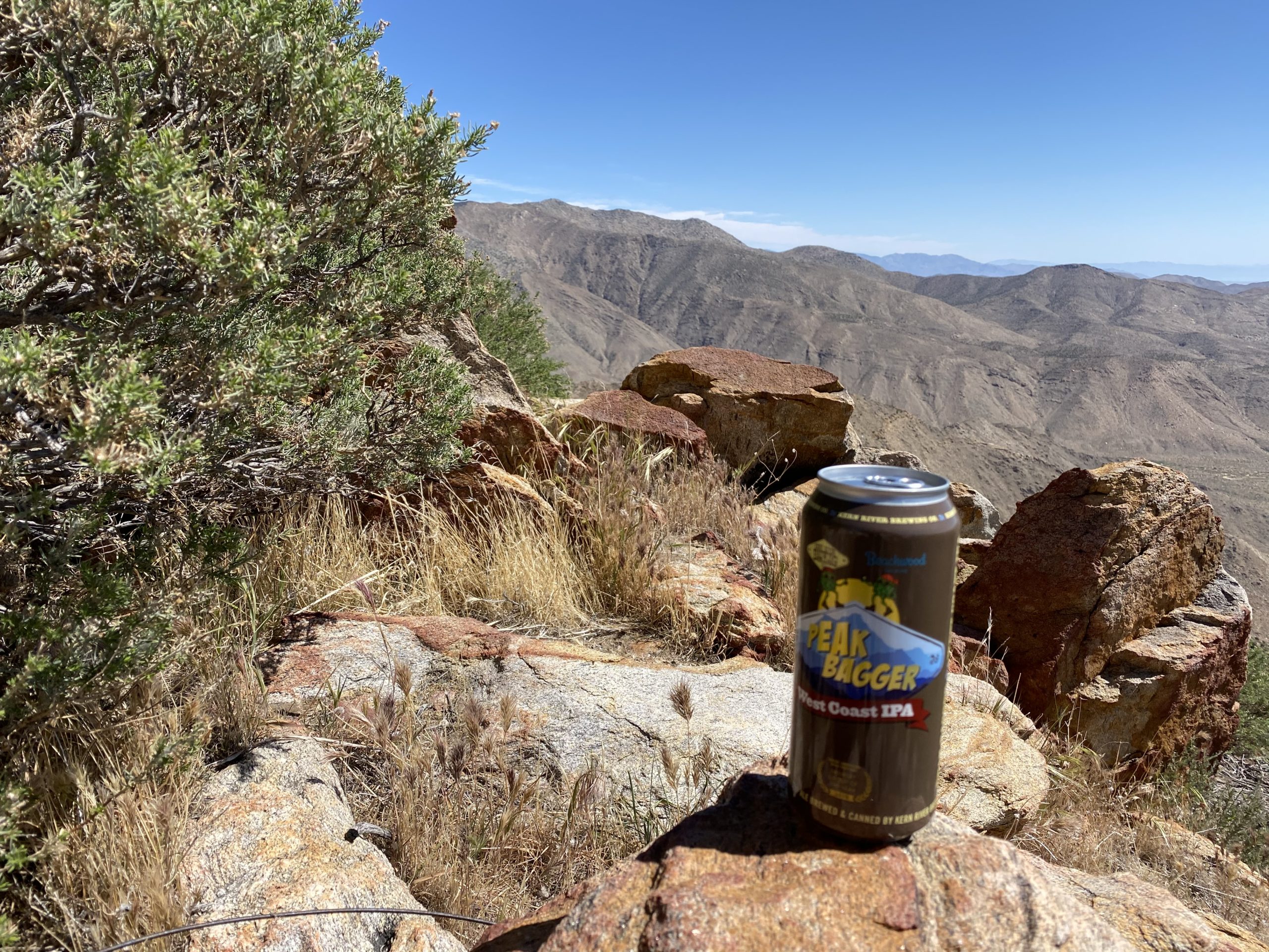
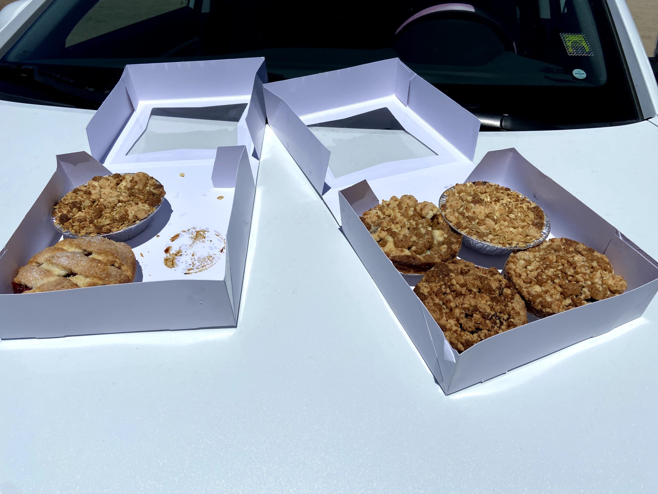
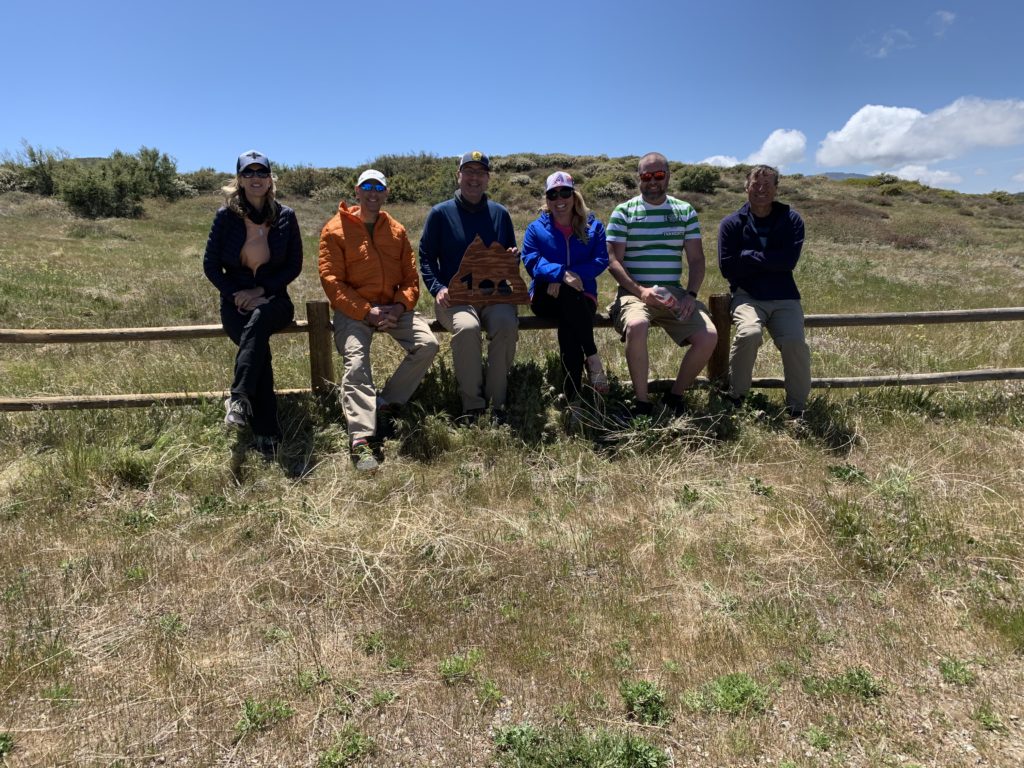
Since Larry said the overgrowth wasn’t too bad, we took the more direct route back up to the trailhead. Again, more wildflowers brightened our climb. While this road was a bit more overgrown, it was not too bad. We would stop to do a periodic tick check. Some of the group found some “hitchhikers” that were dealt with accordingly. As we waited next to where the PCT crosses the old jeep road, a thru-hiker passed by. Once we had regrouped, we climbed the last bit and back to the cars. Once back at the Sunrise Trailhead, my wife and daughter arrived with pies from Betty’s Pies in Encinitas to share. Susie had started this tradition with her completion of several summits, and I was happy to continue it. Since the summit did not lend itself to a group shot (plus the wind), we took a group shot there. After consuming our pies and enjoying a can of Peakbagger IPA from Kern River Brewery that I had been saving, we bid our farewells. Now on to the next adventure…
Gina, Ted, Me, Susie, Matt, Greg
The stats for the hike were 8.82 miles in 4:45 with a elevation gain of 1,764 feet.
I am an avid peak bagger, sometimes backpacker, and former sea kayaker living in San Diego. In 2019, I became the third person to complete the San Diego 100 Peak Challenge. Not stopping with that accomplishment, I set my sights on the harder San Diego Sierra Club 100 Peak list, which I completed in 2021. In addition, I have conquered several Six-Pack of Peaks challenges (SoCal, San Diego, Central Coast, and Arizona-Winter). Beyond attempting the San Diego Sierra Club 100 Peak list a second time, I am looking forward to exploring new summits and new adventures across the southwest.
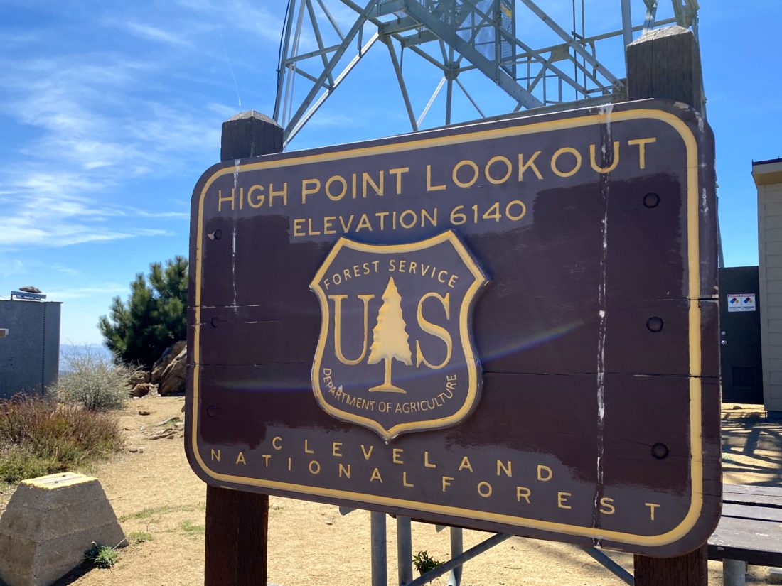
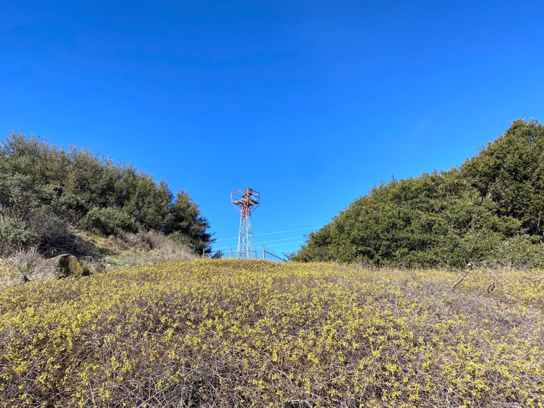
Having checked the Palomar Divide Road was listed as open, we decided to once again drive up toward Palomar High Point. Both Ted and I hiked this peak via Oak Grove last year and honestly did not feel the desire to do it again. So, as we had also done in the past, we drove to a much closer starting point.
The road was in ok shape, with a few potholes to watch out for, but nothing more. As we passed the Barker Valley Trailhead, there were four cars parked off to the side. We reached our usual stopping point, but neither of us felt like hiking from here, so we decided to drive on. We passed a few hikers making their way up, and one returning from the summit. Parking at the locked gate, we grabbed a bottle of water and walked up to the tower. A volunteer was working on replacing the toilet used by the tower staff. We chatted a bit, then set off to snap a few photos before heading back to the car and the hour drive back to the main road.
I am an avid peak bagger, sometimes backpacker, and former sea kayaker living in San Diego. In 2019, I became the third person to complete the San Diego 100 Peak Challenge. Not stopping with that accomplishment, I set my sights on the harder San Diego Sierra Club 100 Peak list, which I completed in 2021. In addition, I have conquered several Six-Pack of Peaks challenges (SoCal, San Diego, Central Coast, and Arizona-Winter). Beyond attempting the San Diego Sierra Club 100 Peak list a second time, I am looking forward to exploring new summits and new adventures across the southwest.
Having just finished the Six-Pack of Peaks Arizona Winter Challenge figured I should pick up working on my hometown set of peaks. Since Ted Markus had never done Volcan Mountain, it seemed like the perfect choice. When we got to the trailhead, there was only one car and a CalFire engine.
Just after the entrance, the three CalFire firefighters were finishing their morning workout. After about a 1/2 mile, we hopped onto the 5 Oaks trail. While this adds a little extra distance to the hike, it was a nicer option.
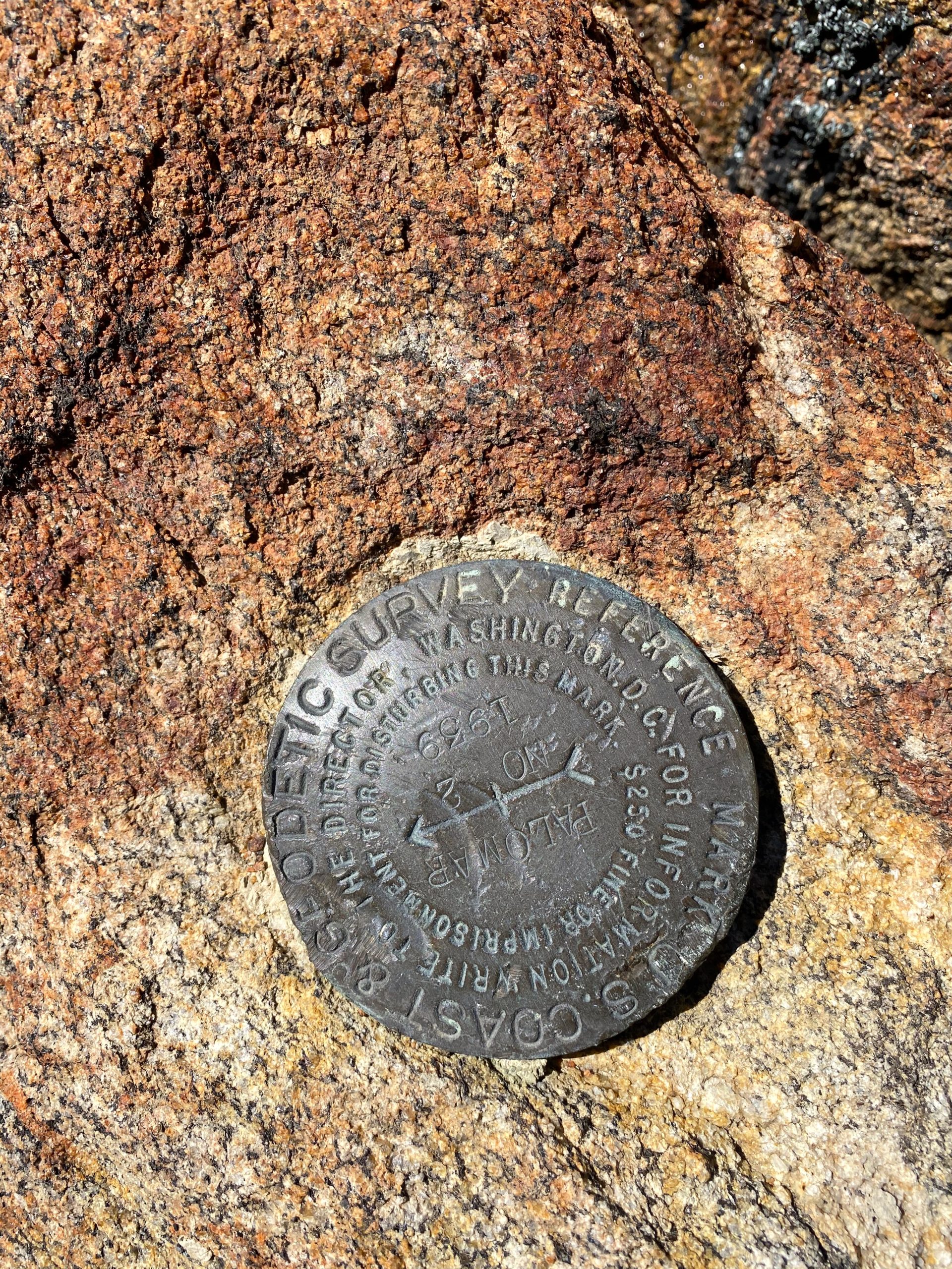
Once back on the main road, we cruised up toward the summit, stopping to look at the ruins of where an early exploration of placing an observatory here (Spoiler, it went to Palomar). Upon reaching the summit we spent a little time exploring, learning about the directional beacon, finding a couple of reference marks, and heading out to one of the benches. A few poppies were scattered along the ground, but they had not opened for the day yet.
We took a nice view to the east, naming off so many peaks we have climbed. Up to this point, we have had the mountain to ourselves. But we were soon joined by other hikers out enjoying the trail. We headed back down along the main road, passing more folks, many with their dogs. This peak was a nice change of pace for both of us. Since it was still early we decided to drive up Palomar Divide Road and cross another peak off this year’s San Diego Challenge, Palomar High Point.
I am an avid peak bagger, sometimes backpacker, and former sea kayaker living in San Diego. In 2019, I became the third person to complete the San Diego 100 Peak Challenge. Not stopping with that accomplishment, I set my sights on the harder San Diego Sierra Club 100 Peak list, which I completed in 2021. In addition, I have conquered several Six-Pack of Peaks challenges (SoCal, San Diego, Central Coast, and Arizona-Winter). Beyond attempting the San Diego Sierra Club 100 Peak list a second time, I am looking forward to exploring new summits and new adventures across the southwest.