Desert View Nature Trail

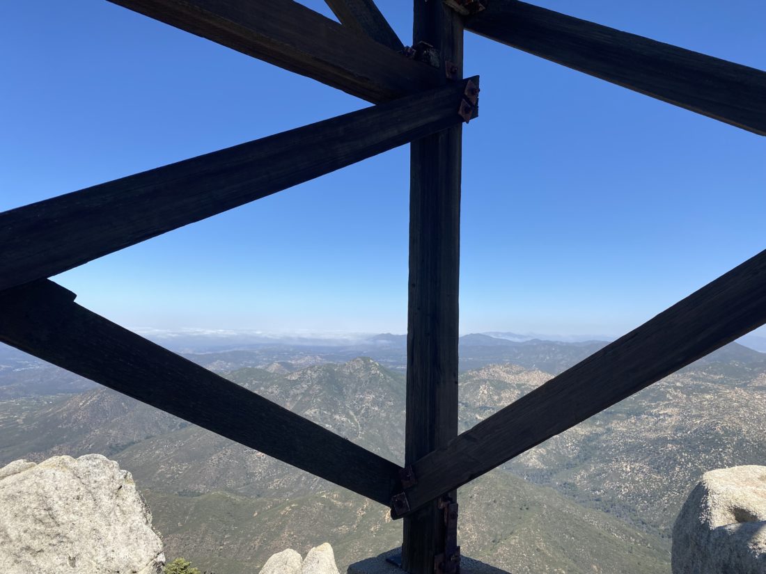
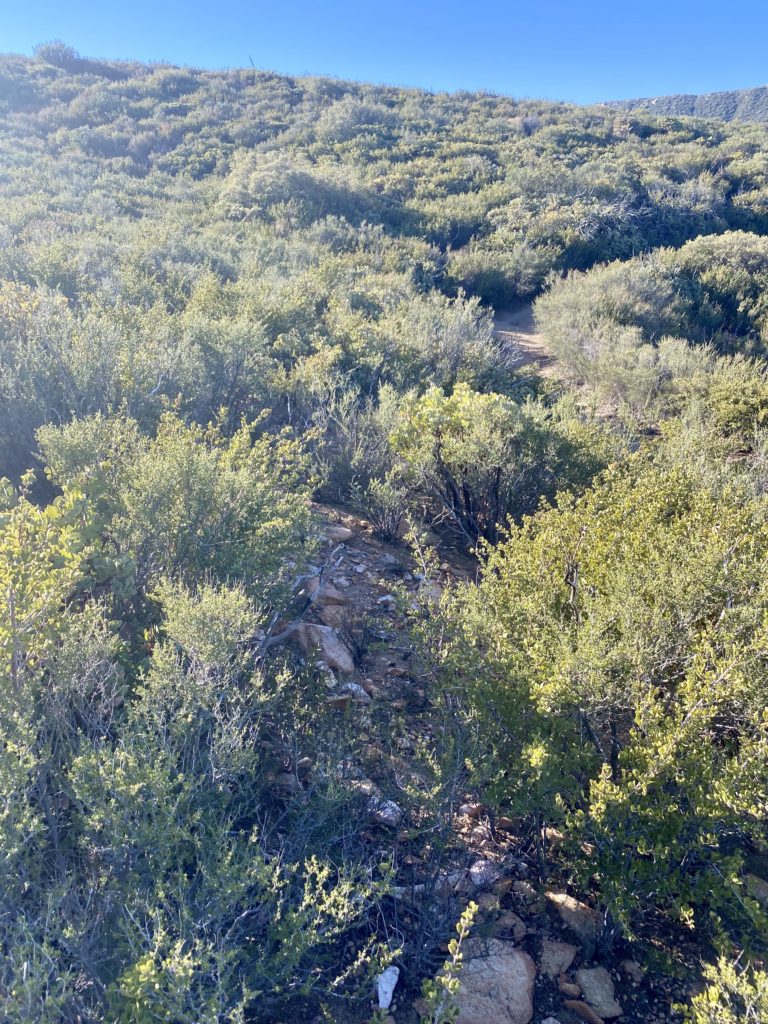
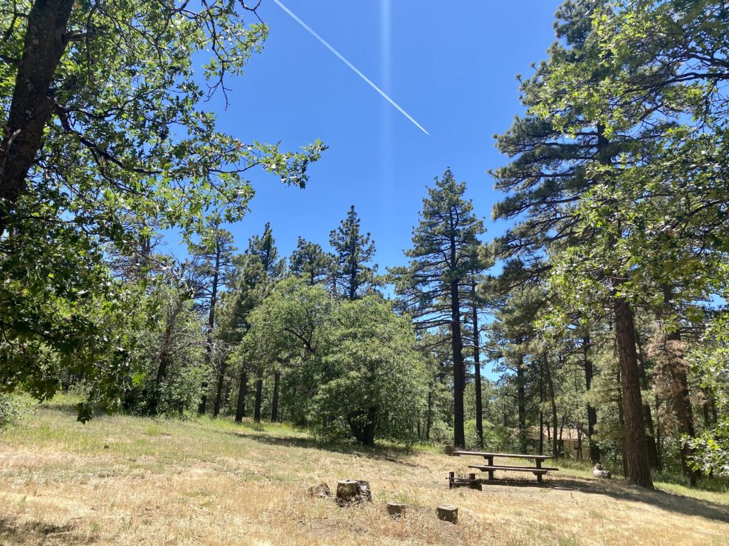
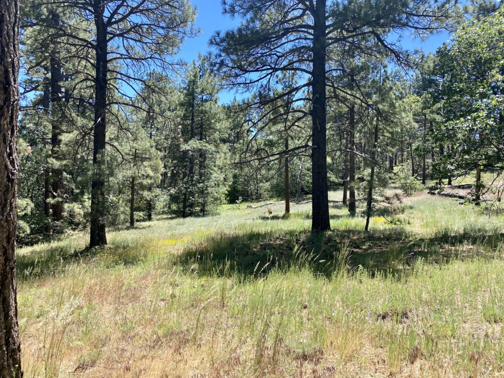
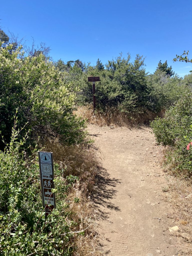
After having a nice picnic lunch at the Desert View Picnic area, it was time to burn off a few of those calories by exploring the Desert View Nature Trail. This trail is just over a mile in length and has minimal elevation gain, but it offers some incredible views despite those small stats. Starting from the southeast edge of the picnic area, we began hiking south. 

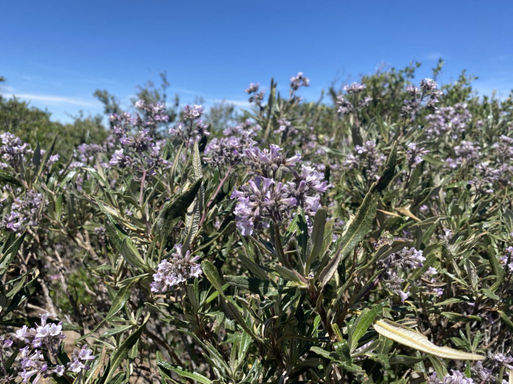
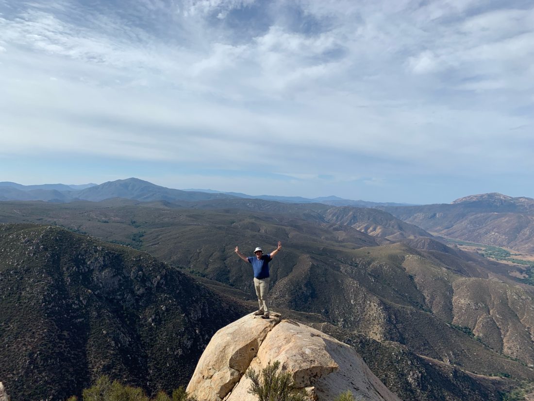
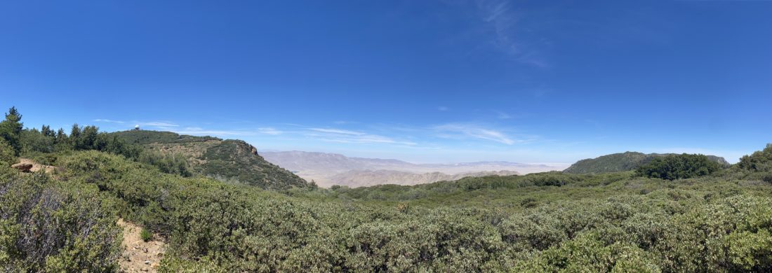
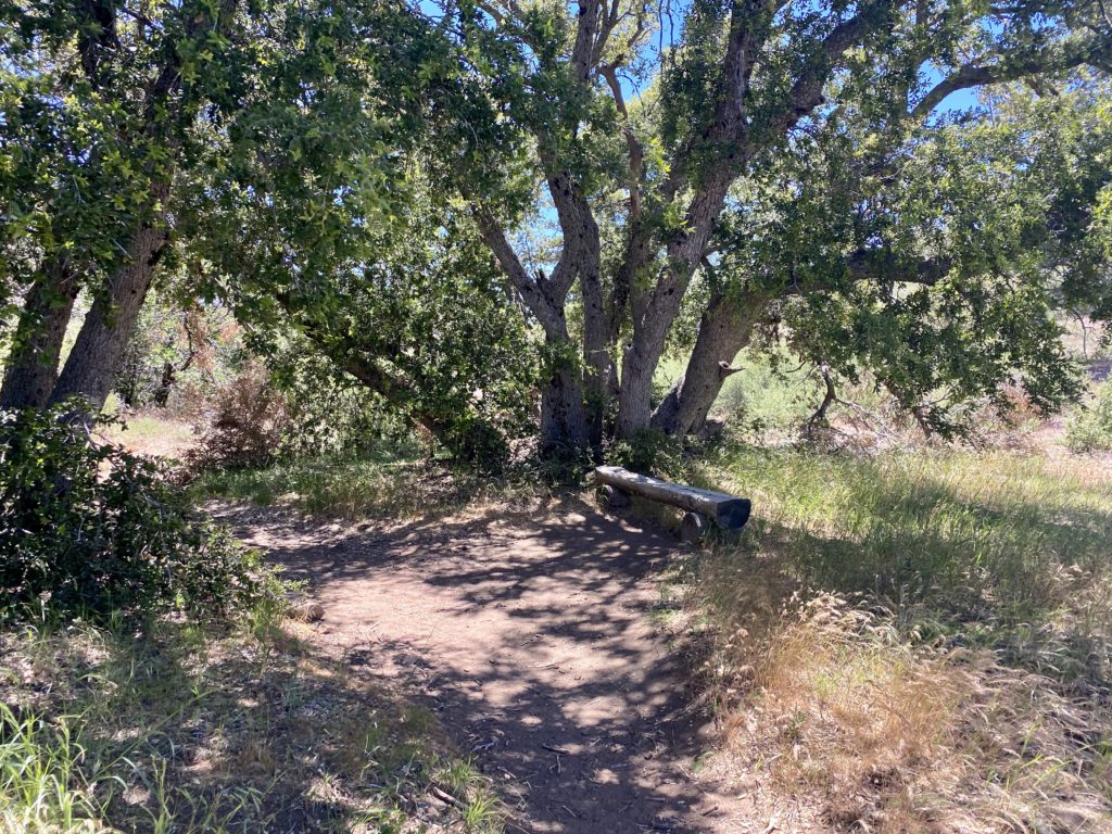
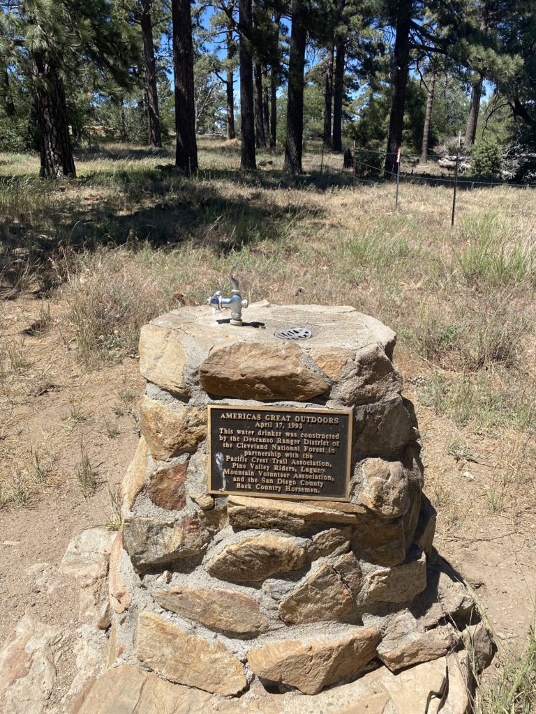
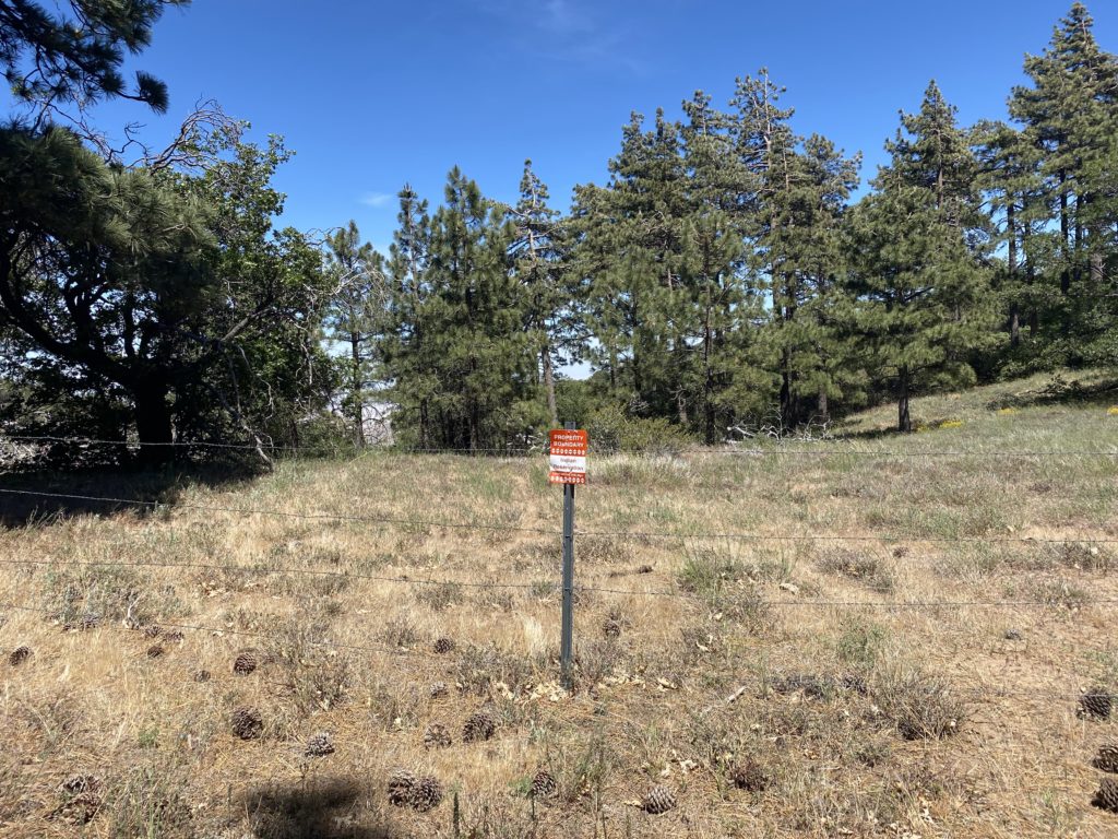
Soon, the views to the east opened up and the Anza-Borrego desert was spread out before us. I could see Red Top and Sawtooth directly in front of me. We continued on until we reached a junction in the trail. From our starting point, this trail is basically a “lollipop”. We soon passed a nice wooden bench nestled under some shady Black Oaks, taking the right fork. The trail continued on until it reached Burnt Rancheria Campground, the other starting point. We walked briefly along the road eastward, until we picked up the trail again. Upon leaving the campground, we found a “water drinker” that had been installed, along with a water trough for horses. To the east was a barbed wire fence and a sign denoting the land beyond was an Indian Reservation.

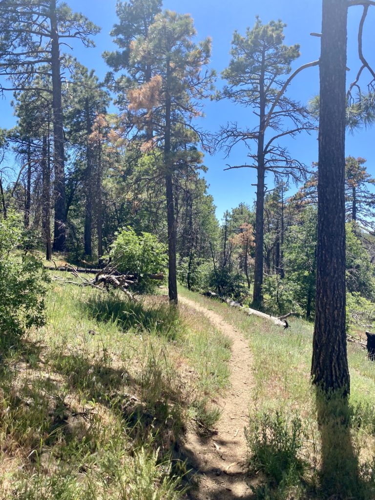
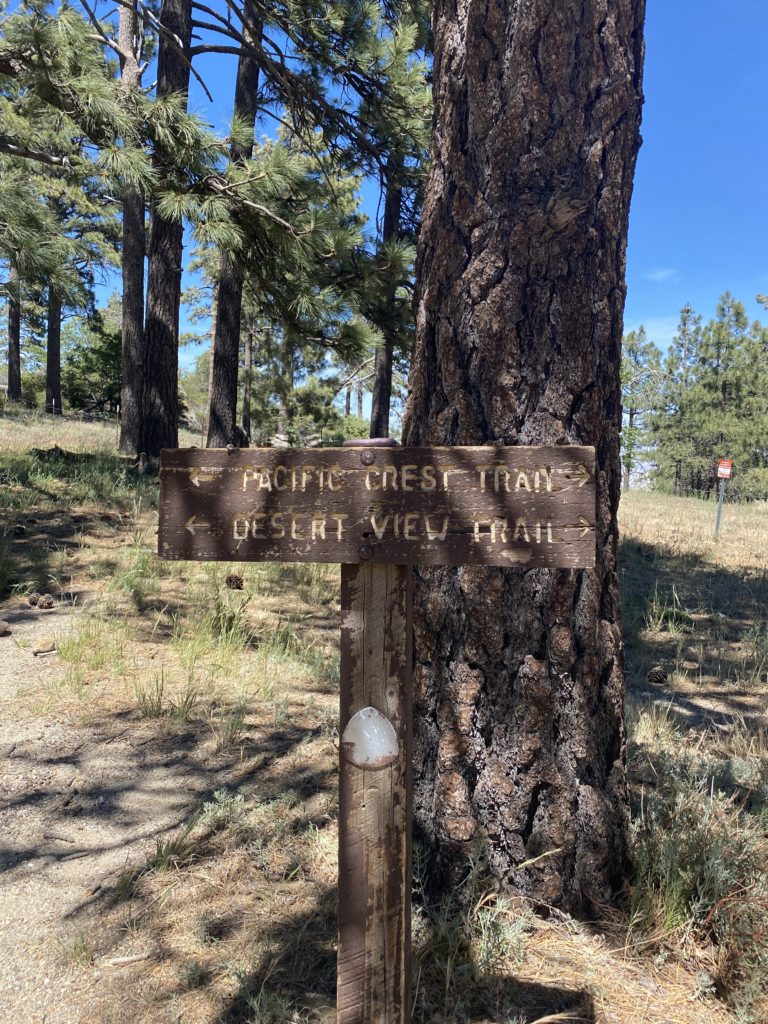
We followed the trail north back to our trailhead. This portion of the Desert View Trail is also shared with the PCT. Soon we found ourselves back in our car after an enjoyable little jaunt. Either a day pass or Adventure Pass will be needed to park at either the Desert View Picnic Area or Burnt Rancheria’s Day Use area. Dogs are allowed on leash. 


Buy Me a Coffee at ko-fi.com

I am an avid peak bagger, sometimes backpacker, and former sea kayaker living in San Diego. In 2019, I became the third person to complete the San Diego 100 Peak Challenge. Not stopping with that accomplishment, I set my sights on the harder San Diego Sierra Club 100 Peak list, which I completed in 2021. In addition, I have conquered several Six-Pack of Peaks challenges (SoCal, San Diego, Central Coast, and Arizona-Winter). Beyond attempting the San Diego Sierra Club 100 Peak list a second time, I am looking forward to exploring new summits and new adventures across the southwest. 

Hot Springs & Corral Benchmark

Since I am halfway done with the San Diego Six-Pack of Peaks, I figured I would cross another one off the list, Hot Springs Mountain. If I was going to do this peak, I had to sync up with Gina Norte and do it with her again. I met her at her house and then drove up toward the summit. The upside of being the trail manager for Los Coyotes is you have some additional access. We parked the car, grabbed our stuff, and headed toward the summit. The bugs were out and I had a few extra bits of protein along the way. I almost broke out the bug net but opted not to.

The summit was empty and we spent just a little bit of time here before heading over to the abandoned lookout tower for a bit. We surveyed possible routes for an attempt to summit Obie Benchmark, but that was for another day. As we cruised back down from the summit, the first wave of hikers began to make their way up. We chatted with some before parting ways.

Our next goal was to visit Corral Benchmark. This peak sits off the main trail. Since I was with Gina, we could climb it. The route up was pretty straightforward and we soon found ourselves at the summit. A register sat off to the side, and a tribal benchmark was affixed to a nearby rock. We had a snack and took in the views. May Grey socked in the coast. In fact, I had a little rain on my way here. Off to the west stood SquareTop, Collins, and Knob. To our southeast, Cody, and Pike. These were some stunning vistas. I was honored to be able to view them.

We grabbed our packs and rejoined the main trail. Soon we were back at Gina’s car and making the drive back down. I bid farewell and began driving back home, with a stop at Dudley’s for a well-earned sandwich.


Buy Me a Coffee at ko-fi.com

I am an avid peak bagger, sometimes backpacker, and former sea kayaker living in San Diego. In 2019, I became the third person to complete the San Diego 100 Peak Challenge. Not stopping with that accomplishment, I set my sights on the harder San Diego Sierra Club 100 Peak list, which I completed in 2021. In addition, I have conquered several Six-Pack of Peaks challenges (SoCal, San Diego, Central Coast, and Arizona-Winter). Beyond attempting the San Diego Sierra Club 100 Peak list a second time, I am looking forward to exploring new summits and new adventures across the southwest. 

Volcan Mountain (via 5 Oaks Trail)

After the hard climb up Sunset Mountain yesterday, I was looking for something a bit tamer. So, I decided to continue working on the San Diego Six-Pack of Peaks list, and Volcan Benchmark seemed like the perfect fit. Plus, I might try to get in another WBC hike afterward, along with a stop at Calico Cidery as well. Susie was fine with this, and we set off together.

We had a slightly later start as we did not need to worry about temperatures for this hike. There were about 8 cars parked along Farmers Road when we arrived. We grabbed our gear and set off. This would be my 5th time up, and Susie has lost track of how many times she had been to the summit. After using the porta-potties, we began hiking up the familiar road. Once we reached the 5 Oaks side trail, we switched to it. We caught a couple of other hikers as we cruised up the shaded trail. 

Once we rejoined the road, we felt the infamous wind that usually blows across this ridge. We continued chatting as we came to the old air beacon that sits on the summit. Susie snapped my photo for the challenge. Off to the southwest, a nice field of poppies beckoned to be photographed. 

After snapping our photos, we headed back down, this time staying on the main road for the entire descent. We passed several folks making their way up, and one pair of hikers also descending. Once back at the car we noted that we both might have set PRs for this peak. I know I did, and Susie was pretty sure as well. Since the Santa Ysabel East trail is just a few minutes down the road, we opted to drive down and add in some more miles. For Volcan, I logged us tracking 5.2 miles in 1:59 and gaining 1,241 feet.


Buy Me a Coffee at ko-fi.com

I am an avid peak bagger, sometimes backpacker, and former sea kayaker living in San Diego. In 2019, I became the third person to complete the San Diego 100 Peak Challenge. Not stopping with that accomplishment, I set my sights on the harder San Diego Sierra Club 100 Peak list, which I completed in 2021. In addition, I have conquered several Six-Pack of Peaks challenges (SoCal, San Diego, Central Coast, and Arizona-Winter). Beyond attempting the San Diego Sierra Club 100 Peak list a second time, I am looking forward to exploring new summits and new adventures across the southwest. 

Cuyamaca Peak (via Conejos Trail)

With the desert too warm to continue working on the San Diego Sierra Club 100 Peak List, I decided to start working on the San Diego Six-Pack of Peaks Challenge. Opted to climb Cuyamaca Peak with a friend. The Los Vaqueros Trailhead was almost packed, as there was a training run for the SD100 Trail Race. We made our way along the Milk Ranch Road, along the way we spotted a herd of deer wandering by. Once at the turn, we began looking for the mountain lion prints that the training director had told us about. Sure enough, we could see a nice collection of the lion’s travels.

We linked up with the Conejos Trail and began working our way up. The trail becomes a bit rocky so we needed to be mindful of our steps. Partway up we heard the sounds of running water, the Conejos Spring was flowing, and in fact, some of the trail itself had running water on it.

As we neared the paved fire road, we noted quite a few trees had been snapped due to the high winds a few weeks back.

Once at the summit, more evidence of this as a mast on some equipment had been taken down and smashed its solar panels. We soaked in the views and enjoyed a well-earned snack before heading down.

Instead of taking the Conejos Trail again, we continued to the Azalea Springs Fire Road. That way we could skip the rocky section. Once back on the Milk Ranch Road, we spotted some wild turkeys. The entire hike took us 4:03 (including the break at the summit) and covered 8.7 miles.


Buy Me a Coffee at ko-fi.com

I am an avid peak bagger, sometimes backpacker, and former sea kayaker living in San Diego. In 2019, I became the third person to complete the San Diego 100 Peak Challenge. Not stopping with that accomplishment, I set my sights on the harder San Diego Sierra Club 100 Peak list, which I completed in 2021. In addition, I have conquered several Six-Pack of Peaks challenges (SoCal, San Diego, Central Coast, and Arizona-Winter). Beyond attempting the San Diego Sierra Club 100 Peak list a second time, I am looking forward to exploring new summits and new adventures across the southwest. 

Inaja Nature Trail

I can’t count the times I have driven past the Inaja Memorial Picnic Ground on my way to and from my hikes. But, this short 1/2 mile hike was included on the North County San Diego Sierra Club’s 50 hikes for 50 years Challenge, so when driving back from hiking Cuyamaca Peak, Ted and I made a quick stop. Next to the parking lot are several covered picnic tables, and a small monument dedicated to the firefighters who lost their lives battling the Inaja Fire. In 1956, 11 firefighters lost their lives while battling the Inaja Fire along the San Diego River outside of Julian. 

Just past the pit toilets, the nature trail begins a short climb up around the hill. Off to our left was the San Diego River Gorge. As the trail looped north, we were greeted with some beautiful views of the Santa Ysabel valley. We spotted a small use trail that led us toward the “summit”, where we found a viewfinder, allowing us to locate various landmarks across the horizon.

The trail continued working its way around and soon we found ourselves back at the trailhead. If we had been smarter, we should have run down to Dudley’s, got our sandwiches and made the short drive backup and enjoyed them here.


Buy Me a Coffee at ko-fi.com

I am an avid peak bagger, sometimes backpacker, and former sea kayaker living in San Diego. In 2019, I became the third person to complete the San Diego 100 Peak Challenge. Not stopping with that accomplishment, I set my sights on the harder San Diego Sierra Club 100 Peak list, which I completed in 2021. In addition, I have conquered several Six-Pack of Peaks challenges (SoCal, San Diego, Central Coast, and Arizona-Winter). Beyond attempting the San Diego Sierra Club 100 Peak list a second time, I am looking forward to exploring new summits and new adventures across the southwest. 

Sheephead Mountain

Today’s adventure was doing Sheephead Mountain for a third time, as Ted Markus needed it for his effort to finish the San Diego Sierra Club 100 Peak list. We drove down the semi-paved Kitchen Creek Road off of Sunrise Highway. The dirt road to East Butte was in better condition than this one. Pine needles again crunched under our boots, as we made our way to the other Kitchen Creek road. Once there, I again made sure to leave a mark to find the use trail back up the ravine. I missed it the first time I summited.

We climbed the improperly placed fence/gate and continued down the road a bit before heading off to locate the use trail that would take us up to the summit. Now the real effort would begin, the trail would climb some 600 feet in about .3 miles. The trail has become a bit overgrown, and in fact, it did rip the left sleeve of my shirt. 

We hung out at the summit just for a bit, taking in the views and having a quick snack before heading back down. The descent was uneventful which, given some of the steep sections, was a good thing. We cruised home and grabbed some burritos from Mi Ranchito in PQ. My tracker logged the hike at 3.2 miles in 2:08 with 909 feet of gain.


Buy Me a Coffee at ko-fi.com

I am an avid peak bagger, sometimes backpacker, and former sea kayaker living in San Diego. In 2019, I became the third person to complete the San Diego 100 Peak Challenge. Not stopping with that accomplishment, I set my sights on the harder San Diego Sierra Club 100 Peak list, which I completed in 2021. In addition, I have conquered several Six-Pack of Peaks challenges (SoCal, San Diego, Central Coast, and Arizona-Winter). Beyond attempting the San Diego Sierra Club 100 Peak list a second time, I am looking forward to exploring new summits and new adventures across the southwest. 

Oriflamme Mountain

After I finished the 100 Peak Challenge back in 2019, a couple of the peaks were swapped out. SquareTop and Rock Mountain were dropped and Paradise and Oriflamme Mountains were added. While I had previously done Paradise, I had never hiked to the summit of Oriflamme. While it can be done as a side trip when doing Roost Benchmark, I never made the extra effort. So, I finally decided to cross this peak off my “unclimbed” list. I drove up in the early morning and parked next to the Lucky S Ranch. While it was in the upper 30s as I passed through Julian, it warmed up to the upper 40s as I set off down the dirt road toward Oriflamme. 

A lot of the route was the same we took on our first trek out to Roost Benchmark. This hike is an inverted one, meaning you hike down and then have the “fun” of hiking back up to the trailhead.

After about 2 miles, it was time to leave the road and begin the cross-country climb to the peak. A cairn marked a good opening through the brush. Thankfully the brush was about knee-high, so spying the path of least resistance was fairly straightforward. The slope posed no issues as I weaved my way up, spotting a cairn from time to time. Finally, the rocky pile that denotes the summit came into view. I scrambled to the top to soak in the views. The register can was safely tucked in a crevice. I signed my name and strolled around the summit, enjoying the panoramic view.

I needed to get back, so I headed down toward the road, again just weaving through the brush and moving mostly down and to the west. I actually exited at the same cairn I used to begin the cross-country section. Maybe I should buy a lottery ticket?

The climb back up was uneventful. It certainly was easier than the last two times I trudged up that road. My tracker logged this hike at 4.4 miles in 2:00 hrs with an elevation gain of 1,288 feet.


Buy Me a Coffee at ko-fi.com

I am an avid peak bagger, sometimes backpacker, and former sea kayaker living in San Diego. In 2019, I became the third person to complete the San Diego 100 Peak Challenge. Not stopping with that accomplishment, I set my sights on the harder San Diego Sierra Club 100 Peak list, which I completed in 2021. In addition, I have conquered several Six-Pack of Peaks challenges (SoCal, San Diego, Central Coast, and Arizona-Winter). Beyond attempting the San Diego Sierra Club 100 Peak list a second time, I am looking forward to exploring new summits and new adventures across the southwest. 

Roost Benchmark

Last week, Susie Kara and I hiked the peak on which she finished her San Diego Sierra Club list. It seemed obvious that this weekend we should rehike the peak on which I finished. We found parking at the trailhead to the Sunset Trail/Lucky S Ranch and headed down the old jeep road. This was also an inverted hike, so we would get the joy of having to climb back to the car.

We grabbed our gear and darted across the road to the trailhead. I had tossed on a light fleece, as it was a bit nippy. We cruised down the road to the first junction and from there we took the short, but more overgrown, route toward the summit. Finally the old road came to an end and we would begin our bushwhacking and sidehilling portion of the hike. Thankfully, it wasn’t too far to reach the summit. We looped around it for the final push and got our first glimpse of the fire damage from the wildfire that occured in May. The fire stopped almost exactly at the summit.

We took a nice break, chatted about the various peaks that filled our vista, and signed the register. Someone had been out here the day before. That would explain the fresh tracks we had seen along the way. Since we both had plans for the late afternoon, we set off toward the car, and the climb would begin.

While I did not set any land speed records during our return, we still held a nice pace. All told by my tracker; 7.9 miles in 4:41 with 1,569 of gain.


Buy Me a Coffee at ko-fi.com

I am an avid peak bagger, sometimes backpacker, and former sea kayaker living in San Diego. In 2019, I became the third person to complete the San Diego 100 Peak Challenge. Not stopping with that accomplishment, I set my sights on the harder San Diego Sierra Club 100 Peak list, which I completed in 2021. In addition, I have conquered several Six-Pack of Peaks challenges (SoCal, San Diego, Central Coast, and Arizona-Winter). Beyond attempting the San Diego Sierra Club 100 Peak list a second time, I am looking forward to exploring new summits and new adventures across the southwest. 

Los Pinos Lookout

After summiting Gasp Benchmark earlier in the day, we decided to see if we could drive up to Los Pinos and get that peak crossed off Susie’s remaining peaks. I had already been there twice before, so I did not need to go back, but was more than happy to act as her ‘car sherpa’. As we passed the trailhead for Corte Madera, it was full, as were the next 3 turn-outs. It was certainly a popular one today. Once we reached the junction at the Corral Canyon OHV area, we spotted a sign that indicated there was a locked gate ahead on the road to Los Pinos. We decided to venture on and see which gate might be closed. Susie thought it might be the lower gate, as that was the one that was locked the last time she was here. But as luck would have it, it was open, so we continued driving upward. Once we reached the summit, the gate for the road to continue north was locked. That was the gate I was expecting to be closed. We parked the car at the junction and walked the .2 miles to the summit. The lookout tower was manned, and Shane invited us up for a tour. Next to the tower, a memorial lookout had been built for a long-time ranger, Norman Mitchell.

Shane gave a full tour of the tower and how it operates. I had been here before, so I hung off to the side to let Susie and Alberto have front-row seats to the lecture and demonstrations. After soaking in the views and all the great information, we bid farewell and headed back down. With that peak, Susie is now under 30 more to go to complete the San Diego Sierra Club 100 list a second time. 


Buy Me a Coffee at ko-fi.com

I am an avid peak bagger, sometimes backpacker, and former sea kayaker living in San Diego. In 2019, I became the third person to complete the San Diego 100 Peak Challenge. Not stopping with that accomplishment, I set my sights on the harder San Diego Sierra Club 100 Peak list, which I completed in 2021. In addition, I have conquered several Six-Pack of Peaks challenges (SoCal, San Diego, Central Coast, and Arizona-Winter). Beyond attempting the San Diego Sierra Club 100 Peak list a second time, I am looking forward to exploring new summits and new adventures across the southwest. 

Eagle Peak

In late May 2024, Forest Service officials renamed this trailhead, Cha’chaany Hamuk, which translates roughly to “three sisters” in the Kumeyaay language. Plus, there is a new parking lot, restrooms and a helicopter landing area for fire and rescue crews.

Today’s adventure had Susie Kara and I heading out to hike Eagle Peak. After some navigational errors on my part during the drive (that I atoned for by buying a flight at Calico Cidery), we pulled into the parking lot. There were a couple of cars already there, including a ranger. After grabbing our gear, we set off down the trail, stopping to chat with the ranger for a bit. He informed us that they are hoping to make some major improvements to this trailhead, pave the parking lot (which is very rutted), add a pit toilet, and some picnic tables. If the budget is approved, work might start in 2022. 

For those unfamiliar with this trail, it shares the same trailhead as Three Sisters Falls, hence why there is a need for the improvements. After about 6/10 of a mile, the trail comes to the junction — to the left is the descent down to the VERY DRY waterfalls and straight onto Eagle Peak. In fact, there is a sign near the start of the trail with a photo of the state of the falls.

Initially, it felt a bit warm and we were glad this hike was just over 4 miles in length. Luckily, a nice breeze picked up and kept things pleasant. The trail is a little overgrown, but not too bad. We quickly worked our way up toward the summit, passing over the minor false summits. We signed the register and stood out on a boulder for some nice photos. We did not linger too long, as we really wanted to sample those ciders back in Wynola. Once back at the car, we estimated it was now in the mid-80s. A few more cars had arrived since we had left. Never can understand hiking in the heat to see a dry waterfall. We did the 4.2 miles in 2:04, including the time on the summit. My tracker reported just over 1,000 feet of gain. 

Our post-hike stop this time was the Calico Cidery in Wynola. This is a really cute tasting room. We each had a flight of the three ciders that were available and enjoyed them on some nice shaded benches. I filled my growler with “The Granny” and Susie opted for “Fieldblend”. With a little luck, we might be able to do one of my remaining peaks next weekend.


Buy Me a Coffee at ko-fi.com

I am an avid peak bagger, sometimes backpacker, and former sea kayaker living in San Diego. In 2019, I became the third person to complete the San Diego 100 Peak Challenge. Not stopping with that accomplishment, I set my sights on the harder San Diego Sierra Club 100 Peak list, which I completed in 2021. In addition, I have conquered several Six-Pack of Peaks challenges (SoCal, San Diego, Central Coast, and Arizona-Winter). Beyond attempting the San Diego Sierra Club 100 Peak list a second time, I am looking forward to exploring new summits and new adventures across the southwest.