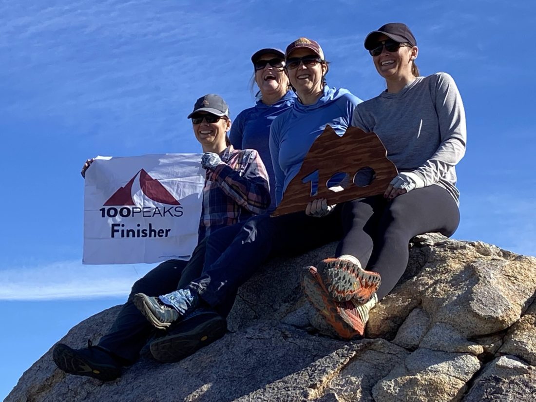
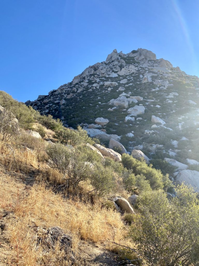
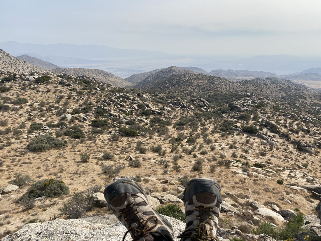
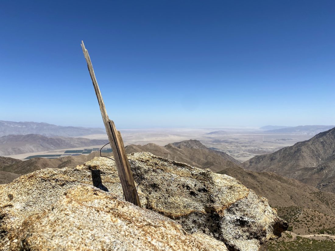
The original plan was to drive out to Ghost Mountain and join Erika, Tara, and Kali as they complete the 100 Peak Challenge! Then afterward we had planned to head down to Diablo Benchmark, but my car had a battery issue, so we had to switch into Susie’s car which would not be capable of the drive up June Wash. Oh well…
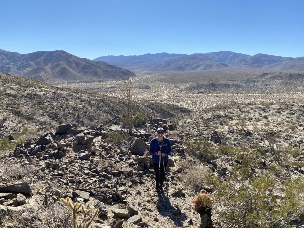
Kali drove out to the entrance to Blair Valley and shuttled us back to the Marshall South trailhead. Once we were all assembled we trekked up to the Marshall South homestead. After some exploring of the ruins, we Kali drove out to the entrance to Blair Valley and shuttled us back to the Marshall South trailhead. Once we were all assembled we trekked up to the Marshall South homestead. After some exploring of the ruins, we headed on to the summit. Unfortunately, just before the summit, I got stabbed by an agave! While our finishers scrambled up the summit block, I took care of my wound. Once I was patched up, all the finishers posed together!
We then cruised back to the homestead and rejoined those who chose not to continue. Once back at the trailhead we shuttled back to Susie’s car. Since my daughter was coming home from college (and I now had to deal with my car trouble), we skipped the pizza back in Wynola.
Big Congrats to all the finishers!
I am an avid peak bagger, sometimes backpacker, and former sea kayaker living in San Diego. In 2019, I became the third person to complete the San Diego 100 Peak Challenge. Not stopping with that accomplishment, I set my sights on the harder San Diego Sierra Club 100 Peak list, which I completed in 2021. In addition, I have conquered several Six-Pack of Peaks challenges (SoCal, San Diego, Central Coast, and Arizona-Winter). Beyond attempting the San Diego Sierra Club 100 Peak list a second time, I am looking forward to exploring new summits and new adventures across the southwest.
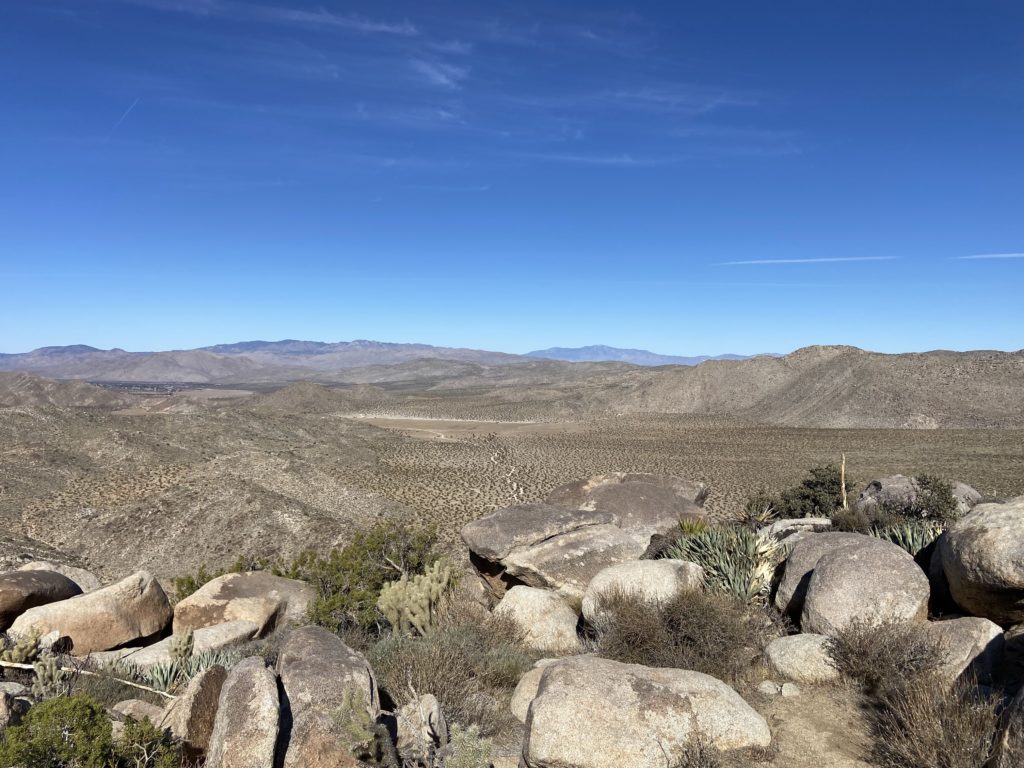
The plan was to climb the ridgeline from Hellhole Canyon and summit Ted and Webo Benchmarks, but as we drove out toward Borrego Springs, neither Susie nor I had that much enthusiasm for this hike. I had already done it twice, so this hike was solely to help Susie along toward her finishing the San Diego Sierra Club 100 list a second time. We pulled into the parking area, looked at the ridge and the 3,000+ feet of gain that stood before us, and said “Let’s hike something else”. Since she did need Borrego Mountain East Butte, we picked that as our first replacement of the day. After a quick pit stop at the bathrooms at the off-road area, we drove the dirt road up toward the land bridge that I used last time.
Susie’s other time summiting East Butte was via the rocky gully. That was the same route I had used for my first time as well. But my second time up I used the land bridge to climb it from the west side.
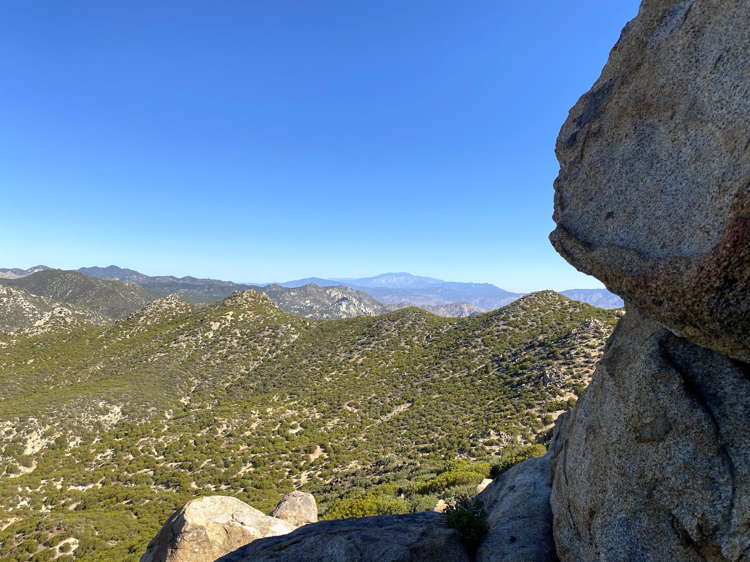
After parking and snapping some photos with the Santa Rosa mountain range behind us, we climbed the steep slope toward the summit. We quickly found ourselves approaching the summit. Once there we signed the register and took in the views. Since this was such a quick jaunt, we debated what else we might try to tackle. Most of our other Sierra Club peaks weren’t an option, so instead, we turned to the San Diego Peak Club List and found Perpendicular Bluff Benchmark as a strong candidate.
I am an avid peak bagger, sometimes backpacker, and former sea kayaker living in San Diego. In 2019, I became the third person to complete the San Diego 100 Peak Challenge. Not stopping with that accomplishment, I set my sights on the harder San Diego Sierra Club 100 Peak list, which I completed in 2021. In addition, I have conquered several Six-Pack of Peaks challenges (SoCal, San Diego, Central Coast, and Arizona-Winter). Beyond attempting the San Diego Sierra Club 100 Peak list a second time, I am looking forward to exploring new summits and new adventures across the southwest.
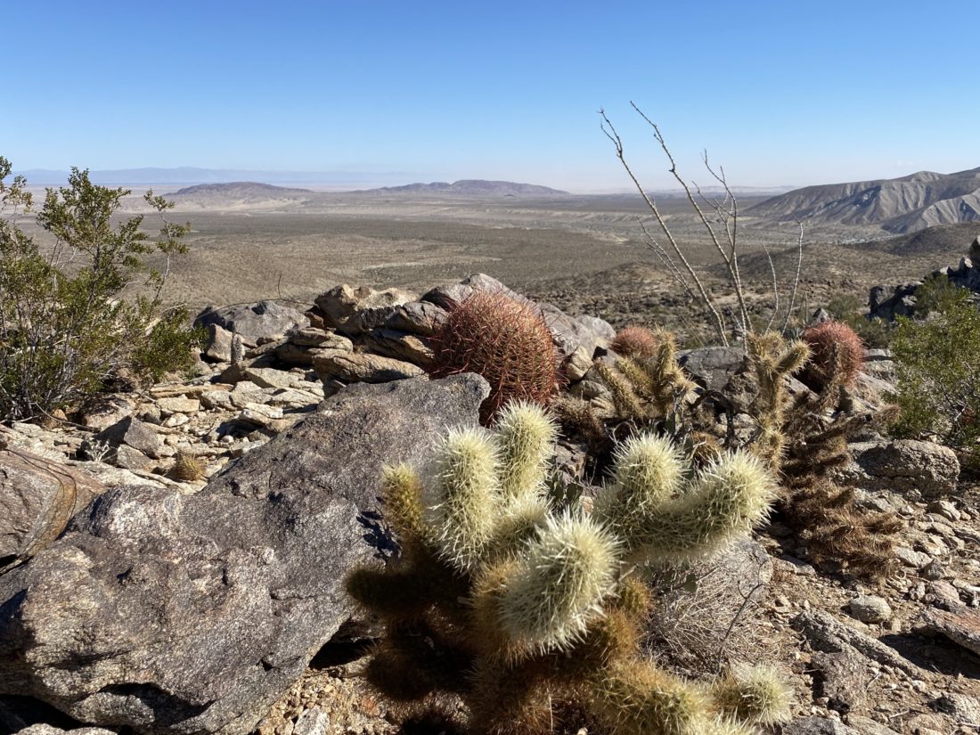
Since hiking Borrego Butte East was such a quick jaunt, we debated what else we might try to tackle. Most of our other Sierra Club peaks weren’t an option, so instead, we turned to the San Diego Peak Club List and found Perpendicular Bluff Benchmark as a strong candidate. We drove back along the 78, amazed at the string of cars and RVs heading the other way. Found a safe place to park near the start of Keith Winston’s track.
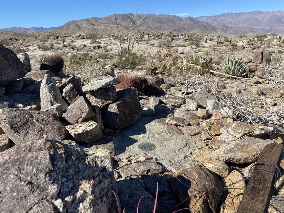
After scampering across the road, we then cruised across the desert floor, passing through a nice grove of agave. In reviewing Keith’s track, we had a general sense of what he did to reach the summit. We saw a nice spot to hop on the ridge that he eventually got onto later. The ridge had no real obstacles or navigational challenges, and soon we were atop Perpendicular Bluff Benchmark.
We found the benchmark and the register and after a short break, we headed back down, following the same ridge. Once back at the car, we both agreed this was a fun little desert peak and we’re glad about opting to do something else. The stats for East Butte were 1.27 miles in 1:19 with an elevation gain of 440 feet. The stats for Perpendicular Bluff were 2.6 miles in 1:50, with an elevation gain of 590 feet.
I am an avid peak bagger, sometimes backpacker, and former sea kayaker living in San Diego. In 2019, I became the third person to complete the San Diego 100 Peak Challenge. Not stopping with that accomplishment, I set my sights on the harder San Diego Sierra Club 100 Peak list, which I completed in 2021. In addition, I have conquered several Six-Pack of Peaks challenges (SoCal, San Diego, Central Coast, and Arizona-Winter). Beyond attempting the San Diego Sierra Club 100 Peak list a second time, I am looking forward to exploring new summits and new adventures across the southwest.
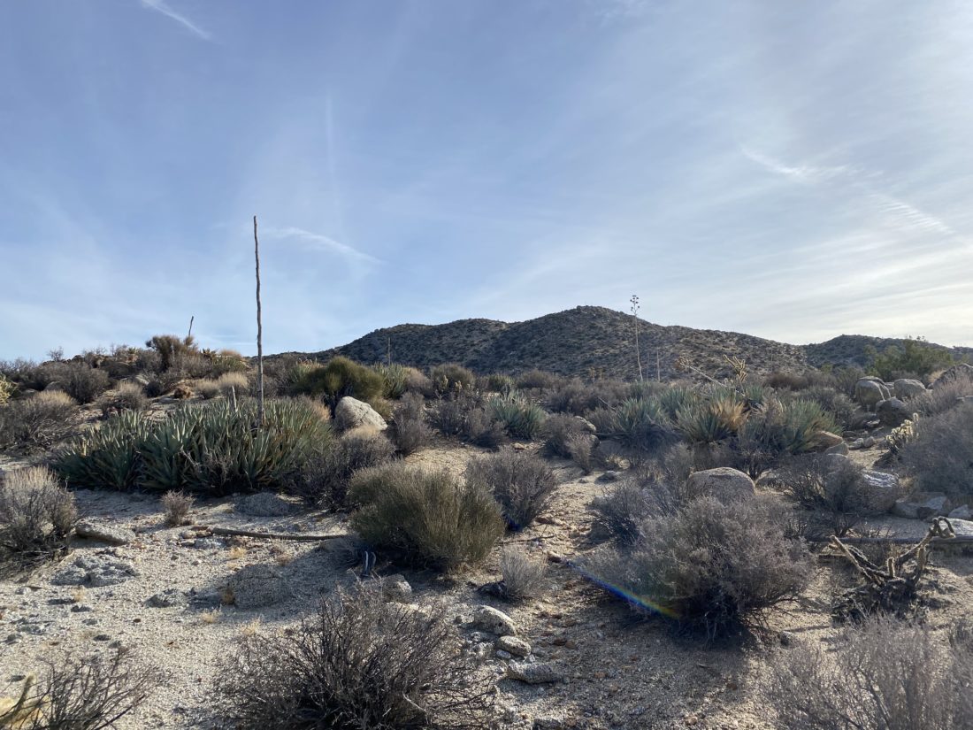
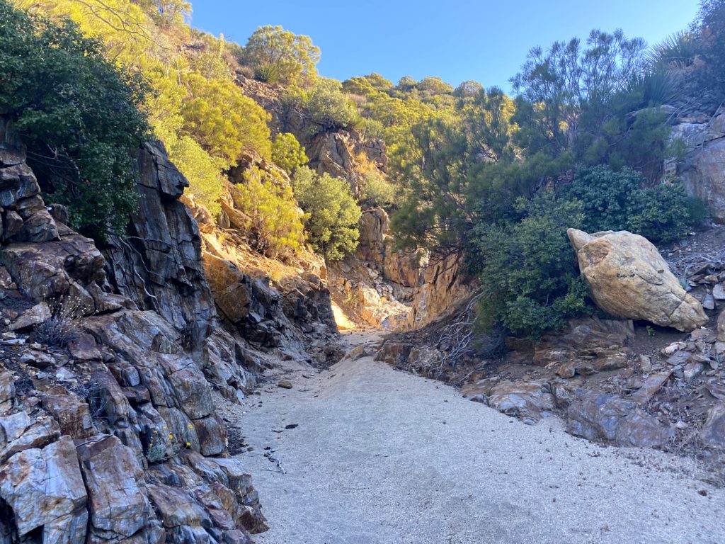
Today’s adventure was to have us hike to the summit of P3640, informally known as North Pinyon. All three of us, Susie, Ted and myself, all had time constraints, so this peak was perfect. Just past the Scissors Crossing we turned off at Plum Canyon and headed south along the dirt road. After about 1.3 miles the road splits, and the right fork heads to the trailhead for Sentenac, while the left fork would take us to the trailhead for North Pinyon. Initially, we had hoped to squeeze in Sentanac since it almost shares the same trailhead, but we just did not have the time. After another 1/2 mile of driving we reached the turnaround. I parked the Outback and we began getting ready to head off.
The route begins with a short scramble over some rocks before spending some time weaving through the canyon in a nice sandy wash. Some interesting geological features revealed themselves along the sides of the wash. A standard collection of desert plants also dotted the route. Eventually, the wash turned rocky and our stroll became less gradual and more stair-like. We had a few dry falls to contend with, with only one truly needing to be bypassed. As the drainage began to end, I located the exit point I had used the last time and climbed up.
With a commanding view of Granite Mountain to our west, we did have our first views of North Pinyon to our east. We worked our way toward a small saddle between the minor peak we were on and the final climb up. The last 4/10 of a mile would climb about 400 feet, but the terrain was easy to navigate. Once over the minor false summit, it was a simple walk over to the true summit just to the east.
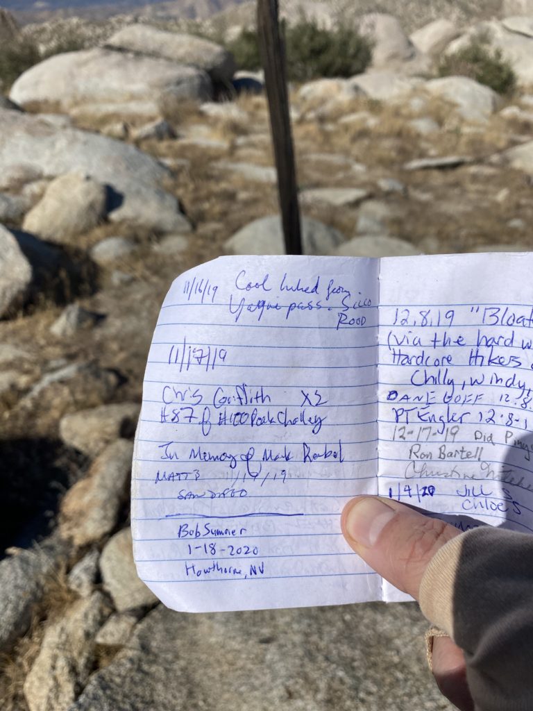
There is no benchmark here, but it does have a register that we gladly signed. The skies were pretty clear, so we had some nice views of Whale Peak to our south, Grapevine and Sentenac to the northwest, and the Salton Sea to the east. After a quick snack, it was time to head back down. The only real challenge in this hike is to make sure you drop down into the correct wash to lead you out. Once we did this, we chatted about our plans to complete the San Diego Sierra Club 100 list again. It is going to be a fun desert season for us! We made a quick stop again at Calico Cidery before dropping Susie off at one of the wineries in Ramona to meet her parents. All told the hike was about 4.25 miles in 3:30 with an elevation gain of 1,498 feet.
I am an avid peak bagger, sometimes backpacker, and former sea kayaker living in San Diego. In 2019, I became the third person to complete the San Diego 100 Peak Challenge. Not stopping with that accomplishment, I set my sights on the harder San Diego Sierra Club 100 Peak list, which I completed in 2021. In addition, I have conquered several Six-Pack of Peaks challenges (SoCal, San Diego, Central Coast, and Arizona-Winter). Beyond attempting the San Diego Sierra Club 100 Peak list a second time, I am looking forward to exploring new summits and new adventures across the southwest.
With my peak-bagging friends busy, I set off to climb San Ysidro solo. I had planned to grab breakfast from the Jack In The Box in Ramona, but they were closed. Crud. Thankfully, Don’s Market in Santa Ysabel was open and I was able to grab some food. Just past where the Montezuma Valley Market is, I turned on to the dirt road that would take me to the start of the hike. I parked, grabbed my gear, and set off down the old jeep road. A tree had fallen since the last time had been here, so I had to drop into the stream bed to bypass it.
At the saddle, I opted to stay high and work my way toward the gully that I would follow to the base of the mountain. While it was not terrible, it was not great either. Once at the gully, the going became easy for a bit. At the base, I checked my previous track and started the climb. Some cairns were erected along the way, but the route mostly showed itself to me.
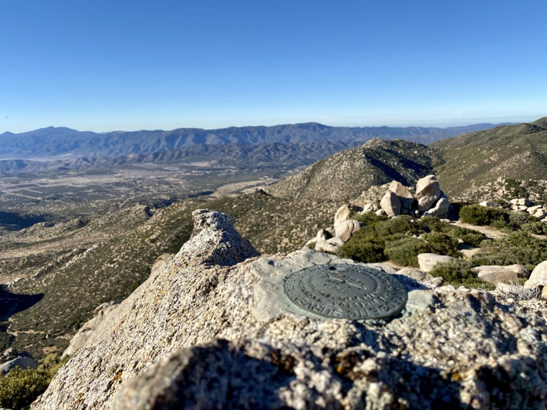
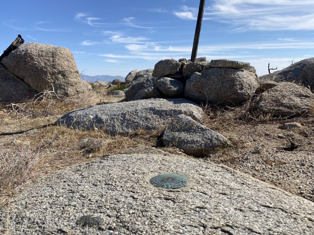
Once at the summit I took in the views. The previous time I was here they were obscured by clouds. I scrambled to the summit block and signed the register. I peered up to locate the two reference marks. I did not feel comfortable scrambling up their respective boulders solo.
My return route went smoothly, letting the mountain guide me back down. I did stay in the gully longer and it seemed to be slightly easier going back to the road. All told the hike was 4.01 miles in 3:38 and an elevation gain of 1,583 feet.
I am an avid peak bagger, sometimes backpacker, and former sea kayaker living in San Diego. In 2019, I became the third person to complete the San Diego 100 Peak Challenge. Not stopping with that accomplishment, I set my sights on the harder San Diego Sierra Club 100 Peak list, which I completed in 2021. In addition, I have conquered several Six-Pack of Peaks challenges (SoCal, San Diego, Central Coast, and Arizona-Winter). Beyond attempting the San Diego Sierra Club 100 Peak list a second time, I am looking forward to exploring new summits and new adventures across the southwest.
A recent storm left temperatures a bit below normal, so we decided to hike one of the more moderate desert peaks we needed. We had a handful of options to pick from, but since Ted had injured himself during a running race, that narrowed the choices to either doing the Webo/Ted combination or Gasp Benchmark. We chose the latter. I picked Susie and Alberto up and we were greeted with a wonderful sunrise as we left San Diego.
Soon, we pulled onto McCain Valley Road and then made the turn onto the rough dirt road toward Sacotone Overlook. This is the same road that will take you to the trailhead for Mt. Tule. It has always been a bit rough, but it has deteriorated quite a bit since I last drove it back in December. Once it turned on to the road toward our starting point for Gasp, it became much better. We gathered our gear and set off down the road. It was a crisp 46°, but we knew it would warm up quickly. We cruised down toward Redondo Springs, chatting about recent hikes. This hike is inverted, so we mostly go down to the peak, then get to climb back up to the car.
The miles passed quickly, and soon we were on the rocky ridge working our way carefully toward the benchmark. At times the winds were quite strong. We guesstimated they might have hit about 40 mph. We weaved our way across the steep and rocky terrain toward the summit.
Once there, we hung out a bit, had a snack, snapped some photos, and signing the register. Thankfully, the winds were not an issue. Soon it was time to climb back to the car.
I kept a nice measured pace on the ascent. Susie and Alberto would pause for a bit at times and once I reached them I just kept motoring on. Soon we reached our car and had another peak crossed off our list! Our stats were 6.5 miles in 3:54 and 1,687 feet of gain.
I am an avid peak bagger, sometimes backpacker, and former sea kayaker living in San Diego. In 2019, I became the third person to complete the San Diego 100 Peak Challenge. Not stopping with that accomplishment, I set my sights on the harder San Diego Sierra Club 100 Peak list, which I completed in 2021. In addition, I have conquered several Six-Pack of Peaks challenges (SoCal, San Diego, Central Coast, and Arizona-Winter). Beyond attempting the San Diego Sierra Club 100 Peak list a second time, I am looking forward to exploring new summits and new adventures across the southwest.
Another fantastic day out in the high desert near Ranchita. Susie Kara and I decided to tackle Wilson Benchmark and Pinyon Ridge. She needed to summit this pair of peaks on her quest to complete the San Diego Sierra Club 100 Peaks list for a second time. Initially, we had talked about doing this hike as an overnight just to mix things up, but in the end we opted just to hike it.
I turned on Old Wilson Road in Ranchita, then hopped on to a side road to connect to Old Culp Valley Road. There was one spot on this dirt road that took a touch of care. We parked at the trailhead and grabbed our gear. We opted to do Wilson first and summit Pinyon on our return. When I had done these peaks previously, I had done Pinyon Ridge first then continued onto Wilson Benchmark.
Once we reached the point where we could leave the old Jeep road to make the climb up Wilson, we debated where we might want to work our way up its gentle slope. The climb up Wilson was nice and easy. The skies were much clearer than last weekend, so we could truly enjoy the views. Our descent took us a slightly different route. We actually spotted a cairn this way, not like it was really needed. We then retraced our route back toward Pinyon Ridge.
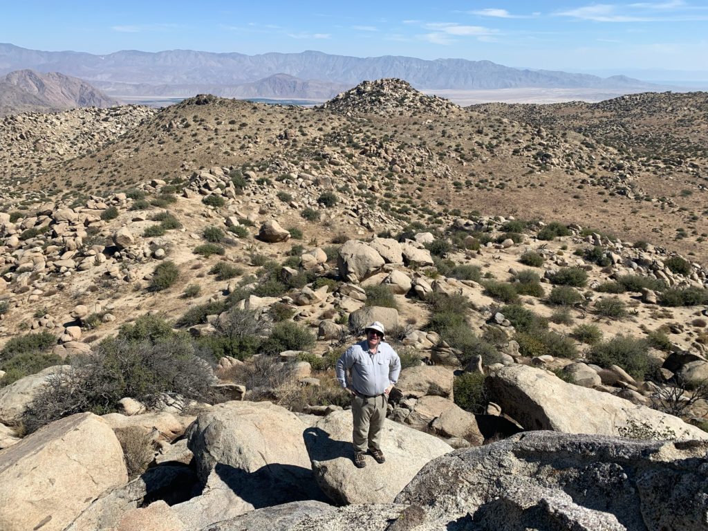
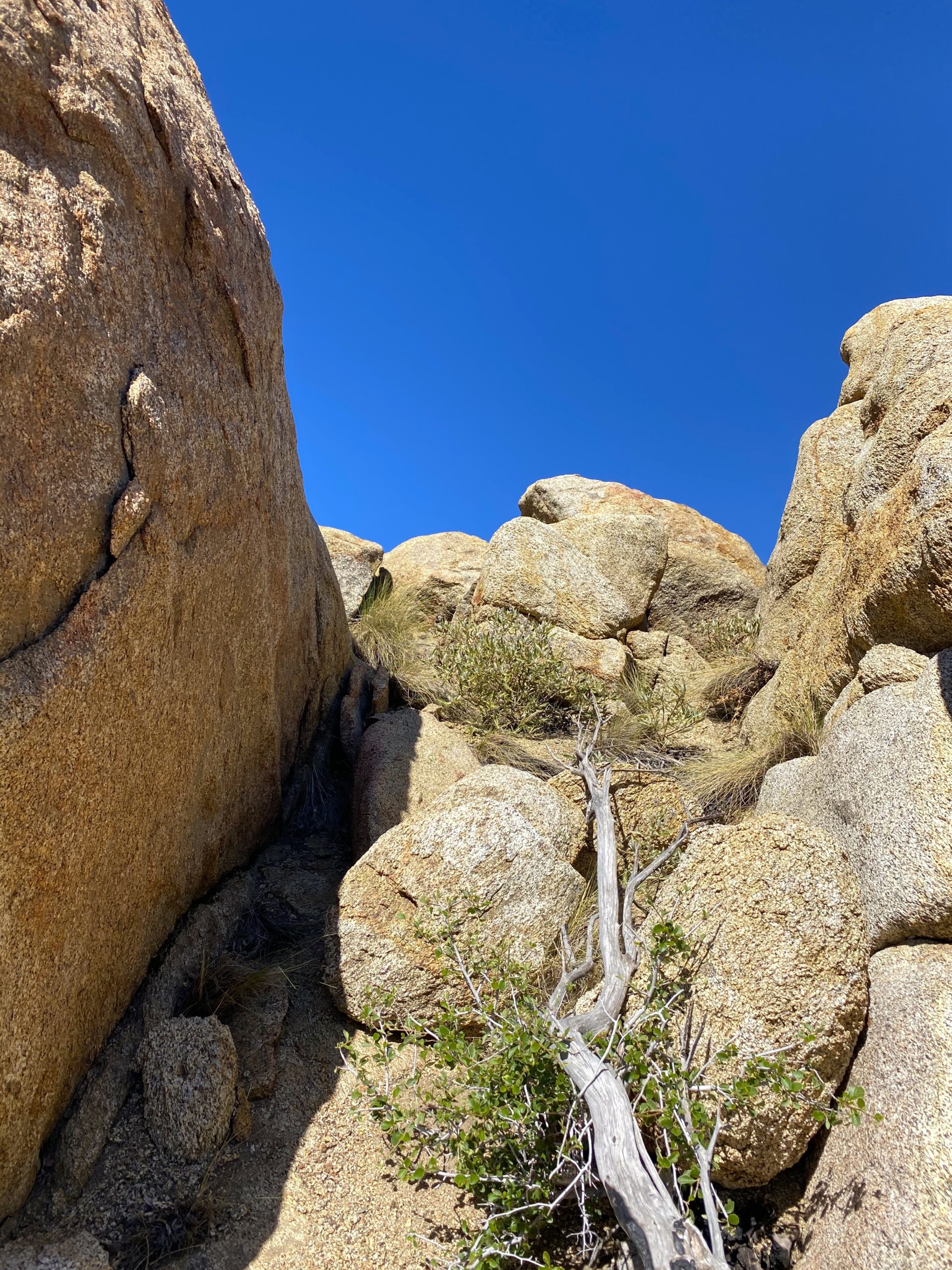
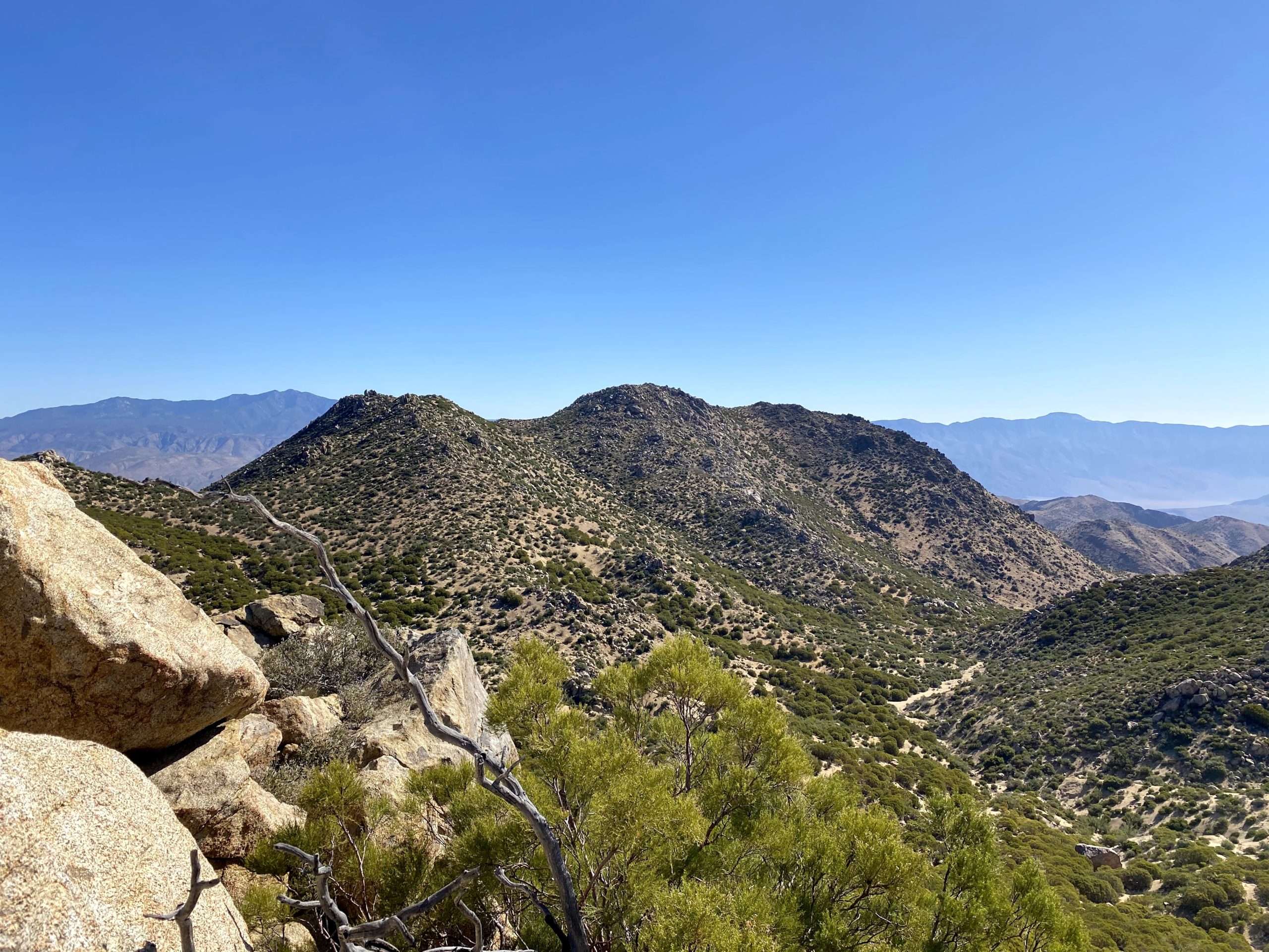
Since I saw there was supposed to be an azimuth mark near Pinyon Ridge, just a bit to the north of the road, I spent some time trying to locate it. Sadly, I did not, but I did get a nice photo of Pinyon Ridge. Since this hike was about exploring new routes, we stayed on the ridge we were on to make our way to the summit. This route took us right to the base of the summit and avoided some of the challenges I remembered from my previous ascents.
We carefully plotted our route up to the top of the actual summit block. Susie took the more traditional scramble on the north side, while I found a nice route on the east side that bypassed the minor friction move that was needed. We took a short break, signed the register, snapped our photos and then headed down. We would switch our descent routes off the summit. Susie tried my route, and I was able to navigate down her route with no issues at all.
Although we had a nice breeze blowing, it was starting to get a tad warm. Soon, the car came back into view. Continuing the “new routes” theme of this hike, we decided to drive out toward Culp Valley instead of back toward Ranchita. Initially the road was great, but there were a couple of spots to be mindful of. For future hikers coming out to this trailhead, I recommend driving in from the Ranchita side. All told this hike was 9.1 miles in 4:40 (including the summit rests), and about 1,500 of elevation gain. On the way home, we again stopped at Don’s Market for a cold drink and Dudley’s for a sandwich.
I am an avid peak bagger, sometimes backpacker, and former sea kayaker living in San Diego. In 2019, I became the third person to complete the San Diego 100 Peak Challenge. Not stopping with that accomplishment, I set my sights on the harder San Diego Sierra Club 100 Peak list, which I completed in 2021. In addition, I have conquered several Six-Pack of Peaks challenges (SoCal, San Diego, Central Coast, and Arizona-Winter). Beyond attempting the San Diego Sierra Club 100 Peak list a second time, I am looking forward to exploring new summits and new adventures across the southwest.
Operation: Help Susie to 100×2! continued today with a return to Ranchita to hike out to White and Bonny Benchmarks. These peaks sit on the very western end of Anza-Borrego State Park. In fact, our initial route from the car parallels the border fence. I had done these peaks several times, so like yesterday I took the lead. Our path weaved around the various bushes and cacti following the animal trails that criss-crossed the desert floor. The plan was to hike out and up to White Benchmark, then work our way back down to pick up Clyde and Bonny Benchmarks.
We would gain almost 1,000 feet by the time we stood atop the summit block of White. The last push to the summit took a bit of effort, as it did become a bit steep and sandy. The skies were still hazy like the day before. It appears the register has been lost, so if anyone reads this and is planning to climb White Benchmark, bring a new one. We both again stared at The Thimble to our north and wondered how people climb it from the south or east side. Susie was so thankful that my route yesterday was 100x easier than her first time up it.
As we made our way back down, we set off toward Clyde Benchmark. We made it part way up, but did not feel the need to reach the top. Again, no register was found where we thought one should be. Bonny was a short distance away. I lead us around the south side to the ledge on the west to the summit. Susie recalled working her way up a crack when she did it in 2017. We sat here for a bit taking in the views. Bonny still had her register, so we dutifully signed it. I opted not to crawl over the reference mark this time.
We scrambled down and continued making our way back to the car. There is yet another benchmark nearby, Hut. But, neither felt the urge to go get, as I recalled the descent was a bit brushy. We stayed heading east to avoid some of the heavier brush that tends to grow in the drainages that seemed to always pull you in. So, we were back in the car and headed home. Normally, we would have grabbed a cold drink at the Montezuma Valley Market, but sadly it burned earlier this year. They are hoping to rebuild. Instead, we made a quick stop at Don’s Market for some cold drinks, and Dudley’s for some sandwiches. The entire hike was 4.5 miles in 3:24 (including stops) with 1,150 feet of gain.
I am an avid peak bagger, sometimes backpacker, and former sea kayaker living in San Diego. In 2019, I became the third person to complete the San Diego 100 Peak Challenge. Not stopping with that accomplishment, I set my sights on the harder San Diego Sierra Club 100 Peak list, which I completed in 2021. In addition, I have conquered several Six-Pack of Peaks challenges (SoCal, San Diego, Central Coast, and Arizona-Winter). Beyond attempting the San Diego Sierra Club 100 Peak list a second time, I am looking forward to exploring new summits and new adventures across the southwest.
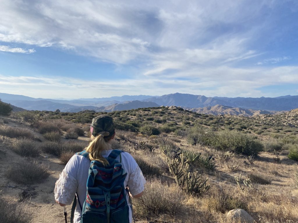
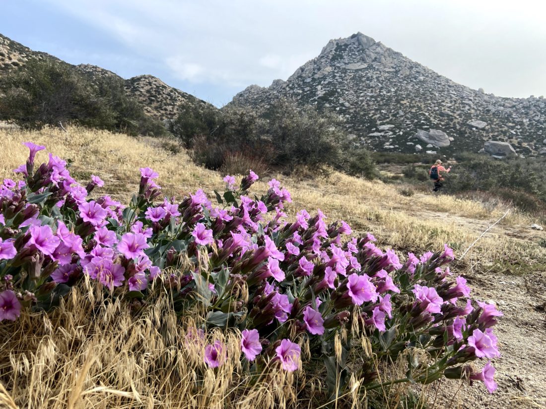
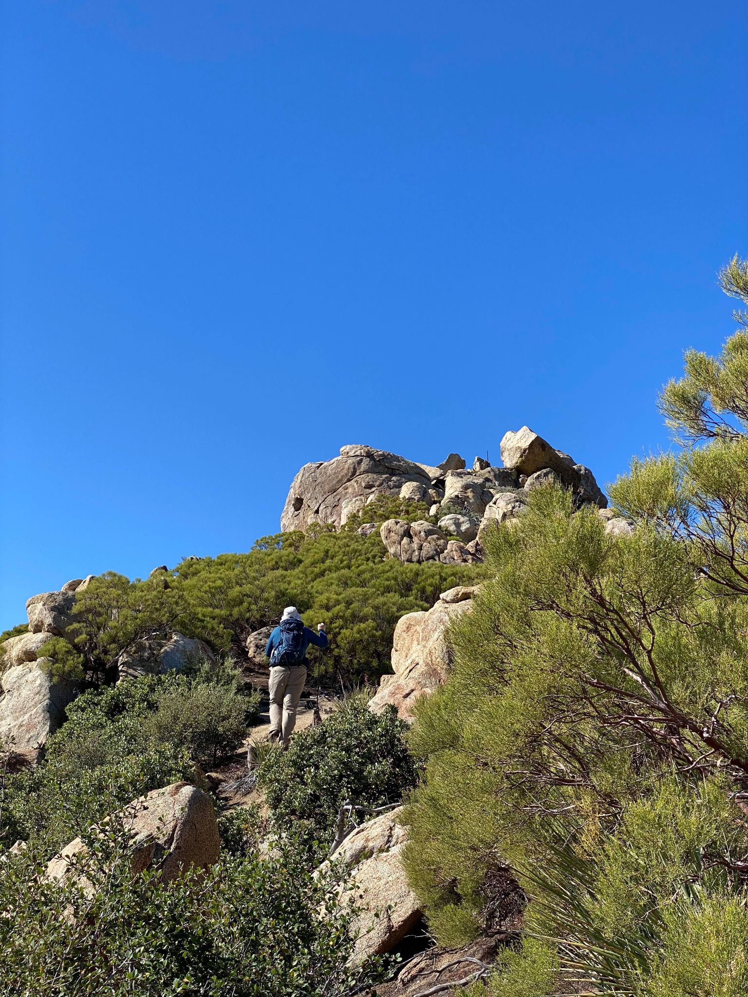
Today’s adventures were about moving forward to finishing the San Diego Sierra Club 100 Peak list again. Both Susie Kara and I are embarking on this effort. While most peaks are still unclimbable due to the desert temps, we do have a few that we can tackle. Our first summit of the day was The Thimble out near Ranchita.
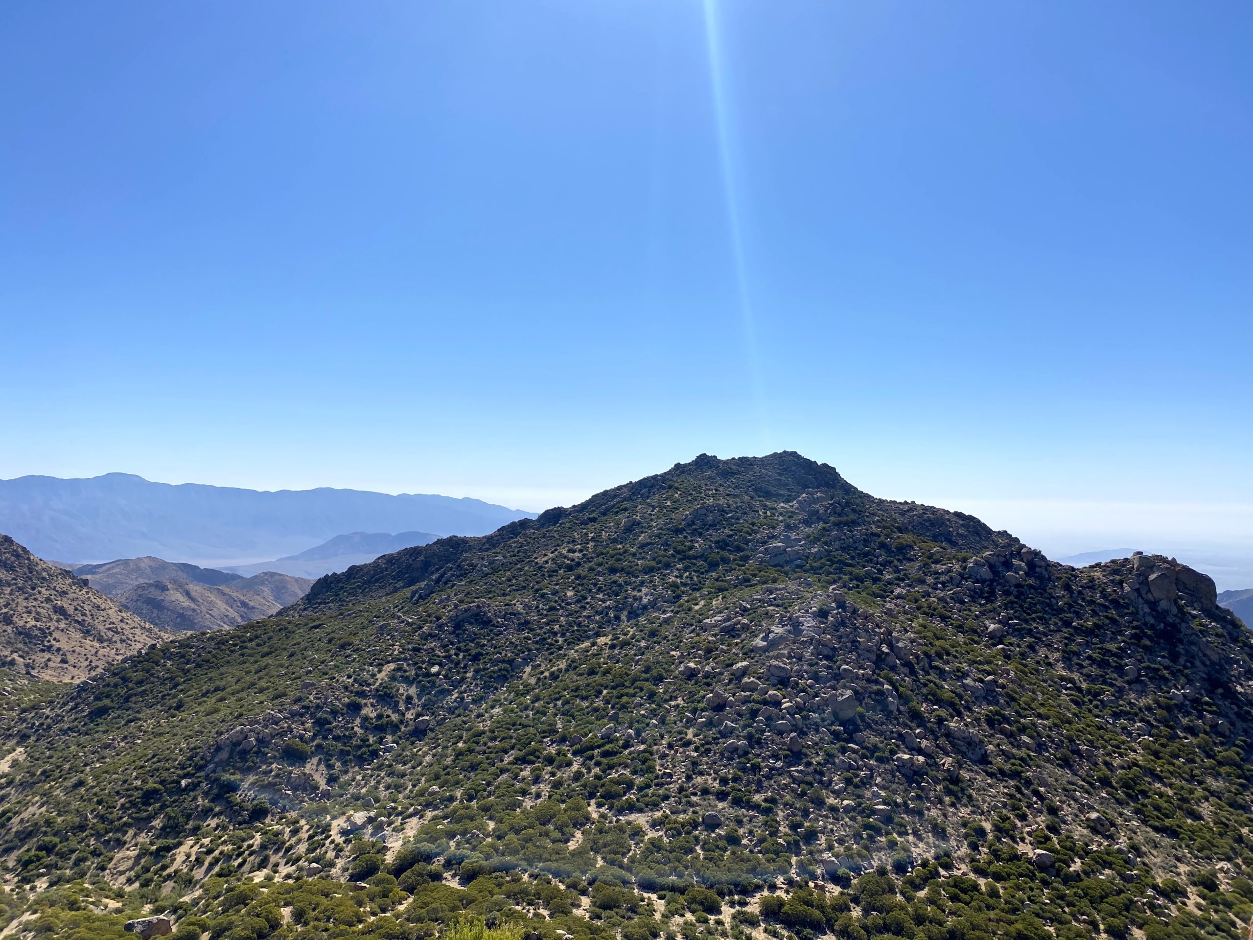
Ted Markus tagged along for the adventure as well. The two of us had done it back in October of 2020. Since I had multiple summits of this peak, I took the lead once we reached the saddle. I guided us up its steep slopes with no real issues. I checked my previous track only near the top and was happy to find I was spot on.
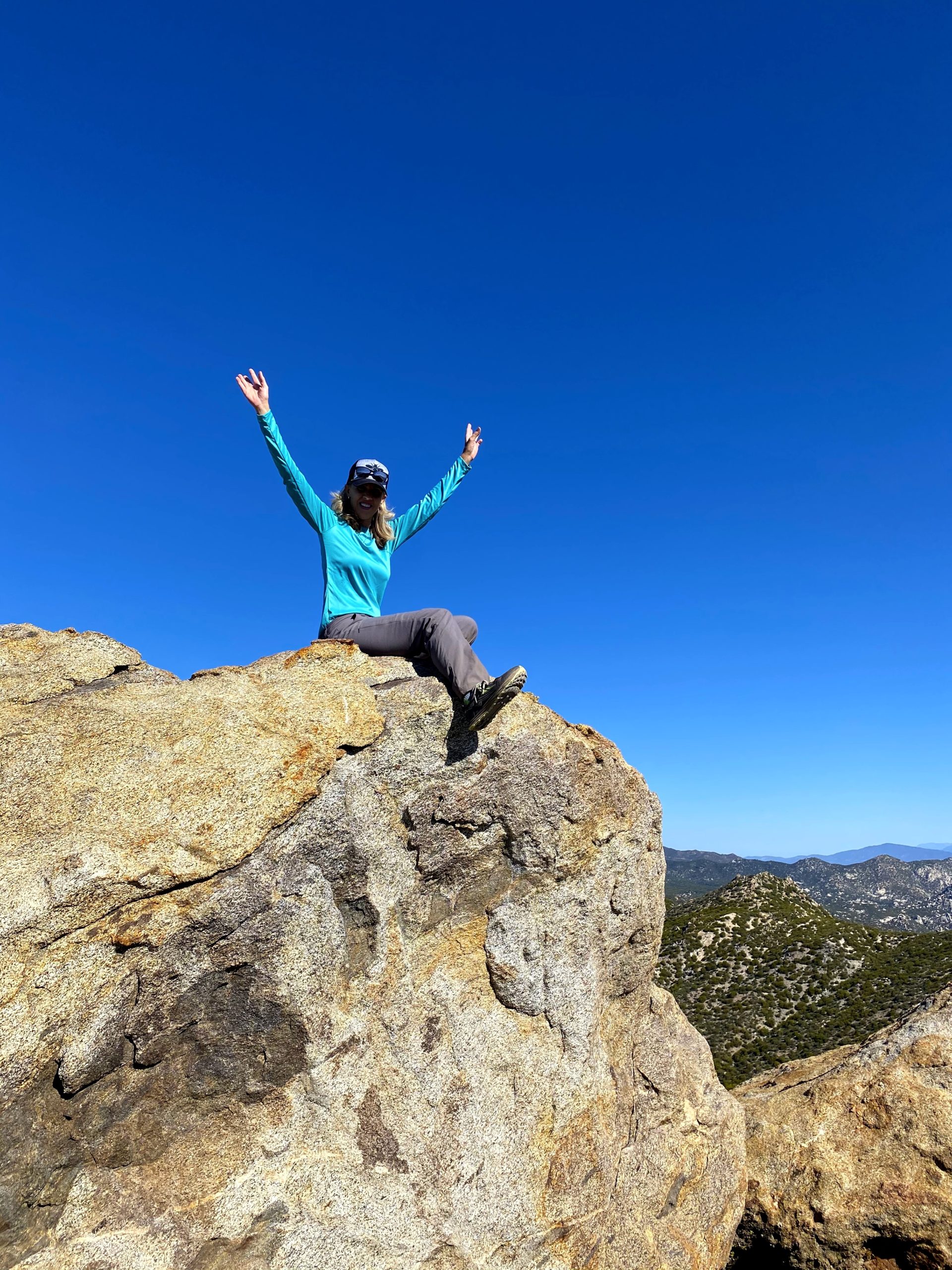
We slipped through the brush tunnel and made our final scramble to the summit. Susie could not believe the difference between this approach and her first one back in 2017. We signed the register and took in the views. The skies were hazy, so it was a bit disappointing. To our north loomed San Ysidro. We had hoped to also summit it today as well. We began our descent, mostly following our earlier route, but we kept looking to see if we would find a path that would allow us not to lose more elevation. Try as we might, nothing opened up. Finally, we threw in the towel and descended to the wash at the base of the peak. We took a nice break and discussed our options. The day had warmed up some, so we became a bit less motivated to make the San Ysidro climb. Plus, our friend Gina Norte had wanted to climb San Ysidro but could not come on this attempt. So we decided to come back when she could join us.
A happy Susie Kara after the summit!
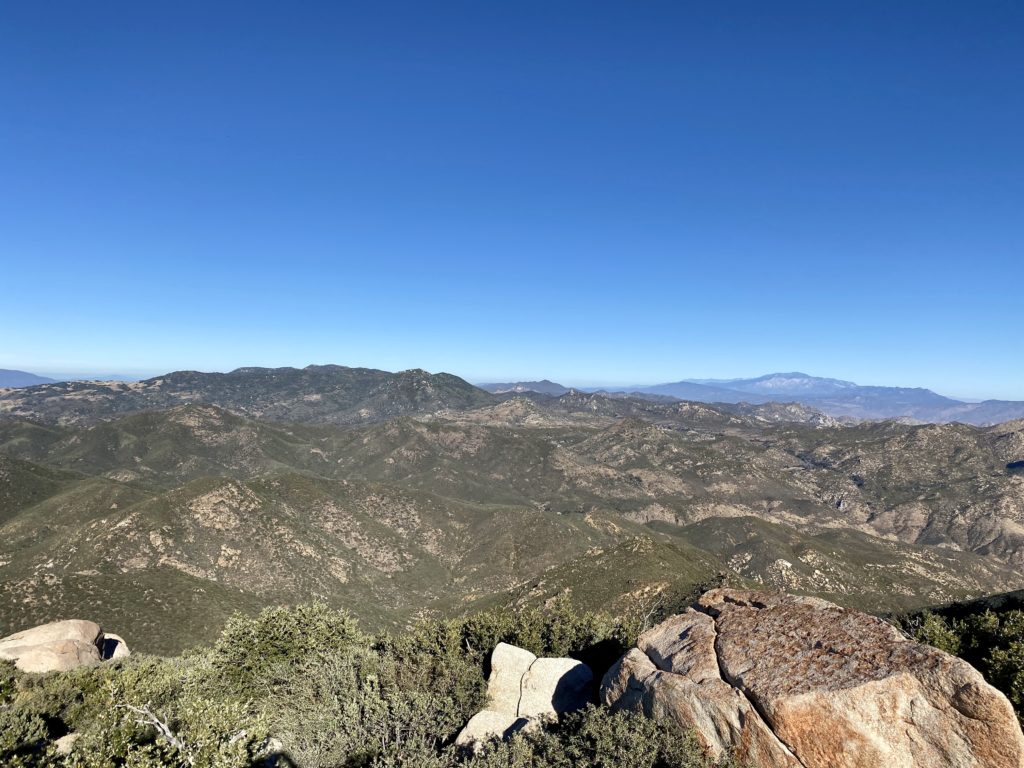
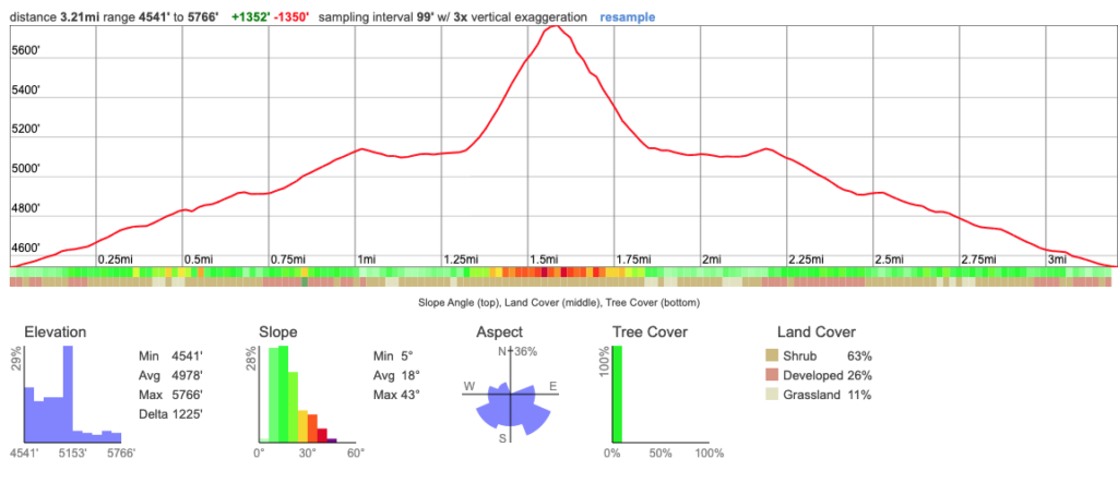
For those who are curious about this hike’s profile, here is our track displayed in CalTopo. Note the average slope on The Thimble is between 40% and 50% for most of the climb.
I am an avid peak bagger, sometimes backpacker, and former sea kayaker living in San Diego. In 2019, I became the third person to complete the San Diego 100 Peak Challenge. Not stopping with that accomplishment, I set my sights on the harder San Diego Sierra Club 100 Peak list, which I completed in 2021. In addition, I have conquered several Six-Pack of Peaks challenges (SoCal, San Diego, Central Coast, and Arizona-Winter). Beyond attempting the San Diego Sierra Club 100 Peak list a second time, I am looking forward to exploring new summits and new adventures across the southwest.
When I was hiking with Gina Norte on Hot Springs Mountain last weekend, she mentioned that she was taking some fellow peakbaggers out for their attempt at Palm Mesa High Point, and possibly Cody & Pike. Since Gina was one of my hiking buddies when I summited Palm Mesa High Point, I knew she was not planning on doing that peak again. She said she might try for Phil and Norte Benchmarks instead. So, I asked if she would enjoy some company, to which she joyfully said yes. We chatted about what other peaks we might explore and how. In the end, we left it a bit flexible as to our plans and were just going to see how the day unfolded.
I arrived at the guard station for Los Coyotes Indian Reservation around 6:15. It was in the high 30s, but the forecast for the region that Gina and I would be hiking was in the low 70s. Alberto and Dale pulled up around 6:30. Initially, another peakbagger, Phil Y. had planned to come but he just did a long hike up in the San Gabriels and was not up for this adventure. Gina arrived soon after and we headed back to the campground. Dale and Alberto transferred into Gina’s car and I stayed in mine. Since I did not know how long Gina and I were going to spend hiking, having my car allowed me to leave if we finished before Dale and Alberto did (which is what we expected).
We drove to the familiar parking spot near the cemetery and quickly gathered our gear. Gina and I weren’t in a rush, but Dale and Alberto had a long, hard day ahead of them, so we got underway fairly quickly. This was the first time I had a chance to meet Dale in real life. We chatted about various topics as we made our way down to the wash and then up the saddle. The biggest question I had was “what order/route they were going to take?” Alberto had been with the group that was with me when I did Palm Mesa High Point. Per our recommendation, he had climbed Cody and Pike Benchmarks, but he was unable to make it down to Palm Mesa High Point. So for him, this was his first priority.
The hike up the wash went quickly. This time I did not miss the junction to the right, but did leave the wash a bit too early to reach the saddle. Nothing too problematic, but that is what happens when you are too busy talking and not double-checking your route that closely. Gina took a quick break just below the saddle and I escorted Dale and Alberto on up to it. Once there I pointed out Pike off to the left and Cody off to the right. I pointed at the wash below us and said “just follow that to Palm Mesa High Point”.
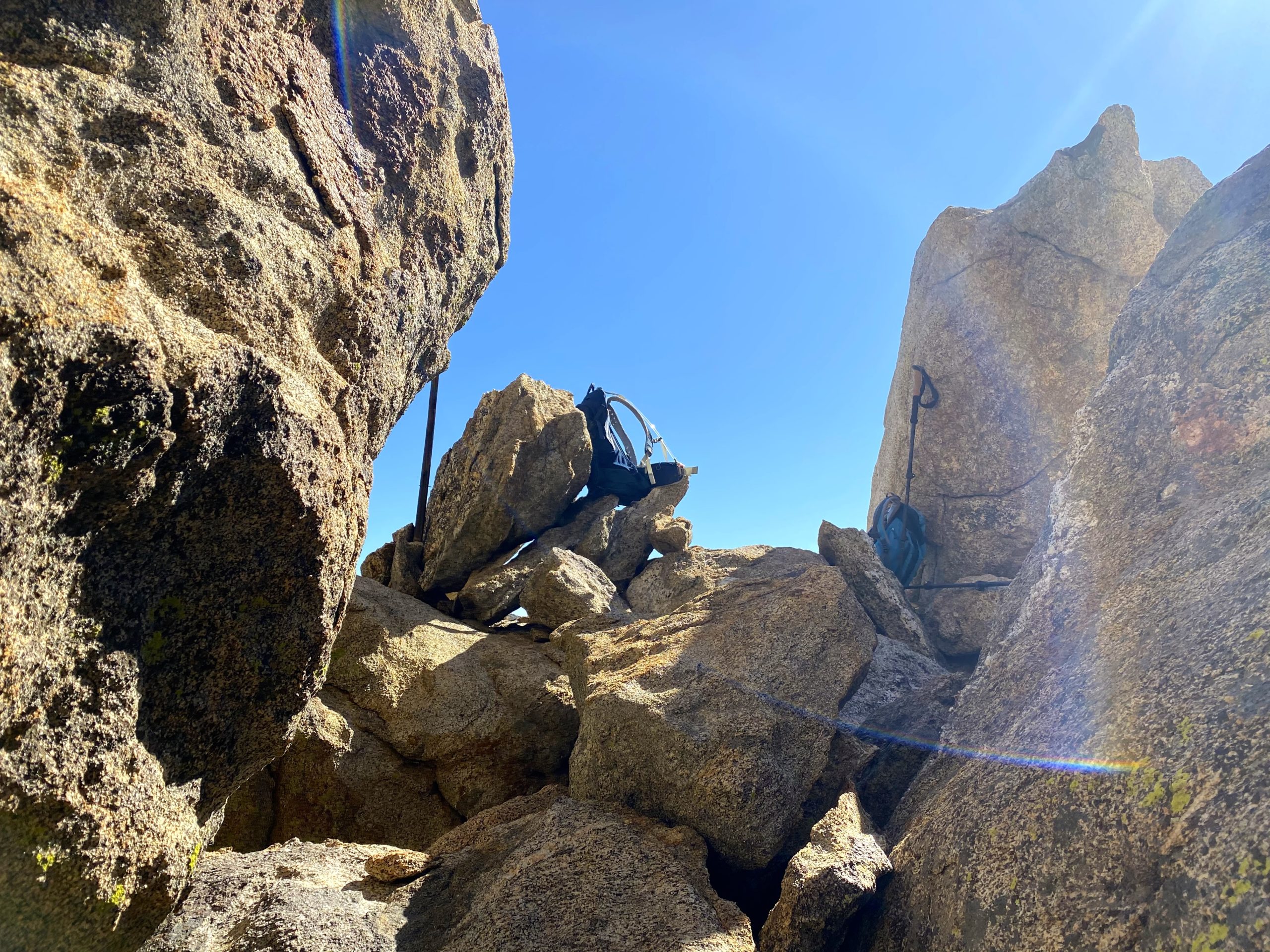
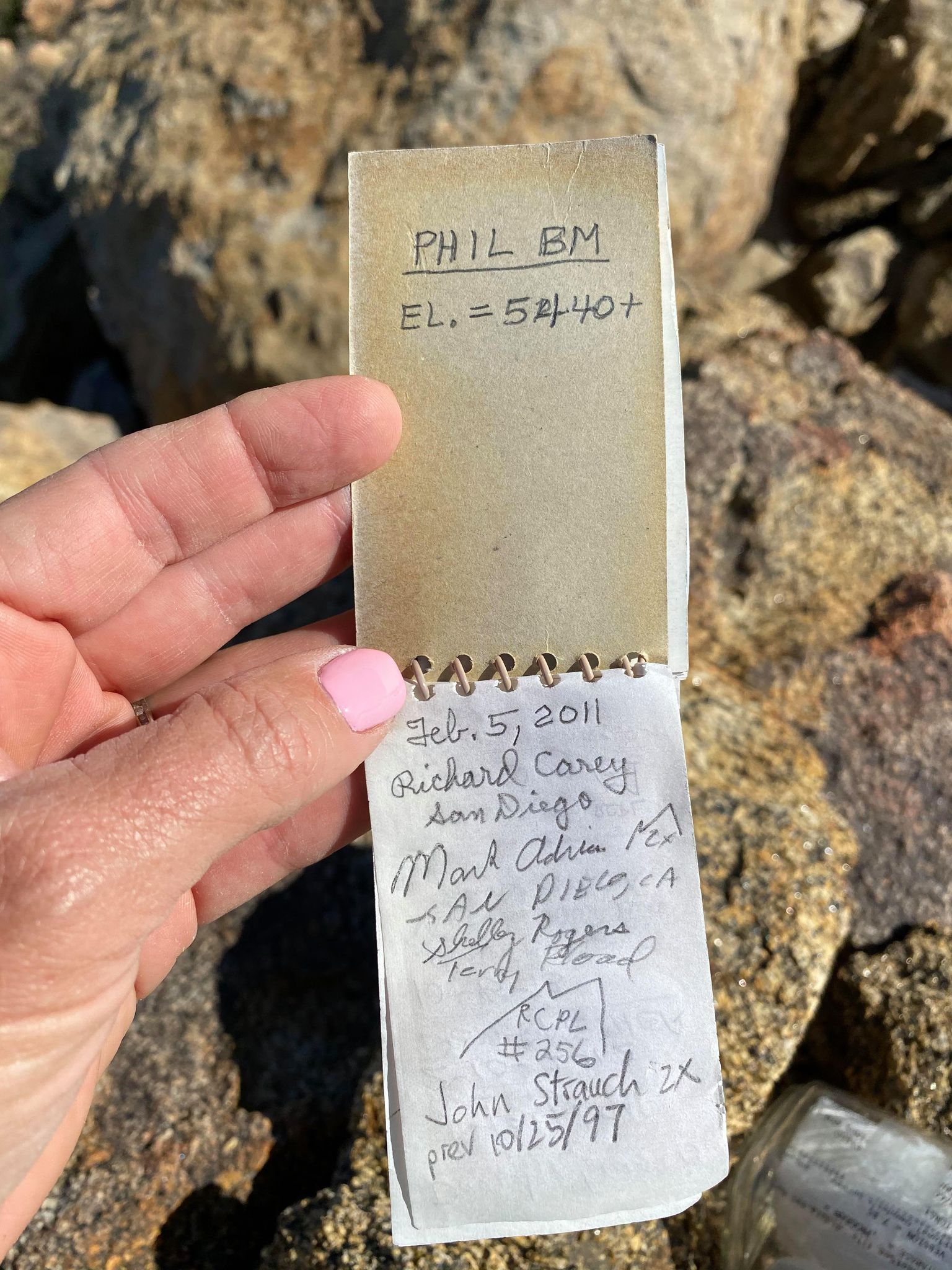
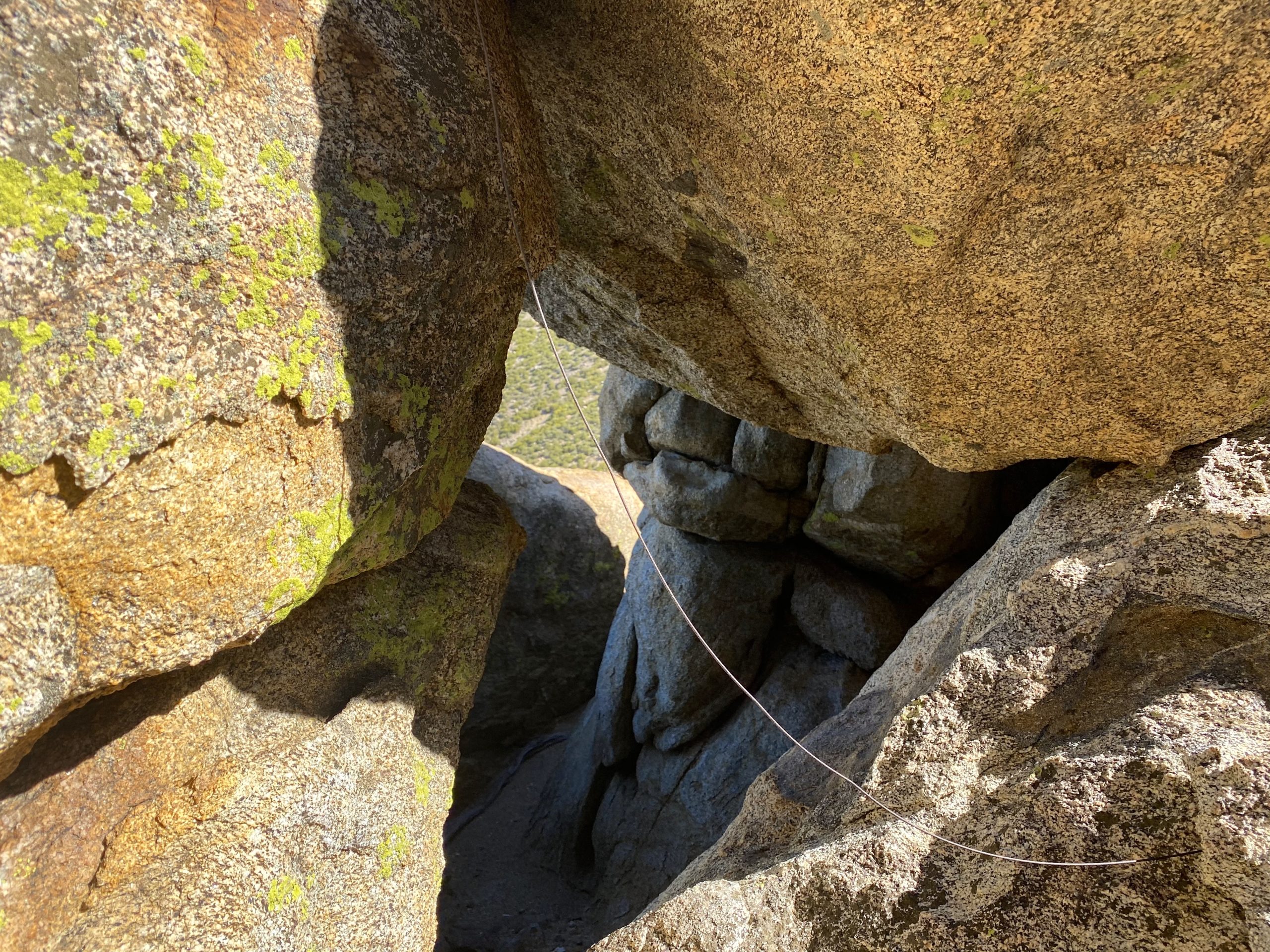
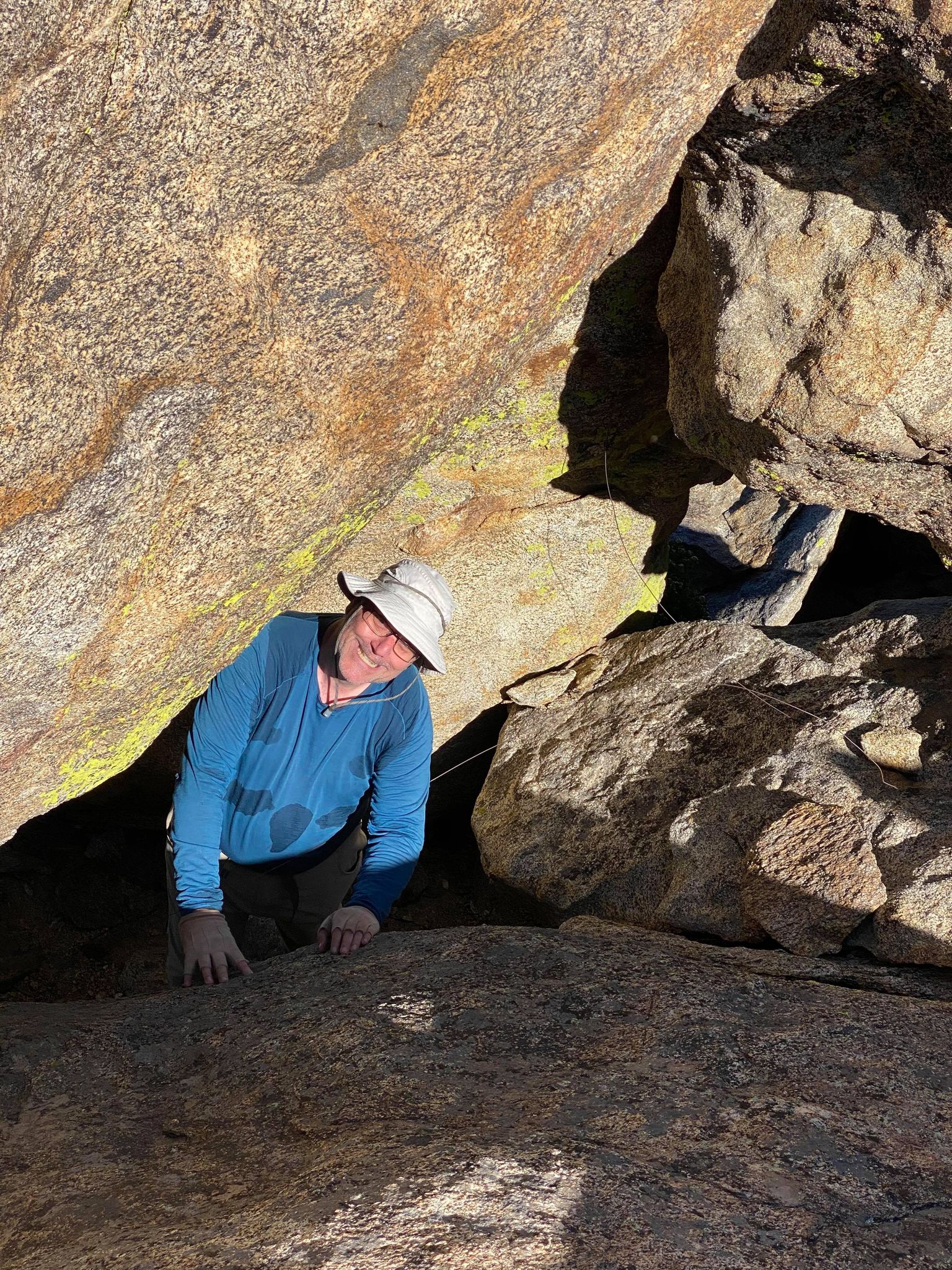
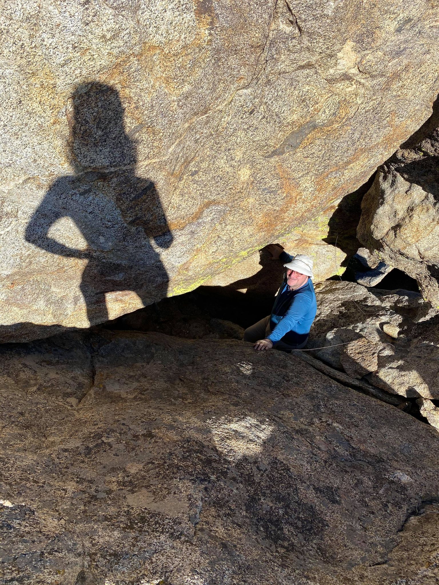
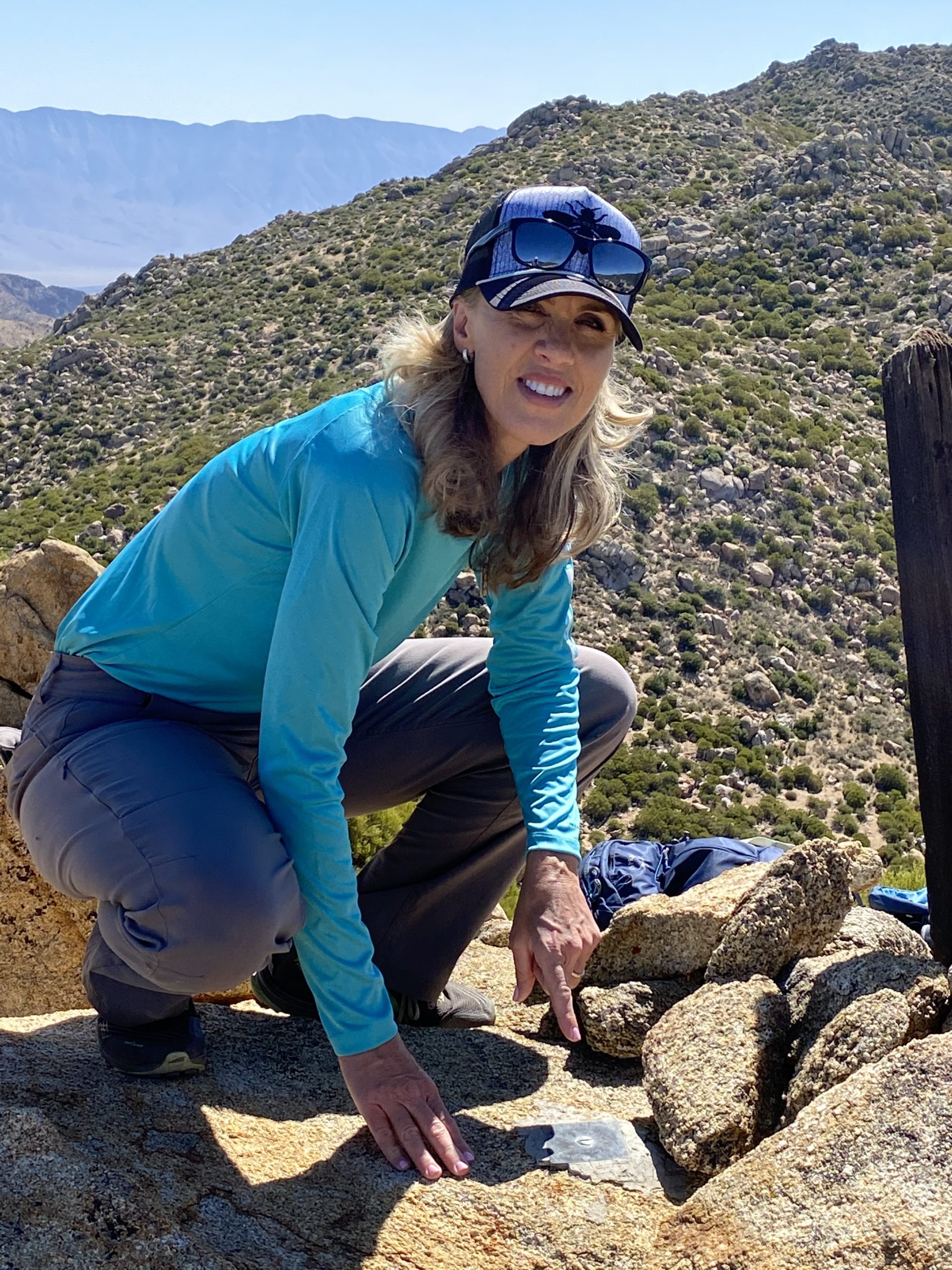
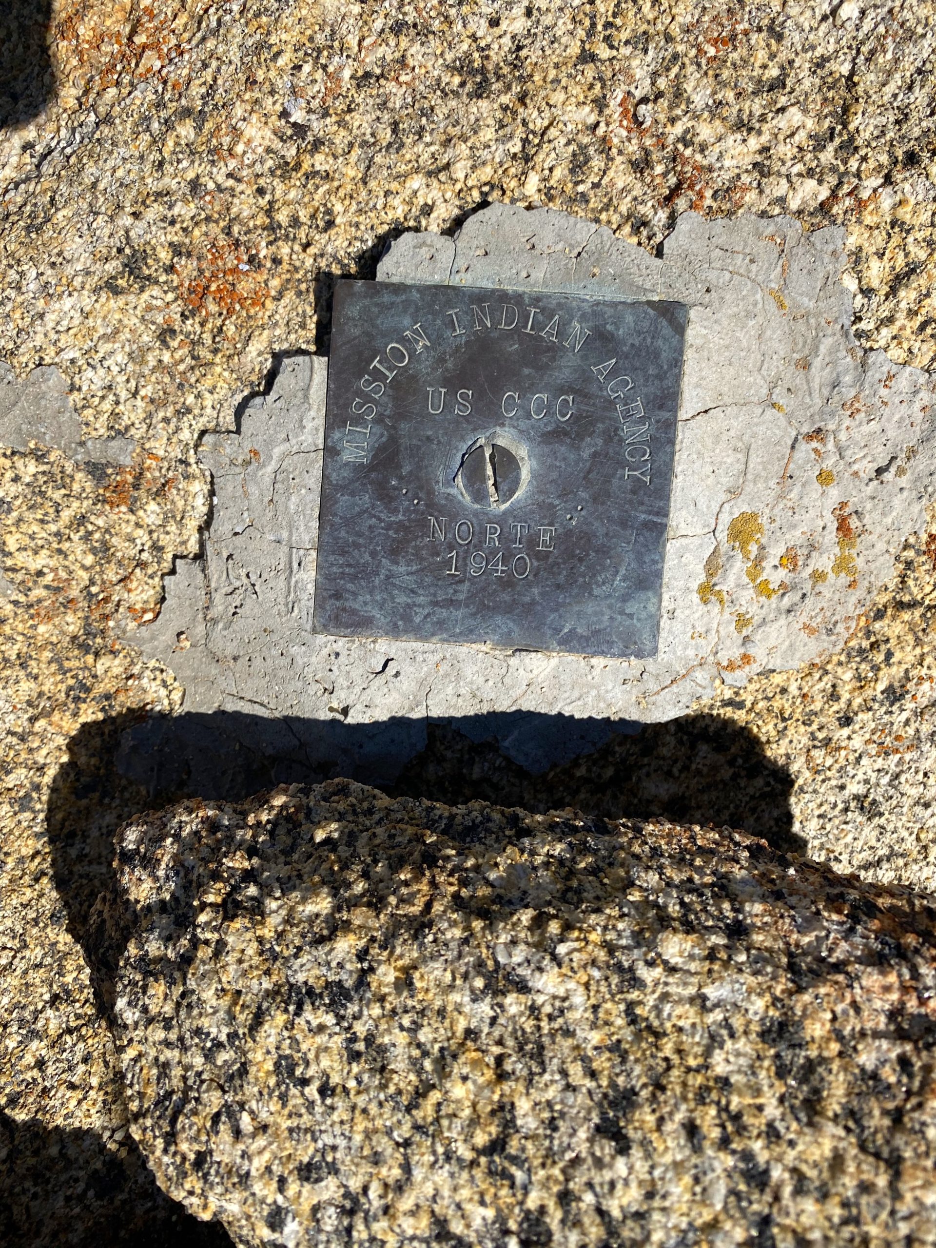
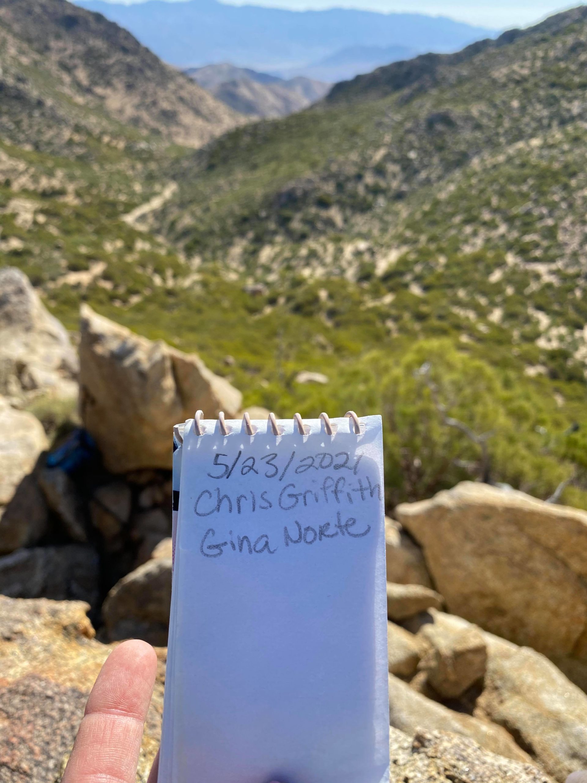
I returned back to Gina, and we set off for our primary peaks, Phil and Norte Benchmarks. I had spotted what appeared to be a descent route up earlier, so took it up the slope. In hardly any time at all, we found ourselves next to the summit of Phil. I spotted the register in a glass jar sitting high up on the summit block. Below it was some of the guidewires for the survey post. Gina carefully scrambled up the rocks and signed us in. Meanwhile, I poked around and found a passage under the summit block that gave us a nice route toward our next peak, Norte. We relaxed and chatted for a while, and also surveyed the surrounding terrain for how we might visit the other nearby peaks. We were in no hurry, so we just sauntered toward Norte.
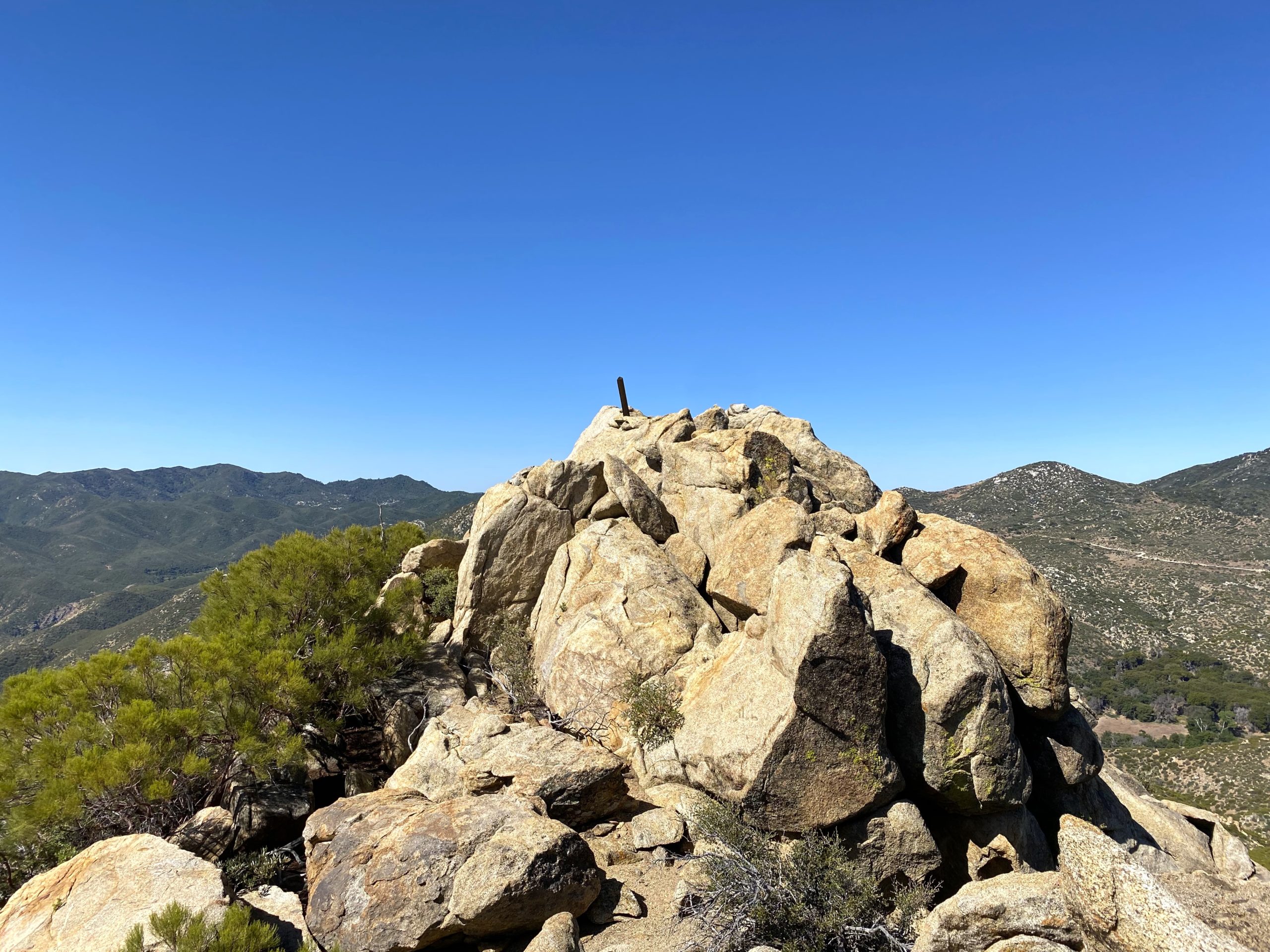
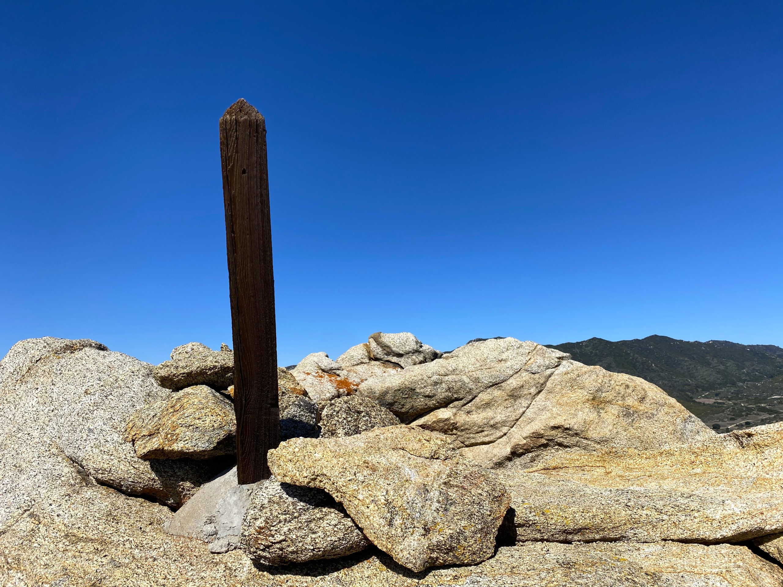
Jim Wick had done Phil and Norte a number of years back, and in his trip report, he mentioned that the approach to Norte was almost a walk up from the south side. So we looped around and his report was spot on. This was a special summit for Gina, as this peak was named in honor of her husband’s family. In fact, the benchmark is different from the regular USGS ones. We proudly signed the register and again took in the views. Since we both were feeling great, we decided to keep on exploring. Almost directly to our south stood Cody Benchmark. Gina had also wanted to climb it, so off we went. I had summited it with Susie Kara back in June of 2020, but we tackled it from the north up a steep and rocky route. This time, Gina and I worked our way along the ridgeline, staying on its northern side. Soon, we found ourselves at the saddle just below the summit and the short climb up.
We relaxed on the summit for a good while, soaking in the view, having a snack, and enjoying a little bit of cell coverage. I showed Gina the route Susie had taken down from Pike and up to Cody. Then looking back west toward Phil and Norte, we could see the difference between the south and north sides of the ridge. While Phil Benchmark was just a mere .7 miles to our north, I had no desire to take the direct route, especially having done the reverse. So, we roughly retraced our route to the saddle.
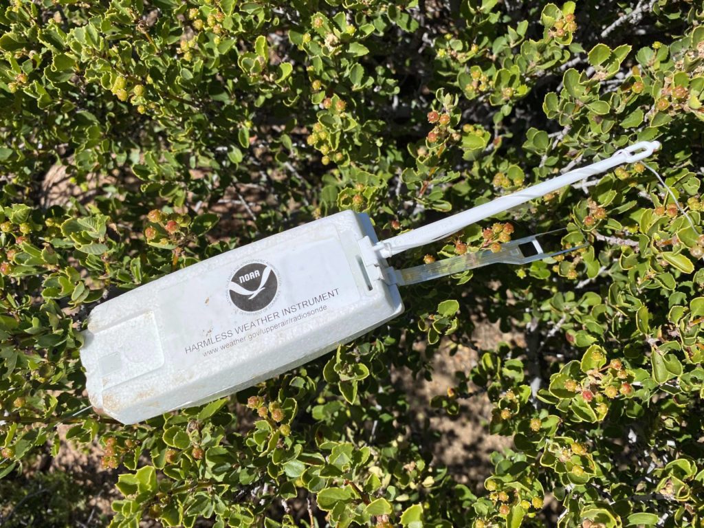
Along the way, I spied a string running from plant to plant. I suspected it was probably a weather balloon of some kind. We located the beacon, then followed the string to see if any remains of the balloon could be found. We only found the plastic hook, so we gathered up the items and stowed them in our pack.
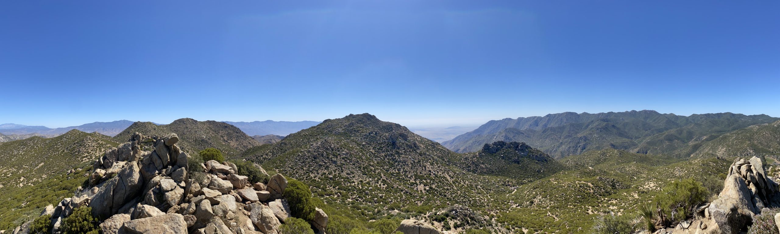
Still feeling good, we set off for our fourth peak of the day, Army Benchmark. This provisional peak sits just north of the saddle. We followed the main ridgeline up toward it. There were two possible bumps that it could be. Once we reached the first one, we did not see any signs that this was it, so we moved on to the next bump, a mere 300 feet away. Here, we did find some remnants of the surveying post. We found a nice spot for our lunch. From my spot, I could see Collins and Knob off to our north. We once again had some cell coverage and got a message that Dale and Alberto had reached Palm Mesa High Point. This let us begin to estimate when they might return. We debated if we should head west and summit Dry Benchmark, or push on and try for the Pikes. Still feeling adventurous, we set off for Pike Benchmark Summit and Pike Benchmark. Since we were on the ridge, we opted to stay on it as we worked our way over. Just to the west of Pike Benchmark Summit is a nice saddle. We walked over to its northern edge and had a sweeping view. Cougar Canyon was below us, SquareTop, Collins, Knob, Palm, and Elder were spread out before us. The final push up to Pike Benchmark Summit was a bit bouldery, so I continued my route finding and weaved our way up it without issue.
Once on the summit, we could see Pike Benchmark just a stone’s throw away to the east. We again took in the views and signed the register. Rather than taking the direct approach to Pike Benchmark, we went north a bit, then across the minor saddle and up to the summit. If memory serves, Susie and I just charged straight across.
As I stood atop my sixth summit of the day, I had to chuckle to myself. Initially, I thought I might just do two peaks, but here I was on #6 of the day. As an added bonus, I was a little closer to finishing the San Diego Sierra Club 100 Peaks list again. We scanned the wash below us to see if we might spot Dale or Alberto, but no luck. Gina and I discussed our route back, one option was to drop down from Pike all the way to the wash and climb back to the saddle, which was probably about 500 feet of gain once we dropped down. Or, we could follow the contour lines and sidehill it back to the saddle. That was the option we decided on, as it was getting a bit warmer in the mid-afternoon sun. I picked various landmarks to work our way toward, adjusting as the terrain revealed itself to us. After about 45 minutes or so, we found ourselves back at the saddle. When I was at the saddle in the morning, there was a cactus that was in full bloom, so I had to find it again since that is something that Gina loves to find.
Although we had not seen nor heard Dale and Alberto, we felt that we should probably head back, just in case they had slipped past us. We cruised back down the wash and back to our cars. We arrived about 4:30 and neither of them was there. We did some calculations of when they might arrive, and we loosely estimated they had at least another hour or more of hiking, depending on if they tried for eighth Cody or Pike on their return. I followed Gina back to the locked gate, and she let me through. I said my goodbyes and headed home. Gina returned to wait for them. She told me they arrived around 6:15 or so. I will let them tell their own adventures. But for us, it was an absolutely fantastic day; six peaks, 6.9 miles, and 1,715 feet of gain!
I am an avid peak bagger, sometimes backpacker, and former sea kayaker living in San Diego. In 2019, I became the third person to complete the San Diego 100 Peak Challenge. Not stopping with that accomplishment, I set my sights on the harder San Diego Sierra Club 100 Peak list, which I completed in 2021. In addition, I have conquered several Six-Pack of Peaks challenges (SoCal, San Diego, Central Coast, and Arizona-Winter). Beyond attempting the San Diego Sierra Club 100 Peak list a second time, I am looking forward to exploring new summits and new adventures across the southwest.