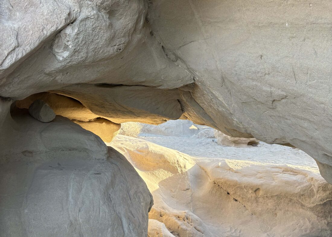
After camping somewhere along Fish Creek Wash, we stopped at the Wind Caves on our way out. We followed the trail up out of the wash and worked our way 0.5 miles to them. I have been here twice before, but previously just made a quick stop before heading on toward the summit of Split Mountain East, so I never really explored them. This time we took our time to explore the area. There are some pretty big caves off to the south of the main trail.
Since we opted not to have a real breakfast at camp, we both were starting to get hungry, so we wrapped up our exploration of the caves and headed back to the car. We had an uneventful drive back out, and before too long a nice hot breakfast at the Red Ocotillo in Borrego Springs sat before us. A nice way to cap off three days and two nights of desert adventures with my son.
I am an avid peak bagger, sometimes backpacker, and former sea kayaker living in San Diego. In 2019, I became the third person to complete the San Diego 100 Peak Challenge. Not stopping with that accomplishment, I set my sights on the harder San Diego Sierra Club 100 Peak list, which I completed in 2021. In addition, I have conquered several Six-Pack of Peaks challenges (SoCal, San Diego, Central Coast, and Arizona-Winter). Beyond attempting the San Diego Sierra Club 100 Peak list a second time, I am looking forward to exploring new summits and new adventures across the southwest.
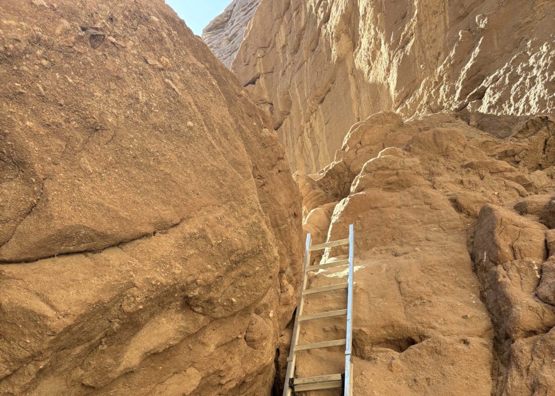
Since we had camped at Cottonwood Campground in Joshua Tree National Park, it was a relatively short drive down to the trailhead to Ladder Canyon. I have wanted to do this trail for some time, but it is an almost three-hour drive from San Diego. We pulled into the parking lot for the hike and gathered our gear. It was warm, but not hot, as we set off up the canyon.
After about 0.4 miles the trail splits, and we decided to follow the standard route of doing the “lollipop” in a clockwise fashion. Ben squirmed through the small cave and up a small ladder, while I took the bypass. From there we ascend, and in one spot descend, a variety of metal ladders that have been placed. Our route took us through the canyon which at times was just a narrow slot.
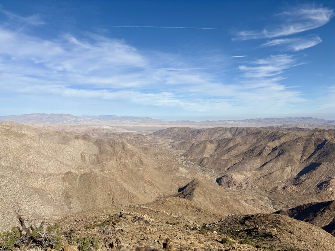
After about 0.6 miles in this canyon, we climbed out of it and onto a ridge. Taking in the views of the Mecca Hills, we followed the ridge northward for a mile. We took a short break at the top of the hill before dropping down to the canyon we would follow to return to the trailhead.
This canyon was nice and wide with walls that were ever-changing in their geology. Some looked like a scene from Indiana Jones…
As we neared the junction, we had two more ladders to descend. These took a little care, as there was some downclimbing before you reached the ladders. In fact, one had a rope to assist (although it was actually placed there to help those hiking the loop in a clockwise direction). I simply slid down the smooth rock, while Ben opted to use the rope.
Soon we were back at the junction. While the day was warm, which we felt up on the exposed ridge, usually the high canyon walls gave us some nice shade. Both of our stomachs were starting to growl, so once back at the car we headed into Mecca for a well-earned lunch. A fun adventure that I was glad to have shared with my son.
I am an avid peak bagger, sometimes backpacker, and former sea kayaker living in San Diego. In 2019, I became the third person to complete the San Diego 100 Peak Challenge. Not stopping with that accomplishment, I set my sights on the harder San Diego Sierra Club 100 Peak list, which I completed in 2021. In addition, I have conquered several Six-Pack of Peaks challenges (SoCal, San Diego, Central Coast, and Arizona-Winter). Beyond attempting the San Diego Sierra Club 100 Peak list a second time, I am looking forward to exploring new summits and new adventures across the southwest.
With Ted watching the Army-Navy game, I decided to join Rick & Andrea on their hike out to Gasp Benchmark. I offered to drive again, and we met in the pre-dawn at the park-and-ride near my house. I drove us out to McCain Valley and then made the turn onto the rough dirt road toward Sacotone Overlook. This is the same road that will take you to the trailhead for Mt. Tule. It has always been a bit rough, but it has deteriorated quite a bit. It was almost as adventurous as the drive to the trailhead to Groan Benchmark (just without the rocks).
I parked in my usual spot, and we gathered our gear and set off down the road. It was crisp, but we knew it would warm up quickly. We cruised down toward Redondo Springs, chatting about recent hikes. This hike is inverted, so we mostly go down to the peak, and then get to climb back up to the car.
The miles passed quickly, and soon we were on the rocky ridge working our way carefully toward the benchmark. Unlike last time, the winds were calm. We weaved our way across the steep and rocky terrain toward the summit.
Once at the summit, we hung out a bit, had a snack, and snapped some photos. We did not locate the register. We did find a Six Moon design sun umbrella sitting on a rock. I packed it out, so if you recently climbed Gasp Benchmark and left one behind, let me know.
We began our return to the car, climbing back up the rocky ridge, onto the dirt road, and finally back to the car. We enjoyed a nice lunch at Mike Hess Brewery in Alpine before returning to San Diego.
I am an avid peak bagger, sometimes backpacker, and former sea kayaker living in San Diego. In 2019, I became the third person to complete the San Diego 100 Peak Challenge. Not stopping with that accomplishment, I set my sights on the harder San Diego Sierra Club 100 Peak list, which I completed in 2021. In addition, I have conquered several Six-Pack of Peaks challenges (SoCal, San Diego, Central Coast, and Arizona-Winter). Beyond attempting the San Diego Sierra Club 100 Peak list a second time, I am looking forward to exploring new summits and new adventures across the southwest.
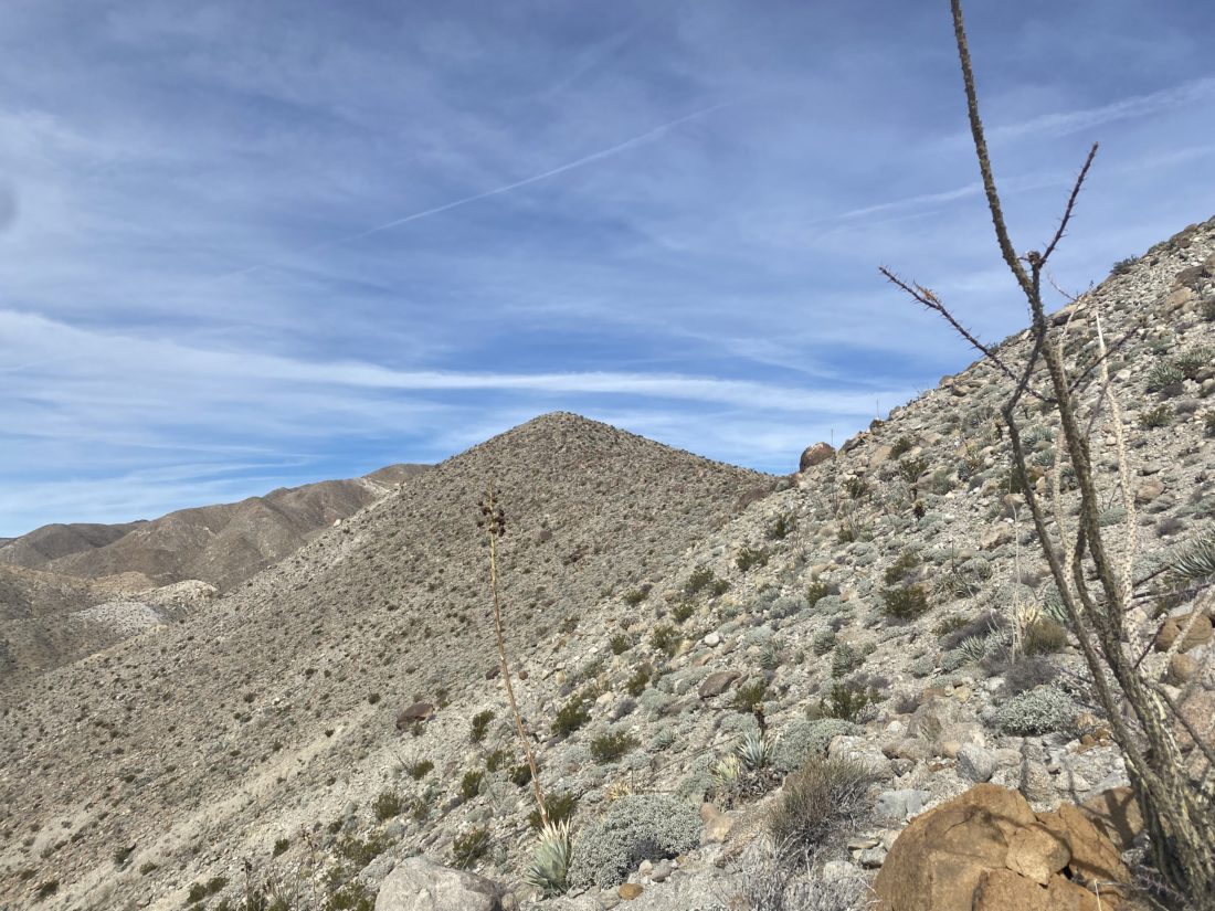
Today’s adventure was to summit Sombrero Peak. I had climbed this peak twice before—The first time I went solo and started from the Indian Canyon trailhead and went up and back. The second time, I was with a group, and while we started at the same trailhead, we descended the west face of Sombrero Peak, then went cross-country to climb False Sombrero. This time I opted to try climbing the peak from McCain Valley. Ted needed to be back in town for an early evening engagement, so that meant a very early start to the day.
Turning off the 8, we then turned onto McCain Valley Road. We passed the turn-off to Mt. Tule, and then the turn off at the trailhead to Gasp Benchmark. Finally, we reached Cottonwood Campground and turned in. There is a $6 day-use fee, which thankfully I knew about and had cash to slip into the envelope. After making use of some extremely clean pit toilets, we gathered our gear and set off down the Pepperwood Trail. Our route would zig-zag north and east toward the peak. We had caught a glimpse of its unique shape on the drive to the trailhead.
We cruised along, with the trail being a mix of motorcycle tracks and roads, allowing us to make good time. Along the way, we passed an old barn and corral. The trail would rise and fall as we drew nearer to the peak. Finally, we reached the point where we would begin the cross-country portion of the hike. Weaving past the cat-claw bushes and the cacti, we reached the base of the peak, near a very faded sign indicating it was Sombrero Peak. We took a break before beginning our ascent. I reviewed Greg Gerlach’s track that I had loaded into OnX and tried to plot our way up the boulders. We followed a faint use-trail for a bit until it faded away. I remembered following cairns before, so I began scanning the boulders for tell-tale signs of the route. I spotted some and we continued upward. As we drew closer, our route drifted from Greg’s, so we worked our way back toward the southern side of the peak. I made one slightly exposed move to get us back on track, while Ted was able to scramble around it, as that is not his thing. The route now seemed a tad more familiar, and a string of cairns quickly led us to the summit.
A register can and summit sign were tucked in the rocks, and I signed us in and snapped a photo with the sign. I showed Ted the east face of the peak and what the route from that side looked like. He thought this was a better choice, even with the 4.75 miles to the base of the peak. I mixed up some electrolytes and enjoyed a Kind bar and oranges before beginning our descent.
Our route down was much easier, but that typically seems to be the case. Back on the trail/road, we cruised toward the car. The day had warmed slightly, and I started to feel the effort a bit. With about a mile to go, I realized I missed a turn, but with the myriad of motorcycle trails and having downloaded the satellite imagery, I spotted another connecting trail that would lead us to the campground. As we approached the campground, four motorcycles rode past us. These were the first ones we had seen all day and I had honestly expected to see more. Back at the car, we tossed in our gear, changed, and then headed toward Mike Hess Brewery in Alpine for some well-earned pizza and beverages. My tracker clocked us at 10.0 miles (Ted had 10.25 on his Garmin) in 5:15 (including time on the summit). All in all, a great day out peakbagging. Plus, Ted is one peak closer to finishing the San Diego Sierra Club 100 Peak list…
I am an avid peak bagger, sometimes backpacker, and former sea kayaker living in San Diego. In 2019, I became the third person to complete the San Diego 100 Peak Challenge. Not stopping with that accomplishment, I set my sights on the harder San Diego Sierra Club 100 Peak list, which I completed in 2021. In addition, I have conquered several Six-Pack of Peaks challenges (SoCal, San Diego, Central Coast, and Arizona-Winter). Beyond attempting the San Diego Sierra Club 100 Peak list a second time, I am looking forward to exploring new summits and new adventures across the southwest.
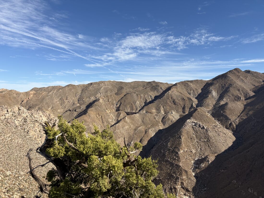
I stood in predawn in the park-and-ride, clutching my warm cup of coffee while waiting for Rick and Andrea to pull up. Today’s adventure was hopefully to be climbing to the top of Groan Benchmark out in the southern portion of Anza-Borrego. This was going to be the first peak of this year’s desert season and we were looking forward to it. We made our way out past Ocotillo and to the turn-off to Carrizo Gorge. We stopped for Rick to set up the camera for some footage for their YouTube channel.
I debated about airing down my tires but opted not to. Rick got his footage and off we went. This was the biggest uncertainty of this hike—could I drive my Outback to the actual trailhead, or would we have to stop early and begin from that point? The first time I hiked Groan, Matt Hanan took us in his Jeep, so there were no issues with the 6.7 miles of off-road adventures. The other time I had been back down this road was also in another 4×4. The road started off pretty sandy, but we got through that without incident. As the canyon narrowed, the road became rockier. With some care and my upgraded tires, we got through it all and arrived at the trailhead. On the flip side, the check engine light came on, and both the Eyesight and X-mode were not working. Great….. At this point, though, we opted to do our hike and see what happened with the car on our return.
With our packs on us, we set off. I opted to use my Daylight Plus instead of my Stratus, as I wanted to go a little lighter this time. After filming our walk-away shot and then getting the camera, we set off down the gorge. Our plan was to follow the same route we used during our descent from Groan back in 2020, and Greg Gerlach and Susie Kara used it when they did the peak in 2022.
The wash was a solid bed of smooth rocks, so we had to be mindful of our steps. After a bit, we made the short scramble up to see the pictographs adorning a small cave on the east side of the canyon. Once we were done marveling at them and wondering what various symbols truly meant, we turned back to the wash and trekked on. The weather was pleasant, albeit a touch warm. Originally, we had discussed car camping, as there was another peak I wanted to climb from the same trailhead, but a forecast for possible rain made that unwise.
We could see some trestles for the railroad along the east side of the gorge, but not the famous wooden trestle. That would not be visible until we reached the summit. We spotted the wash that would begin to take us westward. Cruising along, we came to the first of two dry falls we would need to climb over. Thankfully, both were passable without too much difficulty.
Our real issues were around the vegetation that grew along the canyon floor. We had to push through several sections of brush to continue. One section was pretty nasty, as it was choked with thorny plants. We were not looking forward to fighting our way back through that section. At the small palm grove, we stopped for a snack and some hydration, as we were getting closer to exiting the canyon floor and starting toward the summit. It was about 72°F or so in the shade, and I wished I had more fluids with me.
With our break over, we continued on for about .1 miles, and then up we went. Groan Benchmark was finally in view. Between avoiding the cacti and the steepness of the slope, we tended to follow a switchback-like pattern. Once atop the small bump, we had some side-hilling to reach the saddle next to the peak. I am not a fan of side-hilling (but who really is?) but we traversed that section without incident. As I reached the saddle, I could feel myself starting to bonk. I had been conserving my water and probably could have had another snack as well. The summit wasn’t that far away, so I pushed on. From the saddle, we would go up three fairly steep bits before finally reaching the summit proper. Once there, I plopped down, enjoyed my Gatorade, ate my lunch, and relaxed.
The view was stunning. Across the gorge is the Goat Canyon Trestle, and I wondered how many hikers made their way along the abandoned railroad tracks to walk across it. Next to it stood Puff Benchmark, which I have twice stood atop. Feeling better, I snapped a few photos and hunted for the register, which we could not locate. I tested out the satellite communications options on my new iPhone and let my wife know my status and that of the car. I am not ditching my Garmin InReach, but having a secondary communications device is useful, especially since I am already carrying it.
The descent went fine, and we discussed our favorite shows on Apple+ while watching our footing. The shadows were starting to get longer, and I realized I forgot to pack my regular glasses. We worked our way down those dry falls without any issues and scrambled up the south side of the canyon to avoid most of that thorny section. I motored ahead of Rick and Andrea to race against the fading light. Along the way, I found some cairns, which did allow for some slightly faster traveling. Soon, it was too dim, so I took my glasses off. Thankfully I could see well enough without them to hike at a decent pace. Once back at the car, I put on my regular glasses and enjoyed some cool water, and about 15 minutes later, Rick and Andrea arrived. We did not linger too long, as we still had to drive back out and the owner’s manual did not provide any real insight on the warning lights.
Once past the rocky sections, I felt relief. Even if we had a real issue, we were now in someplace more accessible to be recovered. As we cruised along the sandy portion, we spotted a young man walking along the road. We stopped and he asked if this was the road to Bow Willow campground. We informed him it was just a bit to the north of this road. It turned out he and his companion had gotten their Hyundai stuck in the soft sand, and he had been walking for a bit trying to find the campground with their buddies to help with a recovery.
He hopped in and we continued our drive out. After about a mile, there was the yellow Hyundai with its front wheel partially buried in the sand. Rick, myself, and our guest tried to see if we could give it a push to free the car, but it did not move. Since they had help back at the campground, and where they were stuck was actually not too far from the main road, we left the car as-is. We drove him to his buddies while his partner stayed at the car. As we neared the campground, the sun had set, so it took a bit to locate his friends’ site. As we drove away, we commented how lucky he was that we came along. He had no water on him and probably would have kept walking down the road for at least another mile before making the call to turn back. By that time, he would have been hiking in the dark, with the flashlight on his phone as the only source of light.
Back on the S2, we continued the long drive home. I took it a bit slower up from the desert, but knew we would now be back in “civilization” and my car anxiety lessened. All in all, quite a day. A good solid desert hike, got to cross off a peak from the San Diego Sierra Club list, helped some stranded people, and enjoyed some quality hiking time with some friends.
Update: I disconnected and then reconnected the car battery and the warning lights cleared. This issue has occurred before to other Outback owners, but I will be mindful of it over the coming days.
I am an avid peak bagger, sometimes backpacker, and former sea kayaker living in San Diego. In 2019, I became the third person to complete the San Diego 100 Peak Challenge. Not stopping with that accomplishment, I set my sights on the harder San Diego Sierra Club 100 Peak list, which I completed in 2021. In addition, I have conquered several Six-Pack of Peaks challenges (SoCal, San Diego, Central Coast, and Arizona-Winter). Beyond attempting the San Diego Sierra Club 100 Peak list a second time, I am looking forward to exploring new summits and new adventures across the southwest.
We made the short drive down from the Pena Springs Trailhead to the Hellhole Canyon/Maidenhair Falls Trailhead. I slipped the $10 into the fee slot, while Ted used the facilities that those fees help fund. Four cars were in the parking area already. I wondered if they were hikers out to view the falls early, or were they out hiking some grander adventure? This is the same trailhead that we use when climbing up to Webo Benchmark. After grabbing our gear and snacks, we set off. Soon we reached the junction with the California Riding and Hiking Trail and began our climb up toward Rass Benchmark.
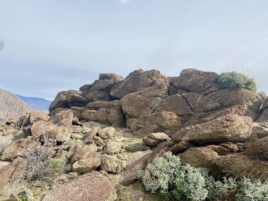
The trail was in better condition than the section we were just on, as being lower, there was less water damage. We could see various plants and cacti starting to begin their spring blooms, but it was still just a bit too early for anything of note. After about 1.3 miles, I began scanning ahead, trying to spot the benchmark. The CRHT basically passes right over it, so I knew I would have to look too hard for it. There, just to the north of the trail, stood a small cluster of rocks. Checking our map, that appeared to be it, so I walked over and spied a reference mark. Welcome to the summit of Rass Benchmark.
Scrambling up, I found the actual benchmark and a register tucked down in the rocks. As I ate my snack, I thumbed through the register, reading many familiar names, and then on a blank page added our own. We snapped our photos and began our descent. The neck was doing ok, but we were starting to think about a real lunch. I had planned to hike over to Hans Benchmark which was nearby, but neither of us felt like doing it. Instead, I pitched driving over and doing Woods Benchmark. It is located near the Borrego Air Ranch, southeast of town. We made the short drive over, sticking to the dirt road that goes around the Air Ranch, and parked at the base of the bump. It really is just a bump on the desert floor. Although we could have driven up, we chose to walk the ¼ mile to the top. There was a concrete block with a mark embedded, so we felt somewhat rewarded.
We snapped a couple of quick photos, then back to the car and into town. We opted to try Carlee’s for lunch. With our hunger resolved, we bid farewell and made the uneventful drive home.
I am an avid peak bagger, sometimes backpacker, and former sea kayaker living in San Diego. In 2019, I became the third person to complete the San Diego 100 Peak Challenge. Not stopping with that accomplishment, I set my sights on the harder San Diego Sierra Club 100 Peak list, which I completed in 2021. In addition, I have conquered several Six-Pack of Peaks challenges (SoCal, San Diego, Central Coast, and Arizona-Winter). Beyond attempting the San Diego Sierra Club 100 Peak list a second time, I am looking forward to exploring new summits and new adventures across the southwest.
Initially, I considered hiking Volcan Mountain to get it done for this year’s 6-pack of peaks challenge. But I realized I could hike it almost anytime, so instead I looked at some options out in Anza-Borrego. I still needed to be mindful of my neck issues, so I settled on trying a few easier ones on the Borrego Benchmark club list. First up was Wee Benchmark. Ted carefully drove up the dirt road to the Pena Springs Trailhead and parked at the turnaround. We grabbed our gear and set off.
Our route followed the California Riding and Hiking Trail for about a mile, making its way up. Soon, Wee Benchmark came into view, we continued on until we were directly south of it, then made the short cross-country climb to its summit.
There we found the benchmark and two registers. I signed us in, while Ted wandered around snapping a few photos. We gazed over toward Hellhole Flats and the various summits that stood out. Since we were hoping to climb a couple more peaks today we headed back down. Once back at the car, we tossed in our gear and headed to our next adventure, Rass Benchmark.
I am an avid peak bagger, sometimes backpacker, and former sea kayaker living in San Diego. In 2019, I became the third person to complete the San Diego 100 Peak Challenge. Not stopping with that accomplishment, I set my sights on the harder San Diego Sierra Club 100 Peak list, which I completed in 2021. In addition, I have conquered several Six-Pack of Peaks challenges (SoCal, San Diego, Central Coast, and Arizona-Winter). Beyond attempting the San Diego Sierra Club 100 Peak list a second time, I am looking forward to exploring new summits and new adventures across the southwest.
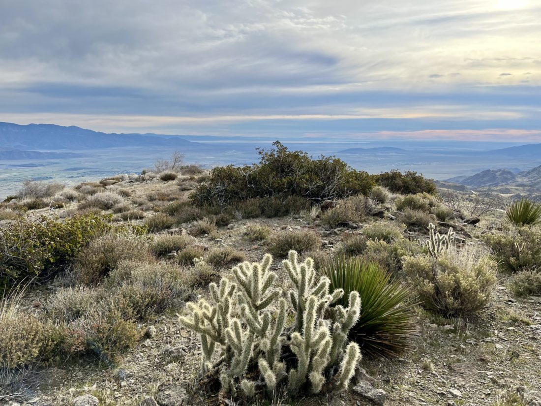
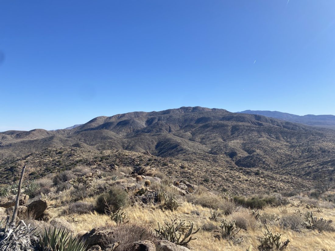
Decided to try to knock off one of my 20 remaining San Diego Sierra Club x2 peaks on Sunday. Susie also needed to climb Pyramid Peak again, so she opted to come along. Sadly, Ted wasn’t feeling up to a hike of this difficulty and waved off joining us. We pulled into the same parking area used to start the long journey up Villager Peak. About 4 cars were already parked here, as well as Rick and Andrea who would be joining us on this trek. I had hiked with them a few times in the past, and since they were also working on both the 100 Peak Challenge and the San Diego Sierra Club 100 peak list, why not try to coordinate some attempts together? After introductions were made, we all finished getting ready. They run a YouTube channel, so they would be stopping from time to time to set up a camera for various hiking shots. The first part of the hike was across the flat open desert toward the wide Palo Verde wash, about a mile or so to our northeast. Since the sun was up, I had no trouble navigating us toward it. Once in the semi-rocky wash, I kept an eye out for the exit out of it onto an old Cahuilla trail. Around some smoke trees, I spied it, double-checked my GPS track, and climbed up.
The trail would steadily climb about 650 feet over the next ½ mile. Part way up, across the canyon, we spotted the remains of an old molybdenum mine. On some maps, it is referenced as the Prospect Mine, but many just refer to it as the Moly Mine. As in Derek’s trip report, we also spotted a bone along the side of the trail. Andrea was not feeling 100% and was hiking at her pace. We would stop from time to time to regroup and verify that we were still good to continue. Once we reached the pass between the two washes, we got our first glimpses of Pyramid Peak off in the distance. After a short flat section, we dropped down into Smoke Tree Wash. This section took a bit of care, as the trail was narrow and the drop-off was pronounced. Thankfully, we were quickly across this portion and down in the wash. We again verified that we were still good to continue on up the wash for a short bit.
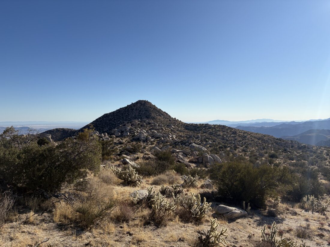
A cairn marked the exit from the wash onto the first of two ridges we would take to the summit. The trail would become steeper, with about 1,300 feet of gain over the next 1.1 miles, and the footing a bit looser. After a bit, it was clear our hiking paces were diverging, so we opted to split up. The route was fairly clear, and I did not feel that navigation was going to be an issue for anyone. I plodded along the trail, keeping my head down, in part to avoid the wind, and pushed toward the next ridge. Once on the second ridge, we looked back for Rick and Andrea and saw they remained a good ways back. After about 1⁄4 of a mile, we reached the summit. A nice-sized cairn stood there, with an ammo back holding the register. The views were sweeping, but the wind was blowing around 30 mph, so we knew we were not going to linger too long. We had our snacks and snapped some photos. In signing the register, we learned that Steve Fausset had passed. Susie had hiked with him once and I was familiar with his name from various registers scattered across a myriad of desert peaks.
As we made our descent, Rick and Andrea were still pushing toward the summit. We knew they were experienced hikers and we did not need to worry too much about them, so after chatting a bit we let them keep climbing while we made our careful descent.
The descent went fun until I slid and got a collection of chollas stuck into my left hand. That was painful to pluck out! Finally, we reached the wash and the 1.5 miles back to the car. I sent a text to Rick that we were down, and sometime later they did the same. Overall my neck and back did pretty well. I logged the hike at 8.1 miles with 2,824 feet of gain. Our total travel time was 7:13, but that included several breaks as we regrouped.
I am an avid peak bagger, sometimes backpacker, and former sea kayaker living in San Diego. In 2019, I became the third person to complete the San Diego 100 Peak Challenge. Not stopping with that accomplishment, I set my sights on the harder San Diego Sierra Club 100 Peak list, which I completed in 2021. In addition, I have conquered several Six-Pack of Peaks challenges (SoCal, San Diego, Central Coast, and Arizona-Winter). Beyond attempting the San Diego Sierra Club 100 Peak list a second time, I am looking forward to exploring new summits and new adventures across the southwest.
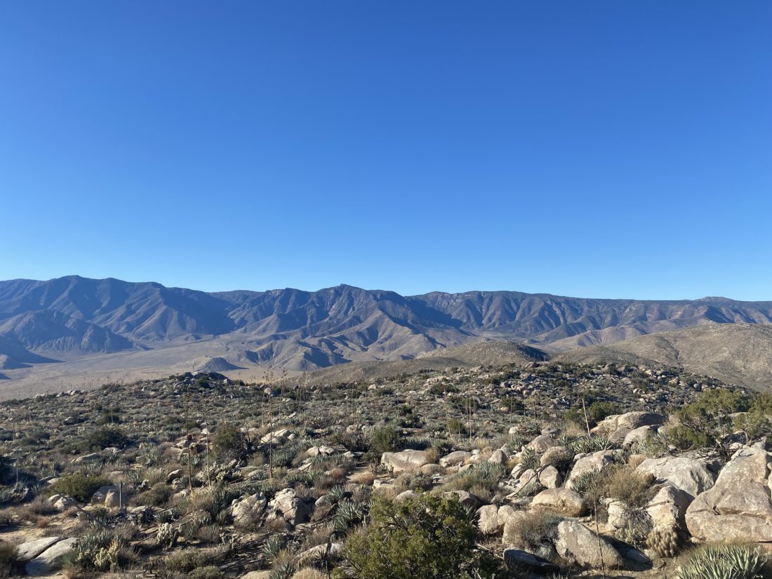
Back at the car after climbing Ghost Mountain, we made the short drive over to Plum Canyon and the trailhead for Sentenac Mountain. The route starts along the California Riding and Hiking Trail before turning west and heading up a side canyon. There the route would transition from a nice trail to picking our way up the narrow canyon. We would scramble over minor dry falls, and a couple that took a bit more to ascend. We weaved around various cacti as we kept pushing upward. We stayed to the left at the fork, then gained the ridge to the summit. As we neared the summit, we spotted a solo hiker cruising ahead of us. So much for checking “Only Party on the Mountain“ on Peakbagger…
He tagged the summit and upon his descent we chatted for a moment, he started at Plum Canyon as well, but we forgot to ask what his ascent route was. When we first spotted him, we assumed he came up from the Blair Valley side. His plan was to loop over to North Pinyon, then back down. We gave him some beta on that peak and wished him well. Once at the summit, we took a short break, enjoyed a snack, and signed the register.
We opted to retrace our ascent route rather than a more direct but steep descent. The return was mostly uneventful except for a poke that I got on my right calf. Turns out I had a good-sized thorn that I had to dig out once back at home. Once back at the car, we began the drive home, with a stop at Dudley’s for some well-earned sandwiches. The neck was giving me some pain, but it might have been all the driving and not the hiking. Will see what tomorrow brings and the options for next weekend.
I am an avid peak bagger, sometimes backpacker, and former sea kayaker living in San Diego. In 2019, I became the third person to complete the San Diego 100 Peak Challenge. Not stopping with that accomplishment, I set my sights on the harder San Diego Sierra Club 100 Peak list, which I completed in 2021. In addition, I have conquered several Six-Pack of Peaks challenges (SoCal, San Diego, Central Coast, and Arizona-Winter). Beyond attempting the San Diego Sierra Club 100 Peak list a second time, I am looking forward to exploring new summits and new adventures across the southwest.
These were to be my first desert hikes of the season. The plan was to hike a couple of easier ones to see how my neck does with some more intense hiking. I thought why not pick two that Ted needed to summit? Since the three of us (Ted, Susie Kara, & I) had not hiked together in some time, we had some catching up to do on the long drive out to the desert. After a quick bio-break, we continued on to the trailhead for Ghost Mountain, only to be reminded that Ted had done this hike before! D’oh! So much for knocking two out for his lists. We thought of pivoting to Pinyon Mountain, which I knew he needed but decided to stick with the plan.
We cruised up the mountain without issue. It was a tad nippy but soon turned to perfect desert hiking weather. After a quick stop at the Marshall South homestead, we pushed onto the summit. We signed the register, surveyed the view, and then headed back down.
I am an avid peak bagger, sometimes backpacker, and former sea kayaker living in San Diego. In 2019, I became the third person to complete the San Diego 100 Peak Challenge. Not stopping with that accomplishment, I set my sights on the harder San Diego Sierra Club 100 Peak list, which I completed in 2021. In addition, I have conquered several Six-Pack of Peaks challenges (SoCal, San Diego, Central Coast, and Arizona-Winter). Beyond attempting the San Diego Sierra Club 100 Peak list a second time, I am looking forward to exploring new summits and new adventures across the southwest.