Borrego Mountain-West Butte

The second summit of the day was going to be Borrego Mountain West Butte. First, I drove back through Borrego Springs to Palm Canyon. I went out to the trailhead, as they were hiking the trail first. As I waited, I chatted with the volunteer for a bit, mostly about summiting Indianhead.

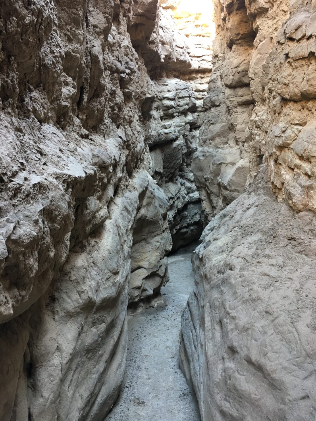
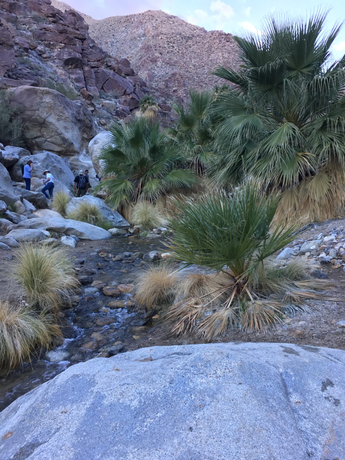
Soon, I spotted the Rabbi and his family coming down the trail. Once they were settled, we drove back to the turnout to the Slot. They parked the RV and piled into the Outback for the short ride to the trailhead. Once there, I pointed them in the direction of the Slot and I headed up the trail to the summit.

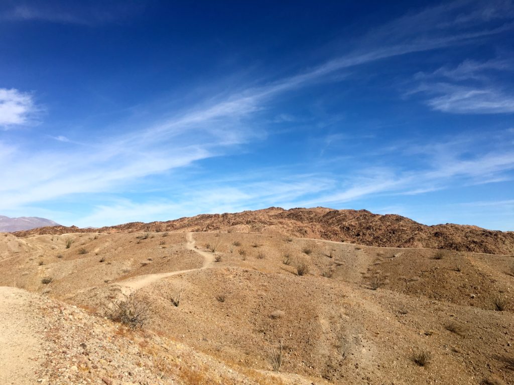
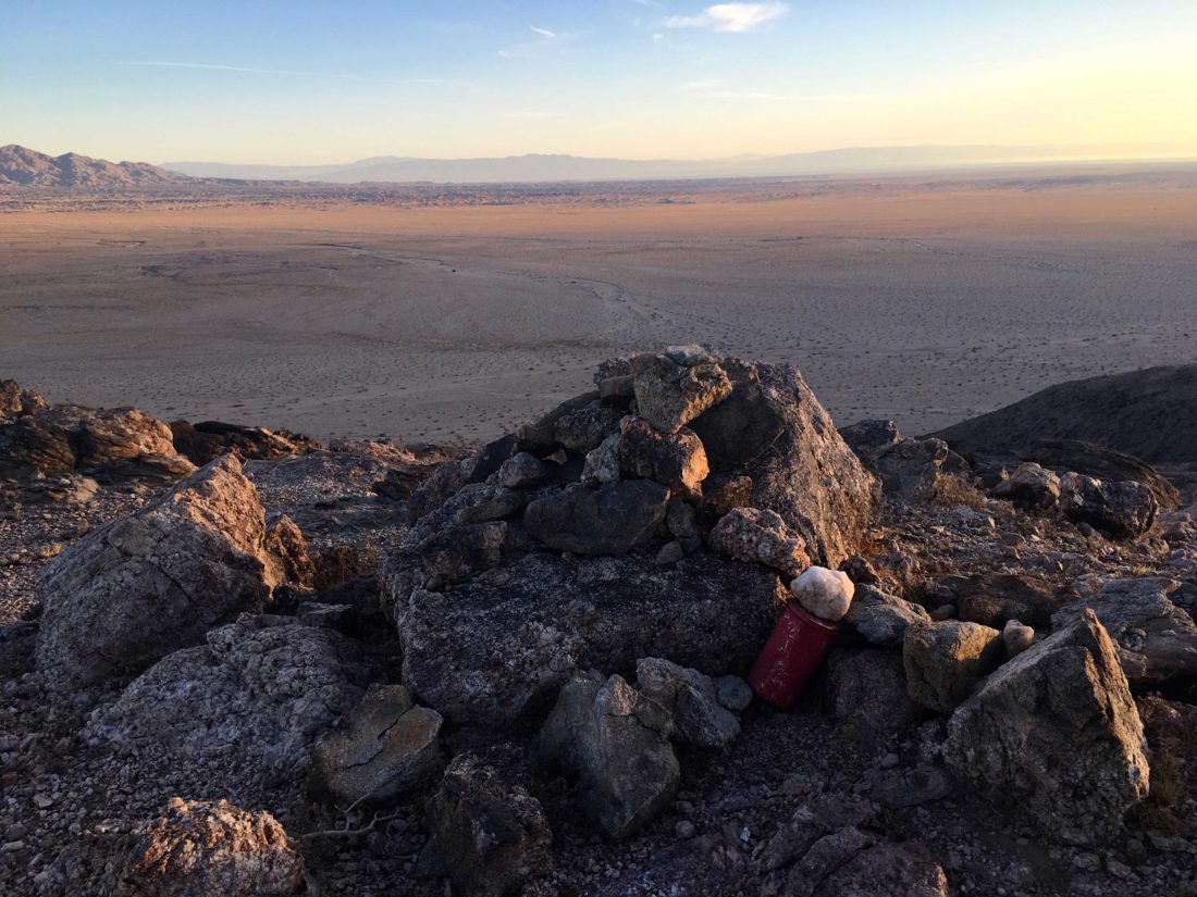
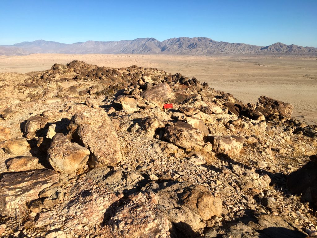
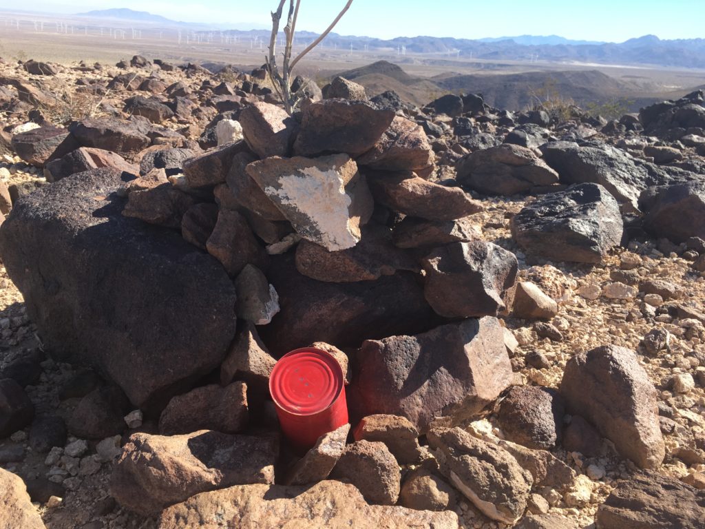
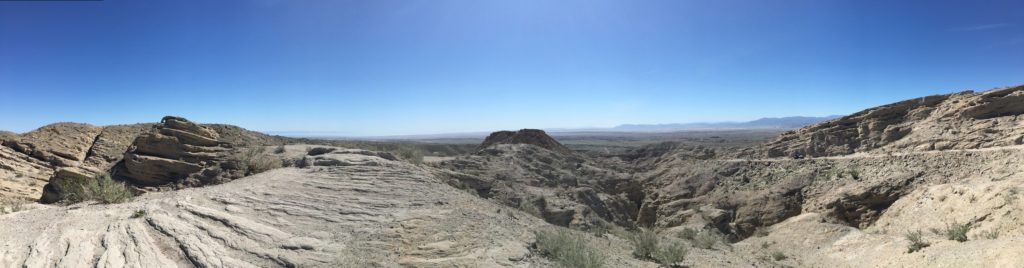
Unlike the scramble to the top of East Butte, the path to the top of West Butte was a well-worn trail. The summit was also a mostly flat butte. I looked for a register but found none. Knowing I had folks possibly waiting for me (I left them the keys), I headed back down.

As I got back to the car, they were enjoying their lunch after a wonderful time in the canyon. We piled back into the car and headed back to the road. I dropped them off as they were to continue their desert adventures, while I was off to hit my third peak, Sentenac Mountain.


Buy Me a Coffee at ko-fi.com

I am an avid peak bagger, sometimes backpacker, and former sea kayaker living in San Diego. In 2019, I became the third person to complete the San Diego 100 Peak Challenge. Not stopping with that accomplishment, I set my sights on the harder San Diego Sierra Club 100 Peak list, which I completed in 2021. In addition, I have conquered several Six-Pack of Peaks challenges (SoCal, San Diego, Central Coast, and Arizona-Winter). Beyond attempting the San Diego Sierra Club 100 Peak list a second time, I am looking forward to exploring new summits and new adventures across the southwest. 

Borrego Mountain-East Butte

I felt like I needed to get back out to Anza-Borrego and get a few more peaks under my belt. The plan was to attempt Borrego Mountain East Butte, then meet up with Rabbi Earne and his family and escort them to the Slot Canyon, while I summited Borrego Mountain’s, West Butte. Finally, with time and energy permitting I was going to try to summit Sentenac Mountain.

I arrived at the trailhead for Borrego Mountain just as the sun was just rising. I bundled up and headed toward the gully that would lead me up to the summit. One nice thing about this hike, there is a bathroom.

At the base of the boulder-filled gully, I surveyed my route. I opted to stick to the left side. I carefully and slowly worked my way up through the jumble of boulders. Soon, I found myself past this challenge and at a saddle between two portions of the East Butte. The summit was on the western side, so up I went.

The actual summit is atop a flat butte,  as I walked around, taking in the sweeping views. I found the register and signed in.

I had an approximate time I needed to meet the Rabbi, so I headed back down. This time I opted to travel on the east side of the gully. It was about the same level of difficulty as the other side. I found myself back at the car and ready to continue the day’s adventures.


Buy Me a Coffee at ko-fi.com

I am an avid peak bagger, sometimes backpacker, and former sea kayaker living in San Diego. In 2019, I became the third person to complete the San Diego 100 Peak Challenge. Not stopping with that accomplishment, I set my sights on the harder San Diego Sierra Club 100 Peak list, which I completed in 2021. In addition, I have conquered several Six-Pack of Peaks challenges (SoCal, San Diego, Central Coast, and Arizona-Winter). Beyond attempting the San Diego Sierra Club 100 Peak list a second time, I am looking forward to exploring new summits and new adventures across the southwest. 

Mine Peak

The first peak of the day was Mine Peak. After the forgotten shoe incident of the day before, I was triple checking all my gear before heading out to Anza-Borrego. With the family out of town, I knew I could take my time with my summits. After following I-8 to S2, I made the right turn onto Dolomite Mine Road. This dirt road worked its way toward the remains of the Dolomite Mine perched on the side of the hill. My Subaru had no trouble getting close to the ruin, but other cars might need to find a turnout a bit further away.

This peak was going to be my first test of a trail-less desert hike. I knew from the trip reports that it was fairly straightforward, and the difficulty level was not terribly high. I followed the road up around the mine for a bit, then began my open desert adventure.

Following faint use trails and the ridgeline, I quickly found myself at the summit. Checking my GPS, I honed in on the register and benchmark.

The skies were clear and the desert spread out in all directions.

I took a short rest and began to retrace my route back to the car, still hoping to summit two more peaks that Saturday. This peak was a perfect intro to desert hiking for me.


Buy Me a Coffee at ko-fi.com

I am an avid peak bagger, sometimes backpacker, and former sea kayaker living in San Diego. In 2019, I became the third person to complete the San Diego 100 Peak Challenge. Not stopping with that accomplishment, I set my sights on the harder San Diego Sierra Club 100 Peak list, which I completed in 2021. In addition, I have conquered several Six-Pack of Peaks challenges (SoCal, San Diego, Central Coast, and Arizona-Winter). Beyond attempting the San Diego Sierra Club 100 Peak list a second time, I am looking forward to exploring new summits and new adventures across the southwest. 

Red Hill

The second hike of the day was up to Red Hill. The ‘trailhead’ was very close to the turnoff to Mine Benchmark. I use trailhead loosely, while there is a nice parking area right off the S2 and an informational sign, there isn’t a trail. So across the flat desert, I headed, weaving my way past the chollas, my summit stood clear out, as it certainly earned the name Red Hill. This summit is covered in the aftermath of volcanic activity. Following my map and GPS, I soon found myself at the base of the peak, I scanned the various routes up, picking one I began my climb upward.

As I worked my way eastward toward my planned route, the terrain changed from the ‘standard’ desert I have been hiking on all day, to that of more red rock.

With the summit drawing near, I began to pick my way through the rockier ground, taking care with each step. I did not want to turn an ankle with a misstep. (although I had better cell coverage out these hikes than I do at my home in Penasquitos!) Soon, I found myself on the summit plateau, a vast field of red rocks spread out before me.

According to my topo map, the high point was near the southern end, where I did find the register wedged in a small rock cairn.

The views were stunning from the summit, I think in part because I was feeling proud of completing two solo desert hikes.


Buy Me a Coffee at ko-fi.com

I am an avid peak bagger, sometimes backpacker, and former sea kayaker living in San Diego. In 2019, I became the third person to complete the San Diego 100 Peak Challenge. Not stopping with that accomplishment, I set my sights on the harder San Diego Sierra Club 100 Peak list, which I completed in 2021. In addition, I have conquered several Six-Pack of Peaks challenges (SoCal, San Diego, Central Coast, and Arizona-Winter). Beyond attempting the San Diego Sierra Club 100 Peak list a second time, I am looking forward to exploring new summits and new adventures across the southwest. 

Calcite Mine

I had gotten the first 4 of the 5 hikes of the Anza-Borrego 5 for 50 Challenge done pretty quickly, but life kept getting in the way of finishing it. I was watching the temperatures start to rise out in the desert, plus it was desert flower season, meaning the park would be more crowded.  My final hike was out to the Calcite Mine. I was able to drag Dave Myron along for this adventure. This was in another part of the park I had never explored, out east along the S-22. We pulled into a small turnout, as I did not want to attempt driving on Calcite Road. 

We hiked along the road for about 2 miles, even with the early start, I could feel the heat. I had to take a short break in the shade to cool off. We explored the mine area. Just after the bombing of Pearl Harbor, this mine was established to extract optical-grade calcite for gun sights, the only mine of its kind in the US. The mine was short-lived, but the deep cuts in the earth are clear evidence of the operation. Bits of calcite can be found scattered around.

We headed back down, we opted to take the slot canyon that parallels the jeep road. I had seen the junction for it when we were heading up to the mine and assumed we would be able to spot it along the way back. Well, we missed it. We continued following the wash that the slot canyon had opened up into. Instead of heading south, the route was now veering eastward. Dave and I debated our options. We could go full cross-country toward the cell tower, which we could see and was near the car, continue in the wash, hoping it would turn to the south and road (which we knew ran east-west), or retrace our route. 

This section of the wash is drivable, and when we had exited the canyon, a truck had pulled up and three hikers set off to explore it from the bottom. While Dave and I mulled our options, they were heading back out. I flagged them down and ask if they knew how much further down the road. They offered to give us a lift, so we hopped into the truck bed and motored out. It turns out, that this wash heads east for quite a while. Off-roaders will know it as Truckhaven Wash. Glad we opted for the lift. They took us back to that car and with that, the challenge was over. I certainly was humbled by this hike, and would learn to improve my research and navigation skills for any future trips (oh, little did I know…). These challenges had been fun, I wonder what other hiking challenges might exist…say what is this “100 Peaks Challenge“?


Buy Me a Coffee at ko-fi.com

I am an avid peak bagger, sometimes backpacker, and former sea kayaker living in San Diego. In 2019, I became the third person to complete the San Diego 100 Peak Challenge. Not stopping with that accomplishment, I set my sights on the harder San Diego Sierra Club 100 Peak list, which I completed in 2021. In addition, I have conquered several Six-Pack of Peaks challenges (SoCal, San Diego, Central Coast, and Arizona-Winter). Beyond attempting the San Diego Sierra Club 100 Peak list a second time, I am looking forward to exploring new summits and new adventures across the southwest. 

Pictographs Trail

I had been out to the pictographs a few years earlier with my twins, so I was familiar with this hike. I drove along the dirt road to the trailhead. It was nicer to do this road in my Subaru rather than my Saturn. I parked at the trailhead and set off. The first half mile gains about 300 feet of elevation, so you get a bit of workout. Once you crest the rise, the trail begins sloping gently down. About .8 miles in, I came to the large boulder with several pictographs on it. These were made by the Kumeyaay, one of two main Native American groups that made their homes in Anza-Borrego and the surrounding regions.

I decided since I did not have to worry about my twins this time, I would continue to the Smuggler Canyon overlook. From here I was rewarded with a fantastic view of the Vallecito Valley. I retraced my route and was back at the car, ready to call it a day. One more hike to do and this challenge was complete!


Buy Me a Coffee at ko-fi.com

I am an avid peak bagger, sometimes backpacker, and former sea kayaker living in San Diego. In 2019, I became the third person to complete the San Diego 100 Peak Challenge. Not stopping with that accomplishment, I set my sights on the harder San Diego Sierra Club 100 Peak list, which I completed in 2021. In addition, I have conquered several Six-Pack of Peaks challenges (SoCal, San Diego, Central Coast, and Arizona-Winter). Beyond attempting the San Diego Sierra Club 100 Peak list a second time, I am looking forward to exploring new summits and new adventures across the southwest. 

The Slot

Having finished the Mission Trails 5 Peak Challenge, I discovered that the Anza-Borrego Foundation was conducting their own hiking challenge in celebration of their 50th Anniversary. Just like the MTRP Challenge, it is a series of 5 unique hikes, each requiring a selfie at a particular spot along each hike. So off to Anza-Borrego I go (oh, if I only knew what truly lay ahead for me…)

For the first hike of this challenge, I opted to go do The Slot at Borrego Mountain. I convinced Mark Better to tag along for this adventure. We found the turnoff from the highway and on to the dirt road. The car seemed a bit loose in the dirt. As we pulled into the trailhead, I discovered why, a flat rear tire. I had a spare and being such a popular trail, I was not worried about being stranded. Since it was early, why not go do the easy 1.5 or so miles through the Slot. We can deal with the tire when we get back.

With Borrego Mountain West Butte rising off to the east, we started along the trail, rising up from the parking area. Soon, the trail dips down into the canyon. Quickly we found ourselves working our way through the narrow canyon. Passing under the fallen rock, we enjoyed twisting and turning along the route. After about 3/4 mile, the canyon opened up, we hiked a bit before turning around and retracing our route.

Once back at the car, we addressed the issue of the flat tire. With a bit of digging and proper leverage, we were able to take care of changing the tire. We headed into Borrego Springs for lunch, and then the second of the planned hikes, the Borrego Palm Canyon Nature Trail.


Buy Me a Coffee at ko-fi.com

I am an avid peak bagger, sometimes backpacker, and former sea kayaker living in San Diego. In 2019, I became the third person to complete the San Diego 100 Peak Challenge. Not stopping with that accomplishment, I set my sights on the harder San Diego Sierra Club 100 Peak list, which I completed in 2021. In addition, I have conquered several Six-Pack of Peaks challenges (SoCal, San Diego, Central Coast, and Arizona-Winter). Beyond attempting the San Diego Sierra Club 100 Peak list a second time, I am looking forward to exploring new summits and new adventures across the southwest. 

Borrego Palm Canyon Nature Trail

After grabbing a burrito in Borrego Springs, we headed to the Borrego Palm Canyon Nature Trail. We paid our $ 10-day use fee and pulled into the parking lot for the trail. Mark had never visited the Palm grove at the end of the trail, so I knew this was going to be another treat. 

This is one of the most popular hikes in all of Anza-Borrego, so it follows a well-worn and marked trail. You can grab a pamphlet that will describe the various markers along the way. Since it was January, water was still flowing from out of the canyon, quite a treat to have to cross a running stream in the desert.

After about 1.5 miles, we reached the grove. Mark did have to be back in town, so we did not spend too long exploring. After the fire in 2020, it was nice to have seen them in their full glory. On the way back from the grove, we opted to take the alternate trail back, in part for fewer hikers and to see more of the park. Once back at the trailhead we headed home. Two of the five were completed!


Buy Me a Coffee at ko-fi.com

I am an avid peak bagger, sometimes backpacker, and former sea kayaker living in San Diego. In 2019, I became the third person to complete the San Diego 100 Peak Challenge. Not stopping with that accomplishment, I set my sights on the harder San Diego Sierra Club 100 Peak list, which I completed in 2021. In addition, I have conquered several Six-Pack of Peaks challenges (SoCal, San Diego, Central Coast, and Arizona-Winter). Beyond attempting the San Diego Sierra Club 100 Peak list a second time, I am looking forward to exploring new summits and new adventures across the southwest.