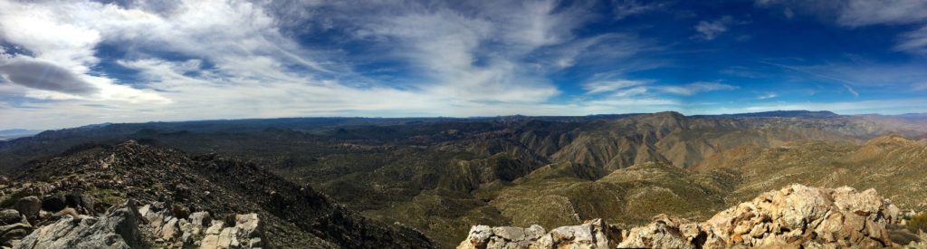
In 2019, a fellow 100 Peak Challenger, Gail Welch, needed to summit this peak. So, I decided to trade routes with her. I will take her out and up Pinyon (more of a car need than a trail route issue), and she would guide me up The Thimble. My Subaru Outback had no trouble on the dirt roads to the trailhead, just a touch of care here and there…
Unlike the first time, we stuck to the ridge for the ascent from the base. This was the right choice as Derek and I had suspected. The only challenge was the 20+ mile an hour winds. Thankfully, the wind was not kicking up any dust.
We made the summit without any issues, signed the register, and headed back down. That was Gail’s 95th peak!
I am an avid peak bagger, sometimes backpacker, and former sea kayaker living in San Diego. In 2019, I became the third person to complete the San Diego 100 Peak Challenge. Not stopping with that accomplishment, I set my sights on the harder San Diego Sierra Club 100 Peak list, which I completed in 2021. In addition, I have conquered several Six-Pack of Peaks challenges (SoCal, San Diego, Central Coast, and Arizona-Winter). Beyond attempting the San Diego Sierra Club 100 Peak list a second time, I am looking forward to exploring new summits and new adventures across the southwest.
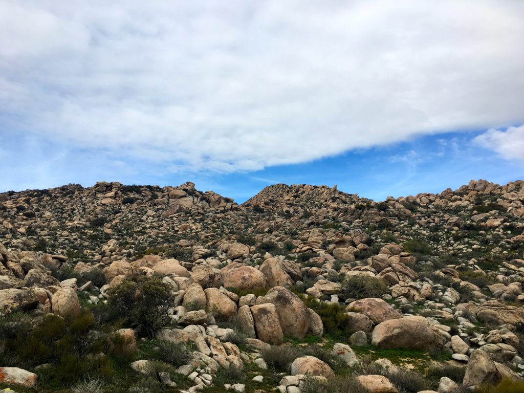
There are two primary routes to the summit of San Ysidro, the long multi-peak bagging route from Montezuma Valley road or via the route from Landmark Road. Earlier in the week, Susie Kara (the first 100 Peaks finisher!) pinged me and asked if I was hiking this weekend and if I wanted a hiking buddy. To which I quickly said yes to both. My plan was to summit San Ysidro and The Thimble.
Having already summited Bonny and White Benchmarks (along with Clyde and Hut), and given the traverse from White to The Thimble is a slog, Susie Kara and I opted to start from the Landmark Road trailhead.
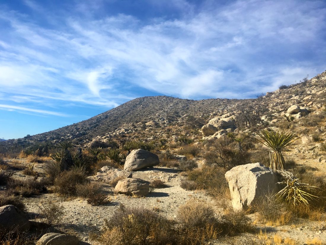
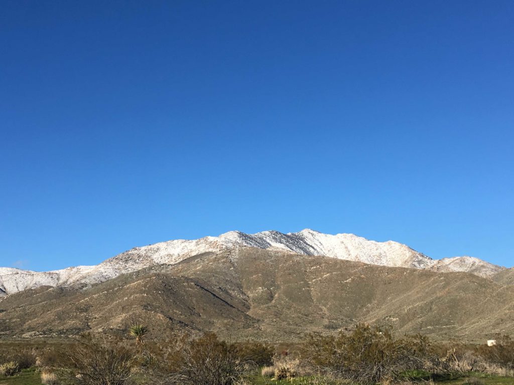
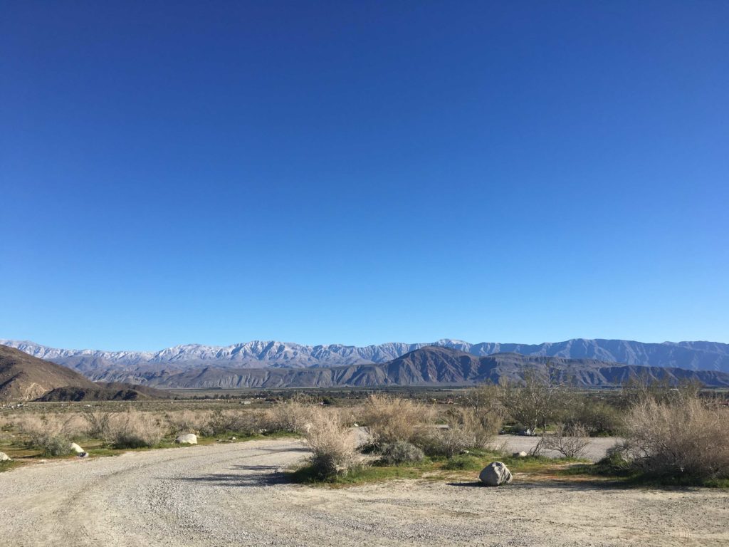
We headed out from San Diego early, so as not to be caught in the hordes heading out to the desert to view the wildflowers. A storm had passed through the county on Thursday, so we knew it was going to be chilly. As we drove out, we could spot patches of snow on the mountains. However, both San Ysidro and The Thimble looked fairly free of the white stuff.
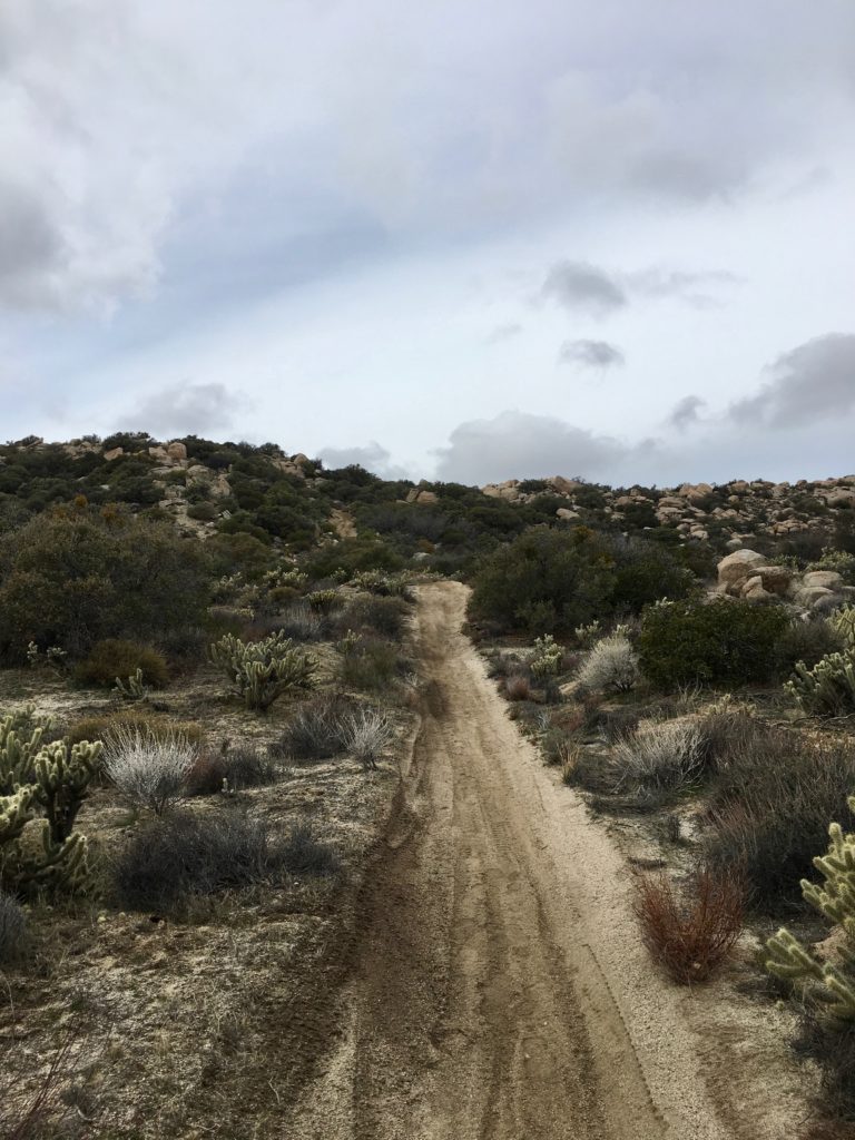
We parked to the left of the BLM sign, this area has a fair amount of private property, so navigating it can be tricky. That section between White Benchmark and The Thimble is a great example. Our route was not going to have this issue. The Subaru handled the dirt road again with no issues. As we left the car, the thermometer read 37°F, but the sun was shining and we were properly dressed.
The initial portion of the route follows an old jeep trail, so we made good time as we worked our way north, then to the east. The road kept climbing upward. Although one might be tempted to keep driving, a massive oak tree has fallen and blocked the road about 1/4 mile up. Thin patches of snow were scattered about.
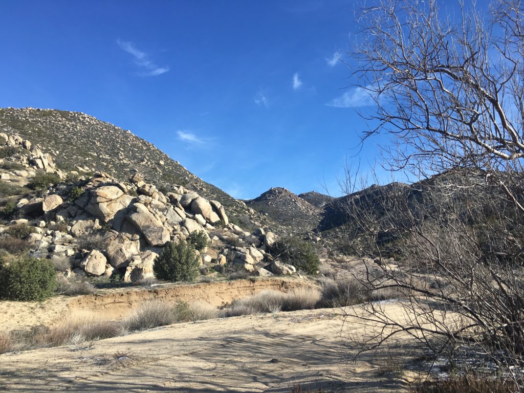
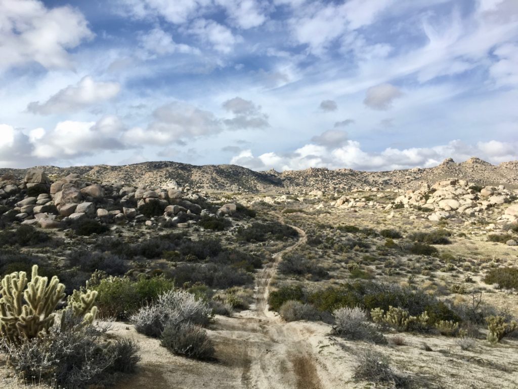
At the junction, we made our right-hand turn to continue on toward the gully that we would use to reach San Ysidro. In reviewing other trip reports and routes, we knew the trail leaves the road just past a noticeable rock outcropping. We were also able to spot a few cairns along the hillside to validate our research. So, our cross-country portion began. There was a faint trail that guided us ever upward, but the terrain is fairly straight-forward to follow.
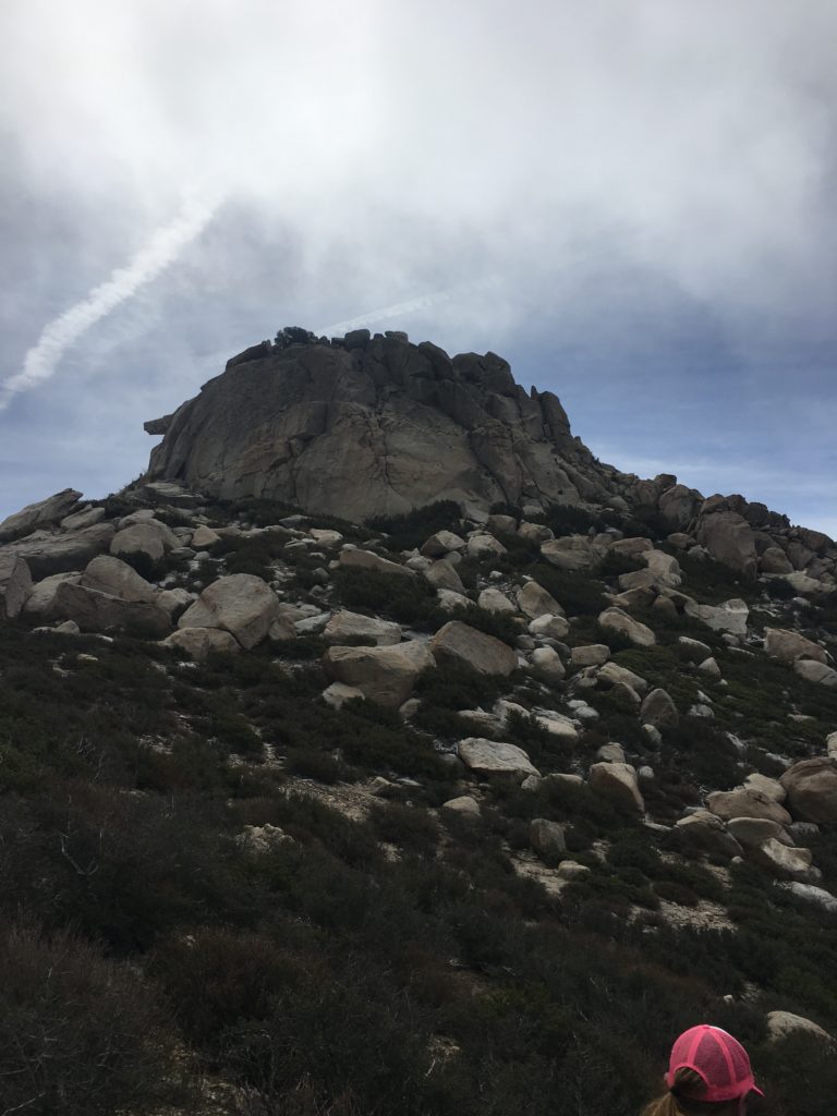
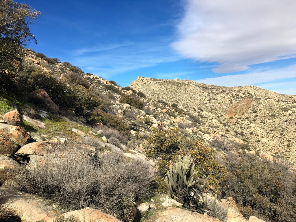
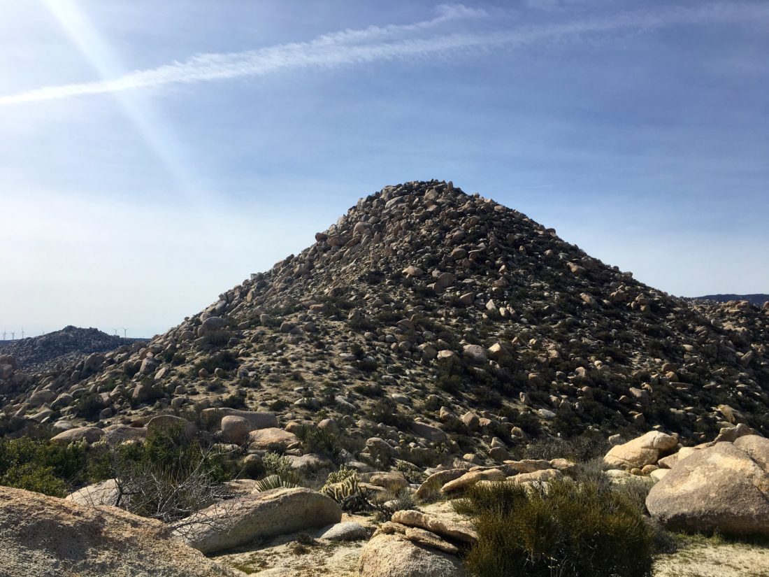
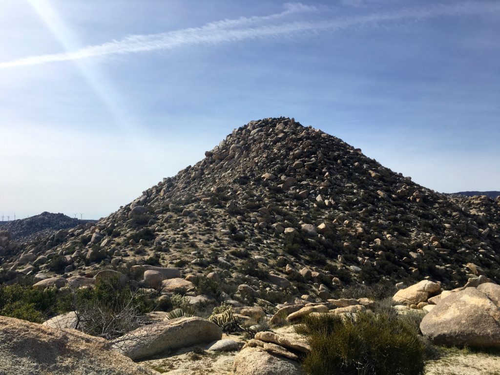
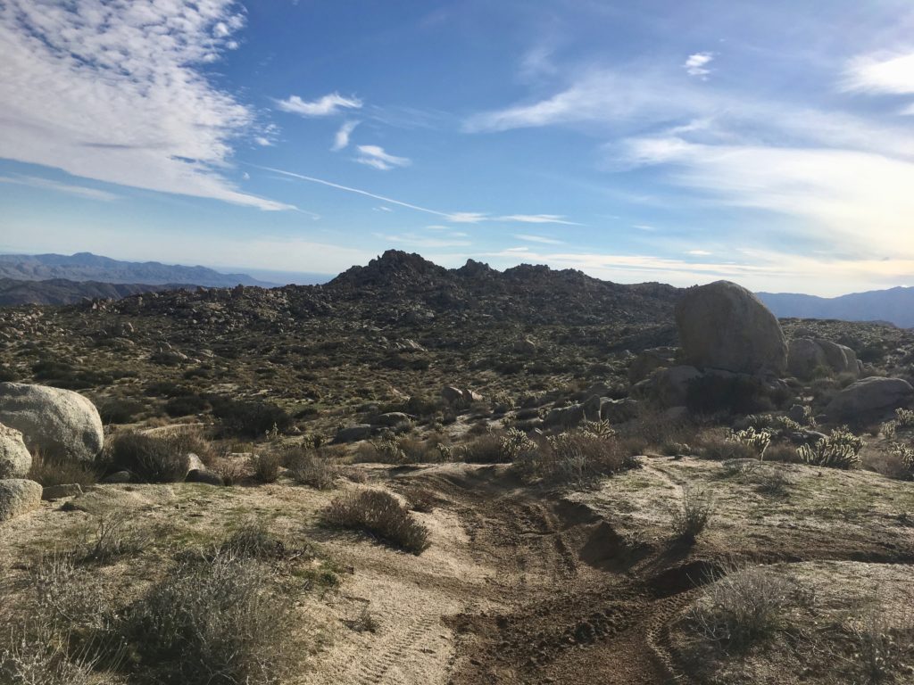
Eventually, we intersected the main gully that would lead us most of the way to San Ysidro. The Thimble stood above us to the East. Our plan was to tackle it on our way back.
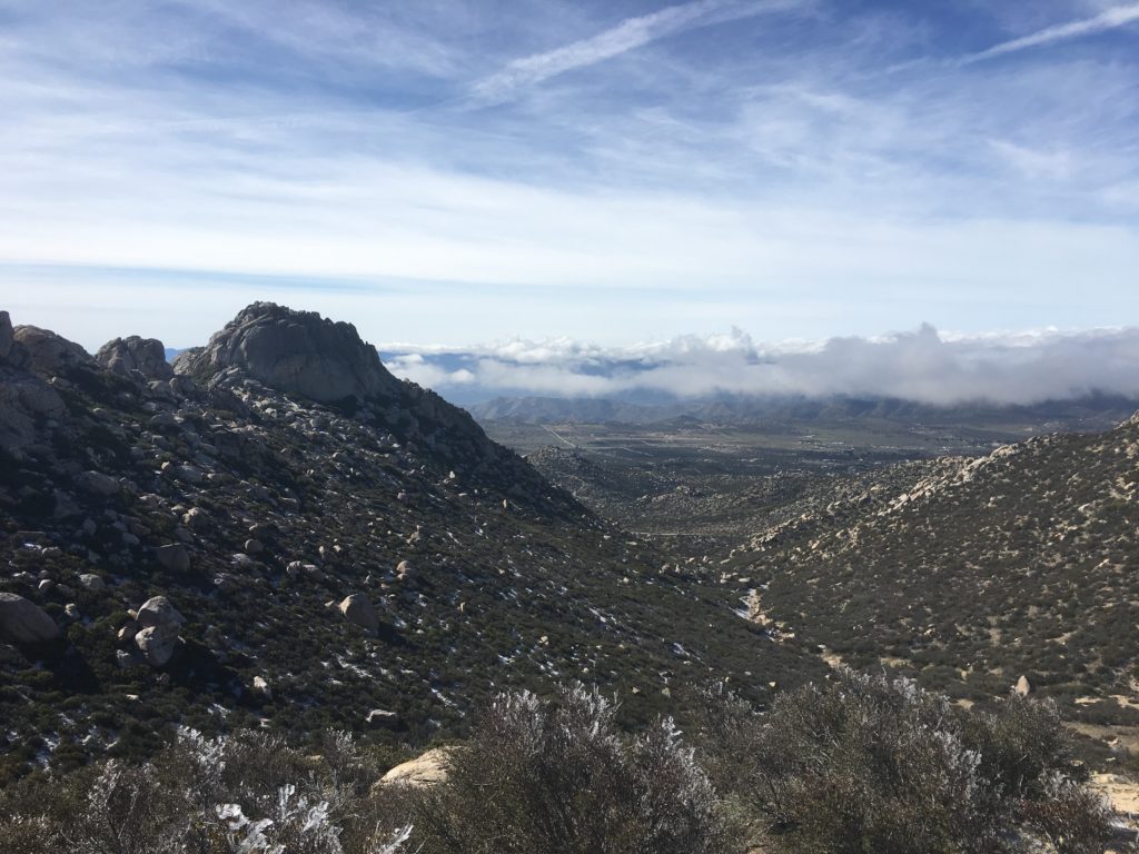
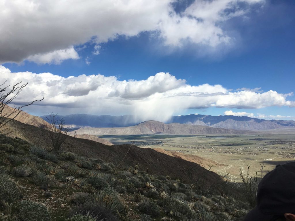
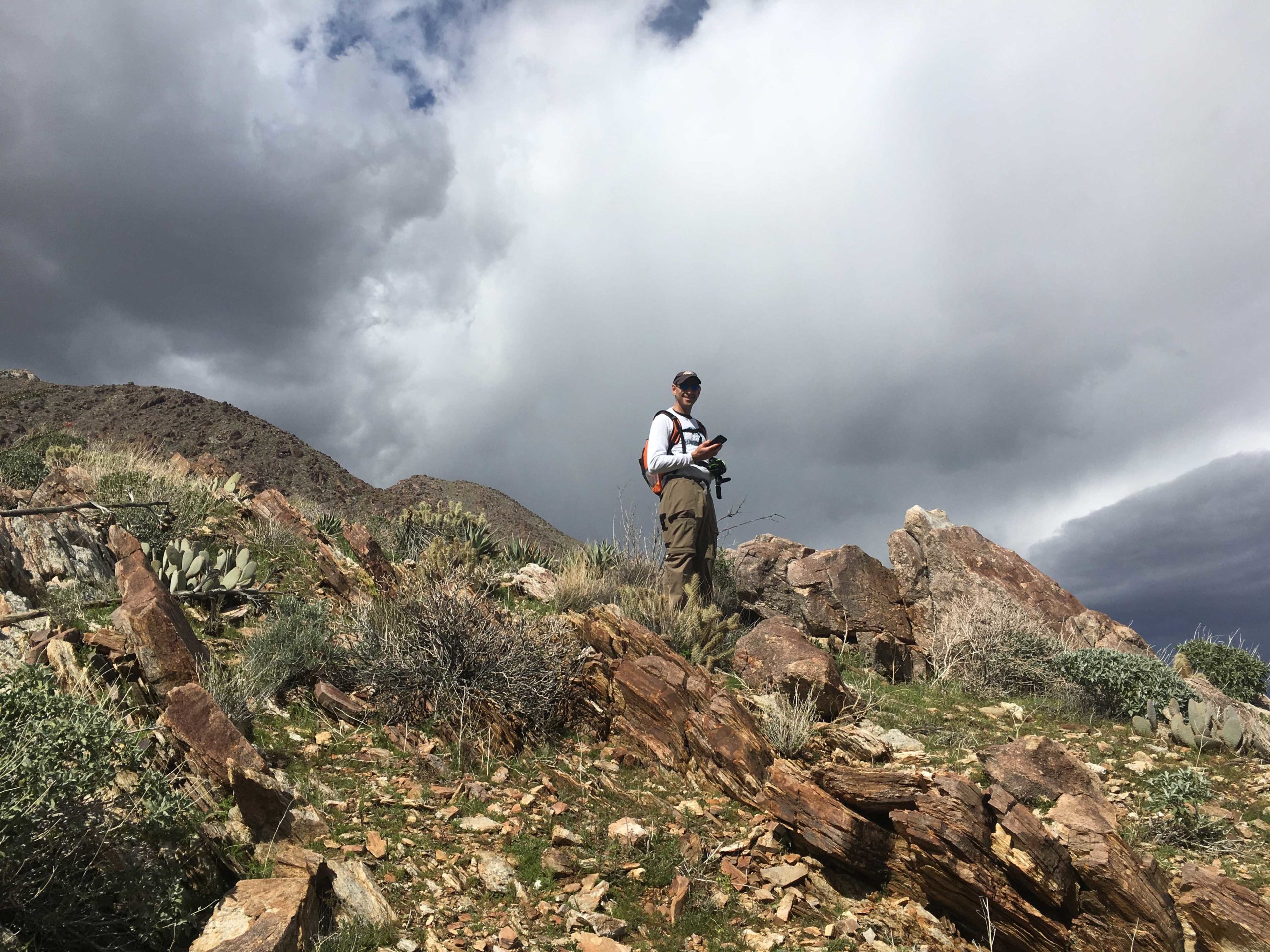
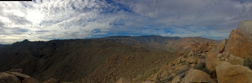
The gully began to veer to the left, and the direct route stayed to the right. We opted for the direct route. As we began to gain elevation in earnest, we soon found ourselves surrounded by ice-covered plants and rocks. The ice had actually frozen horizontally! The ground was thankfully free from it. However, as we approached the summit, clouds blew in! What was clear 10 minutes before was now a grey mess. The winds also had picked up. They had been blowing a bit, but at the summit, it was very windy.
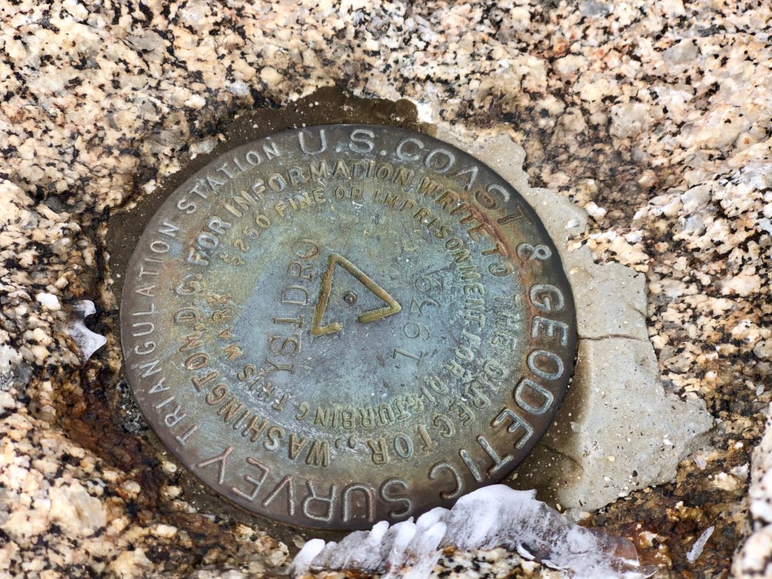
Susie was able to scramble the ice-covered summit block and sign the register and photograph the benchmark. The other marks were inaccessible due to the conditions. We quickly left the summit and dropped back below the clouds and discussed the rest of the day.
We could see The Thimble below us. Clouds drifted in and out, hiding its rocky face. We looked at various route options and discussed the conditions and risks. We are both experienced hikers, but we took careful stock of options. What if the conditions turn into a whiteout, can we navigate out? Will we be able to scale the rocks at the base of The Thimble? What about the actual route to the top?
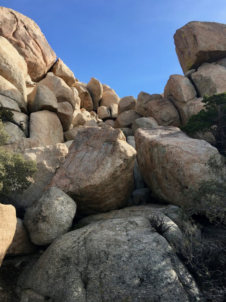
In the end, we decided to work our way toward it, and honestly look at it and decided then if we would actually try to reach the top. We headed back down toward the gully, all the while looking at the conditions in the sky and on the peak. We cut across toward the northwest side. Eventually, our route was blocked by car-plus-size boulders that were too icy to deal with. We looped around to the east side to see what we might find.
I had no problem saying “not today”, as did Susie. We poked around the base of The Thimble, as we did not have the full route information for it (turns out we sort of did). But as we looked at it closer, we both decided that attempting the final push to the top would not be wise. The conditions on the top were going to be dangerous and not worth the risk. So, with that, we dropped back down to the gully. Along the way, a massive fly-by of Painted Ladies passed us. We stopped and just watched them flutter past.
As we worked our way back to the car, we noticed all the trash we had missed when we had started. Next time, I will pack a large trash bag to do some cleanup.
For me, both peaks are now crossed off my list, although I might be able to attempt The Thimble again soon with another 100 Peak Challenger who loves that summit.
I am an avid peak bagger, sometimes backpacker, and former sea kayaker living in San Diego. In 2019, I became the third person to complete the San Diego 100 Peak Challenge. Not stopping with that accomplishment, I set my sights on the harder San Diego Sierra Club 100 Peak list, which I completed in 2021. In addition, I have conquered several Six-Pack of Peaks challenges (SoCal, San Diego, Central Coast, and Arizona-Winter). Beyond attempting the San Diego Sierra Club 100 Peak list a second time, I am looking forward to exploring new summits and new adventures across the southwest.
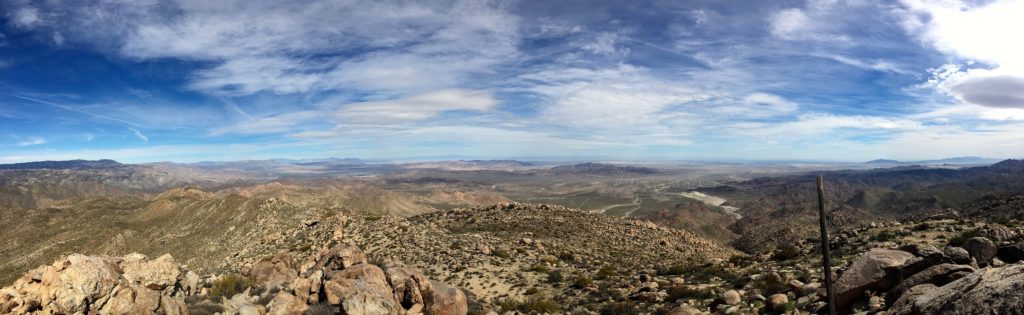
Well with the forecast for the weekend looking rainy and windy, I opted to take a “Me” day and attempt Jacumba Mountain again. Last weekend, I tried summiting it via the Morteros Palm route. Had two companions along for the hike. We got close to the summit, but a few route errors and its difficulty had us reach a predefined turnaround time.
So, this time I decided to see if I could attempt the summit via the southern route. I knew the road would be a challenge, as reports of its condition were not good. I pulled off the 8 at the In-Ko-Pah and headed to TM019. The road was rough in spots, but my Subaru Outback handled it without an issue. I reached the spot where Patrick O’Neil’s track began. Judging by the road ahead, I concur that this was a good spot to park.
As I stepped out of the car, I was reminded why there are windmills all around the area. It was breezy, and the rule of one door open at a time was certainly in effect. I headed down the road for a short while until it was time to head cross-country. This attempt would be completed without any trails to guide me. It would be a combination of topo maps, gpx, and old fashion navigation skills.
The first part of the route weaved through the rocks and cacti. I knew this section would be fairly straightforward. After a bit, the route began to gain some elevation. Unlike the first attempt, this gain was not nearly as painful or difficult. In fact, it was almost stair-like for portions.
The route also had some nice level sections to pause and catch your breath at.
The real challenge of this route is the middle section. The ridge is too jumbled with boulders, so I followed the general route that Patrick used. This portion is a slow scramble over rocks and through the trees. The upside was I was shielded from the wind.
Eventually, I came to the saddle before the final push to the summit. I dropped down and was reminded of the wind as my hat almost blew off.
I looped around to the east and approached from that side. There is a nice flat region, perfect for a quick break before the final push. For much of the hike, the summit is not visible.
As I reached the summit, I could not believe I made it! This was my 90th peak! I found the benchmarks and signed the register. I did not stay too long, as my hat almost went flying away again. The views were fantastic. I could see the spot where we had turned back. Looking at the route we would have taken, it would have been slow going.
I headed back down and began to retrace my route. At times it was easy, as my footprints were visible on the desert floor. As I approached the middle section again, I did find an easier route for about half of it. More luck than skill. I continued to plow along the side of the mountain, looking for any signs from the route gods…
I reached the end of that section and began the final push back to the car. The day had warmed up to the mid-60s and was glad I started early.
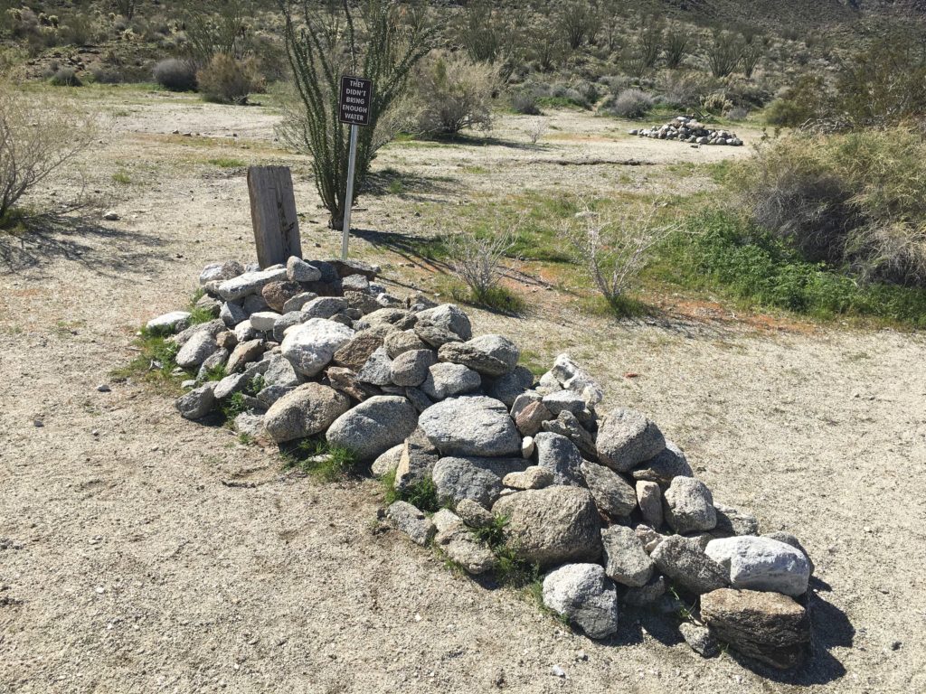
I had a few route errors returning, mostly me trying not to lose elevation. Along the way, I collected several bits of trash. I assume they were discarded by migrants. The empty pack of Mexican Marlboros was one clue. Soon, the radio tower was again visible and I knew my car was nearby.I plodded back up the road, again confirming my decision not to take the Subaru down it. The drive back was uneventful, just slow and careful. Now on to the final 10!
I am an avid peak bagger, sometimes backpacker, and former sea kayaker living in San Diego. In 2019, I became the third person to complete the San Diego 100 Peak Challenge. Not stopping with that accomplishment, I set my sights on the harder San Diego Sierra Club 100 Peak list, which I completed in 2021. In addition, I have conquered several Six-Pack of Peaks challenges (SoCal, San Diego, Central Coast, and Arizona-Winter). Beyond attempting the San Diego Sierra Club 100 Peak list a second time, I am looking forward to exploring new summits and new adventures across the southwest.
I, along with two hiking companions made the long drive out to Mortero Palms in southern Anza-Borrego. One of them was a young fellow I had never hiked with, but since my other companion is in good shape, I was not worried about him. He had just started working on the 100 Peak Challenge. Once we reached the trailhead, we would initially follow the same route you would take if you were going to view the Goat Canyon Trestle legally.
Once past the palms, we continued working our up toward the saddle where we would turn toward the summit instead of the trestle. We did find a nice use trail for some of this portion. I was in the back of the group, as both of them were in better shape than I. Unfortunately, the new guy raced on far ahead and headed up an incorrect route. I had to hustle to catch them and inform them of their navigation error. We got back on track, but we had lost some time and the new guy needed to be back in town by a certain time.
We could now start to see the summit off in the distance and began working our way up to it. I was watching our pace and our planned turnaround time. Unfortunately, we reached that point. We still had another mile to go and about 600 feet of elevation gain. That was going to take probably about 45 minutes to an hour to do. This summit would have to wait for another day
As we descended down the ridge, once again, they raced ahead and out of sight. I had the car keys, so I knew that they weren’t going anywhere without me. We did regroup near the saddle and continued working our way down. But I was not pleased about splitting up during the descent.
We picked up the use trail again until it ends back in the boulder section near the first bit of the hike. Rather than following the track I had been recording, the new guy was off down the wrong canyon. This was the third time he had made a navigational error. I reviewed my topo map, yes a paper one, and saw this canyon would get back to the trailhead. We worked our way down it, we carefully work our way down some steep dry waterfalls. I was not a happy hiker.
We safely made it back to the car and headed home. I have had some time to reflect on this attempt. For me, I need to make sure that everyone understands our route and what to do at certain points along the way. In the past, our groups had always stayed together, but this time this was not the case. But as a hiker on any hike, it is your responsibility of yourself to know the general route and what to expect. You always need to ask yourself, if I was now alone on this hike would I know how to get back?
I am an avid peak bagger, sometimes backpacker, and former sea kayaker living in San Diego. In 2019, I became the third person to complete the San Diego 100 Peak Challenge. Not stopping with that accomplishment, I set my sights on the harder San Diego Sierra Club 100 Peak list, which I completed in 2021. In addition, I have conquered several Six-Pack of Peaks challenges (SoCal, San Diego, Central Coast, and Arizona-Winter). Beyond attempting the San Diego Sierra Club 100 Peak list a second time, I am looking forward to exploring new summits and new adventures across the southwest.
Since we had President’s Day off, we had planned to hike Granite Mountain, but its snow-capped summit had other ideas.
Opted to bag some peaks on the San Diego 100 list instead. First up was Ode Benchmark. Near the visitor center, this peak was a quick walk across the desert floor then up along the ridgeline.
The mountains all around us were dusted in snow. I pointed out various peaks, some summited, some still to do.
We found the benchmark with no trouble. The register was ruined, and I forgot the spare I usually carry. We had to shed a few layers, as Ted and I had dressed for a much higher summit.
After touring the visitor center, we made the short drive to the Hellhole Canyon trailhead. Our next target was going to be Ted Benchmark.
I am an avid peak bagger, sometimes backpacker, and former sea kayaker living in San Diego. In 2019, I became the third person to complete the San Diego 100 Peak Challenge. Not stopping with that accomplishment, I set my sights on the harder San Diego Sierra Club 100 Peak list, which I completed in 2021. In addition, I have conquered several Six-Pack of Peaks challenges (SoCal, San Diego, Central Coast, and Arizona-Winter). Beyond attempting the San Diego Sierra Club 100 Peak list a second time, I am looking forward to exploring new summits and new adventures across the southwest.
Since Ted and I had President’s Day off, we had planned to hike Granite Mountain, but its snow-capped summit had other ideas.
After touring the Anza-Borrego Visitor Center and hiking to nearby Ode Benchmark, we made the short drive to the Hellhole Canyon trailhead. Our next peak was going to be Ted Benchmark, and maybe Webo Benchmark which sits further up the ridge.
We followed the shared trail for a while before again cutting across the desert floor to the start of the ridgeline.
Ted Benchmark sits at over 2,300 feet, so the summit was going the take a bit more effort than Ode Benchmark. We picked our way around the rocks and cacti, although Ted got attacked by two different chollas…
We reached the summit but did not stay long, as the wind was picking up. Over Coyote Canyon, we could the showers falling. So down we went. As we descended, we could see rain falling above Indianhead to our north, and the skies to the west did not look friendly. Webo Benchmark sits past Ted, and we did initially consider pushing on to it, but the weather helped change our minds.
Once we reached the desert floor, we were amazed at the number of hikers still heading up to Maidenhair Falls. The skies were darkening and the winds were picking up still. Back in the car, we warmed back up and headed back into town for some burritos. Coming back home, it actually began snowing!! No worries, we were actually behind the snowplow, but nothing sticking to the road.
It was a great day hiking and fun to be back on the trails with Ted again!
I am an avid peak bagger, sometimes backpacker, and former sea kayaker living in San Diego. In 2019, I became the third person to complete the San Diego 100 Peak Challenge. Not stopping with that accomplishment, I set my sights on the harder San Diego Sierra Club 100 Peak list, which I completed in 2021. In addition, I have conquered several Six-Pack of Peaks challenges (SoCal, San Diego, Central Coast, and Arizona-Winter). Beyond attempting the San Diego Sierra Club 100 Peak list a second time, I am looking forward to exploring new summits and new adventures across the southwest.
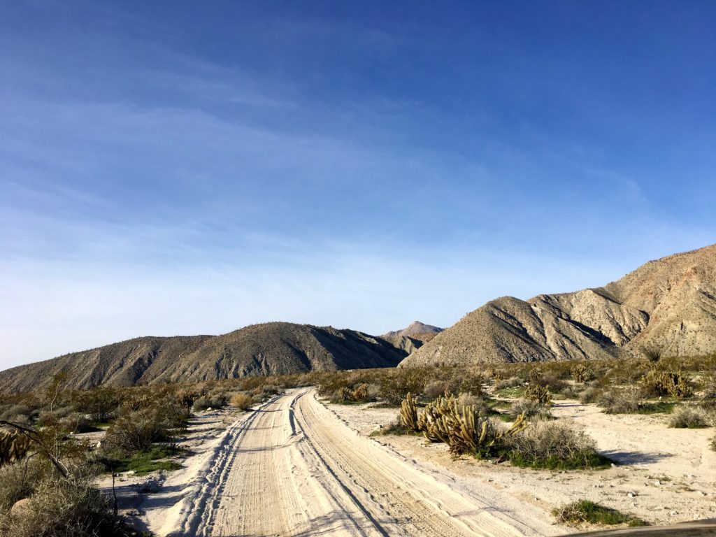
I decided to take advantage of a break between the storms and head back out to Anza Borrego to attempt Sombrero Peak. Of my remaining peaks, this was one of the few peaks left that I felt comfortable hiking solo. The drive out was uneventful, sadly no Bighorn sheep this time. I drove past the turnoff to Indian Gorge to the Mountain Palms campground where some pit toilets are. Priorities.
As I began driving down Indian Gorge toward the trailhead, I stopped and chatted with two folks out looking for wildlife. I told them about the herd from my earlier visit. I wished them well and headed down the road. The Outback handled the road without a problem, just a few spots that took a touch of care.
I reached the trailhead a touch before 9. As I geared up, I debated if I should bring my poles. Looking at the first part of the route, there was going to be a fair amount of bouldering, so I opted to leave them behind.
Passing the palm trees at the start of the trail, I headed southwest and began working my way up the gorge. I initially missed the side canyon that I wanted to take, I thought it was a bit further up the main canyon. Checking my map, I realized the canyon to the south I bypassed a couple of hundred yards back was the one I need to take. Doubling back, I worked my way up the first of several steep sections toward the summit.
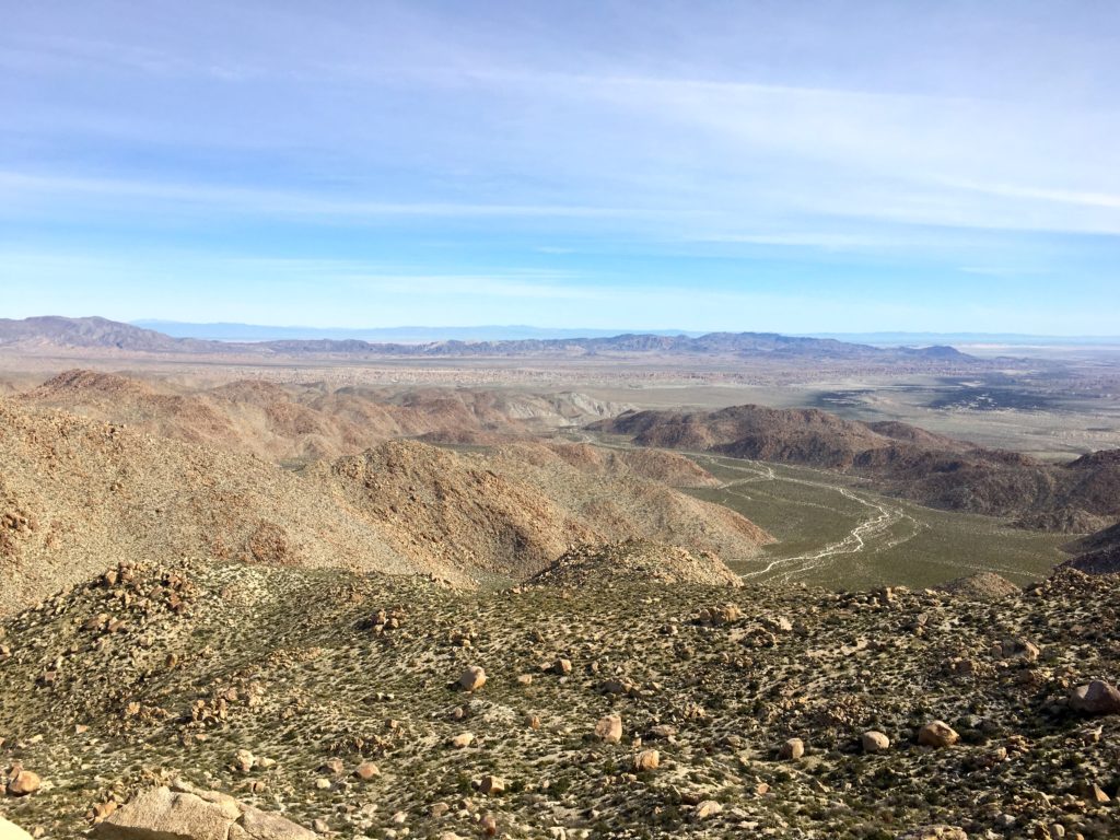
Along the way, I gave my left knee a nice scrape while navigating a dry waterfall. With some field first aid applied, I continued on toward a gentle plateau. I was able to look out to the east and the green valley that I drove through earlier.
The actual peak was still hidden from view, but the route toward it was fairly straightforward, just go up…
I did not see any use trail or other markers, so I exercised my route-finding skills, avoiding the cacti and around the rocks that litter the slope. Eventually, I did find some footprints along the desert floor, so I let these be my guide when I could find them. This section was hard work. About every five minutes or so I would find a rock and catch my breath.
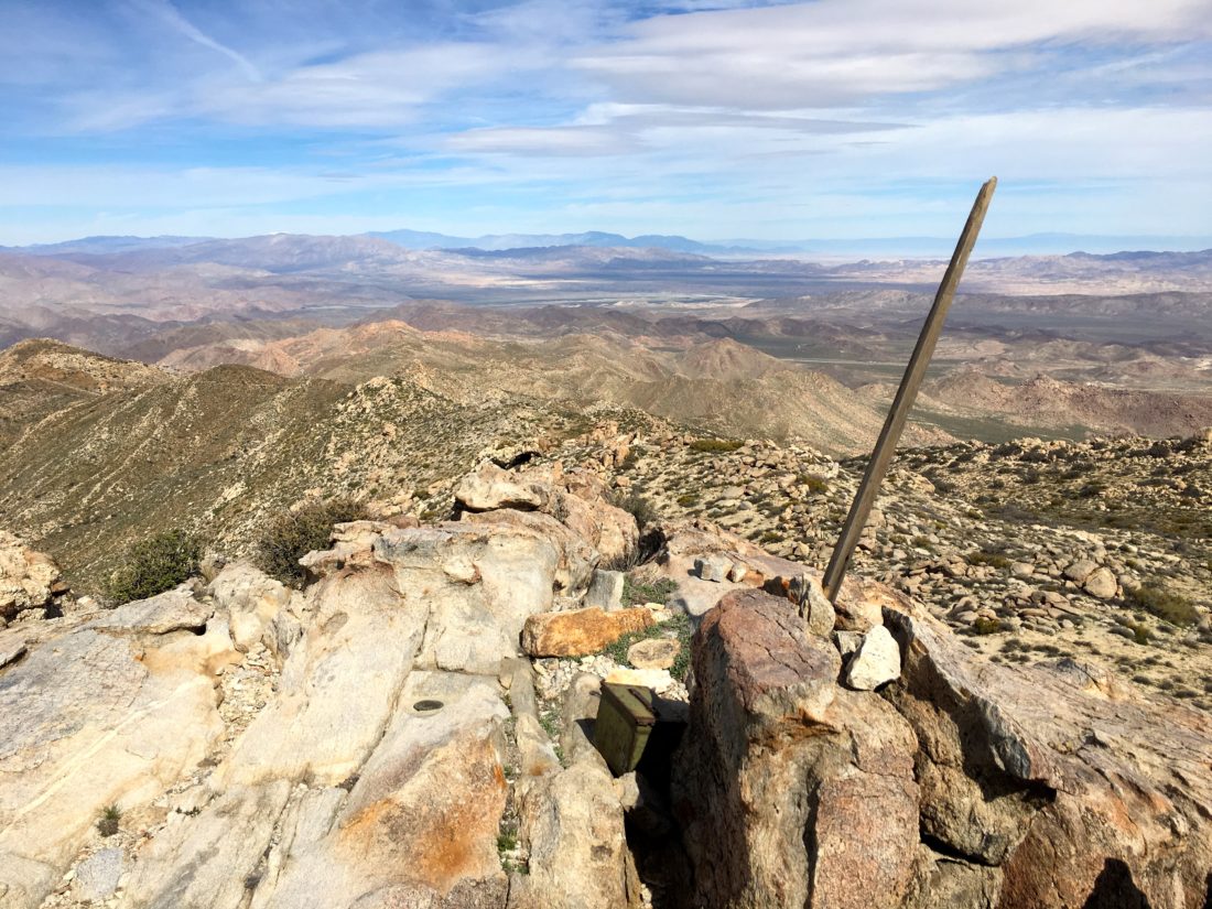
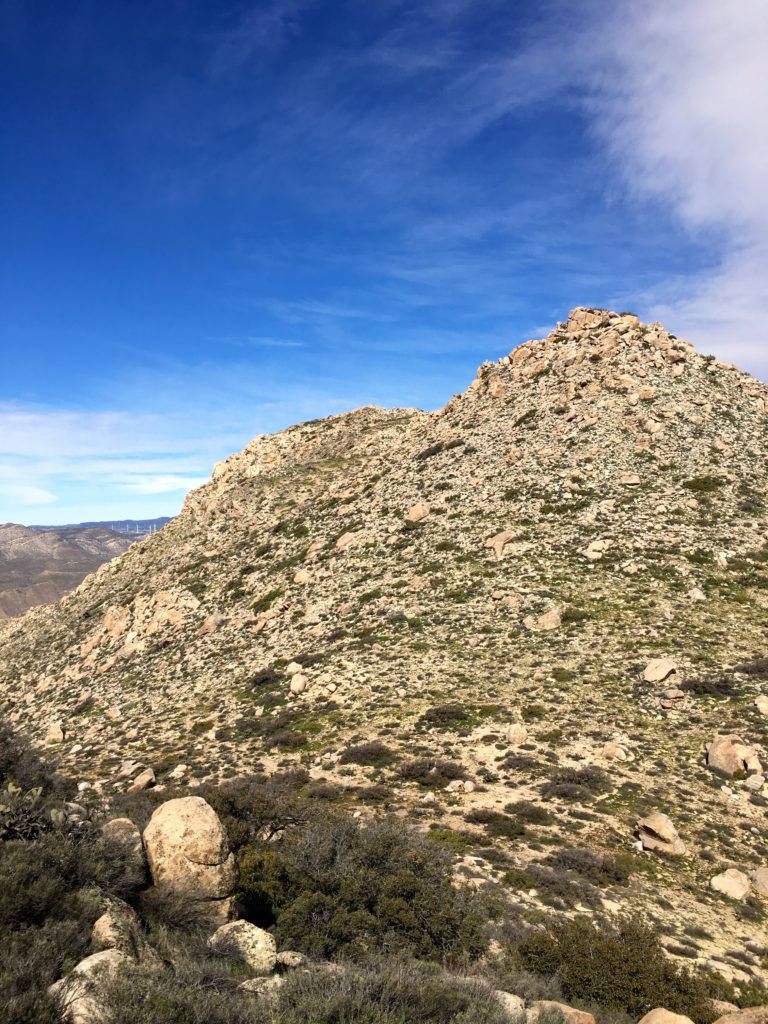
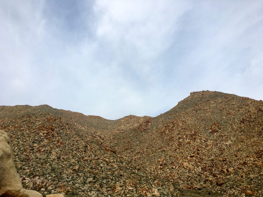
Cresting over the ridge, Sombrero Peak finally revealed itself to me. One last push to the summit. I scanned the slopes and saw a workable route to the top. Finally, I had reached the summit! This was one hard peak to bag. The descriptions that friends had given me were accurate in the difficulty of summiting this peak. I found the register, and as I took the time to read past entries, I saw many familiar names.
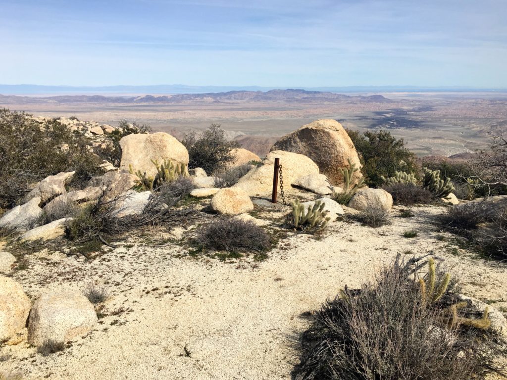
I scrambled around a bit looking for the survey marker, I suspect it was atop one block I did not feel comfortable scaling solo. Looking to the east, the windmills of McCain Valley seemed awfully close. I had read several trip reports about folks hiking over from the west.
I knew I still had a hard descent ahead of me and began heading back down. Initially, I was disappointed I did not find the mystery post and chain, and bam! there it was.
Remember, my decision to leave my hiking poles back in the car? Yeah, big mistake. I felt it some when I was climbing, but now I really could use them. I took a more direct path down (the more northern track on my map) toward the top of that side canyon. I worked my way down the canyon, scrambling down the rocks, and soon the tops of those palm trees came into view. Before I knew it, the glinting sun off my car was visible.
All told the hike was only 3 miles, but it took over 4 hours of hiking time and gained over 1,906 feet of elevation.
I am an avid peak bagger, sometimes backpacker, and former sea kayaker living in San Diego. In 2019, I became the third person to complete the San Diego 100 Peak Challenge. Not stopping with that accomplishment, I set my sights on the harder San Diego Sierra Club 100 Peak list, which I completed in 2021. In addition, I have conquered several Six-Pack of Peaks challenges (SoCal, San Diego, Central Coast, and Arizona-Winter). Beyond attempting the San Diego Sierra Club 100 Peak list a second time, I am looking forward to exploring new summits and new adventures across the southwest.
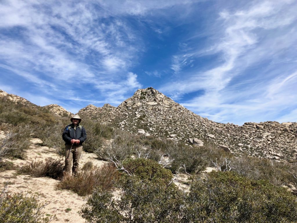
Today’s adventures were to summit both False Sombrero and Sombrero Peaks. Joining me on these attempts would be Derek Loranger, my friend, and creator of the 100 Peak Challenge. I knew Derek through my work as a user experience designer, but this was the first time we had a chance to actually hike together. Headed out to Anza Borrego today to attempt both False Sombrero and Sombrero Peaks. As we drove through Ramona, we spotted a bald eagle sitting on a fence. Later in Anza Borrego, we encountered a herd of bighorn sheep crossing the road. First time for me.
The dirt road took a little care to get to the trailhead. Derek Loranger and I headed up the boulder-filled wash toward False Sombrero. Along the way, an agave got Derek in the shin.
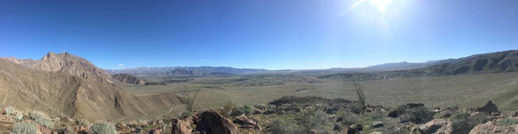
Once we cleared the boulders, the sandy scree started and my lungs were burning. Susie Kara was right, it was tough. Soon we found ourselves at the saddle and the short push to the summit. Again, the desert views never cease to amaze me.
We signed the register and began working our way down. The sandy section was fun and fast. Then the boulder scrambling began in reverse.
By the time we returned to the car, Sombrero Peak was seeming less likely. We opted to drive over to the trailhead anyway, just to see the road status. Once there, we walked up the trail a bit, then enjoyed a nice beer (Thanks Second Chance Brewery) and the scenery. Once back in civilization, we split a pizza in Wynola. Along the way pointing out various peaks that needed to be done or ones that are now crossed off my list. All in all, another peak summited. 12 to go!
I am an avid peak bagger, sometimes backpacker, and former sea kayaker living in San Diego. In 2019, I became the third person to complete the San Diego 100 Peak Challenge. Not stopping with that accomplishment, I set my sights on the harder San Diego Sierra Club 100 Peak list, which I completed in 2021. In addition, I have conquered several Six-Pack of Peaks challenges (SoCal, San Diego, Central Coast, and Arizona-Winter). Beyond attempting the San Diego Sierra Club 100 Peak list a second time, I am looking forward to exploring new summits and new adventures across the southwest.
I had planned to try to summit Sugg Peak with the expert guidance of Susie Kara, but alas she was under the weather. Since I was already up and ready to go, I had to quickly pivot to an alternate plan. The challenge I am starting to face with my remaining peaks is that many are long and difficult, and not suited for a solo attempt. Luckily, Peak 3339 was still on my list of peaks left to summit.
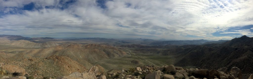
I drove out toward Boulevard as the sun rose over the mountains. Frost lined the side of the road from the recent rains. As I drove north along McCain Valley road, I passed the turnoff to the trailhead to Mt. Tule. Soon I came to the Lark Canyon OHV Staging Area, which has several pit toilets.
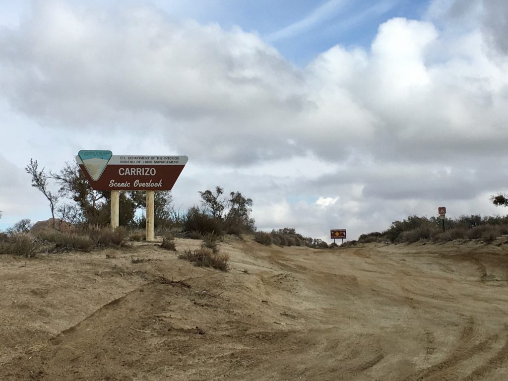
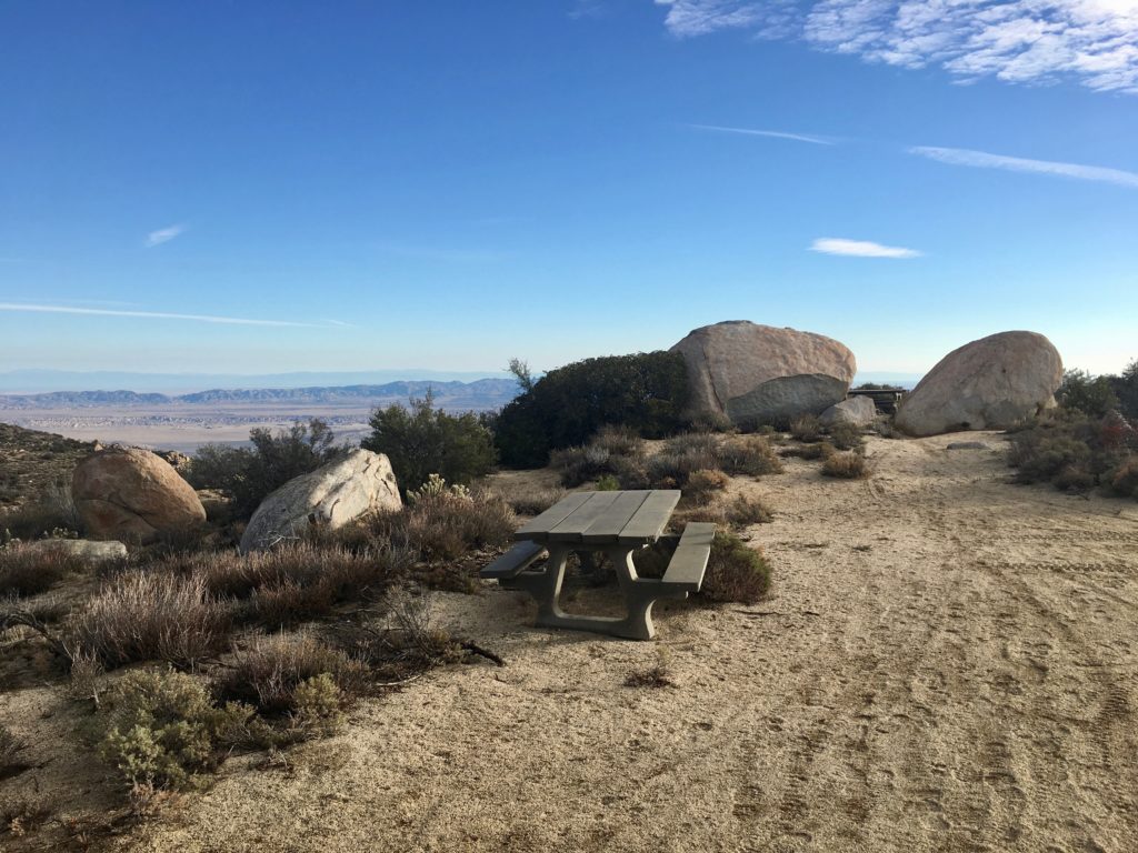
Continuing north along a well-graded dirt road I reached the Carrizo Scenic Overlook. I turned off here and parked at a nice turnout. The trailhead is to the east beyond a fence. I passed a few picnic tables and a metal grill before descending steeply down.
The route to Peak 3339 follows a motorcycle trail most of the time, so navigation is not difficult. Unfortunately, this is an inverted summit, meaning that you start higher than the actual summit.
I worked my way down the trail, reminiscing of my former dirt bike days, and secretly hoping I might catch a ride back up…
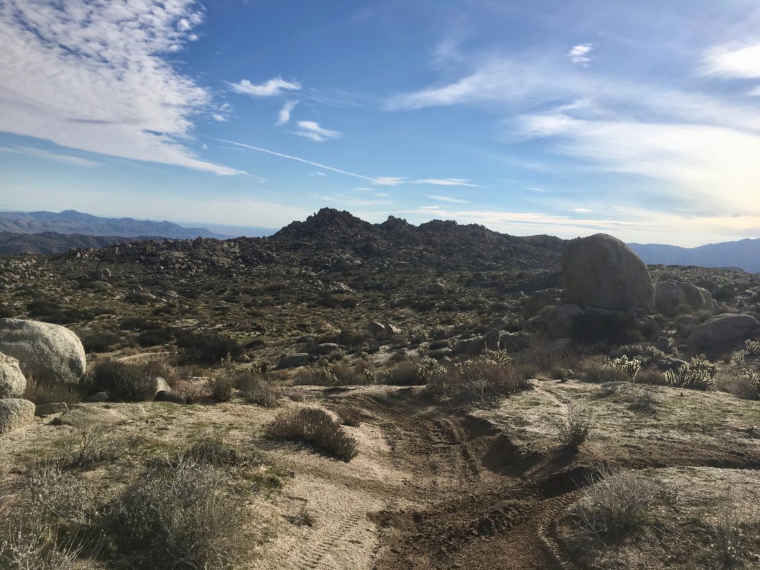
The peak was one of the bumps basically straight ahead of me in the distance, however, the trail turns northward for a while before returning to its eastward route. The advice I read recommended staying on the trail as long as possible before heading cross-country to the peak.
As the peak drew near, I eventually decided it was time to leave the trail and begin the actual climb to the summit. I unfortunately worked my way a tad too far south along the peak cluster. Navigating back to Peak 3339 from the south, I did not find any easy routes up. So, I worked my way back to the west side of the peak. There I found a nice route that took me basically to the top.
There I scrambled to the top of a nice block and enjoyed the view. I did not find a register. It might have been on the other block, but I was not comfortable scrambling solo to check it out.
After a snack, I headed down from the summit and began crossing the open desert to rejoin the trail. The windmills stood out along the ridge to the west, reminding me of the climb still to come to get back to the car.
Oddly, I never heard the sounds of any motorcycles, although I saw many being unloaded earlier. No complaints, as the quiet of the desert is always welcome. As I made my way back up the steep incline, I met a fellow hiker. With a copy of Afoot and Afield In San Diego in hand, he was out exploring as well. Turns out he is a fellow Gaucho. He graduated a few years before me with a degree in geology. We chatted for some time before we went our separate ways.
As I neared the end of the trail, I picked up two beer cans that were tossed to the side of the trail. Ugh. Although I had hoped to summit Al Holden as well, I did not want to venture out to it solo. But this was such a fun hike, I figured I would return with some friends to explore the area more another time.
I am an avid peak bagger, sometimes backpacker, and former sea kayaker living in San Diego. In 2019, I became the third person to complete the San Diego 100 Peak Challenge. Not stopping with that accomplishment, I set my sights on the harder San Diego Sierra Club 100 Peak list, which I completed in 2021. In addition, I have conquered several Six-Pack of Peaks challenges (SoCal, San Diego, Central Coast, and Arizona-Winter). Beyond attempting the San Diego Sierra Club 100 Peak list a second time, I am looking forward to exploring new summits and new adventures across the southwest.
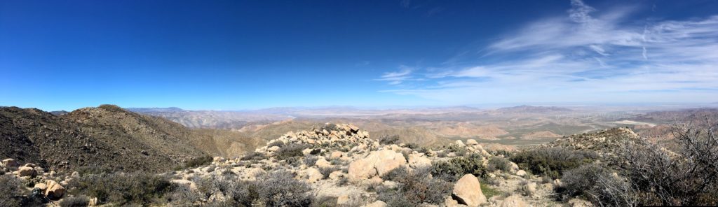
As my remaining peak list dwindles, solo hikes are in short supply. Coyote Mountain was one of the few peaks left. I drove out to Anza-Borrego in the early morning and was greeted with a gorgeous sunrise as I left Ranchita and began my descent into Borrego Springs.
The trailhead is off Rockhouse Canyon Road; I loved that Apple Maps told me I had to park and walk to it. Ha! Although it is a dirt road, a standard car would have no trouble.
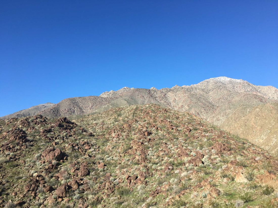
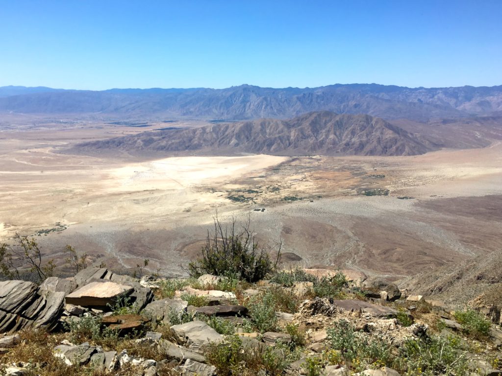
Looking at Coyote Mountain from the Villager ridge (from a previous hike)
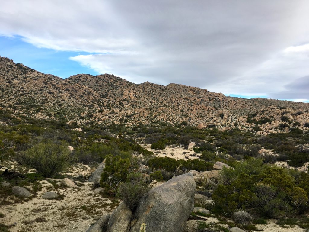
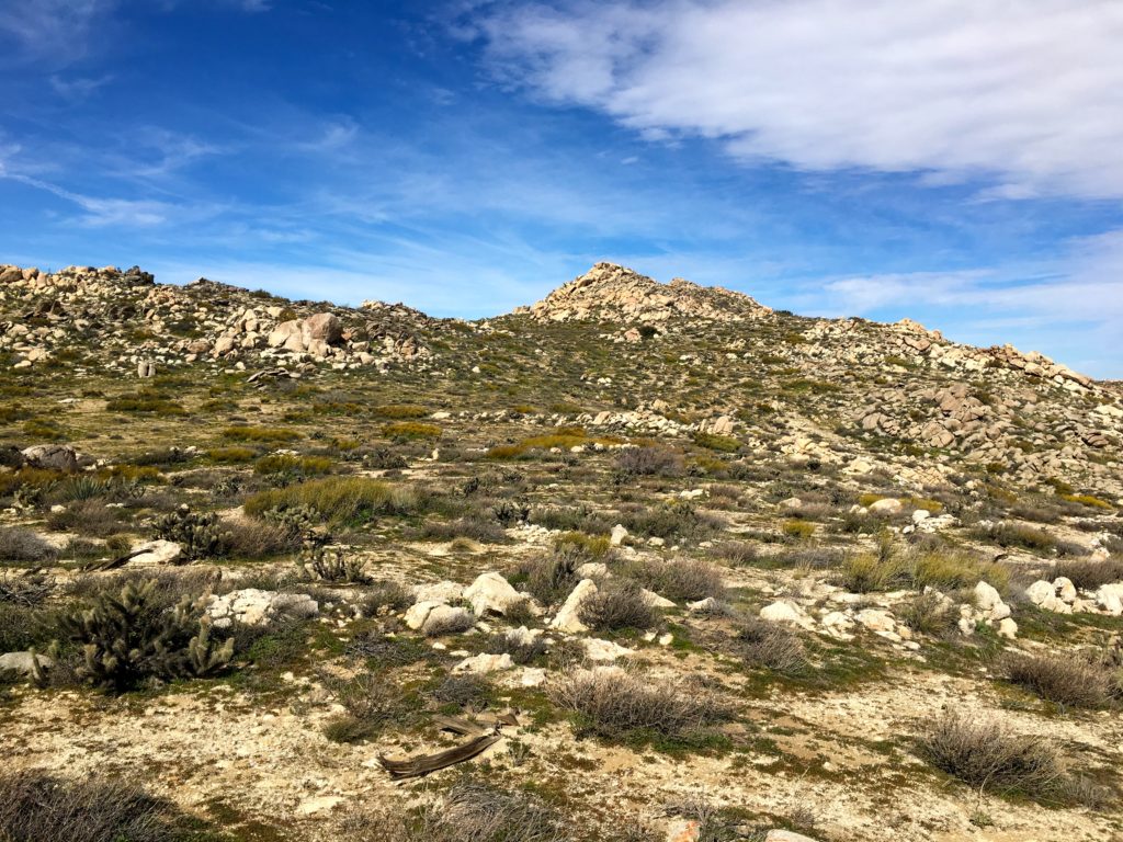
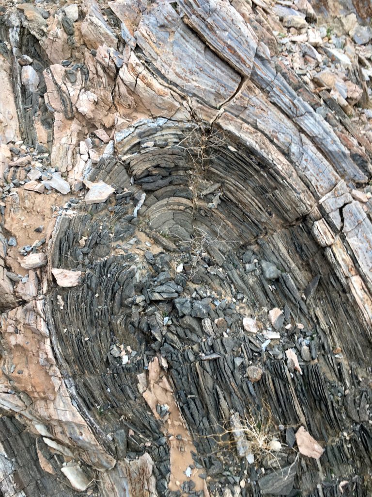
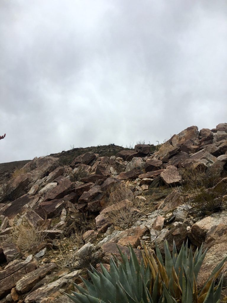
The skies were partly overcast, as a storm was due in the afternoon. I parked, and Coyote Mountain loomed before me. The route follows the ridgeline to the summit, so the only minor challenge is crossing the desert floor to it.
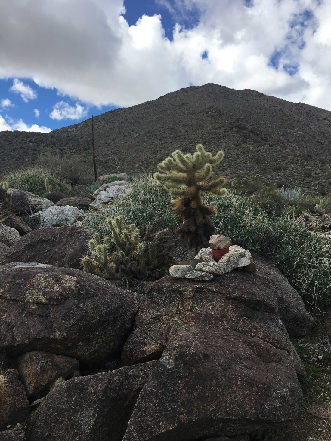
As I began working my way up the start of the ridge, I spotted this geological wonder.
I navigated my way up, and at times a clear use trail guided me through the rocks and sharp pointy plants. At other times, the trail would fade away, or I was working my way up a steep and rocky section.
The route would alternate between sections that burned your quads and easier sections that would allow you to catch your breath. As the summit looms over you, the route bends westward, letting you know that the end is close at hand.
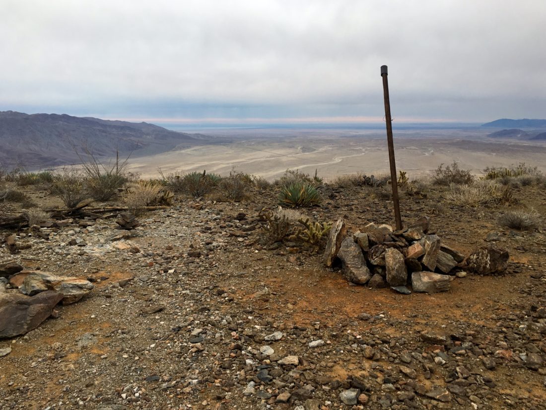
At the summit, you are almost immediately greeted with a pole denoting the register and the benchmark is nearby.
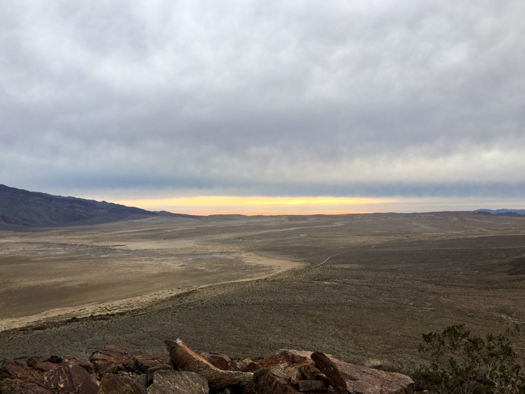
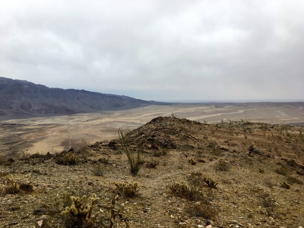
I took in the views of Clark Dry Lake bed to the east, near where I started. To the west and south bits of Borrego Springs. I had a snack, then wandered over to a nearby bump to the west. Another register was tucked in a pile of rocks as well.
Then it was time to work my way back down because I certainly did not want to do this in the rain. About halfway down, about 14 hikers were making their way up. This turned out to be a guided hike led by the Anza Borrego Foundation. A bit behind them were two other hikers, and we chatted some. I mentioned what I was doing, and it turns out I was chatting with Greg Gerlach and Kelly Laxamana, two peakbaggers I trust on peakbagger.com. How I wish I could have picked their brain more about my remaining summits.
With about a mile to go, my knees started to really hurt. The steepness of this summit was getting to me. As I slowed my pace, I began looking for the best option to depart from the ridgeline and get back to flatter ground. I made it back to the car and was glad to be done and heading back into Borrego Springs for a cold beverage and some Mexican food. As I drove back home and crested into Ranchita, the rain started to fall. 83 summits are done, and looking forward to finishing them!
I am an avid peak bagger, sometimes backpacker, and former sea kayaker living in San Diego. In 2019, I became the third person to complete the San Diego 100 Peak Challenge. Not stopping with that accomplishment, I set my sights on the harder San Diego Sierra Club 100 Peak list, which I completed in 2021. In addition, I have conquered several Six-Pack of Peaks challenges (SoCal, San Diego, Central Coast, and Arizona-Winter). Beyond attempting the San Diego Sierra Club 100 Peak list a second time, I am looking forward to exploring new summits and new adventures across the southwest.