The hope was to summit four different peaks today; Mt. Tule, Red Hill, Mine Benchmark, and Ghost Mountain. With the recent storm, the surrounding mountains were covered in snow, and I knew I might have issues along the 8. So, I actually left a little later than usual to allow the roads to be clear. Even so, I still saw a car on its side, most probably due to the road conditions.
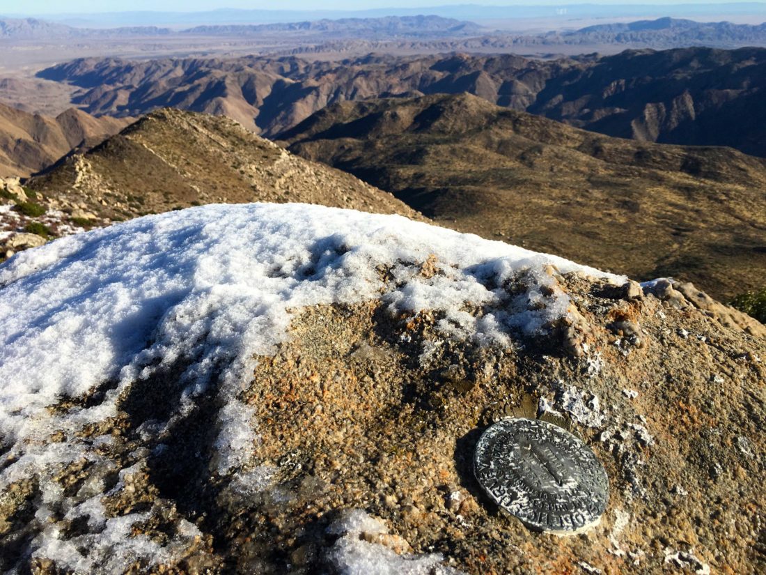
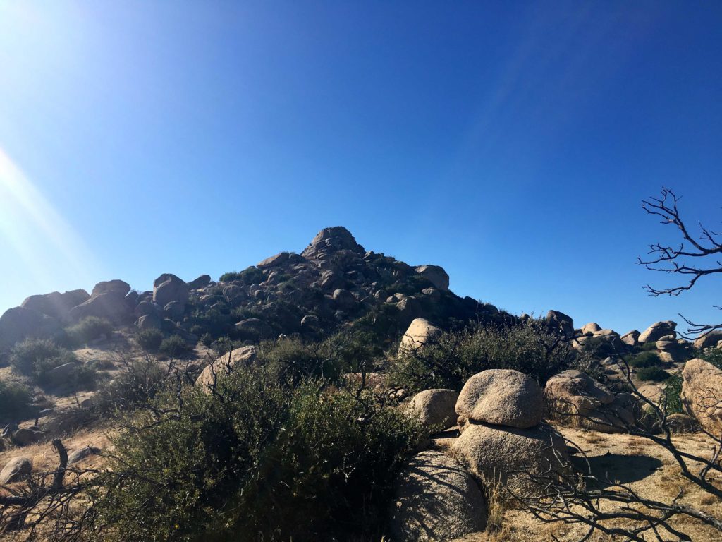
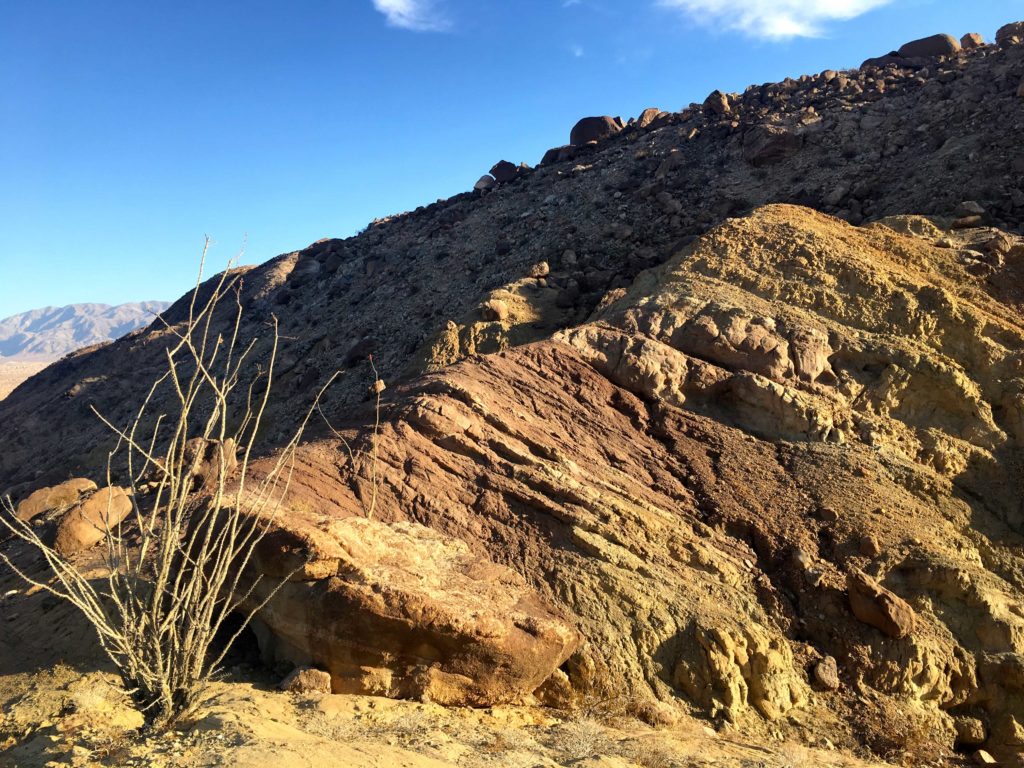
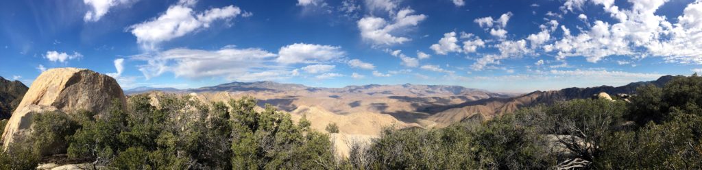
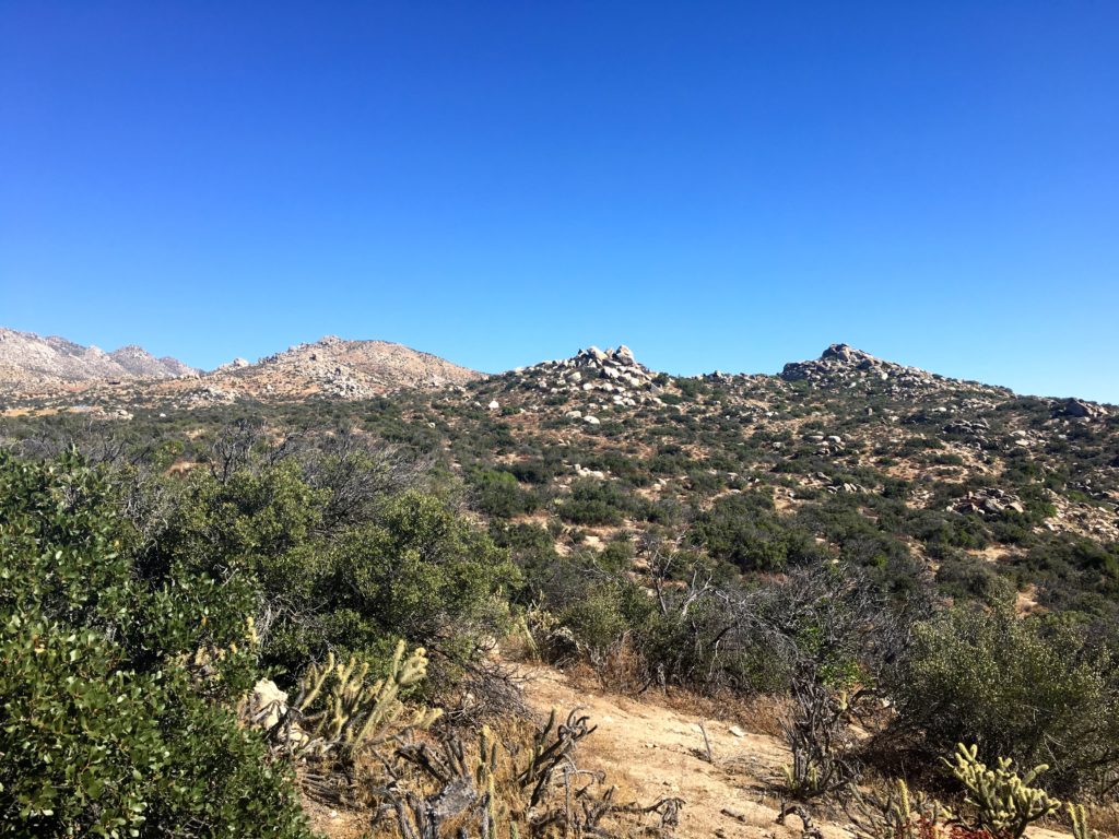
First up was Mt. Tule out by McCain Valley, near Boulevard. Instead of parking where I did last time, I turned onto MV052 and continued a bit further. I figured 15 minutes couldn’t hurt since I had a full dance card. It was cold enough for ice to form a thin layer on the puddles in the road. A light dusting of snow appeared to be atop Mt. Tule as well. Grabbing my warmer gear, I set off. At the road’s end, I spotted a use trail to the southern edge of the turnaround. This trail quickly led me up to the northern peaklet. As I got closer, more and more snow was on the ground. A familiar crunch sounded under my boots as I began working to the southernmost peak.
What a wonderful way to start the day, atop a snow-capped peak and some incredible views. I signed the register and found the two reference marks, but had no luck finding the main mark.
With three more peaks to attempt, I did not have time to dawdle. Retracing my snowprints, I found the use trail again and made my way down. #91 was in the bag!
I am an avid peak bagger, sometimes backpacker, and former sea kayaker living in San Diego. In 2019, I became the third person to complete the San Diego 100 Peak Challenge. Not stopping with that accomplishment, I set my sights on the harder San Diego Sierra Club 100 Peak list, which I completed in 2021. In addition, I have conquered several Six-Pack of Peaks challenges (SoCal, San Diego, Central Coast, and Arizona-Winter). Beyond attempting the San Diego Sierra Club 100 Peak list a second time, I am looking forward to exploring new summits and new adventures across the southwest.
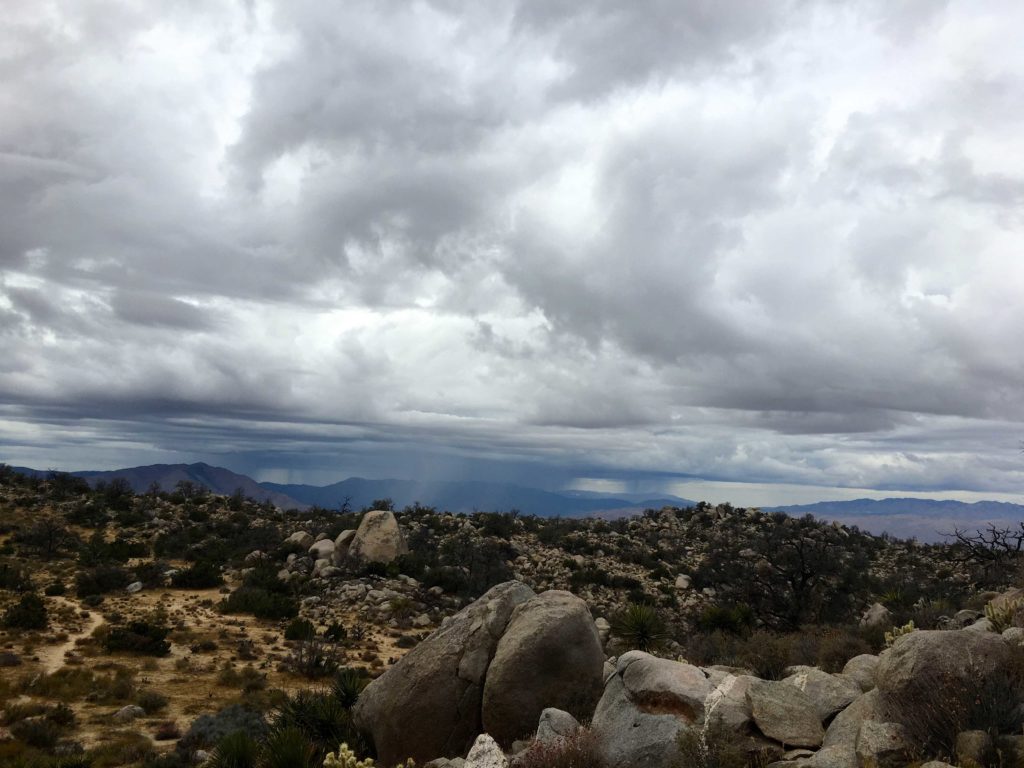
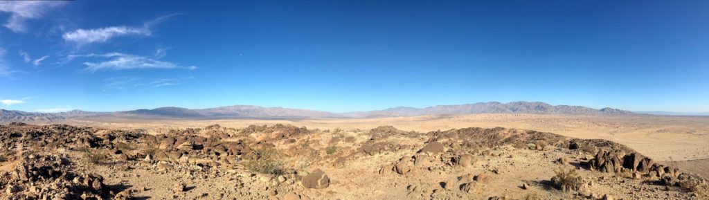
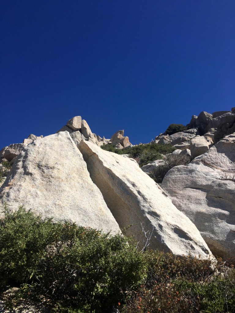
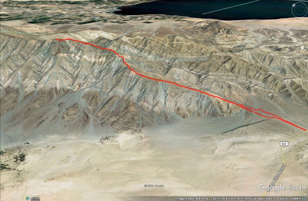
Ted and I pulled off the Borrego Salton Seaway at the trailhead commonly used for climbing Villager or Pyramid Peaks at about 5:15 am. Matt was already there, and soon Susie arrived, followed by Greg. Our goal today was to work our way up from the desert floor to Rosa Point, #28 on the San Diego 100, then onto Mile High (#24). We knew this was going to be a long, hard day, hence the pre-dawn start.
Under the faint light of a sliver of the moon, we set off across the desert floor, illuminated by our headlamps. Our first landmark was the entrance to Palo Verde Wash, about a mile northeast of our starting point. I mistook a wash to the north as our entrance, but a quick check of our route had us back on track with only about 10 minutes of backtracking.
We would follow this wash for about a mile and a half. At about the 1900’ elevation point, a steep ridge was on our left. It was here we would climb out of the canyon and onto the ridgeline that we would use for most of the ascent.
Once up this section, we stopped for a short breather and to check in with one another. Susie was not sure about continuing. She really wanted to add Rosa Point to her list, having already summited Mile High back in 2017. I guess doing Cactus to Clouds the day before night had something to do with it. If you are unfamiliar with that hike, it is one of the toughest in the US. Some 10,000+ feet of elevation gain in 21 miles and a modest portion was in the snow. She wished us good luck on our attempt and headed back down.
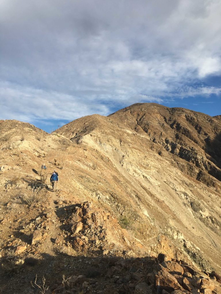
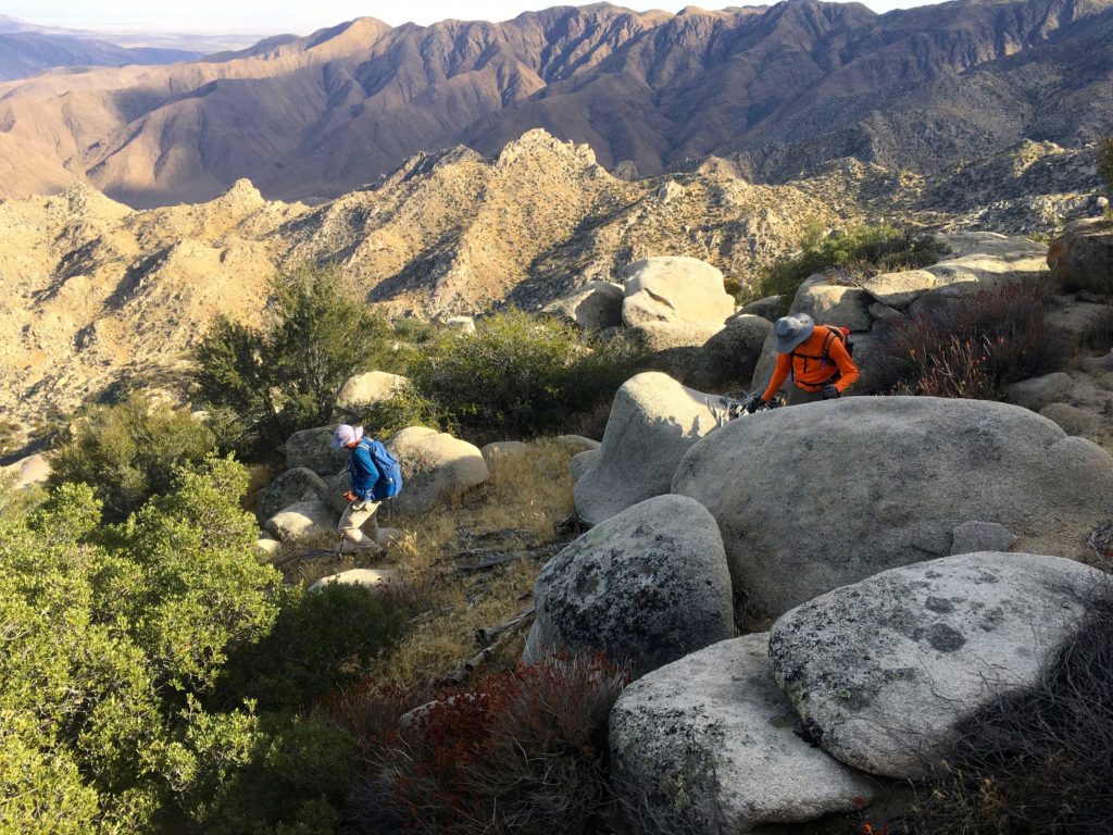
The four of us continued our journey. This was Greg’s third time doing this loop, so we knew we were in good hands. Greg and I traded off navigation checks as we followed a modest use trail northward. The weather was perfect—low 50s with a slight breeze. As we kept climbing upward, the trail was steep but manageable. Finally, at about 3,400’ we began a short descent across the top of the Palo Verde Wash. After this welcomed respite from climbing, it was time to gain the final 1600’ of elevation to reach Rosa Point. Matt’s climbing ability was impressive, as he just seemed to effortlessly fly up the ridgeline. Greg followed him, while Ted and myself brought up the rear. Ted and I have an arrangement—he takes the photos and I keep us from getting lost.
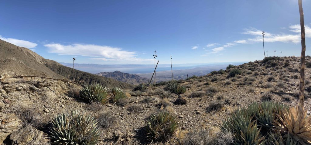
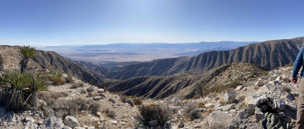
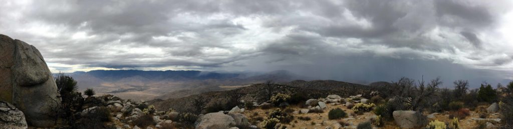
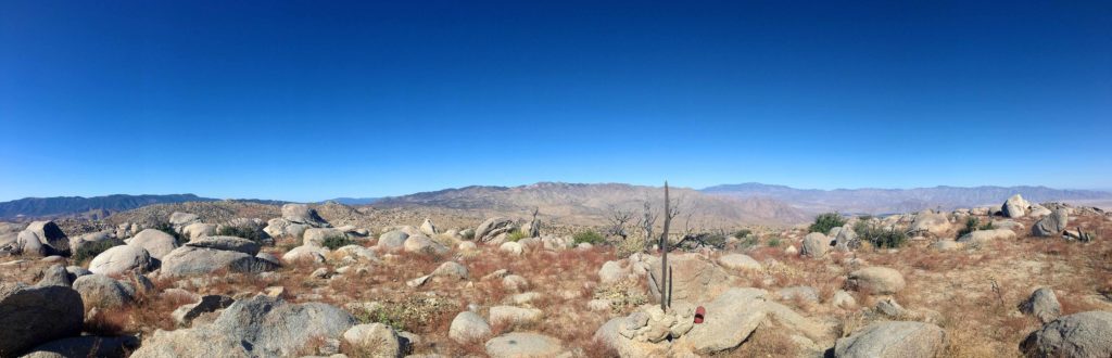
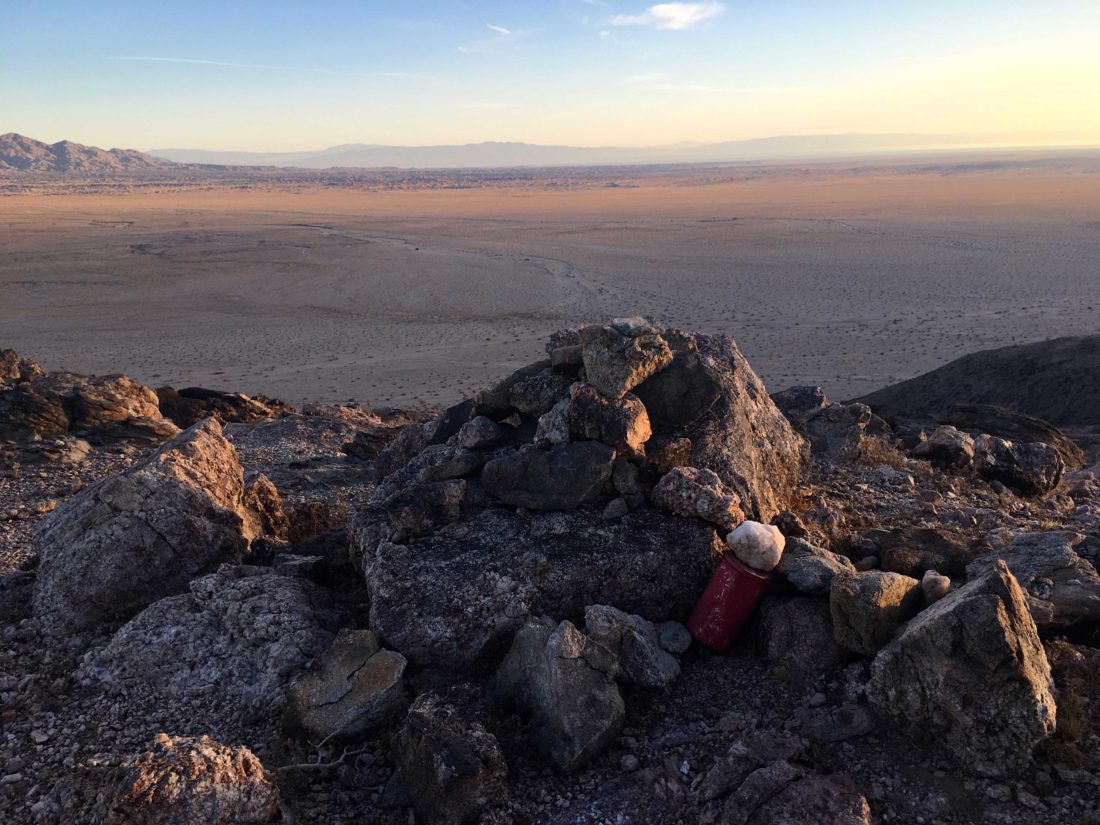
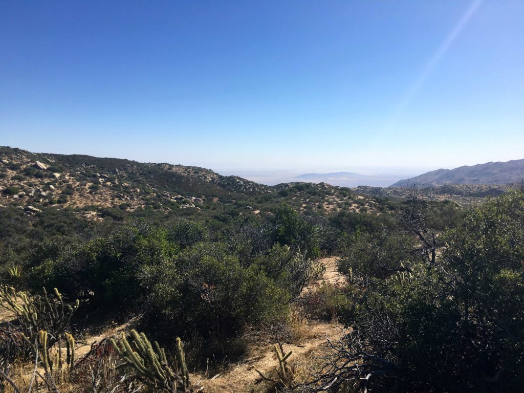
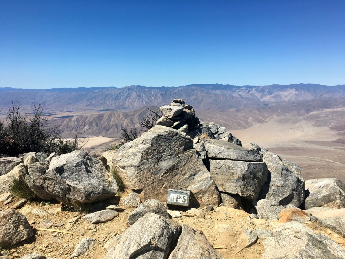
Soon Rosa Point came clearly into view. Just about 4 hours after we started, we were soaking up the views of the Salton Sea to the east, Anza Borrego to the south, and our next summit, Mile High, off to the northwest. After signing the register and having some snacks we headed off. Greg estimated it would take us about 2 hours to work our way to Mile High.
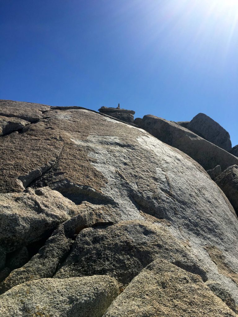
Although Rosa Point sits at 5,000 feet and Mile High is only 320 feet higher, we still had some work ahead of us to reach its summit. Our route follows the narrow ridgeline, traversing several bumps along the way.
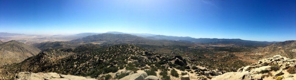
Just before 1 pm, we reached the summit of Mile High! The views were even more stunning than the ones from Rosa Point. I sat against a rock and enjoyed my well-earned PB&J, a small can of Coke, and a nice orange. After tending to a few hot spots on my feet, I signed the register and took some photos. For some reason, my phone was acting wonky. I shut it down in case I needed it later.
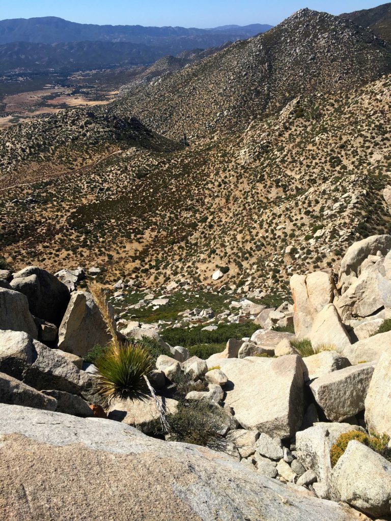
Unfortunately, we still had one more big challenge ahead of us. Rather than turn back and hike the way we came, the safer option is to take the village use trail back down. One issue is this requires descending about 1,000 feet along a steep, rocky, and tricky ridge. Once at the saddle, you then have a 600-foot climb upwards. Like I said, a real challenge.
Once safely at the saddle, we surveyed the various options for our ascent. A route a bit to the south seemed to be less rocky, so up we went. I knew I just needed to push up this and it would be a relatively easy 5 miles back to the car. The advantage of having done Villager before was I knew this section, but first I had to get there. I started my climb, not sure how often I would need to stop. Ted said to take it one step at a time. I picked my way up, chugging along. Ted would call out the elevation gain, “200 feet gained, halfway, 150 to go”. I could see the sunlight on the top of the ridge and knew I had just climbed that section without stopping! I was amazed at myself. While it was no speed record, we had made the ascent in about 35 minutes. We were still on our projected pace.
After a break for some fluids and snacks, we set off down the trail. Greg and Matt were about 300 yards to the south, waiting for us. Now that we had regrouped, it was time to head down. Matt and Greg soon pulled away but having hiked this portion before I was not concerned. I would rather take it a touch slower than risk a misstep.
We got past the two steep sections of the trail and past the narrow section well before a beautiful sunset. Donning our lights we continued on down the trail. I was glad I picked up a new headlamp earlier in the week. Going from 200 lumens to 350 really made a difference.
As we neared the final switchbacks at the end of the Ridgeline, we could see the headlamps of Greg and Matt waiting for us at the base. From here, Greg guided us onto the use trail, and we began zooming across the desert floor. Soon we found ourselves back at our cars. All told we covered some 15.8 miles, gained over 6,100 feet of elevation, and did it in about 12 1/2 hours total. We packed up our gear and drove back into town for some well-earned burritos. That was peak #90 of me for the 100 Peak Challenge! As for the San Diego 100, well I now have 70 of those done as well!
Oh, remember Susie? She stopped off at the Borrego Springs Visitor Center and summited Ode Benchmark…
I am an avid peak bagger, sometimes backpacker, and former sea kayaker living in San Diego. In 2019, I became the third person to complete the San Diego 100 Peak Challenge. Not stopping with that accomplishment, I set my sights on the harder San Diego Sierra Club 100 Peak list, which I completed in 2021. In addition, I have conquered several Six-Pack of Peaks challenges (SoCal, San Diego, Central Coast, and Arizona-Winter). Beyond attempting the San Diego Sierra Club 100 Peak list a second time, I am looking forward to exploring new summits and new adventures across the southwest.
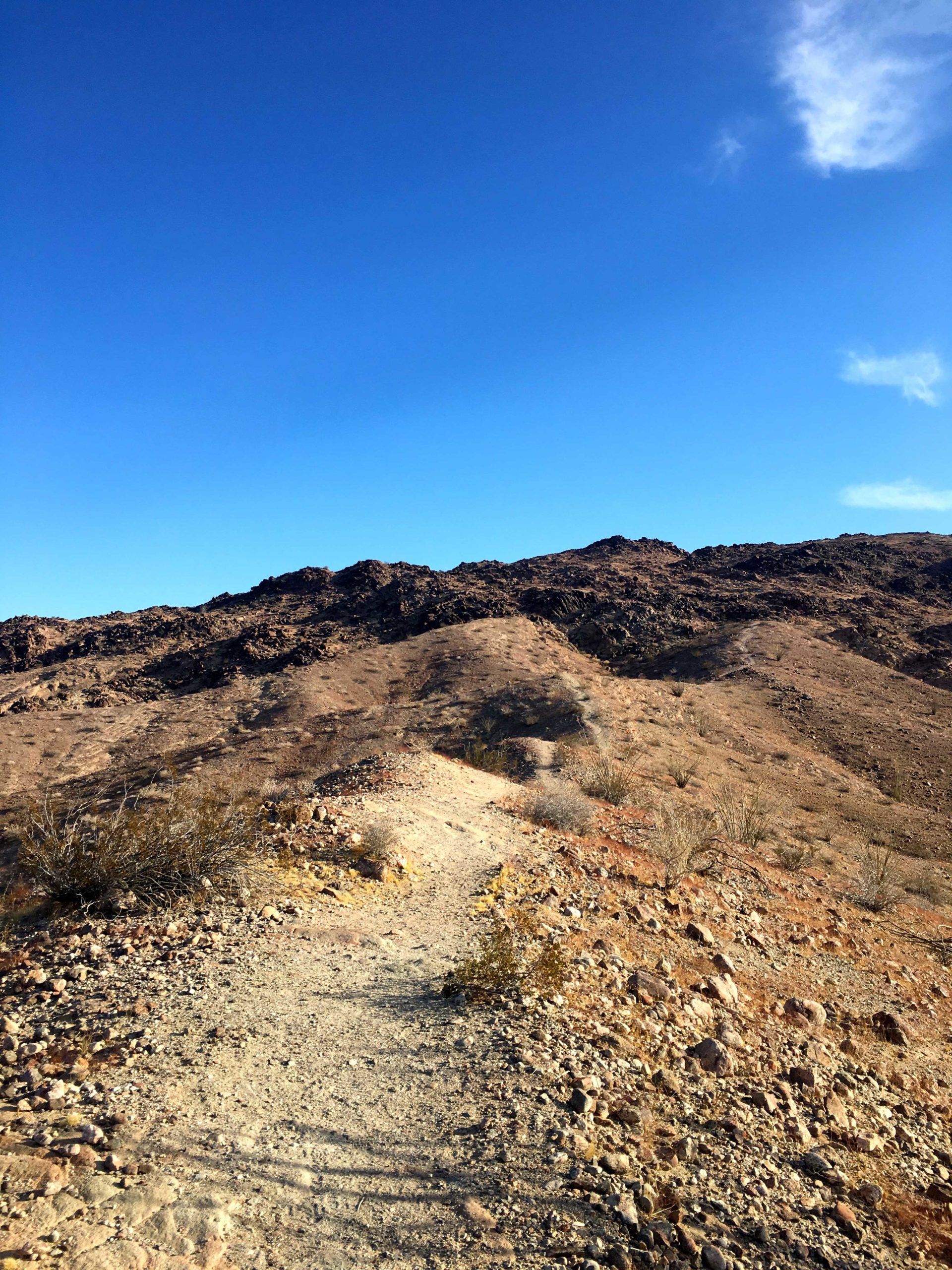
I was finally able to find time to go hiking with our Associate Rabbi, Matthew Earne. I had been trying to keep Whale Peak as an option for us to summit together, as it is not too difficult, but still provides some challenge and adventure to the outing. The first winter storm was coming to San Diego, but the forecast still looked ok to head out and do it. I did remind him to make sure to toss a rain jacket into his pack.
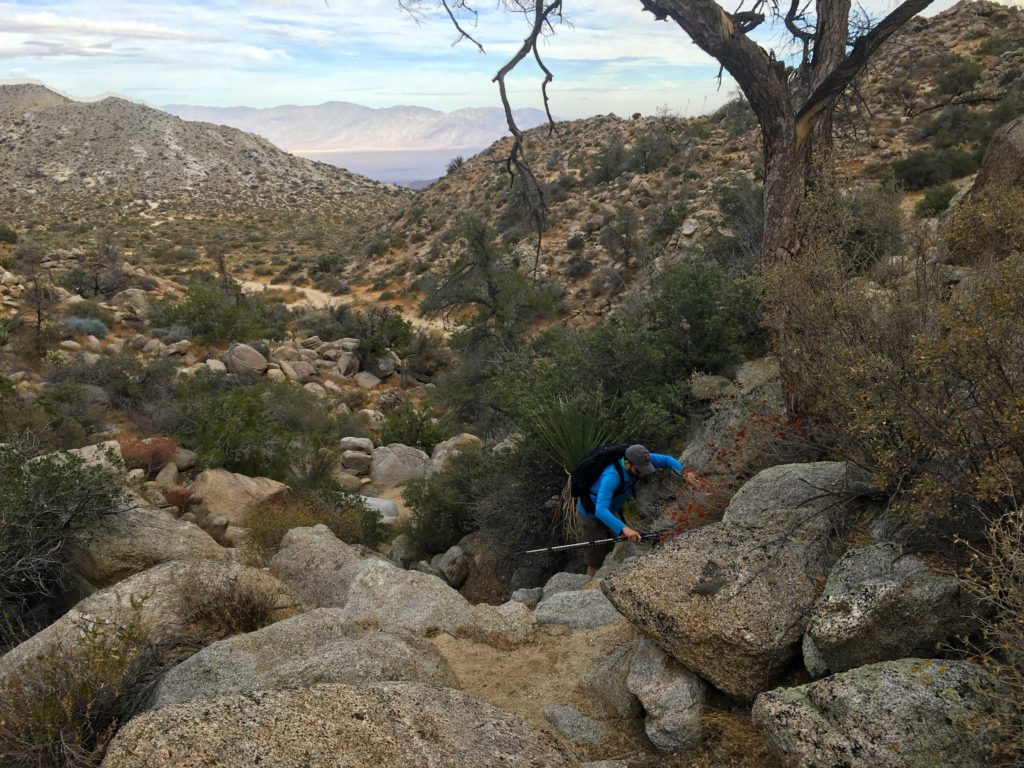
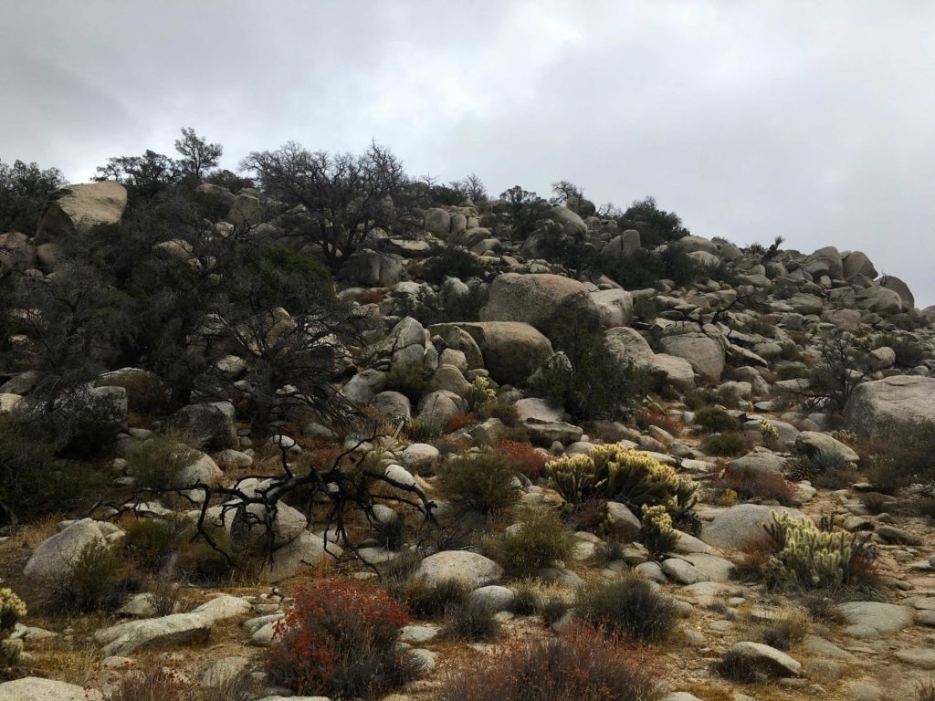
Once we got to the trailhead, we geared up and began the first climb of the ascent. We began working our way up the steep wash to the first of several mini-plateaus along the route. The trail was easy to spot as we cruised toward the next slope. Cairns would also mark the way. As Scott Turner wrote in Modern Hiker, “Whale Peak trail has a reputation for getting even seasoned and experienced hikers lost.” Since I was the guide for this ascent, I tried to keep my bearings about me as we hiked on. The last time I did this peak, Derek Loranger led the way.
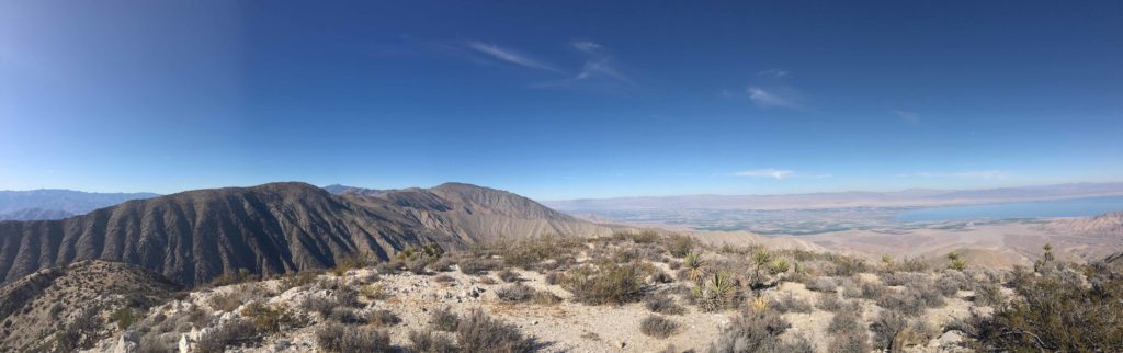
In addition to the route, I was also keeping a watchful eye on the skies for any unexpected weather changes. We could see the rain coming down off to the west on those mountains, but nothing seemed to be approaching us. The winds were light and the temperatures pleasant.
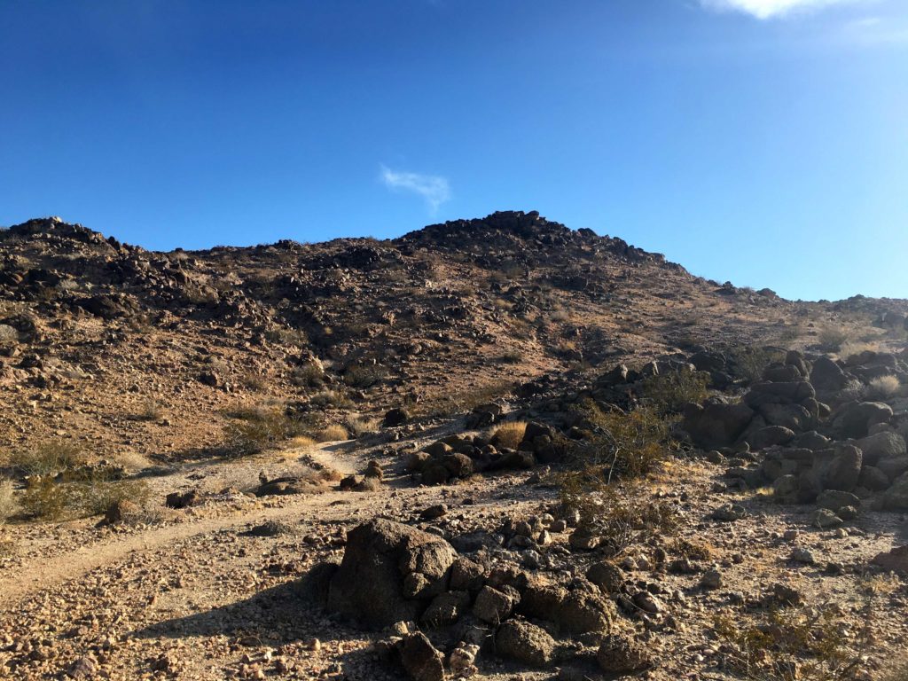
After making our way up the next set of slopes, we soon came to the final steep push to the summit. I told Matt that once it got steep, we would be close to the summit.
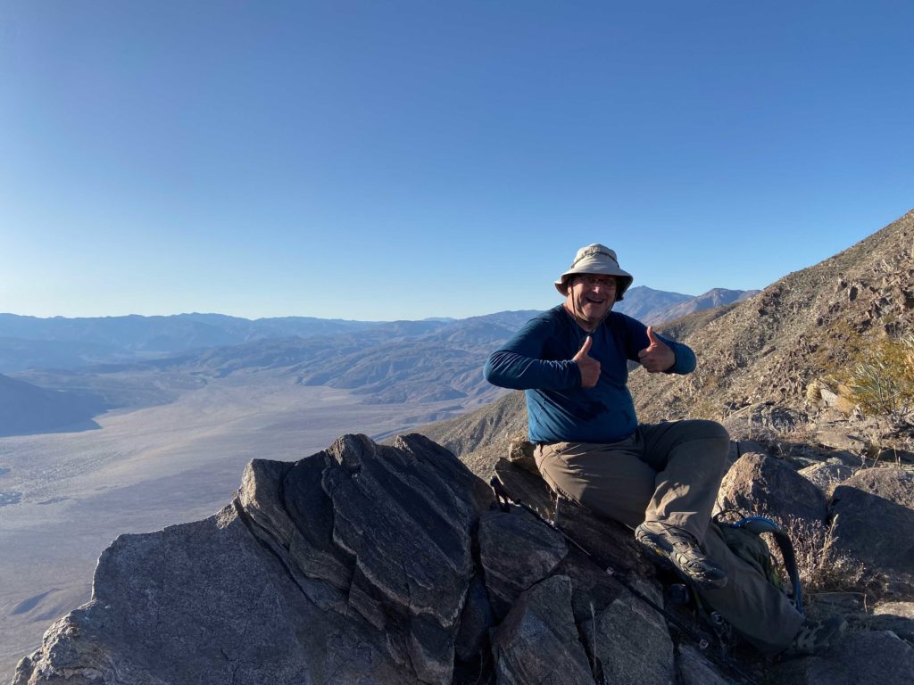
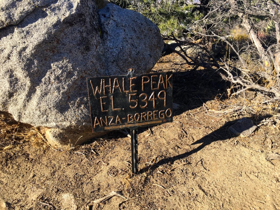
We picked our way up the rocks until I spotted the familiar rocks that denote the summit. With the risk of weather looming over us, we did not linger. Tucked well under a rocky nook was the register, which we happily signed, took a few photos, and grabbed a quick snack.
I pointed out various landmarks from our vantage point; Granite, Pinyon, Blair Valley, etc. A few sprinkles were starting to fall, so we donned our jackets and set out to descend. I must have gotten turned around at the summit and accidentally headed east. After about 10 minutes, I stopped to check my location, as I was spotting neither a trail nor any cairns. Remember what Scott said, Whale Peak had gotten me too. We turned around, and climbed back up to the summit, with me apologizing to Matt several times. Back on the summit and oriented correctly, we cruised back down the peak.
The rain never materialized, so we both removed our jackets. We could see some evidence of rain that had fallen elsewhere on the peak; some granite rocks had some small puddles of water, and the soil was slightly damp. What was nice was, that the desert air was now filled with so many joyful odors. You just wanted to stop and breathe it in.
We made our way back down the steep wash and to the car. I had hoped we might be able to also go summit Ghost Mountain, but between the later than planned start and what was sure to be a slower drive home in the rain, we skipped it. This was peak #89 of my #100PeakChallenge.
I am an avid peak bagger, sometimes backpacker, and former sea kayaker living in San Diego. In 2019, I became the third person to complete the San Diego 100 Peak Challenge. Not stopping with that accomplishment, I set my sights on the harder San Diego Sierra Club 100 Peak list, which I completed in 2021. In addition, I have conquered several Six-Pack of Peaks challenges (SoCal, San Diego, Central Coast, and Arizona-Winter). Beyond attempting the San Diego Sierra Club 100 Peak list a second time, I am looking forward to exploring new summits and new adventures across the southwest.
After having fun summiting three peaks the day before, I was looking to continue to pick off the remaining peaks of my 100 Peak Challenge. Given the unseasonably warm temperatures, I knew which hikes I needed to do—the Wilson Benchmark/Pinyon Ridge combination. Matt, a friend of Susie Kara, joined me on this adventure. Once again, we drove out to Ranchita and then down the dirt road to the trailhead. My Subaru Outback had no trouble with the road, but I would not take my Acura on it. We parked, gathered our gear, and headed down the old jeep trail. It was nice not to be bundled up for warmth like the last time I hiked to these summits.
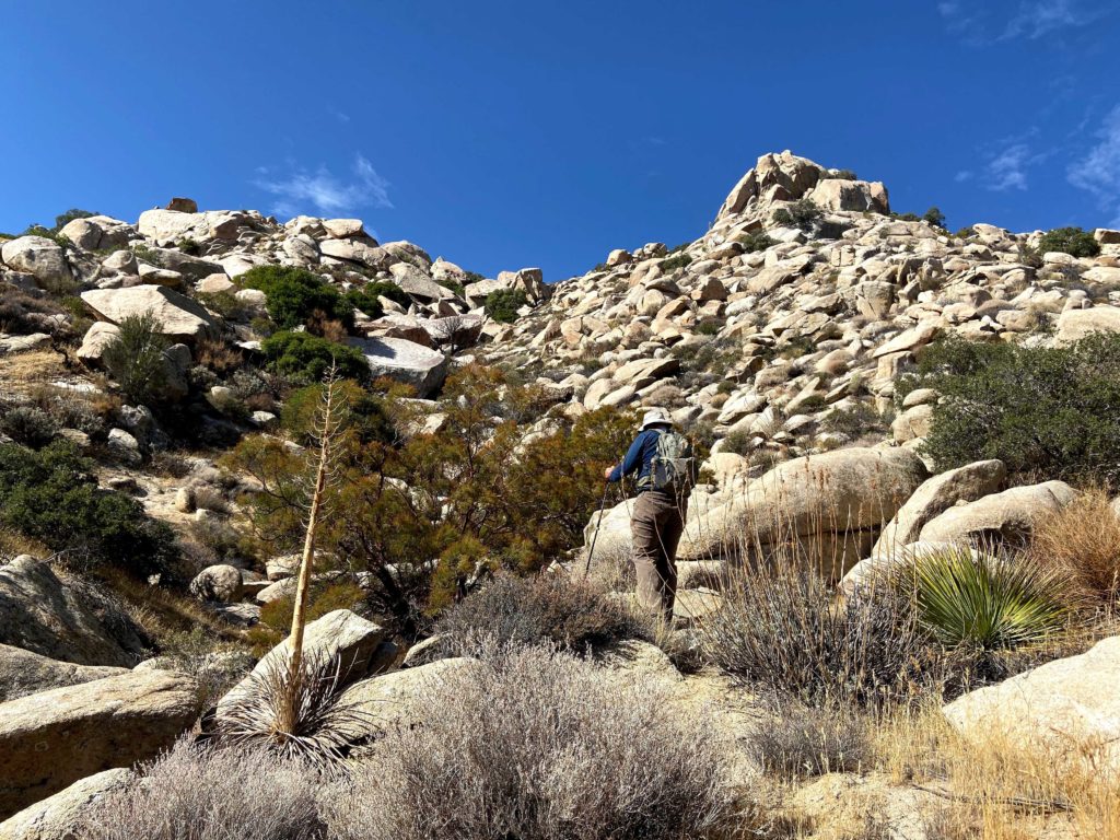
The miles ticked off quickly, and soon we were at the point to leave the trail and ascend Pinyon Ridge. Since I knew from which side to climb the summit block, we aimed for the northeast face.
We climbed up to the top and sat and soaked in the views.
As Matt is relatively new to San Diego, I pointed out the various peaks all around us. The register was tucked away under a good collection of rocks. After a nice rest, we scrambled down and we continued cross-country to the east to rejoin the jeep trail.
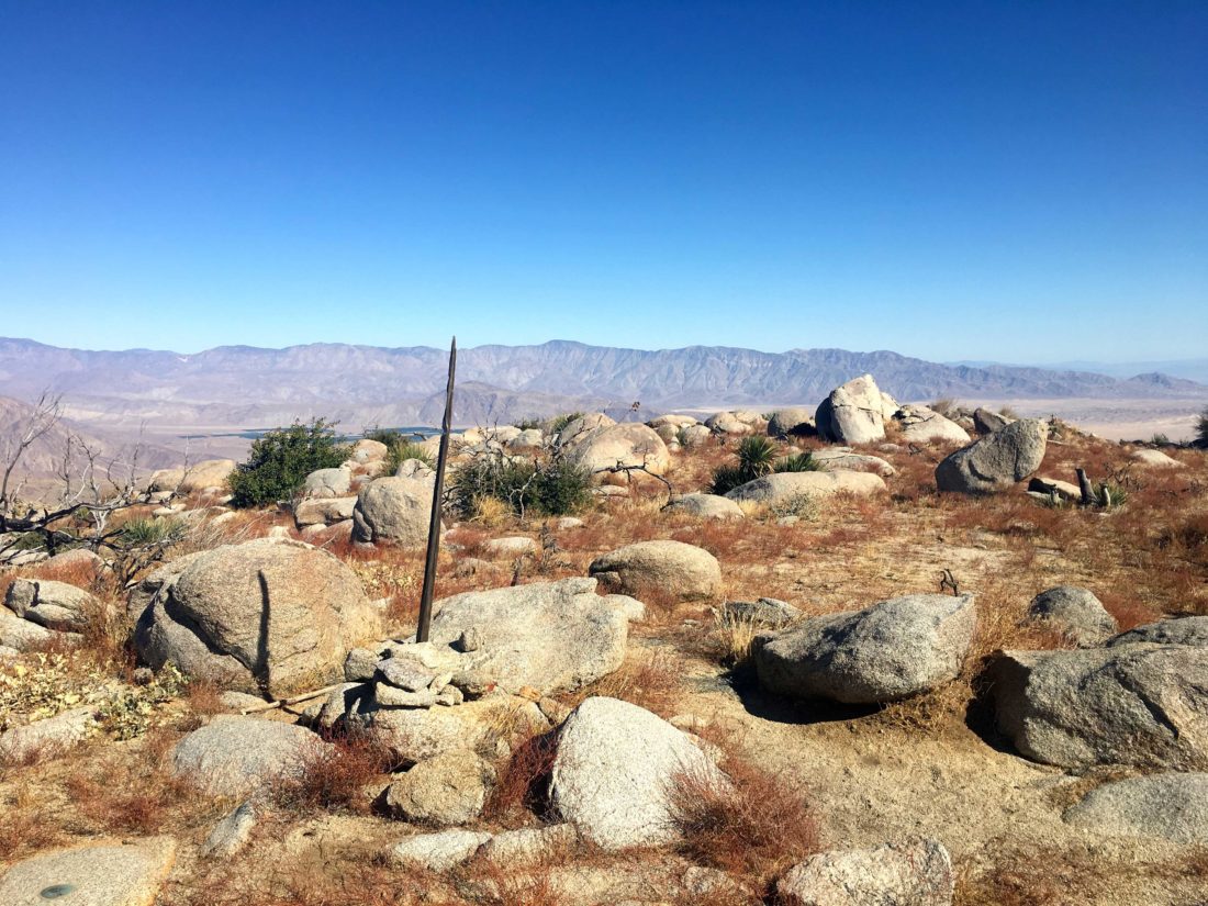
Upon reaching the base of the bump that Wilson Benchmark sits upon, we worked our way up. There is no trail at this point, so it is a “Choose Your Own Adventure” type of ascent. Soon, the wooden stake came into view, which denotes the summit. Both a benchmark and a reference mark were quickly found, along with the register. The peaks to the east were more easily seen, so I continued my role as a tour guide. We hung out here for a bit, then decided to head back.
Back on the jeep trail, we cruised non-stop back to the car. Peaks #87 and #88 were done. On the way home, we stopped at the little store in Ranchita to grab a cold drink. The clerk remembered me and we chatted a bit about the day’s adventures. It was a picture-perfect day to have done these two.
I am an avid peak bagger, sometimes backpacker, and former sea kayaker living in San Diego. In 2019, I became the third person to complete the San Diego 100 Peak Challenge. Not stopping with that accomplishment, I set my sights on the harder San Diego Sierra Club 100 Peak list, which I completed in 2021. In addition, I have conquered several Six-Pack of Peaks challenges (SoCal, San Diego, Central Coast, and Arizona-Winter). Beyond attempting the San Diego Sierra Club 100 Peak list a second time, I am looking forward to exploring new summits and new adventures across the southwest.
The second peak of the day was going to Borrego Mountain West Butte. Pulling into the parking area for the Borrego Mountain West Butte, there was one car parked. It appeared I was still ahead of the crowds that come to hike the Slot. To get to the summit of this Butte, I just needed to follow the trail leading east.
As I quickly made my way up to the well-defined trail, I could see several groups camping down in Hawk Canyon. Approaching the top, the trail shifted from dirt to more rocky, but still relatively easy to navigate.
Once atop the Butte, I checked my location to find the actual summit. I remembered that there was neither a register nor a benchmark here. A nice rock formation served as my summit.
The day was indeed warming up, so if I wanted to get at least one more peak in, I needed to hustle down to the car. As I approached the trailhead, the parking area had now filled up with more cars, and I could see folks milling about before they went off down the Slot. Peak #85 was crossed off, and I drove about 15 minutes to the Plum Canyon tour off and my third peak of the day, Sentenac Mountain.
I am an avid peak bagger, sometimes backpacker, and former sea kayaker living in San Diego. In 2019, I became the third person to complete the San Diego 100 Peak Challenge. Not stopping with that accomplishment, I set my sights on the harder San Diego Sierra Club 100 Peak list, which I completed in 2021. In addition, I have conquered several Six-Pack of Peaks challenges (SoCal, San Diego, Central Coast, and Arizona-Winter). Beyond attempting the San Diego Sierra Club 100 Peak list a second time, I am looking forward to exploring new summits and new adventures across the southwest.
As the end of the year keeps getting closer, I have to be mindful of my remaining peaks. Today I planned to summit either 3 or 4 peaks out in Anza Borrego. The forecast was for highs in the mid-80s, so by the fourth peak, it might be too warm to want to do. It also meant back to being at the trailhead at dawn.
First up was Borrego Mountain East Butte. Unlike last time, where I went up the boulder-filled gully, this time I was going to try a different route from the west side. I drove up Goat Trail, a dirt road across from the Desert Ironwood Resort. Just as the road makes a sharp left is a nice parking area and the trailhead.
The sun had just risen, but it had not cleared the Butte yet, so I grabbed my gear and crossed over the land bridge to Butte.
Once across, I began carefully climbing up the rocky slope.
While not the craziness of the gully, this route still took a little care and effort. A few cairns mark the route, but if you have some desert route-finding skills you should be able to pick your way up.
Once I reached the top of Butte, I made my way to the high point and the register. I signed my name as an x2, then took in the views.
As I knew the forecast was going to be in the mid-80s, I did not linger. Back at the car, I was off to Borrego Mountain West Butte, about 10 minutes away. Peak #84 was now done.
I am an avid peak bagger, sometimes backpacker, and former sea kayaker living in San Diego. In 2019, I became the third person to complete the San Diego 100 Peak Challenge. Not stopping with that accomplishment, I set my sights on the harder San Diego Sierra Club 100 Peak list, which I completed in 2021. In addition, I have conquered several Six-Pack of Peaks challenges (SoCal, San Diego, Central Coast, and Arizona-Winter). Beyond attempting the San Diego Sierra Club 100 Peak list a second time, I am looking forward to exploring new summits and new adventures across the southwest.
I knew the attempt to summit Square Top was going to be hard, but this turned out to be the hardest hike I have ever done to date.
Ted Markus and I pulled into the parking lot in Borrego Springs just before sunrise to meet with Greg Gerlach who was accompanying us on this hike and providing the needed 4×4 to the trailhead. Greg is working on his third pass through the San Diego 100, which is slightly different from the 100 Peak Challenge, so teaming up made perfect sense. Greg’s hiking resume is inspiring and it was a great thrill to spend some time in the mountains with him.
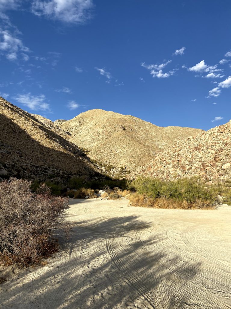
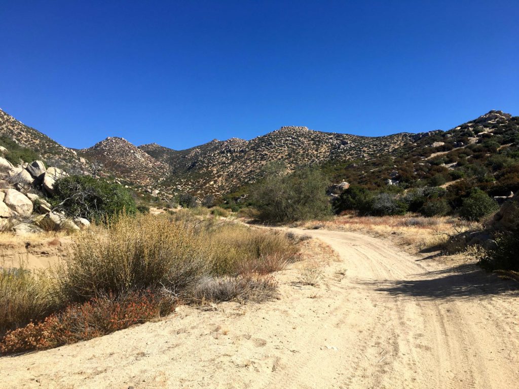
Heading north from Borrego Springs, we began our off-road adventure. After a couple of water crossings, the road turns rocky for a bit. This is why we took Greg’s truck and not my Subaru Outback. After about an hour of driving, we reached the Sheephead Canyon Primitive Campground, just past it was the trailhead. We quickly geared up and set off.
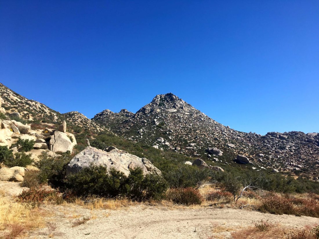
Square Top used to be done from a route from the Los Coyotes Indian Reservation, but it appears the road to that trailhead is permanently closed to non-reservation residents. So we need to summit this peak from the east. The trail followed the dry stream bed for a short distance. This would be the only flat section of the entire day. We had a route loaded on our devices, plus a paper map, and left the stream bed and began scrambling up and over the boulders along the ridgeline. In addition to the boulders, the steepness of the ridgeline can not be understated. It would range between 30-50% grade throughout most of the hike.
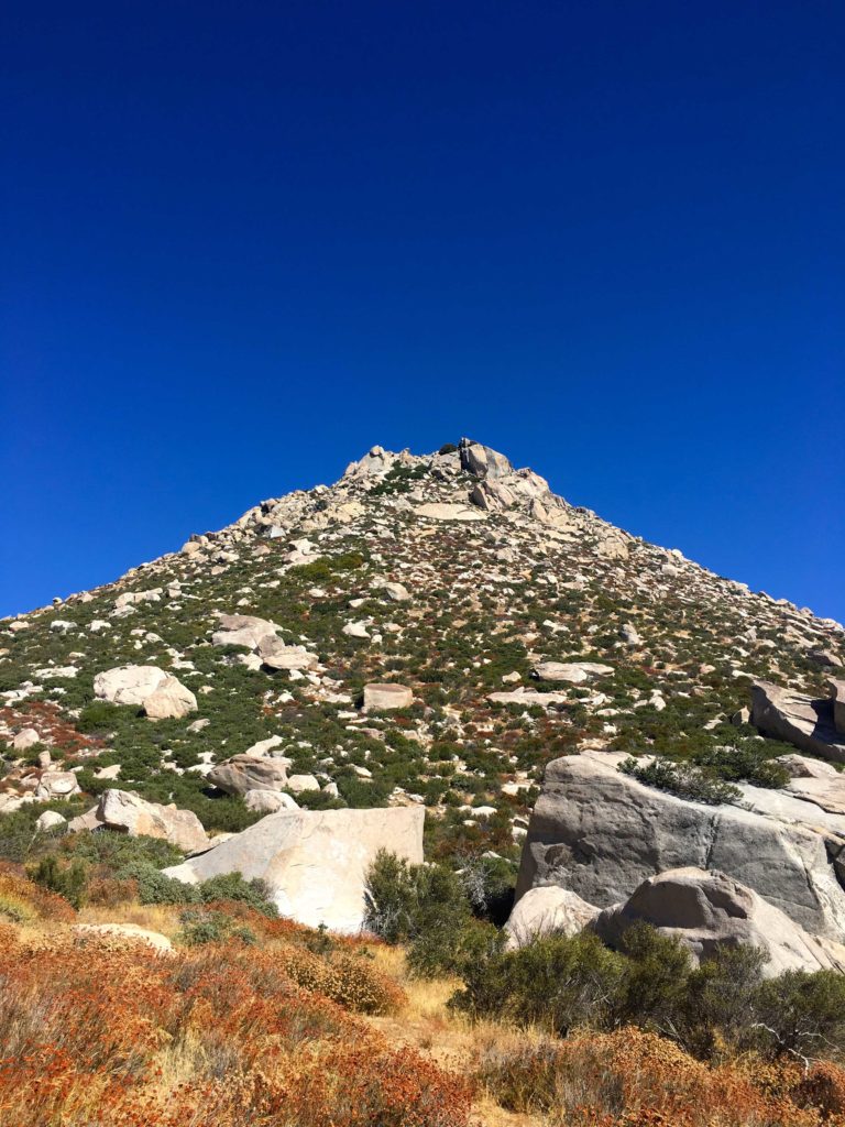
While we could see Square Top off in the distance when we started the hike, it was now fully hidden behind P3360. After about two hours of hiking, we finally reached this intermediate summit and a well-earned break. There was a register tucked away, so we added our names. Square Top now loomed before us. We scanned its rocky and steep slopes for a possible route up. We agreed on a basic plan of attack, but first, we had to drop down some 300 feet of elevation. Climbing back up that on our return was going to suck.
We found a manageable route down to the saddle and then began to push up. The steepness remained about the same, but toward the base, the boulder field was pretty intense to work through. Some very large rocks served as our intermediate landmarks to aim for as we work our way upward.
At this point, I started to have some real trouble. The effort was really getting me and I had to take a lot of breaks as we slogged forward. Both Ted and Greg were very supportive and accommodating as I sat and caught my breath. I really considered turning back several times; this was harder than any summit I had previously done. But I knew if I did turn back I would probably never have another chance, and my 100 Peak Challenge would be over. I dug deep and found the will and energy to push on.
Soon we started to encounter the denser brush that surrounded the summit. I knew the summit was close, we had agreed that if our descent was in the dark, it was ok with all of us. Greg really knew what this summit meant to me. Slipping past the brush, the summit plateau was reached, and we soon found ourselves at the summit block. We had done it!
We signed the registers and took a short break. Without climbing gear, the actual summit block is unreachable. All this work and we don’t actually get to stand on the actual top… We did not stay too long, as we all knew the effort that still lay ahead of us to get back to the trailhead.
We began our careful and slow descent, doubling checking our tracks so as not to get off course. As we approached the boulders near the base of the summit, working through this section again sapped my energy. Greg and Ted continued to lead the way, and I plodded slowly along behind. I dug deep once again and began the ascent up P3360. But I knew once I crossed the summit, it would be all ‘downhill’ from there.
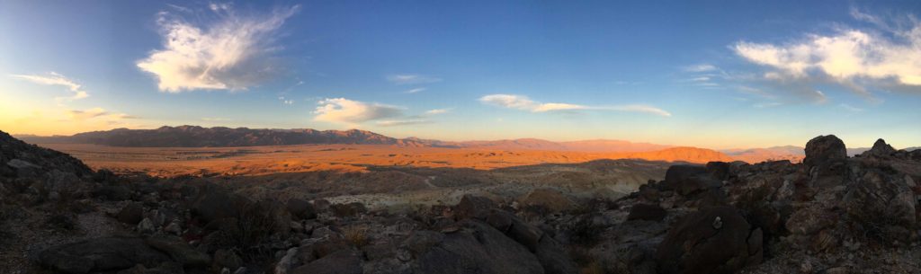
The sun was setting, casting a rosy light on the Santa Rosa Mountains to the east, meaning our last mile was going to be in the dark. Obviously, this was going to slow our pace even further, but we had prepared for this in case this happened. As we carefully picked our way back down, the steepness was a constant issue. I could not believe that we had gone up this! I missed seeing deer go prancing by, but Ted and Greg saw them. I was too focused on the descent and not injuring myself and missed them.
Finally, we reached the stream bed and began heading back to Greg’s truck. I ran out of my water with about a quarter-mile to go, so I was looking forward to the cool drinks in my cooler.
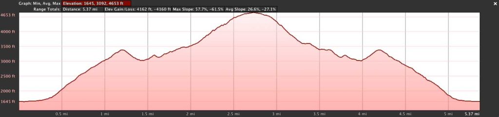
All told, this hike was a mere 5.3 miles on my device. Ted and Greg had different mileage from their devices. Our elevation gain was 3,617 feet and I had us on the trail for 11 hours, 10 of it actually hiking. We all agreed that this was one beast of a summit. While we were proud of making it but were certain we would never do it again.
I am an avid peak bagger, sometimes backpacker, and former sea kayaker living in San Diego. In 2019, I became the third person to complete the San Diego 100 Peak Challenge. Not stopping with that accomplishment, I set my sights on the harder San Diego Sierra Club 100 Peak list, which I completed in 2021. In addition, I have conquered several Six-Pack of Peaks challenges (SoCal, San Diego, Central Coast, and Arizona-Winter). Beyond attempting the San Diego Sierra Club 100 Peak list a second time, I am looking forward to exploring new summits and new adventures across the southwest.
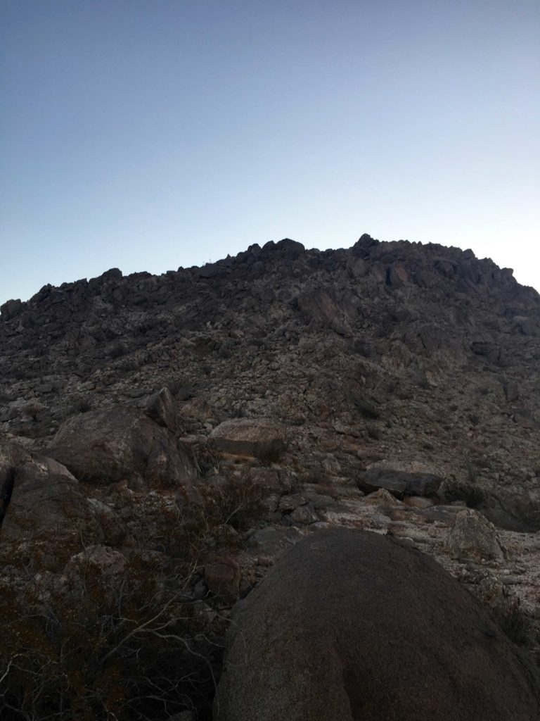
After two failed attempts at summiting The Thimble (see here for those trip reports), I headed back out to try again. Originally, fellow 100 Peaker, Gail Welch was going to guide me up, but she took a tumble on the ice and was out of commission. Matt Hanan, an SD100 Peaker, had to do solo Dad duty, so I headed out to Ranchita alone.
Pulling into my now familiar turn out, I headed out along the road toward my challenge. A nice breeze kept the temperatures pleasant as I work my way up the road. Just past the crest in the road, my first view of The Thimble came into view. I studied it imposing face and attempted to scout out my route up it. I had a GPS track from Hann Asoy’s successful summit, so I had that to fall back on, but I wanted to try this on my own.
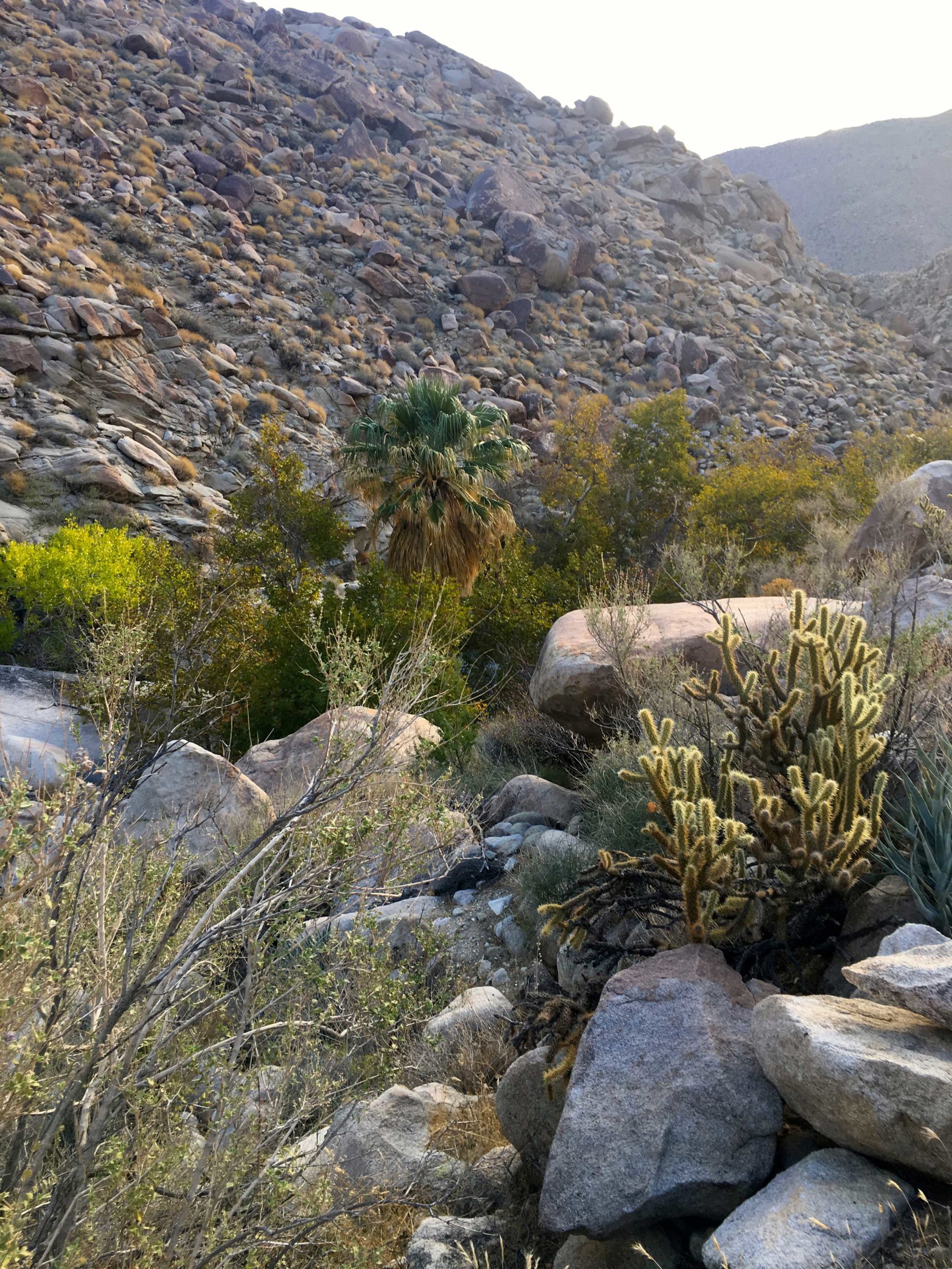
I worked my way up through the brush looking for the end of the barbed wire fence. The route gets close to some of the private property, so I was trying to be mindful. The slope quickly grew steep, somewhere between 30-50%. My route weaved around the granite boulders and past the brush. Once in and while I did need to push through some to continue my climb.
Looking up at The Thimble
As I drew near the summit, a thicket of brush stood before me. I tried seeing if there was a route to the left side, but it was too thick. Nothing appeared in the middle. I was thinking I might need to descend and look for an alternate route. I texted my wife and let her know my status, I figured I still had another 30 minutes of climbing ahead of me.
I decided to see if there might be a path near a large granite boulder to the right, and there was! I squeezed past the brush and the summit lay before me. So much for another 30 minutes of climbing!
Nearing the summit
Sadly the register seems to be missing, but the views were incredible! I might have let out a shout upon reaching the top… The Thimble had been conquered! San Ysidro stood to the north, Bonny, and White to the south. The Salton Sea was visible in the distance.
After a brief break, I began a careful descent. It is almost easier to find a nicer path when going down. Once off the peak, I cruised back down to the car, stopping at the Ranchita General Store for some cold drinks before the drive home.
Looking at my down route
With that my #78 peak of #100PeakChallenge was done!
I am an avid peak bagger, sometimes backpacker, and former sea kayaker living in San Diego. In 2019, I became the third person to complete the San Diego 100 Peak Challenge. Not stopping with that accomplishment, I set my sights on the harder San Diego Sierra Club 100 Peak list, which I completed in 2021. In addition, I have conquered several Six-Pack of Peaks challenges (SoCal, San Diego, Central Coast, and Arizona-Winter). Beyond attempting the San Diego Sierra Club 100 Peak list a second time, I am looking forward to exploring new summits and new adventures across the southwest.
With the weather starting to turn, it was time to start thinking about my remaining peaks in the desert. While the true desert was still a tad warm still, the weather for the peaks near Ranchita was nice enough for them to be attempted. My feet were still a tad sore from the summiting of Sheephead Mountain and Manza Benchmark yesterday, so I did not feel like hiking out to Wilson Benchmark. Instead, I opted to do White Benchmark and Bonny Benchmark.
After making breakfast at home, I pulled into the familiar turnout for this hike just past the Anza-Borrego State Park sign. Grabbing my gear and applying a good application of sunscreen, I set off across the desert floor. The first peak I wanted to summit was White Benchmark about 2 miles away and some 1,000 or so feet of elevation to be gained. Although I passed by Bonny, I wanted to summit it on the return route.
I followed the faint use trails, dodging the pointy pain planets along the way, toward the summit of White Benchmark. The breeze kept any bugs away and made the temperature perfect. Soon the summit lay before me. I scrambled up the summit block and was again rewarded with a tremendous view of Anza-Borrego to the east. I don’t think there is a register here, just the benchmark.
After a brief break, I began my descent, however, two other peaks were on the agenda; Bonny and Clyde. Following the ridgeline down from White, I began working my way to Bonny, but first up was Clyde. While not on any list, I felt I had to do the pair. Actually, it is basically on the route down from White, so it is not a problem. I scrambled a good way up the summit but did not climb the final portion since I was out here solo.
From there I made my way toward Bonny. Once I reached the peak, I worked my way along the south side until I reached the ledge on the west face. I carefully worked way along with it until I reached the summit again. There are two marks here, along with a register.
After a quick break, I carefully headed back down from the summit. Unlike my last two times to the peak, I opted not to go visit Hut Benchmark. Instead, I angled across along the desert floor following more faint use trails until I returned to the car. With that, peaks #75 and #76 were done!
I am an avid peak bagger, sometimes backpacker, and former sea kayaker living in San Diego. In 2019, I became the third person to complete the San Diego 100 Peak Challenge. Not stopping with that accomplishment, I set my sights on the harder San Diego Sierra Club 100 Peak list, which I completed in 2021. In addition, I have conquered several Six-Pack of Peaks challenges (SoCal, San Diego, Central Coast, and Arizona-Winter). Beyond attempting the San Diego Sierra Club 100 Peak list a second time, I am looking forward to exploring new summits and new adventures across the southwest.
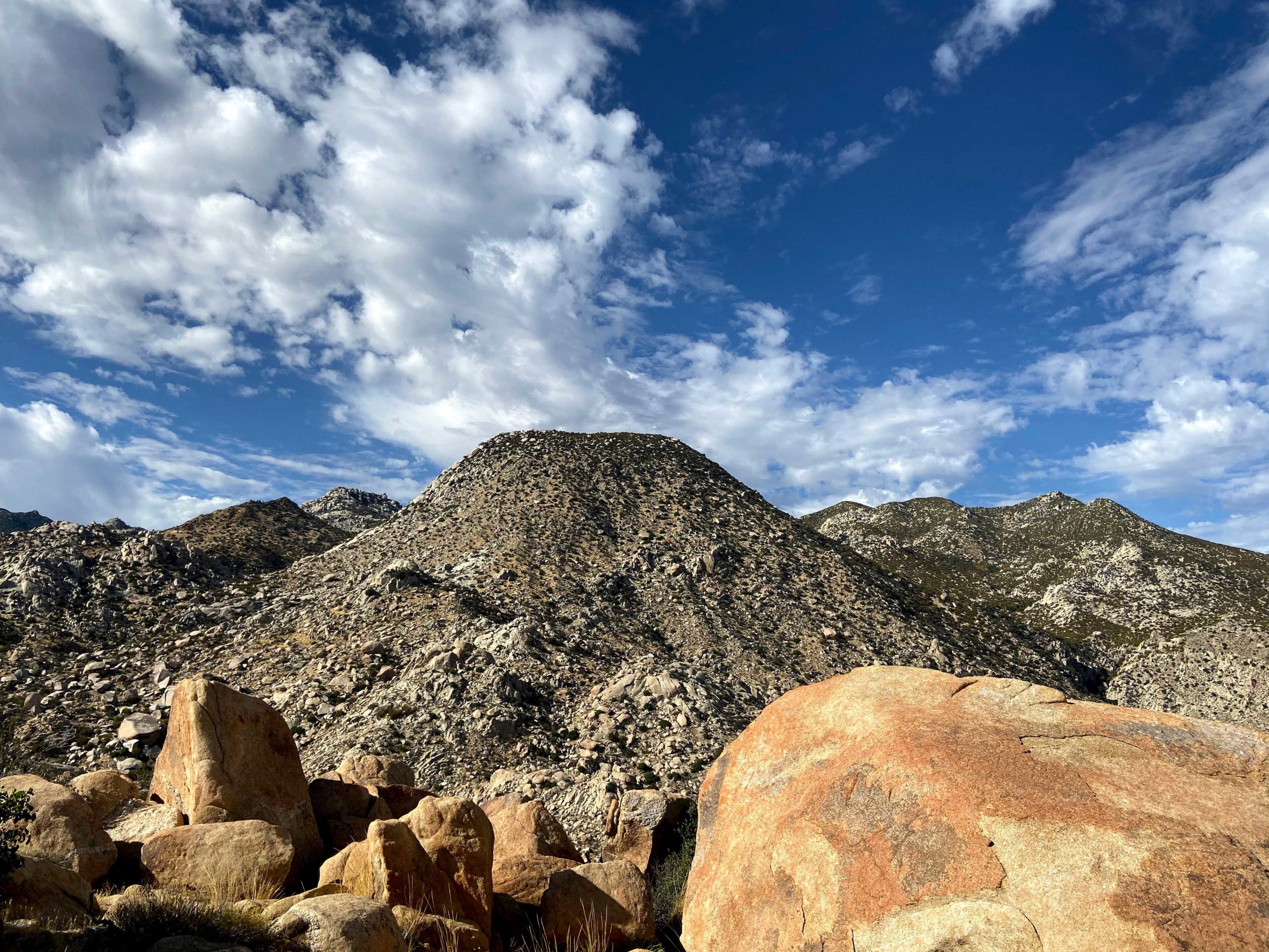
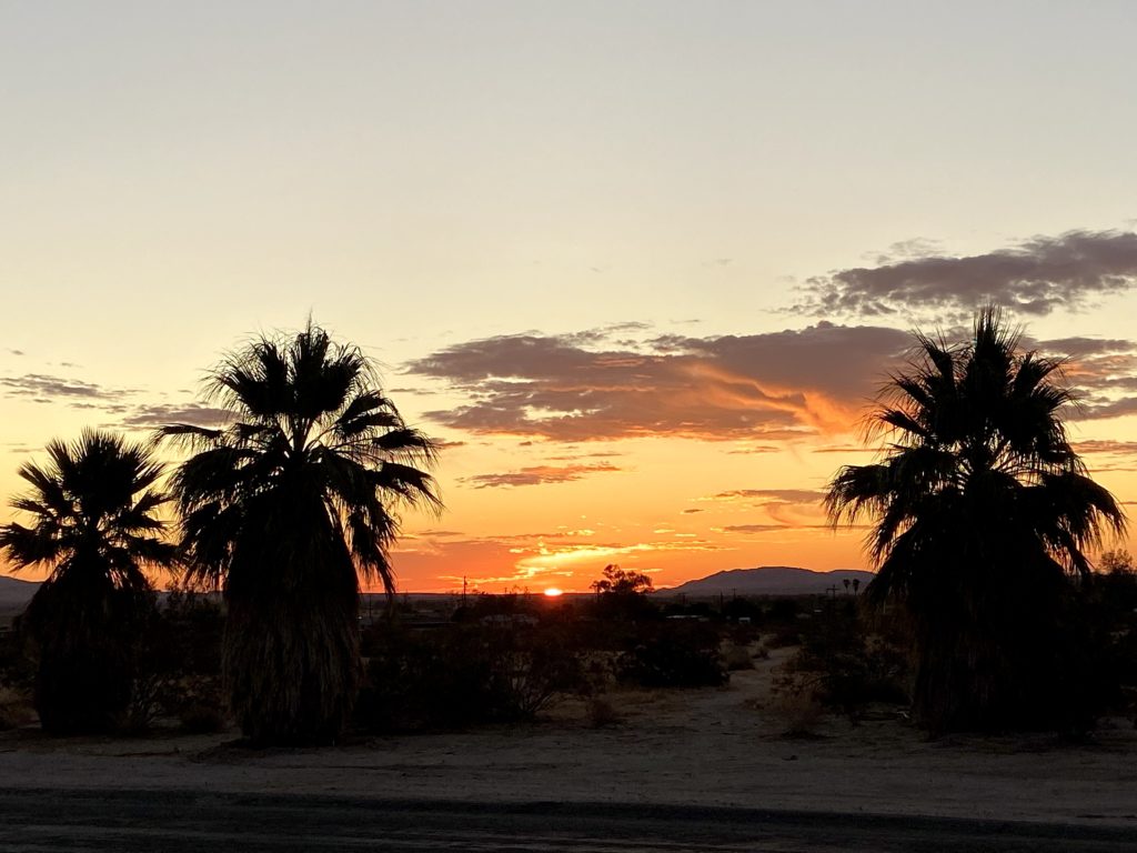
In my push to complete the 100 Peak Challenge, I wanted to attempt summiting Villager. This is a beast of a hike. As Susie Kara puts it, “Think of it like Coyote Mountain times 3!” The approximate round trip distance is 14 miles with an elevation gain of over 4,800 feet. The summit sits at 5,756’, so you are going to feel this hike! Unfortunately, none of my usual hiking partners were free, but my lovely wife said I could attempt this hike solo. Little did she know when I was planning to hit the trailhead… Since the furnace is awakening out in Anza Borrego, I needed to try to get some of the hike done under the cover of darkness. I forgot how beautiful the night sky is in the desert. Borrego Springs is a dark sky city, so the stars and the Milky Way shone brightly. I had to fight the urge to skip the hike and simply enjoy the heavens.
Loading up over 4 liters of fluids and switching on my headlamp, I headed across the desert floor. I tried to follow the trail to the base of the ridge. There was no moon, only my headlamp to guide me. I overshot the ridge and found myself heading up a wash. Quickly backtracking, I soon found the use trail that leads up from the desert floor onto the ridge.
The loose rocks clattered under my feet as I pushed upward over the first steep section of the ascent. The trail would oscillate between flatter sections and steep rocky sections. The use trail weaves past cacti with blooms waiting to open. The sun finally rose over the Santa Rosas, illuminating the desert. I carefully passed the steep drop-offs and continued ever upward. The trail would fade away at times, but it was quickly found again. The sections around miles 4 and 5 took some extra time to ascend. Reviewing my topo map, I knew I had some calmer sections on which to recover from those efforts.
The Salton Sea finally appeared from behind Mile High. I looked across at that peak, knowing it is also on the 100 Peak list, but the thought of dropping 1000’, then climbing that again to the summit seemed well beyond my conditioning. The plants continued to change as I continued to gain elevation. The gentle breeze helped keep the temperature down, plus the elevation helped as well. I knew the descent was going to be toasty, but for now, I would enjoy the wonderful weather. With one final push after a short descent from the pre-summit, I found myself on the summit of Villager! There is no Benchmark, but a full ammo box for the register. I took a short nap under the shade of a Pinyon.
Then back down the ridge. I did not expect anyone else on the mountain, but just as I was surprised on Coyote Mountain, the same occurred on Villager. First was a group of 6 hikers pushing toward the summit. They were followed by two more hikers, however, they were planning to continue on to Rabbit Peak after camping somewhere. About a mile or so later, I met two more hikers who were planning the do the grand loop. I wished them all good luck.
I carefully worked my way down those tricky sections and kept pushing downward. Unfortunately, my foot slid on some loose rock at one spot and angered my knee slightly. This did slow me a bit, but the use trail easily guided me back down the ridge. It was easier to see it on the descent, but isn’t that usually the case? Once back on the desert floor, the temperature was now pushing the mid-80s and I was feeling the past 13+ miles of hiking. I slowly crossed the wash that I had not seen fully in the predawn. I found the trail that escaped me at the start and I was finally back at the car, some 13 hours later.
I am an avid peak bagger, sometimes backpacker, and former sea kayaker living in San Diego. In 2019, I became the third person to complete the San Diego 100 Peak Challenge. Not stopping with that accomplishment, I set my sights on the harder San Diego Sierra Club 100 Peak list, which I completed in 2021. In addition, I have conquered several Six-Pack of Peaks challenges (SoCal, San Diego, Central Coast, and Arizona-Winter). Beyond attempting the San Diego Sierra Club 100 Peak list a second time, I am looking forward to exploring new summits and new adventures across the southwest.