I needed to return to Monserate Mountain to take some updated photographs for a trail guide I am writing from SoCal Hiker. Since I had the day from work, I thought would make the short drive up and snap a few photos that I needed.


After taking a few versions of the new sign, I started up the trail. Since a portion of the trail is closed until December 2022, I was hoping to photograph the closure signage at the junction for inclusion in the guide. Plus, I need some ‘trail’ shots to reflect what the trail looks like. My two previous times up this peak were a bit light on photos.


At the first junction, there was no signage, but I was really enjoying the hike, so I kept going. Finally, at the final junction, there was a closure warning. I continued onto the summit and snapped more photos. San Gorgonio and San Jacinto’s snowcapped summits stood off to the north.


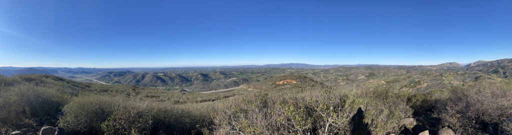


I certainly had a much better set of photos for the guide, so I headed back down to the car. All in all, a nice hike of 3.1 miles in 1:34 with an elevation gain of 1,148 feet.


I am an avid peak bagger, sometimes backpacker, and former sea kayaker living in San Diego. In 2019, I became the third person to complete the San Diego 100 Peak Challenge. Not stopping with that accomplishment, I set my sights on the harder San Diego Sierra Club 100 Peak list, which I completed in 2021. In addition, I have conquered several Six-Pack of Peaks challenges (SoCal, San Diego, Central Coast, and Arizona-Winter). Beyond attempting the San Diego Sierra Club 100 Peak list a second time, I am looking forward to exploring new summits and new adventures across the southwest.